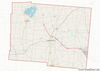
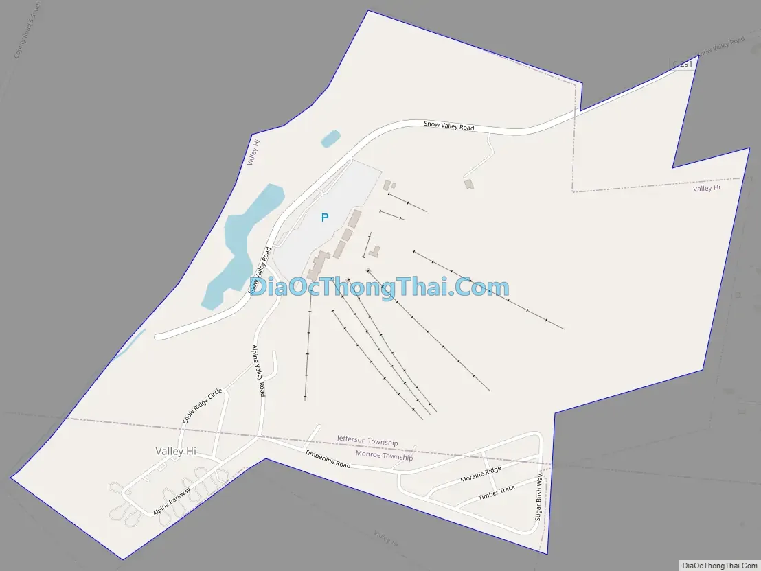
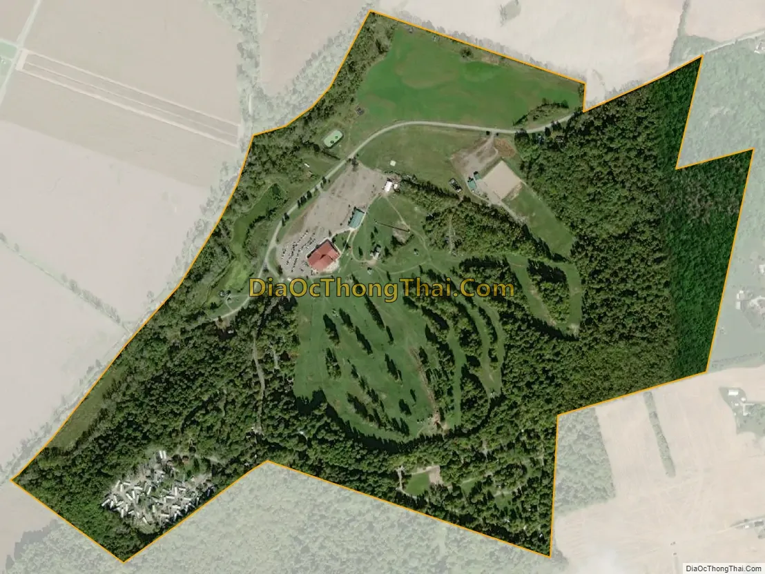
Valley Hi is a village in Logan County, Ohio, United States. The population was 212 at the 2010 census. The village is located nearby U.S. Route 33 and is about an hour northwest of Columbus. The village lies mostly in Jefferson Township, but its southernmost portion extends into Monroe Township.
| Name: | Valley Hi village |
|---|---|
| LSAD Code: | 47 |
| LSAD Description: | village (suffix) |
| State: | Ohio |
| County: | Logan County |
| Elevation: | 1,270 ft (387 m) |
| Total Area: | 0.62 sq mi (1.61 km²) |
| Land Area: | 0.62 sq mi (1.61 km²) |
| Water Area: | 0.00 sq mi (0.00 km²) |
| Total Population: | 228 |
| Population Density: | 366.56/sq mi (141.60/km²) |
| FIPS code: | 3979226 |
| GNISfeature ID: | 1055101 |
Online Interactive Map
Click on ![]() to view map in "full screen" mode.
to view map in "full screen" mode.
Valley Hi location map. Where is Valley Hi village?
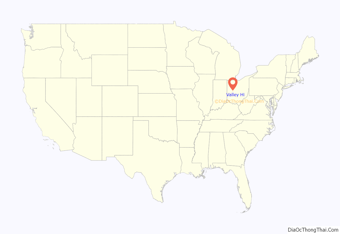
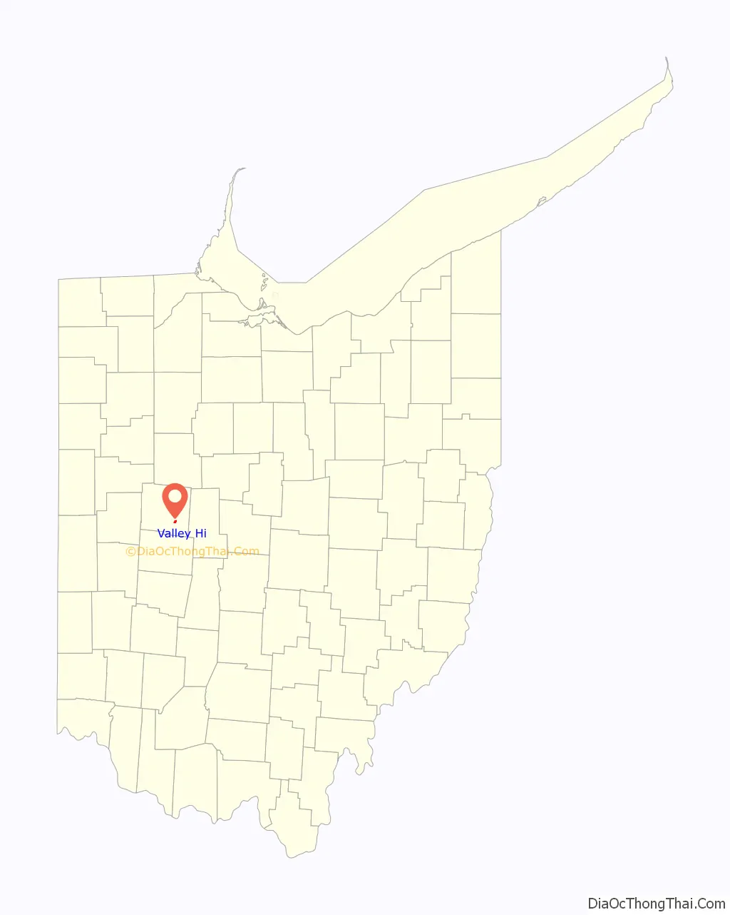
Valley Hi Road Map
Valley Hi city Satellite Map
Geography
Valley Hi is located at 40°18′45″N 83°40′46″W / 40.31250°N 83.67944°W / 40.31250; -83.67944, and according to the United States Census Bureau, the village has a total area of 0.62 square miles (1.61 km), all of it land. The village is located in an area with some of the steepest terrain in normally flat Western Ohio and serves as home to the Mad River Mountain ski area. In fact, most of the village is located on top of a steep ridge (mountain, by some standards) and is actually located above the ski area, with many of the slopes circling one side of the village. Valley Hi has a distinct “Alpine” flavor with many of the streets named for European mountain locations and homes decorated in a Swiss chalet style.
See also
Map of Ohio State and its subdivision:- Adams
- Allen
- Ashland
- Ashtabula
- Athens
- Auglaize
- Belmont
- Brown
- Butler
- Carroll
- Champaign
- Clark
- Clermont
- Clinton
- Columbiana
- Coshocton
- Crawford
- Cuyahoga
- Darke
- Defiance
- Delaware
- Erie
- Fairfield
- Fayette
- Franklin
- Fulton
- Gallia
- Geauga
- Greene
- Guernsey
- Hamilton
- Hancock
- Hardin
- Harrison
- Henry
- Highland
- Hocking
- Holmes
- Huron
- Jackson
- Jefferson
- Knox
- Lake
- Lake Erie
- Lawrence
- Licking
- Logan
- Lorain
- Lucas
- Madison
- Mahoning
- Marion
- Medina
- Meigs
- Mercer
- Miami
- Monroe
- Montgomery
- Morgan
- Morrow
- Muskingum
- Noble
- Ottawa
- Paulding
- Perry
- Pickaway
- Pike
- Portage
- Preble
- Putnam
- Richland
- Ross
- Sandusky
- Scioto
- Seneca
- Shelby
- Stark
- Summit
- Trumbull
- Tuscarawas
- Union
- Van Wert
- Vinton
- Warren
- Washington
- Wayne
- Williams
- Wood
- Wyandot
- Alabama
- Alaska
- Arizona
- Arkansas
- California
- Colorado
- Connecticut
- Delaware
- District of Columbia
- Florida
- Georgia
- Hawaii
- Idaho
- Illinois
- Indiana
- Iowa
- Kansas
- Kentucky
- Louisiana
- Maine
- Maryland
- Massachusetts
- Michigan
- Minnesota
- Mississippi
- Missouri
- Montana
- Nebraska
- Nevada
- New Hampshire
- New Jersey
- New Mexico
- New York
- North Carolina
- North Dakota
- Ohio
- Oklahoma
- Oregon
- Pennsylvania
- Rhode Island
- South Carolina
- South Dakota
- Tennessee
- Texas
- Utah
- Vermont
- Virginia
- Washington
- West Virginia
- Wisconsin
- Wyoming