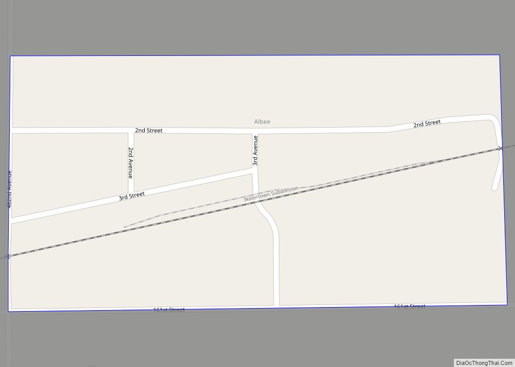
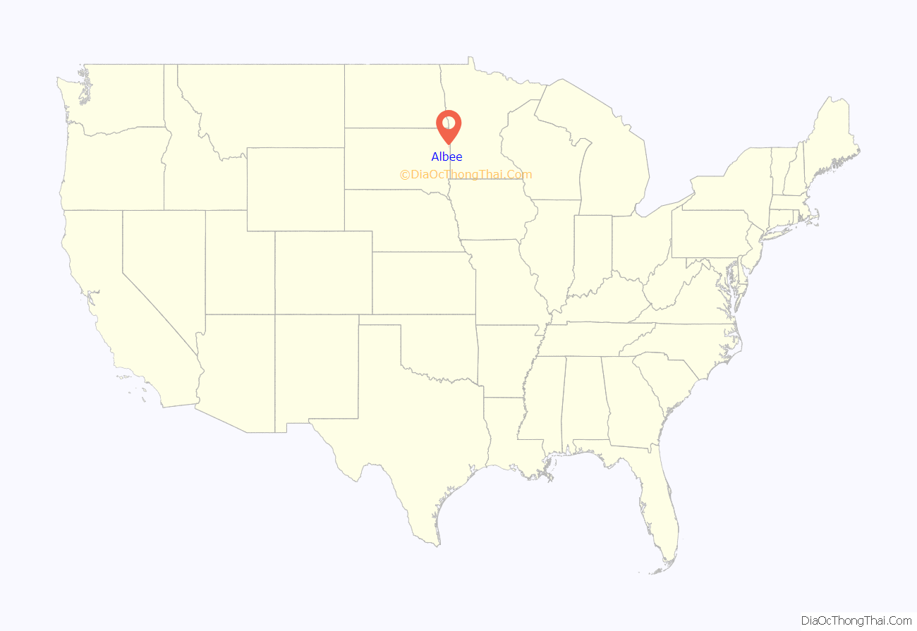
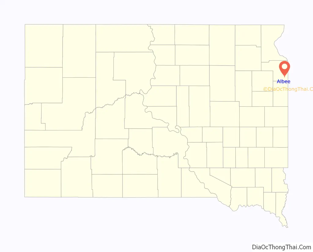
Albee is a town in Grant County, South Dakota, United States. The population was 7 at the 2020 census.
| Name: | Albee town |
|---|---|
| LSAD Code: | 43 |
| LSAD Description: | town (suffix) |
| State: | South Dakota |
| County: | Grant County |
| Incorporated: | 1902 |
| Elevation: | 1,181 ft (360 m) |
| Total Area: | 0.13 sq mi (0.34 km²) |
| Land Area: | 0.13 sq mi (0.34 km²) |
| Water Area: | 0.00 sq mi (0.00 km²) |
| Total Population: | 7 |
| Population Density: | 53.44/sq mi (20.69/km²) |
| ZIP code: | 57259 |
| Area code: | 605 |
| FIPS code: | 4600620 |
| GNISfeature ID: | 1253600 |
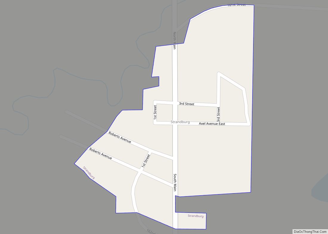
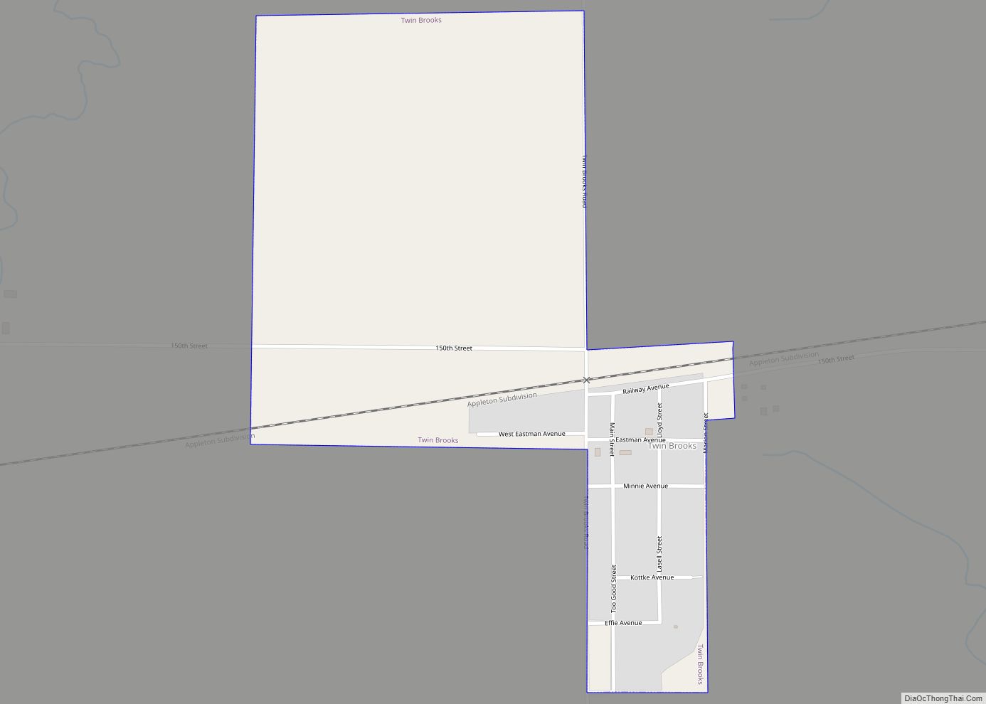
Online Interactive Map
Click on ![]() to view map in "full screen" mode.
to view map in "full screen" mode.
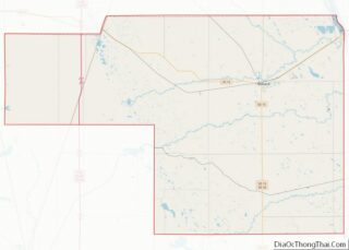
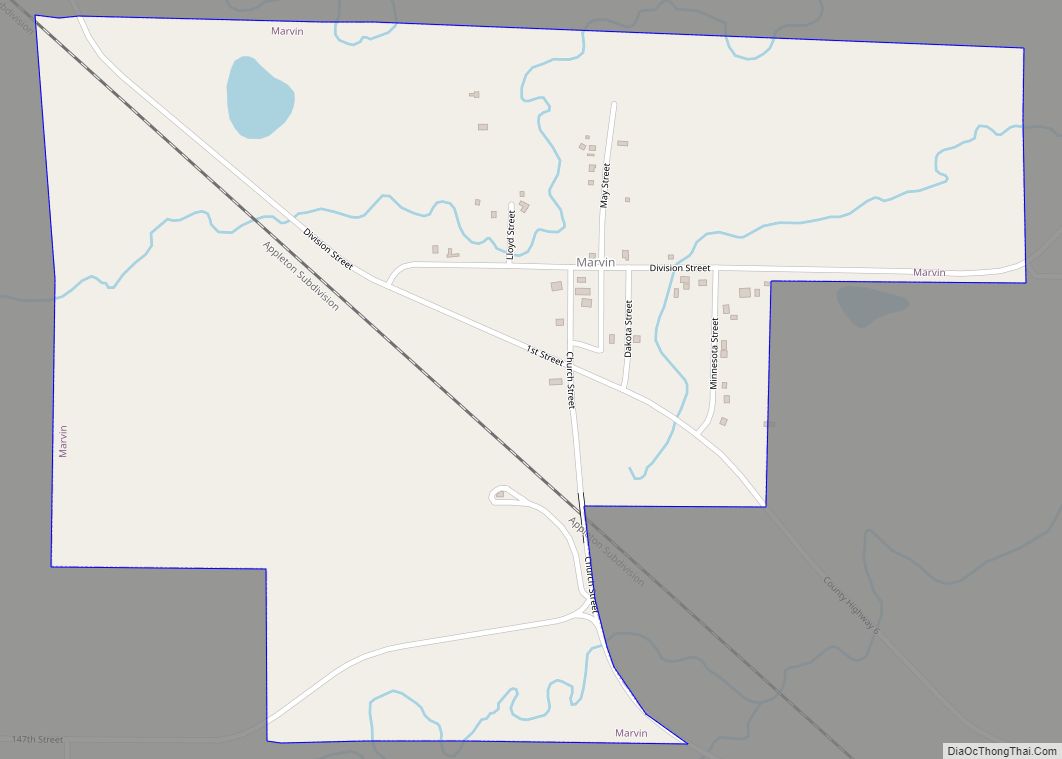
Albee location map. Where is Albee town?
History
A post office called Albee was established in 1888, and remained in operation until 1992. The community was named in honor of W. C. Albee, a railroad official.
Albee Road Map

Albee city Satellite Map

Geography
According to the United States Census Bureau, the town has a total area of 0.13 square miles (0.34 km), all land.
See also
Map of South Dakota State and its subdivision:- Aurora
- Beadle
- Bennett
- Bon Homme
- Brookings
- Brown
- Brule
- Buffalo
- Butte
- Campbell
- Charles Mix
- Clark
- Clay
- Codington
- Corson
- Custer
- Davison
- Day
- Deuel
- Dewey
- Douglas
- Edmunds
- Fall River
- Faulk
- Grant
- Gregory
- Haakon
- Hamlin
- Hand
- Hanson
- Harding
- Hughes
- Hutchinson
- Hyde
- Jackson
- Jerauld
- Jones
- Kingsbury
- Lake
- Lawrence
- Lincoln
- Lyman
- Marshall
- McCook
- McPherson
- Meade
- Mellette
- Miner
- Minnehaha
- Moody
- Pennington
- Perkins
- Potter
- Roberts
- Sanborn
- Shannon
- Spink
- Stanley
- Sully
- Todd
- Tripp
- Turner
- Union
- Walworth
- Yankton
- Ziebach
- Alabama
- Alaska
- Arizona
- Arkansas
- California
- Colorado
- Connecticut
- Delaware
- District of Columbia
- Florida
- Georgia
- Hawaii
- Idaho
- Illinois
- Indiana
- Iowa
- Kansas
- Kentucky
- Louisiana
- Maine
- Maryland
- Massachusetts
- Michigan
- Minnesota
- Mississippi
- Missouri
- Montana
- Nebraska
- Nevada
- New Hampshire
- New Jersey
- New Mexico
- New York
- North Carolina
- North Dakota
- Ohio
- Oklahoma
- Oregon
- Pennsylvania
- Rhode Island
- South Carolina
- South Dakota
- Tennessee
- Texas
- Utah
- Vermont
- Virginia
- Washington
- West Virginia
- Wisconsin
- Wyoming