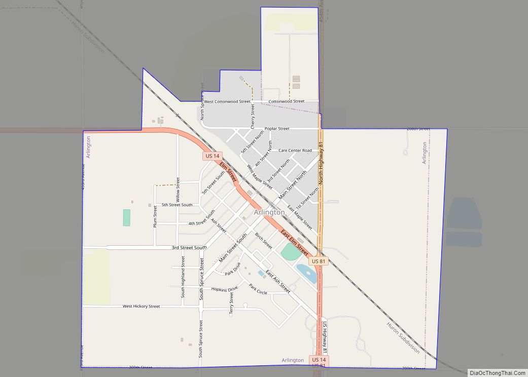
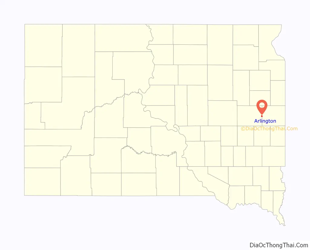
Arlington is a city in Brookings and Kingsbury counties in the State of South Dakota. The population was 915 at the 2020 census.
| Name: | Arlington city |
|---|---|
| LSAD Code: | 25 |
| LSAD Description: | city (suffix) |
| State: | South Dakota |
| County: | Brookings County, Kingsbury County |
| Founded: | 1880 |
| Elevation: | 1,844 ft (562 m) |
| Total Area: | 1.72 sq mi (4.45 km²) |
| Land Area: | 1.72 sq mi (4.45 km²) |
| Water Area: | 0.00 sq mi (0.00 km²) |
| Total Population: | 915 |
| Population Density: | 532.60/sq mi (205.64/km²) |
| ZIP code: | 57212 |
| Area code: | 605 |
| FIPS code: | 4602180 |
| GNISfeature ID: | 1267666 |
| Website: | www.arlingtonsd.com |
Online Interactive Map
Click on ![]() to view map in "full screen" mode.
to view map in "full screen" mode.
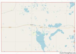
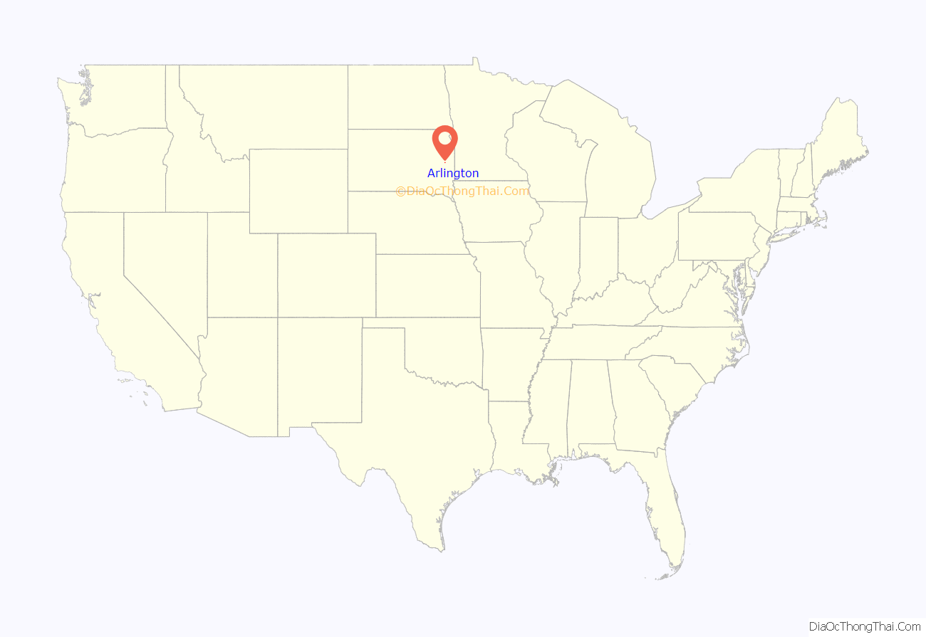
Arlington location map. Where is Arlington city?
History
The city was platted by the Western Town Lot Company in 1880, and originally named Nordland, with the platted streets given Norwegian names. The city was renamed a few years later, and in 1885 given the name of Arlington, after the colonial center in Virginia. (It was briefly named Denver in the interlude, but postal authorities did not approve of the name.) The streets were not renamed until several decades passed, with Olaf Street eventually changed to Main Street, Kanut Street to Third Street, etc.
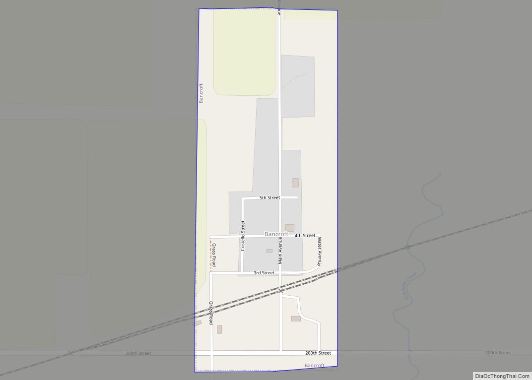
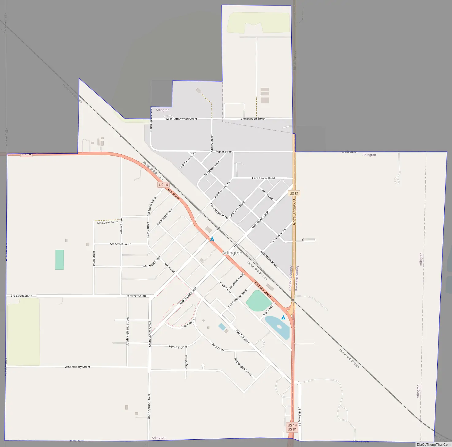
Arlington Road Map
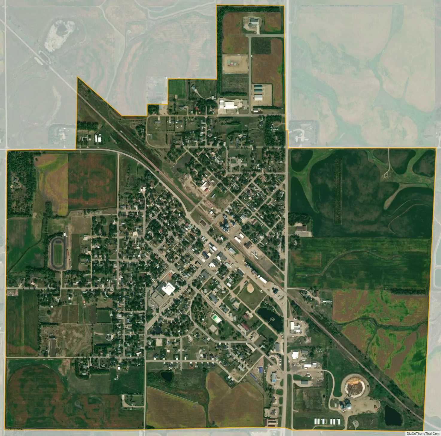
Arlington city Satellite Map
Geography
Arlington is at 44°21′52″N 97°8′5″W / 44.36444°N 97.13472°W / 44.36444; -97.13472 (44.364322, -97.134646), primarily in Kingsbury County.
According to the United States Census Bureau, the city has a total area of 1.66 square miles (4.30 km), all land. Lake Poinsett is to the northeast.
See also
Map of South Dakota State and its subdivision:- Aurora
- Beadle
- Bennett
- Bon Homme
- Brookings
- Brown
- Brule
- Buffalo
- Butte
- Campbell
- Charles Mix
- Clark
- Clay
- Codington
- Corson
- Custer
- Davison
- Day
- Deuel
- Dewey
- Douglas
- Edmunds
- Fall River
- Faulk
- Grant
- Gregory
- Haakon
- Hamlin
- Hand
- Hanson
- Harding
- Hughes
- Hutchinson
- Hyde
- Jackson
- Jerauld
- Jones
- Kingsbury
- Lake
- Lawrence
- Lincoln
- Lyman
- Marshall
- McCook
- McPherson
- Meade
- Mellette
- Miner
- Minnehaha
- Moody
- Pennington
- Perkins
- Potter
- Roberts
- Sanborn
- Shannon
- Spink
- Stanley
- Sully
- Todd
- Tripp
- Turner
- Union
- Walworth
- Yankton
- Ziebach
- Alabama
- Alaska
- Arizona
- Arkansas
- California
- Colorado
- Connecticut
- Delaware
- District of Columbia
- Florida
- Georgia
- Hawaii
- Idaho
- Illinois
- Indiana
- Iowa
- Kansas
- Kentucky
- Louisiana
- Maine
- Maryland
- Massachusetts
- Michigan
- Minnesota
- Mississippi
- Missouri
- Montana
- Nebraska
- Nevada
- New Hampshire
- New Jersey
- New Mexico
- New York
- North Carolina
- North Dakota
- Ohio
- Oklahoma
- Oregon
- Pennsylvania
- Rhode Island
- South Carolina
- South Dakota
- Tennessee
- Texas
- Utah
- Vermont
- Virginia
- Washington
- West Virginia
- Wisconsin
- Wyoming