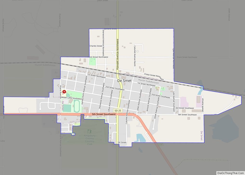
De Smet is a city in and the county seat of Kingsbury County, South Dakota, United States. The population was 1,089 at the 2010 census.
| Name: | De Smet city |
|---|---|
| LSAD Code: | 25 |
| LSAD Description: | city (suffix) |
| State: | South Dakota |
| County: | Kingsbury County |
| Founded: | 1880 |
| Incorporated: | 1883 |
| Elevation: | 1,726 ft (526 m) |
| Total Area: | 1.16 sq mi (3.00 km²) |
| Land Area: | 1.16 sq mi (3.00 km²) |
| Water Area: | 0.00 sq mi (0.00 km²) |
| Total Population: | 1,056 |
| Population Density: | 911.92/sq mi (351.97/km²) |
| ZIP code: | 57231 |
| Area code: | 605 |
| FIPS code: | 4616260 |
| GNISfeature ID: | 1265178 |
Online Interactive Map
Click on ![]() to view map in "full screen" mode.
to view map in "full screen" mode.
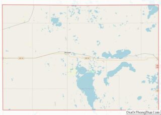
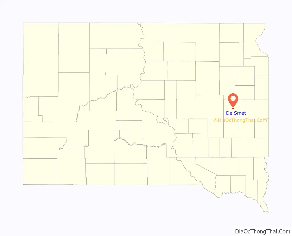
De Smet location map. Where is De Smet city?

History
Located in the area of South Dakota known as “East River” (east of the Missouri River, which diagonally divides the state), De Smet was platted by European Americans in 1880. It was named for Belgian Father Pierre De Smet, a 19th-century Jesuit missionary who worked with Native Americans in the United States and its territories for most of his life. In the mid 1880s, prairie fires and failures of crops after a three-year period of drought caused many settlers to relocate their farms and homesteads to easier areas. By 1917, De Smet was a cow town, with many trains passing through every day carrying cattle to market.
The Charles Ingalls family, originally of Wisconsin, arrived in De Smet in 1879. Their travels and pioneer life in Minnesota, Kansas, Dakota Territory, and Iowa would be later chronicled in the Little House series of books written by the Ingallses’ second oldest daughter, Laura Elizabeth – later known as Laura Ingalls Wilder. Laura Ingalls and her husband Almanzo Wilder would first settle in De Smet along with Wilder’s parents and brother. There the Wilders lived just outside of De Smet on farmland, while the Ingallses stayed in the town of De Smet. After building a home and starting a business there, Charles Ingalls helped to found the First Congregational Church of De Smet, later helping to build the church building, with the first service being held there on August 30, 1882. Ingalls and his wife, along with oldest daughter Mary, were among the church’s eight original charter members.
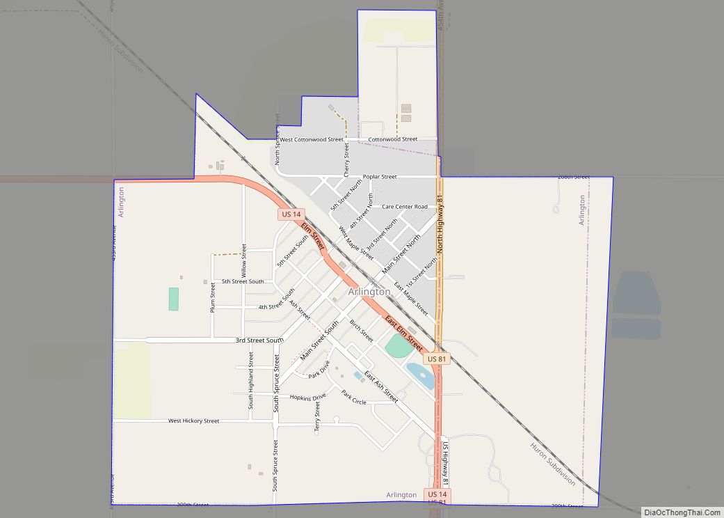
De Smet Road Map
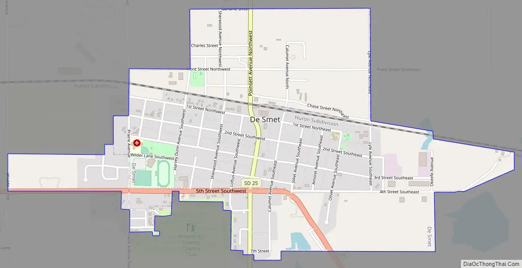
De Smet city Satellite Map

Geography
De Smet is located in central Kingsbury County at 44°23′9″N 97°33′6″W / 44.38583°N 97.55167°W / 44.38583; -97.55167 (44.385871, -97.551703). It is 33 miles (53 km) east of Huron and 41 miles (66 km) west of Brookings.
According to the United States Census Bureau, the city has a total area of 1.16 square miles (3.00 km), all land.
De Smet has been assigned the ZIP code 57231 and the FIPS place code 16260.
Climate
See also
Map of South Dakota State and its subdivision:- Aurora
- Beadle
- Bennett
- Bon Homme
- Brookings
- Brown
- Brule
- Buffalo
- Butte
- Campbell
- Charles Mix
- Clark
- Clay
- Codington
- Corson
- Custer
- Davison
- Day
- Deuel
- Dewey
- Douglas
- Edmunds
- Fall River
- Faulk
- Grant
- Gregory
- Haakon
- Hamlin
- Hand
- Hanson
- Harding
- Hughes
- Hutchinson
- Hyde
- Jackson
- Jerauld
- Jones
- Kingsbury
- Lake
- Lawrence
- Lincoln
- Lyman
- Marshall
- McCook
- McPherson
- Meade
- Mellette
- Miner
- Minnehaha
- Moody
- Pennington
- Perkins
- Potter
- Roberts
- Sanborn
- Shannon
- Spink
- Stanley
- Sully
- Todd
- Tripp
- Turner
- Union
- Walworth
- Yankton
- Ziebach
- Alabama
- Alaska
- Arizona
- Arkansas
- California
- Colorado
- Connecticut
- Delaware
- District of Columbia
- Florida
- Georgia
- Hawaii
- Idaho
- Illinois
- Indiana
- Iowa
- Kansas
- Kentucky
- Louisiana
- Maine
- Maryland
- Massachusetts
- Michigan
- Minnesota
- Mississippi
- Missouri
- Montana
- Nebraska
- Nevada
- New Hampshire
- New Jersey
- New Mexico
- New York
- North Carolina
- North Dakota
- Ohio
- Oklahoma
- Oregon
- Pennsylvania
- Rhode Island
- South Carolina
- South Dakota
- Tennessee
- Texas
- Utah
- Vermont
- Virginia
- Washington
- West Virginia
- Wisconsin
- Wyoming