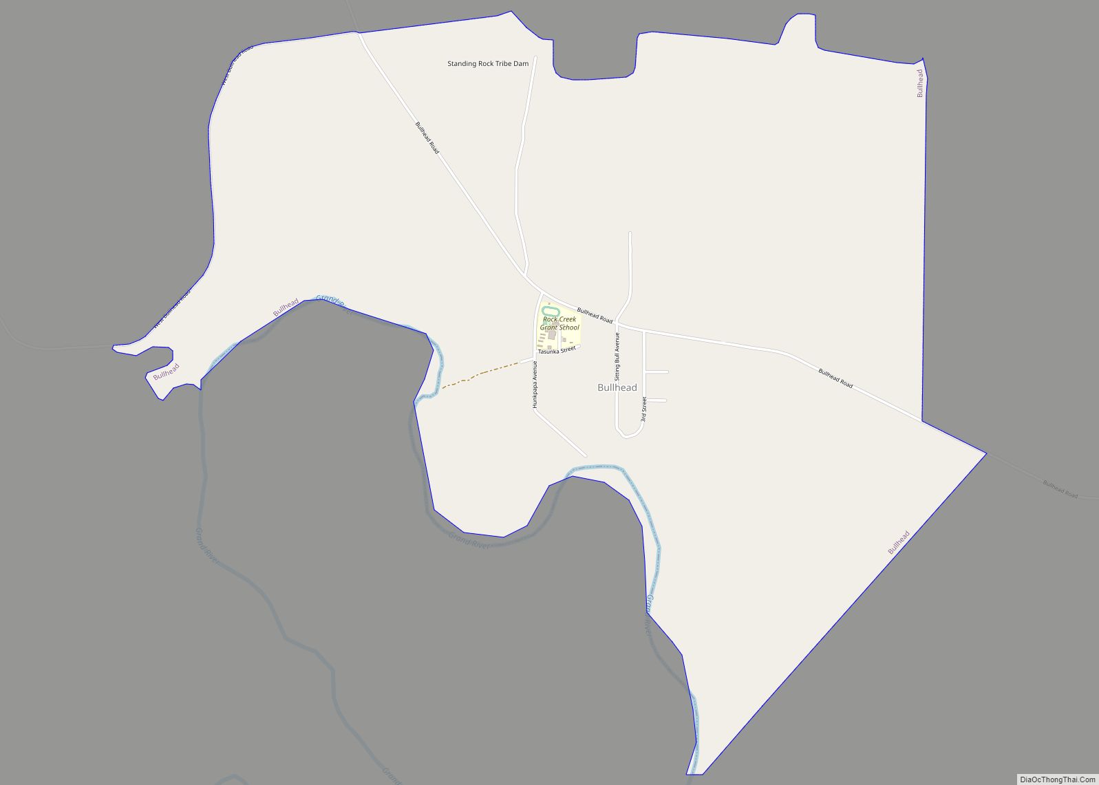
Bullhead is a census-designated place (CDP) in Corson County, South Dakota, United States, within the Standing Rock Indian Reservation. The population was 348 at the 2010 census.
| Name: | Bullhead CDP |
|---|---|
| LSAD Code: | 57 |
| LSAD Description: | CDP (suffix) |
| State: | South Dakota |
| County: | Corson County |
| Elevation: | 1,775 ft (541 m) |
| Total Area: | 3.09 sq mi (8.00 km²) |
| Land Area: | 3.01 sq mi (7.81 km²) |
| Water Area: | 0.08 sq mi (0.20 km²) |
| Total Population: | 308 |
| Population Density: | 102.19/sq mi (39.45/km²) |
| ZIP code: | 57621 |
| Area code: | 605 |
| FIPS code: | 4608460 |
| GNISfeature ID: | 1254153 |
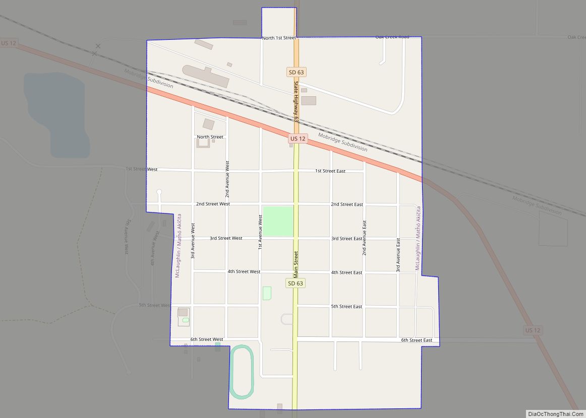
Online Interactive Map
Click on ![]() to view map in "full screen" mode.
to view map in "full screen" mode.
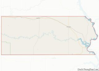
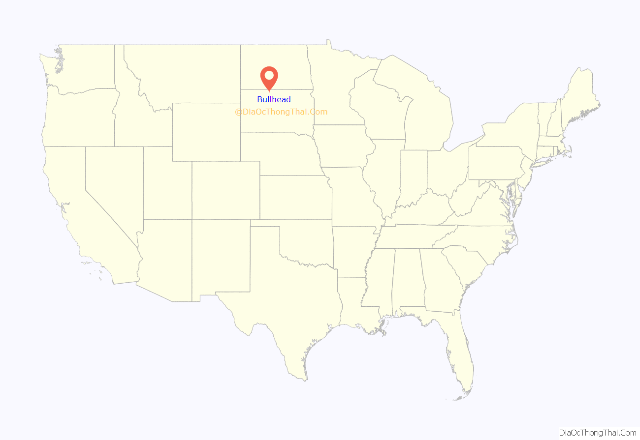
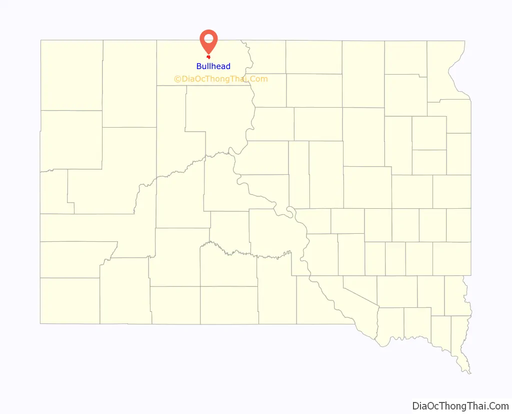
Bullhead location map. Where is Bullhead CDP?
History
The community has the name of Bullhead, a member of the Indian police who was killed in an altercation near the town site.
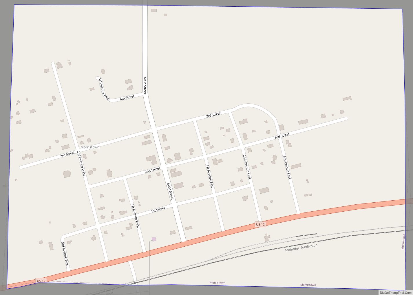
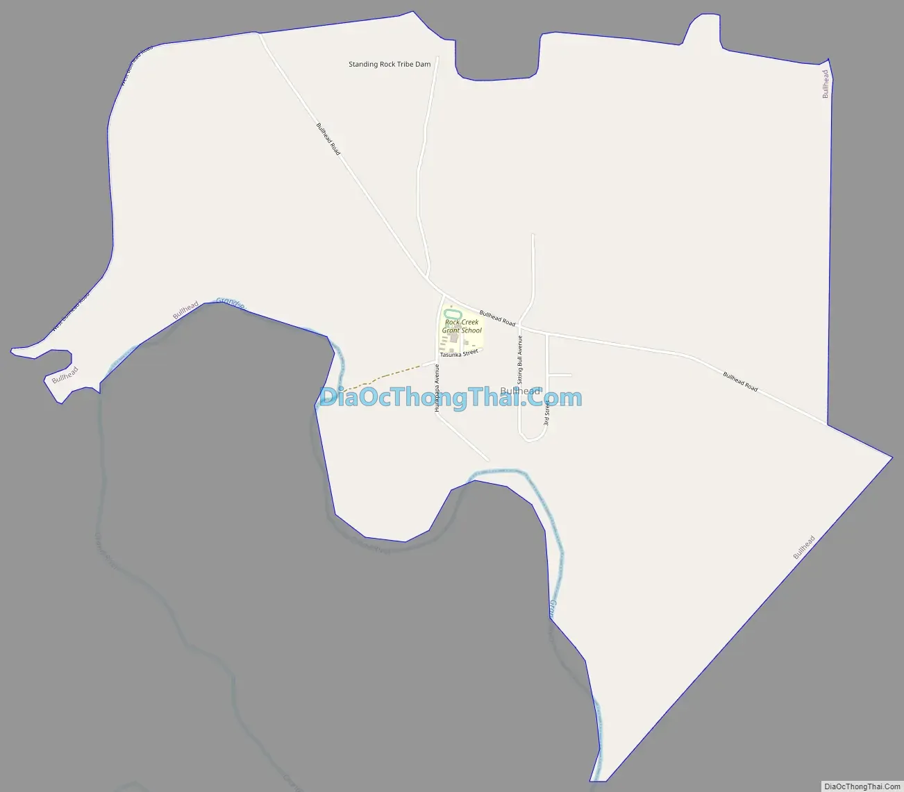
Bullhead Road Map
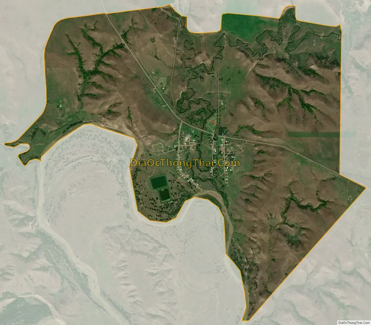
Bullhead city Satellite Map
Geography
Bullhead is located at 45°46′2″N 101°4′55″W / 45.76722°N 101.08194°W / 45.76722; -101.08194 (45.767129, -101.081841).
According to the United States Census Bureau, the CDP has a total area of 3.1 square miles (8.0 km), of which 3.0 square miles (7.8 km) is land and 0.1 square miles (0.26 km) (2.59%) is water.
Bullhead has been assigned the ZIP code 57621.
See also
Map of South Dakota State and its subdivision:- Aurora
- Beadle
- Bennett
- Bon Homme
- Brookings
- Brown
- Brule
- Buffalo
- Butte
- Campbell
- Charles Mix
- Clark
- Clay
- Codington
- Corson
- Custer
- Davison
- Day
- Deuel
- Dewey
- Douglas
- Edmunds
- Fall River
- Faulk
- Grant
- Gregory
- Haakon
- Hamlin
- Hand
- Hanson
- Harding
- Hughes
- Hutchinson
- Hyde
- Jackson
- Jerauld
- Jones
- Kingsbury
- Lake
- Lawrence
- Lincoln
- Lyman
- Marshall
- McCook
- McPherson
- Meade
- Mellette
- Miner
- Minnehaha
- Moody
- Pennington
- Perkins
- Potter
- Roberts
- Sanborn
- Shannon
- Spink
- Stanley
- Sully
- Todd
- Tripp
- Turner
- Union
- Walworth
- Yankton
- Ziebach
- Alabama
- Alaska
- Arizona
- Arkansas
- California
- Colorado
- Connecticut
- Delaware
- District of Columbia
- Florida
- Georgia
- Hawaii
- Idaho
- Illinois
- Indiana
- Iowa
- Kansas
- Kentucky
- Louisiana
- Maine
- Maryland
- Massachusetts
- Michigan
- Minnesota
- Mississippi
- Missouri
- Montana
- Nebraska
- Nevada
- New Hampshire
- New Jersey
- New Mexico
- New York
- North Carolina
- North Dakota
- Ohio
- Oklahoma
- Oregon
- Pennsylvania
- Rhode Island
- South Carolina
- South Dakota
- Tennessee
- Texas
- Utah
- Vermont
- Virginia
- Washington
- West Virginia
- Wisconsin
- Wyoming