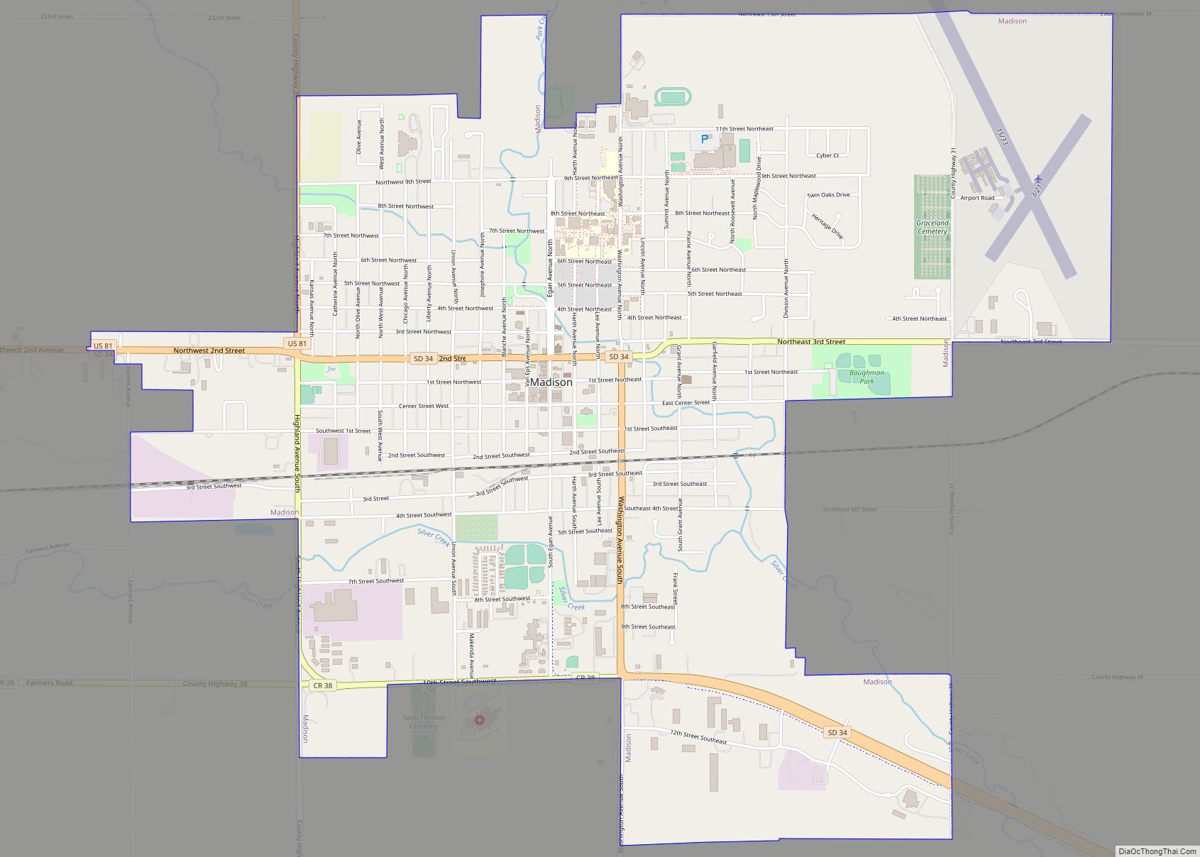
Madison is a city in Lake County, South Dakota, United States. The population was 6,191 at the 2020 census. It is the county seat of Lake County and is home to Dakota State University.
| Name: | Madison city |
|---|---|
| LSAD Code: | 25 |
| LSAD Description: | city (suffix) |
| State: | South Dakota |
| County: | Lake County |
| Founded: | 1880 |
| Incorporated: | 1885 |
| Elevation: | 1,677 ft (511 m) |
| Total Area: | 4.62 sq mi (11.95 km²) |
| Land Area: | 4.62 sq mi (11.95 km²) |
| Water Area: | 0.00 sq mi (0.00 km²) |
| Total Population: | 6,191 |
| Population Density: | 1,341.20/sq mi (517.87/km²) |
| Area code: | 605 |
| FIPS code: | 4640220 |
| GNISfeature ID: | 1256295 |
| Website: | www.cityofmadisonsd.com |
Online Interactive Map
Click on ![]() to view map in "full screen" mode.
to view map in "full screen" mode.
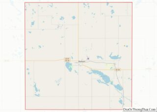
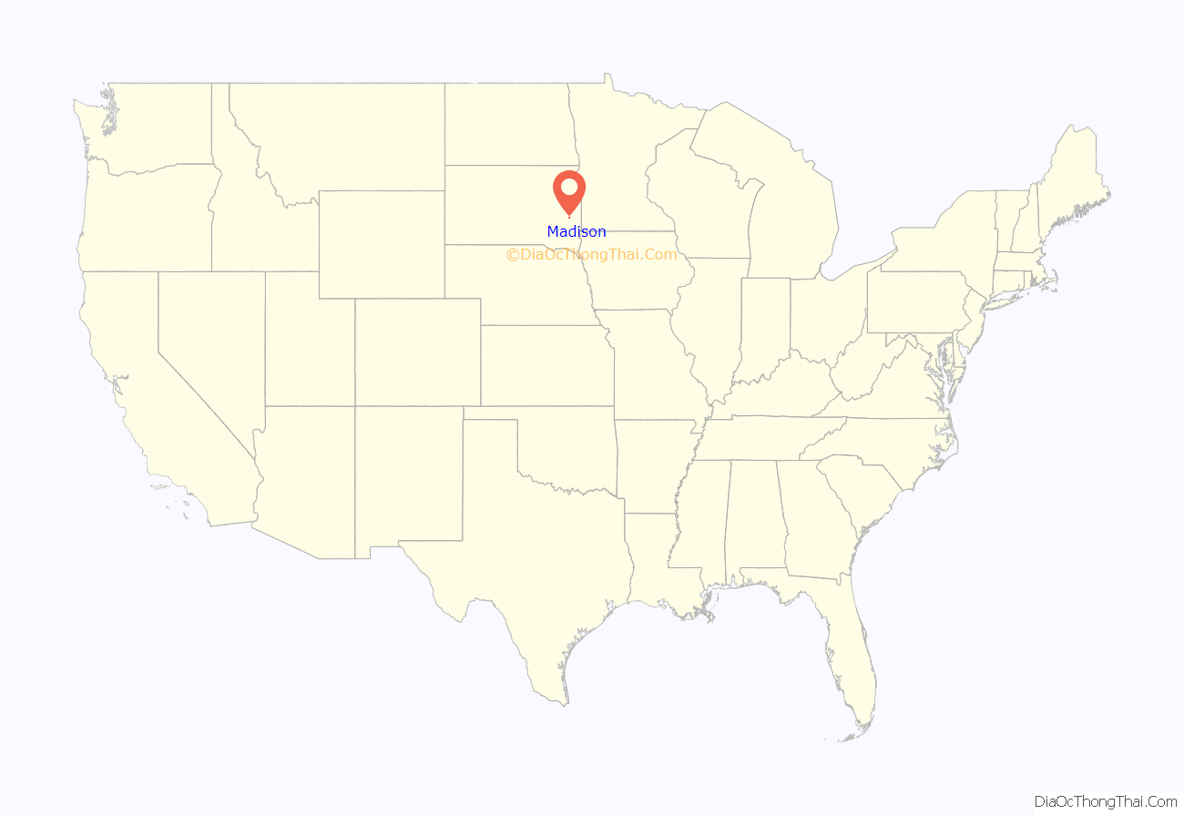
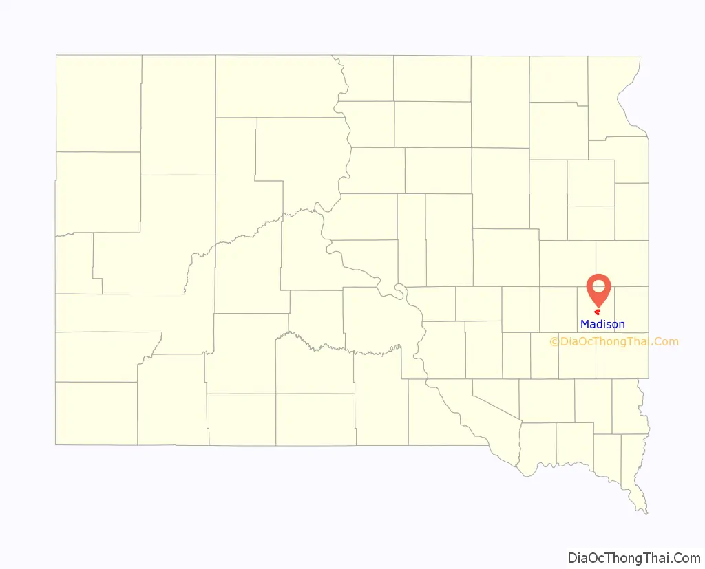
Madison location map. Where is Madison city?
History
Madison was laid out in 1873. The city was named after Madison, Wisconsin.
On May 12, 2022, Madison, along with several other towns in the region, were affected by a destructive derecho.
Madison Road Map
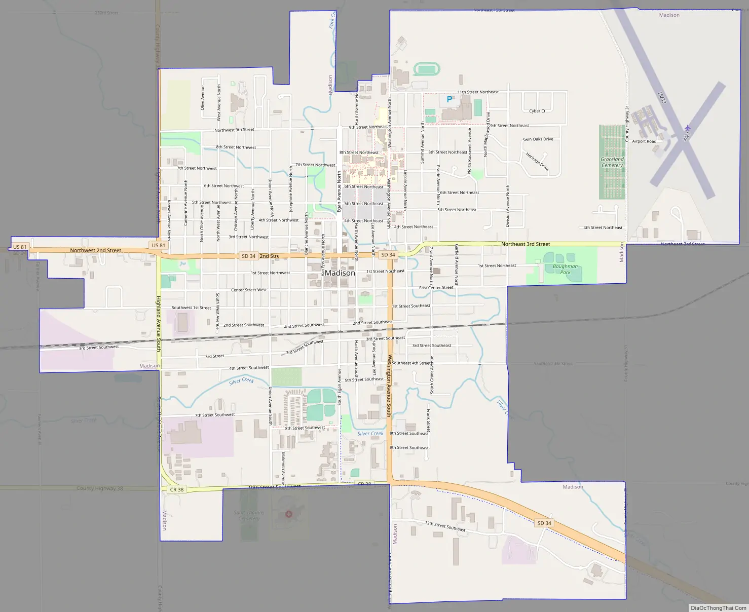
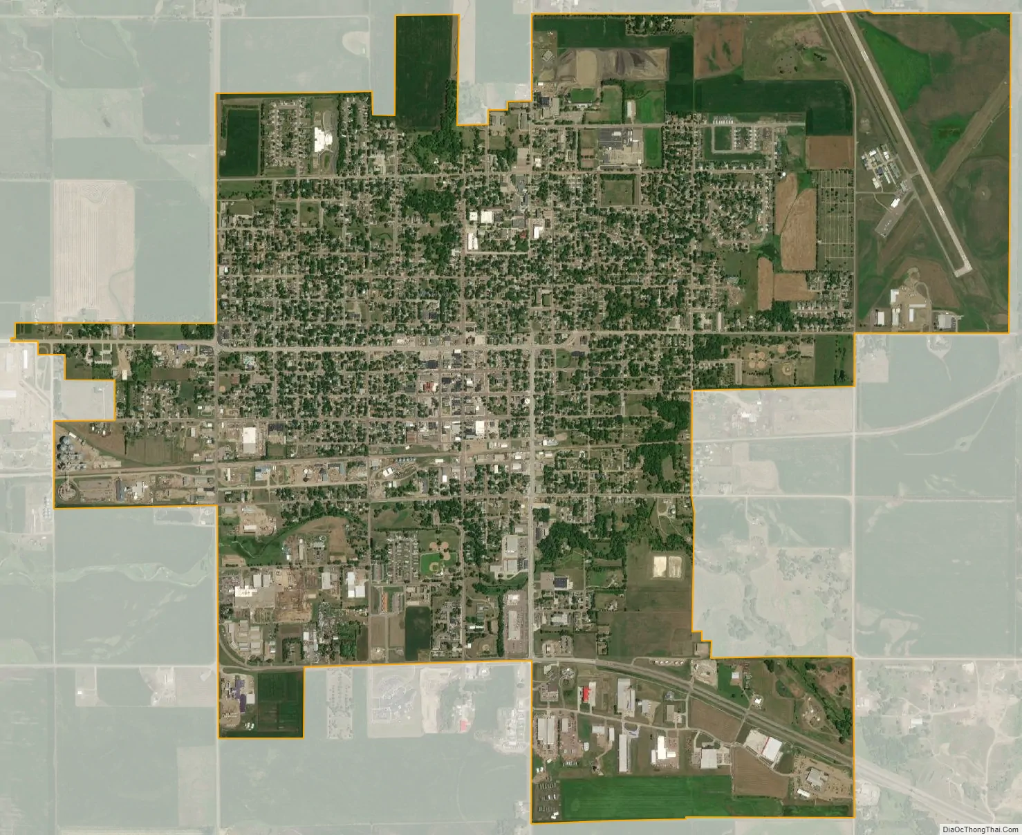
Madison city Satellite Map
Geography
Madison is located at 44°0′28″N 97°6′53″W / 44.00778°N 97.11472°W / 44.00778; -97.11472 (44.007734, -97.114738).
According to the United States Census Bureau, the city has a total area of 4.61 square miles (11.94 km), all land.
Madison has been assigned the ZIP code 57042 and the FIPS place code 40220.
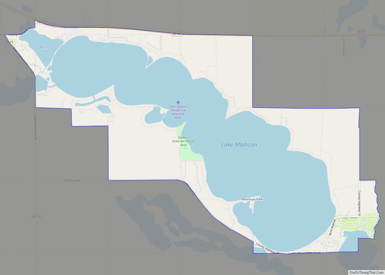
Madison is located between Lake Herman and Lake Madison.
Climate
See also
Map of South Dakota State and its subdivision:- Aurora
- Beadle
- Bennett
- Bon Homme
- Brookings
- Brown
- Brule
- Buffalo
- Butte
- Campbell
- Charles Mix
- Clark
- Clay
- Codington
- Corson
- Custer
- Davison
- Day
- Deuel
- Dewey
- Douglas
- Edmunds
- Fall River
- Faulk
- Grant
- Gregory
- Haakon
- Hamlin
- Hand
- Hanson
- Harding
- Hughes
- Hutchinson
- Hyde
- Jackson
- Jerauld
- Jones
- Kingsbury
- Lake
- Lawrence
- Lincoln
- Lyman
- Marshall
- McCook
- McPherson
- Meade
- Mellette
- Miner
- Minnehaha
- Moody
- Pennington
- Perkins
- Potter
- Roberts
- Sanborn
- Shannon
- Spink
- Stanley
- Sully
- Todd
- Tripp
- Turner
- Union
- Walworth
- Yankton
- Ziebach
- Alabama
- Alaska
- Arizona
- Arkansas
- California
- Colorado
- Connecticut
- Delaware
- District of Columbia
- Florida
- Georgia
- Hawaii
- Idaho
- Illinois
- Indiana
- Iowa
- Kansas
- Kentucky
- Louisiana
- Maine
- Maryland
- Massachusetts
- Michigan
- Minnesota
- Mississippi
- Missouri
- Montana
- Nebraska
- Nevada
- New Hampshire
- New Jersey
- New Mexico
- New York
- North Carolina
- North Dakota
- Ohio
- Oklahoma
- Oregon
- Pennsylvania
- Rhode Island
- South Carolina
- South Dakota
- Tennessee
- Texas
- Utah
- Vermont
- Virginia
- Washington
- West Virginia
- Wisconsin
- Wyoming