Viborg (/vaɪˈbɜːrɡ/; VY-burg) is a city in Turner County, South Dakota, United States. The population was 814 at the 2020 census.
| Name: | Viborg city |
|---|---|
| LSAD Code: | 25 |
| LSAD Description: | city (suffix) |
| State: | South Dakota |
| County: | Turner County |
| Incorporated: | 1903 |
| Elevation: | 1,306 ft (398 m) |
| Total Area: | 0.52 sq mi (1.34 km²) |
| Land Area: | 0.52 sq mi (1.34 km²) |
| Water Area: | 0.00 sq mi (0.00 km²) |
| Total Population: | 814 |
| Population Density: | 1,568.40/sq mi (605.72/km²) |
| ZIP code: | 57070 |
| Area code: | 605 |
| FIPS code: | 4667020 |
| GNISfeature ID: | 1265707 |
| Website: | https://www.viborgsd.org/ |
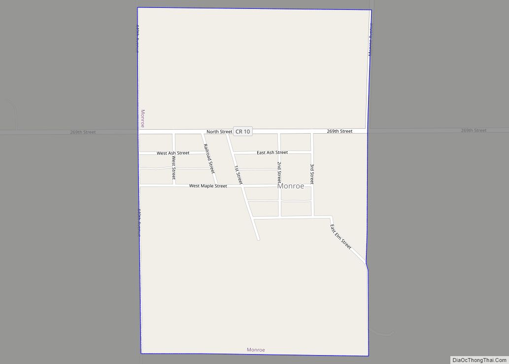
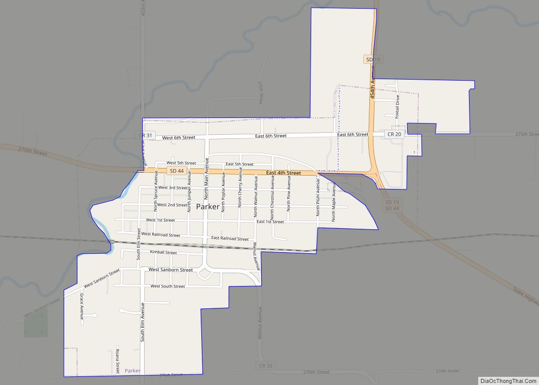
Online Interactive Map
Click on ![]() to view map in "full screen" mode.
to view map in "full screen" mode.
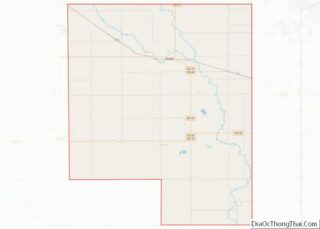
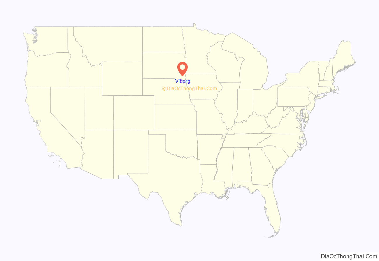
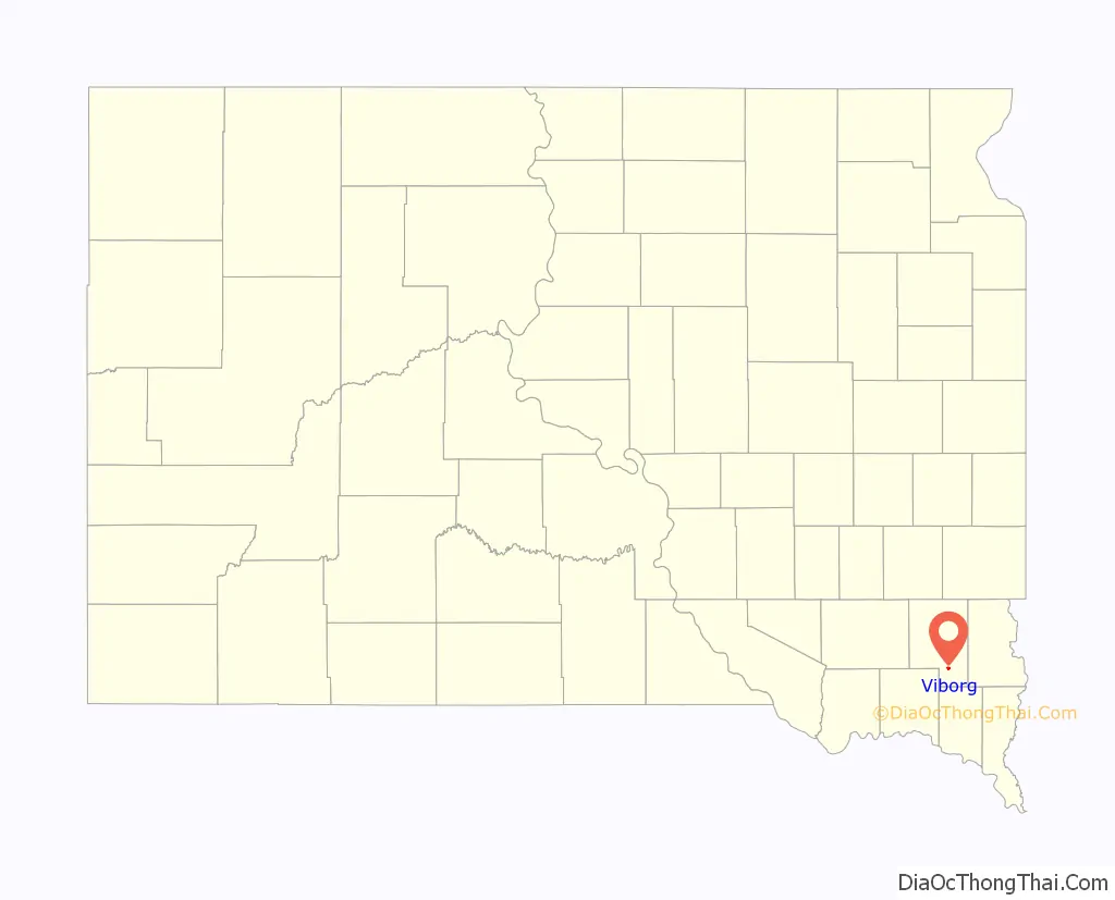
Viborg location map. Where is Viborg city?
History
Founded by Danish Americans, the city is named after the Danish city of Viborg. The area was first settled by Danish migrants in the 1860s, founding a community known as Daneville. With the advent of the railway in 1893, a new settlement closer to the railway was created as Viborg. Viborg was incorporated as a city on August 25, 1903.
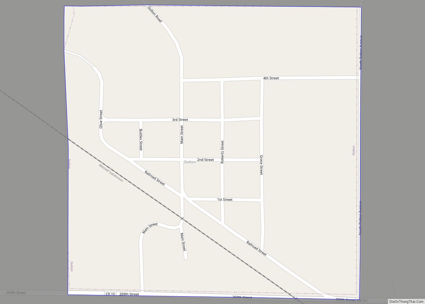
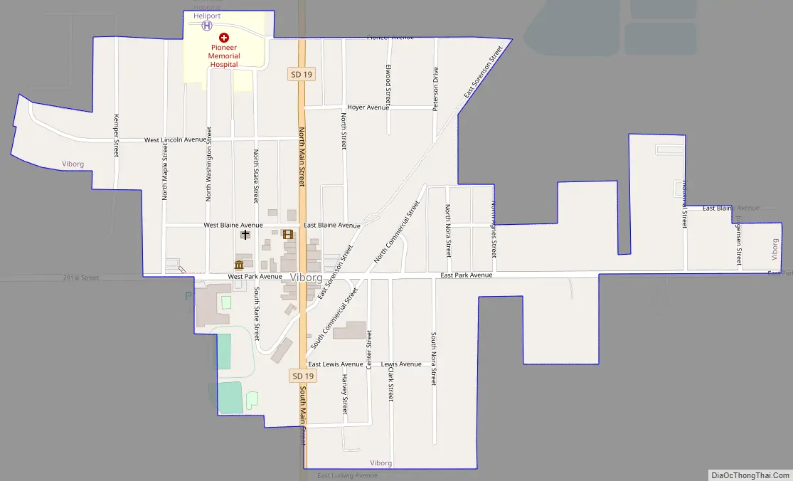
Viborg Road Map
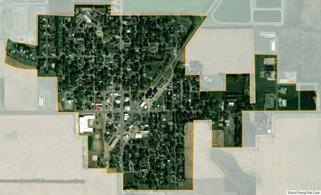
Viborg city Satellite Map
Geography
Viborg is located at 43°10′22″N 97°4′51″W / 43.17278°N 97.08083°W / 43.17278; -97.08083 (43.172664, -97.080757).
According to the United States Census Bureau, the city has a total area of 0.40 square miles (1.04 km), all land.
Viborg has been assigned the ZIP code 57070 and the FIPS place code 67020.
See also
Map of South Dakota State and its subdivision:- Aurora
- Beadle
- Bennett
- Bon Homme
- Brookings
- Brown
- Brule
- Buffalo
- Butte
- Campbell
- Charles Mix
- Clark
- Clay
- Codington
- Corson
- Custer
- Davison
- Day
- Deuel
- Dewey
- Douglas
- Edmunds
- Fall River
- Faulk
- Grant
- Gregory
- Haakon
- Hamlin
- Hand
- Hanson
- Harding
- Hughes
- Hutchinson
- Hyde
- Jackson
- Jerauld
- Jones
- Kingsbury
- Lake
- Lawrence
- Lincoln
- Lyman
- Marshall
- McCook
- McPherson
- Meade
- Mellette
- Miner
- Minnehaha
- Moody
- Pennington
- Perkins
- Potter
- Roberts
- Sanborn
- Shannon
- Spink
- Stanley
- Sully
- Todd
- Tripp
- Turner
- Union
- Walworth
- Yankton
- Ziebach
- Alabama
- Alaska
- Arizona
- Arkansas
- California
- Colorado
- Connecticut
- Delaware
- District of Columbia
- Florida
- Georgia
- Hawaii
- Idaho
- Illinois
- Indiana
- Iowa
- Kansas
- Kentucky
- Louisiana
- Maine
- Maryland
- Massachusetts
- Michigan
- Minnesota
- Mississippi
- Missouri
- Montana
- Nebraska
- Nevada
- New Hampshire
- New Jersey
- New Mexico
- New York
- North Carolina
- North Dakota
- Ohio
- Oklahoma
- Oregon
- Pennsylvania
- Rhode Island
- South Carolina
- South Dakota
- Tennessee
- Texas
- Utah
- Vermont
- Virginia
- Washington
- West Virginia
- Wisconsin
- Wyoming