Wolsey is a town in Beadle County, South Dakota, United States. The population was 459 at the 2020 census.
| Name: | Wolsey town |
|---|---|
| LSAD Code: | 43 |
| LSAD Description: | town (suffix) |
| State: | South Dakota |
| County: | Beadle County |
| Incorporated: | 1883 |
| Elevation: | 1,352 ft (412 m) |
| Total Area: | 2.30 sq mi (5.96 km²) |
| Land Area: | 2.27 sq mi (5.87 km²) |
| Water Area: | 0.04 sq mi (0.09 km²) |
| Total Population: | 459 |
| Population Density: | 202.65/sq mi (78.25/km²) |
| ZIP code: | 57384 |
| Area code: | 605 |
| FIPS code: | 4672540 |
| GNISfeature ID: | 1259072 |
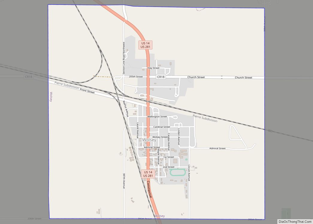
Online Interactive Map
Click on ![]() to view map in "full screen" mode.
to view map in "full screen" mode.
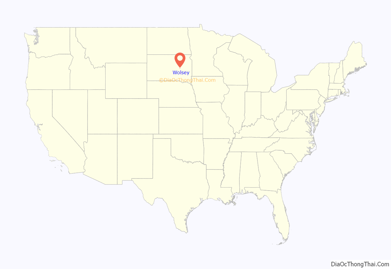
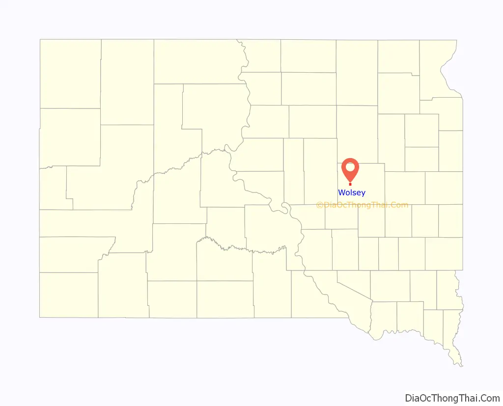
Wolsey location map. Where is Wolsey town?
History
The first settlement at Wolsey was made in 1882. A post office has been in operation in Wolsey since 1883, the same year the town was platted. The township was organized the following year, in 1884. The town of Wolsey was named for Thomas Wolsey, an English cardinal.
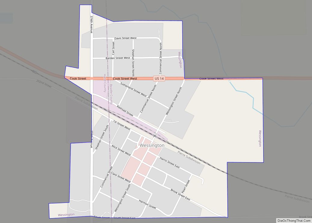
Wolsey Road Map
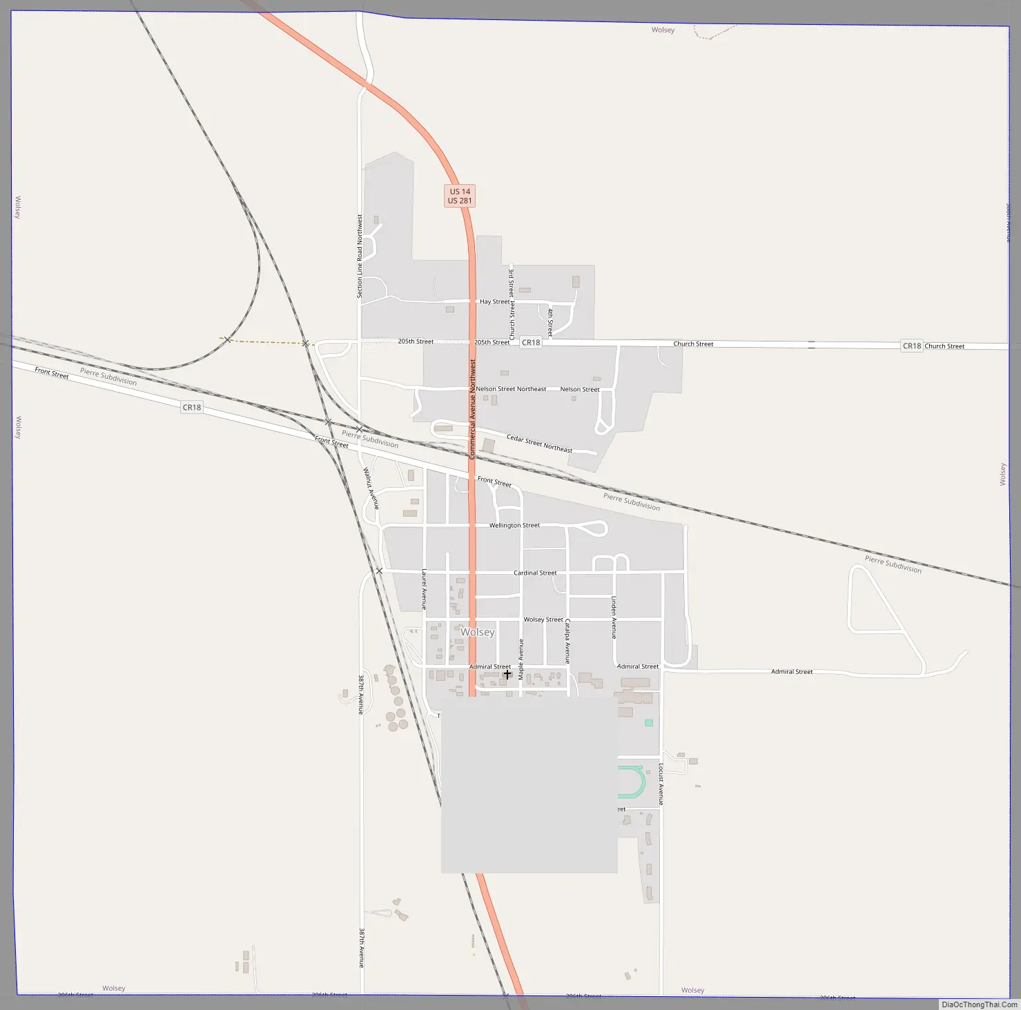
Wolsey city Satellite Map

Geography
Wolsey is located at 44°24′32″N 98°28′27″W / 44.40889°N 98.47417°W / 44.40889; -98.47417 (44.408775, -98.474139).
According to the United States Census Bureau, the town has a total area of 2.31 square miles (5.98 km), of which 2.27 square miles (5.88 km) is land and 0.04 square miles (0.10 km) is water.
Wolsey has been assigned the ZIP code 57384 and the FIPS place code 72540.
See also
Map of South Dakota State and its subdivision:- Aurora
- Beadle
- Bennett
- Bon Homme
- Brookings
- Brown
- Brule
- Buffalo
- Butte
- Campbell
- Charles Mix
- Clark
- Clay
- Codington
- Corson
- Custer
- Davison
- Day
- Deuel
- Dewey
- Douglas
- Edmunds
- Fall River
- Faulk
- Grant
- Gregory
- Haakon
- Hamlin
- Hand
- Hanson
- Harding
- Hughes
- Hutchinson
- Hyde
- Jackson
- Jerauld
- Jones
- Kingsbury
- Lake
- Lawrence
- Lincoln
- Lyman
- Marshall
- McCook
- McPherson
- Meade
- Mellette
- Miner
- Minnehaha
- Moody
- Pennington
- Perkins
- Potter
- Roberts
- Sanborn
- Shannon
- Spink
- Stanley
- Sully
- Todd
- Tripp
- Turner
- Union
- Walworth
- Yankton
- Ziebach
- Alabama
- Alaska
- Arizona
- Arkansas
- California
- Colorado
- Connecticut
- Delaware
- District of Columbia
- Florida
- Georgia
- Hawaii
- Idaho
- Illinois
- Indiana
- Iowa
- Kansas
- Kentucky
- Louisiana
- Maine
- Maryland
- Massachusetts
- Michigan
- Minnesota
- Mississippi
- Missouri
- Montana
- Nebraska
- Nevada
- New Hampshire
- New Jersey
- New Mexico
- New York
- North Carolina
- North Dakota
- Ohio
- Oklahoma
- Oregon
- Pennsylvania
- Rhode Island
- South Carolina
- South Dakota
- Tennessee
- Texas
- Utah
- Vermont
- Virginia
- Washington
- West Virginia
- Wisconsin
- Wyoming