Collegedale is a city in Hamilton County, Tennessee, United States. The population was 11,109 at the 2020 census. Collegedale is a suburb of Chattanooga and is part of the Chattanooga, TN–GA Metropolitan Statistical Area. Collegedale is home to Southern Adventist University. The median household income is one of the highest in Hamilton County. It has been ranked as one of the best and safest places to live in Tennessee. The unincorporated community of Ooltewah is an enclave in Collegedale.
| Name: | Collegedale city |
|---|---|
| LSAD Code: | 25 |
| LSAD Description: | city (suffix) |
| State: | Tennessee |
| County: | Hamilton County |
| Incorporated: | 1968 |
| Elevation: | 791 ft (241 m) |
| Total Area: | 12.03 sq mi (31.16 km²) |
| Land Area: | 12.03 sq mi (31.16 km²) |
| Water Area: | 0.00 sq mi (0.00 km²) |
| Total Population: | 11,109 |
| Population Density: | 923.36/sq mi (356.52/km²) |
| ZIP code: | 37302, 37315, 37363 |
| Area code: | 423 |
| FIPS code: | 4716300 |
| GNISfeature ID: | 1280968 |
| Website: | www.collegedaletn.gov |
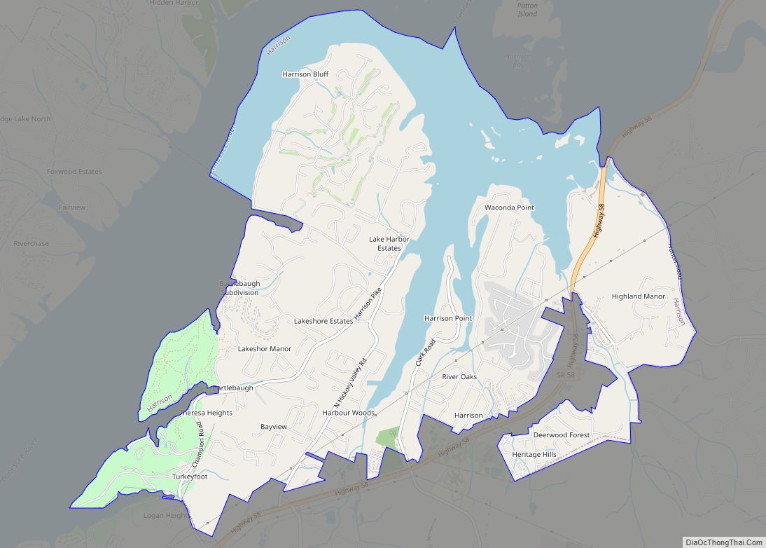
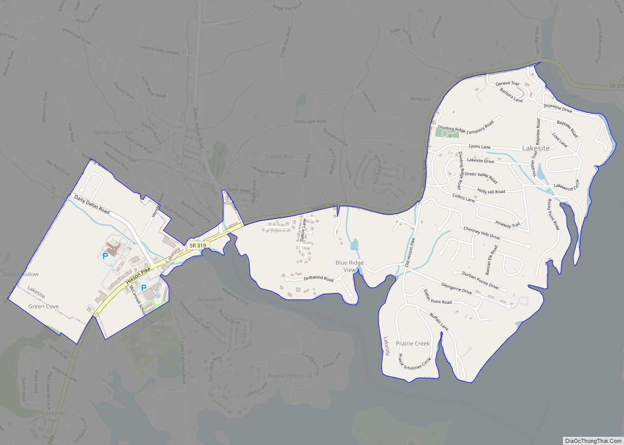
Online Interactive Map
Click on ![]() to view map in "full screen" mode.
to view map in "full screen" mode.
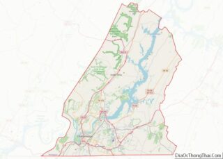
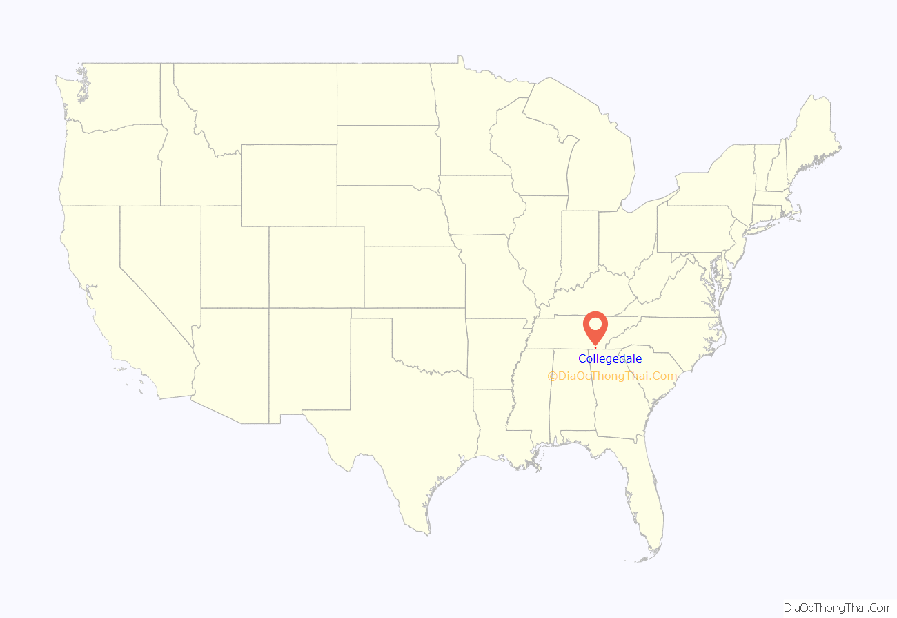
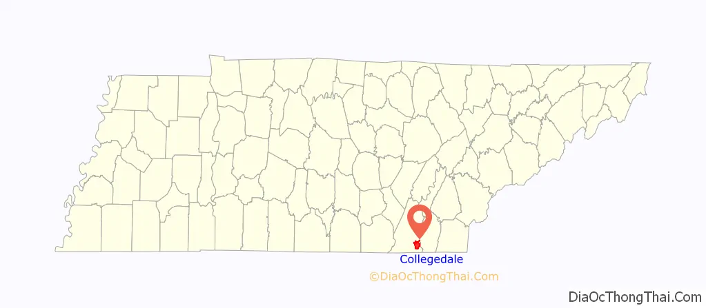
Collegedale location map. Where is Collegedale city?
History
Collegedale was founded as the site of Southern Adventist University (then Southern Junior College) in 1916. It was incorporated under a city manager government in 1968. J.M. Ackerman was the first city manager, and Fred Fuller served as the city’s first mayor.
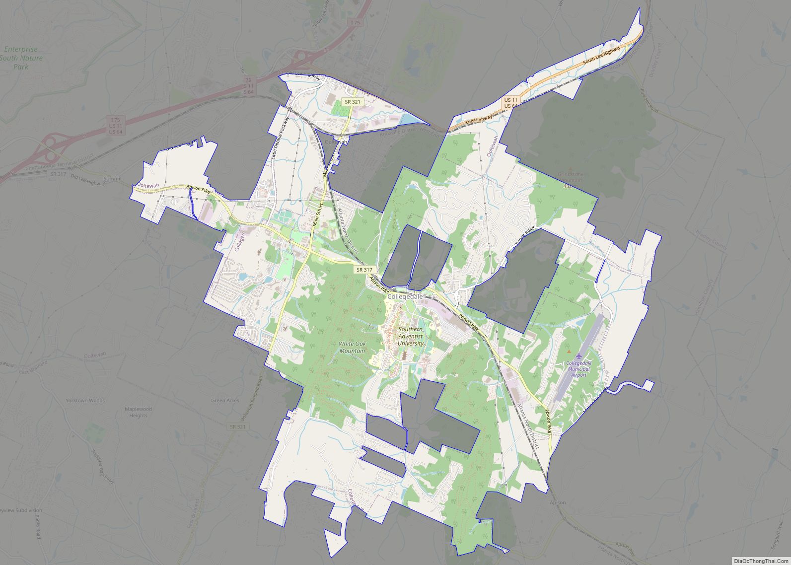
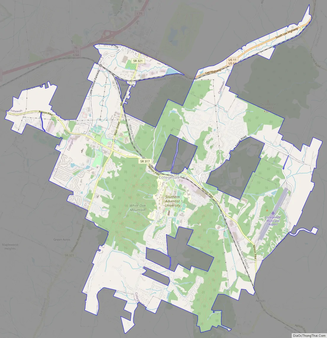
Collegedale Road Map
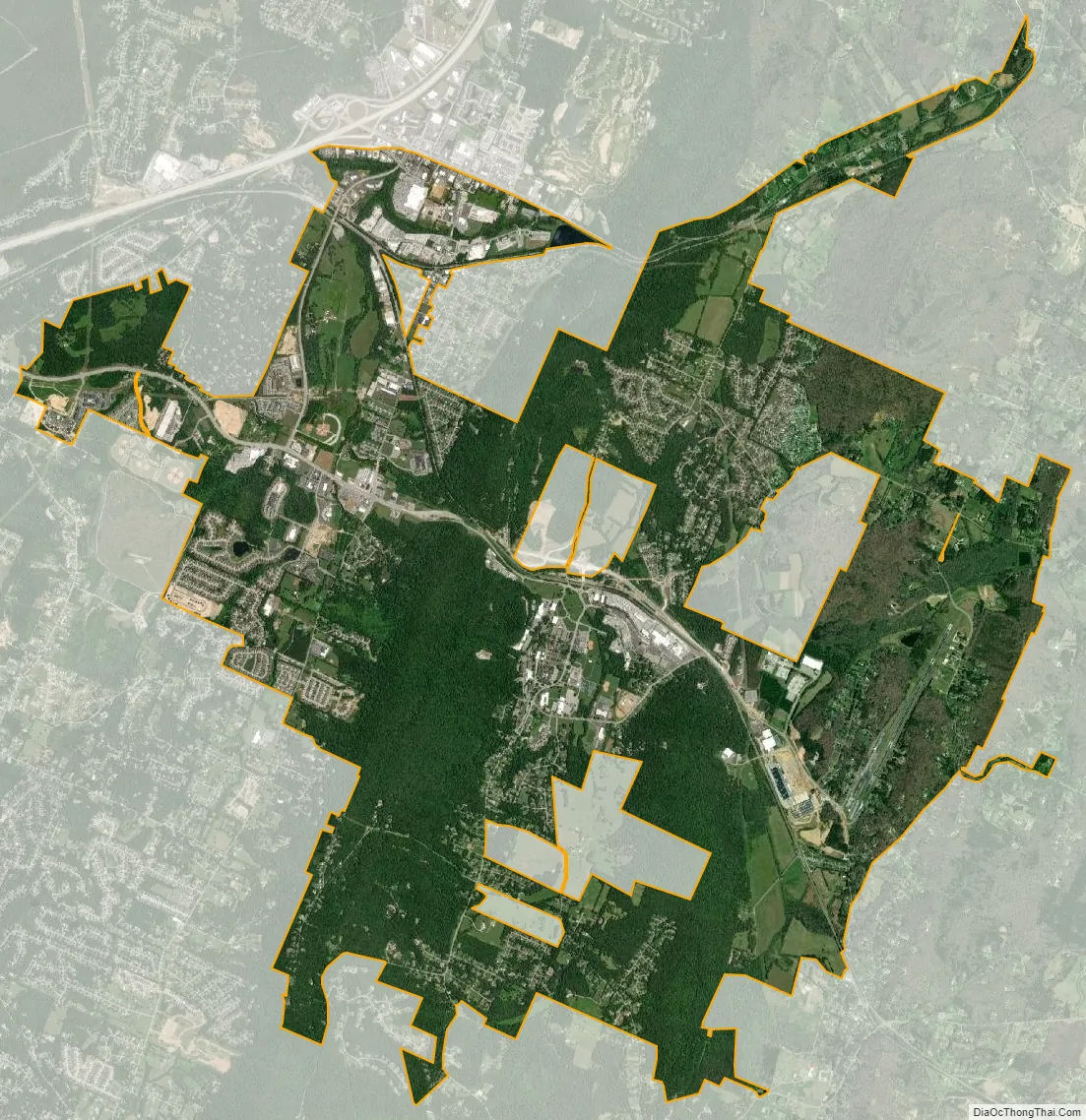
Collegedale city Satellite Map
Geography
Collegedale is located in southeastern Hamilton County at 35°3′6″N 85°2′49″W / 35.05167°N 85.04694°W / 35.05167; -85.04694 (35.051578, -85.047004), in the valley of Wolftever Creek. Just west of the city center, the creek cuts through White Oak Mountain, forming Collegedale Gap. Tennessee State Route 317 passes through the city center and Collegedale Gap, leading southeast 10 miles (16 km) to State Route 60 and northwest 4 miles (6 km) to Interstate 75 in the northeastern outskirts of Chattanooga. Downtown Chattanooga is 19 miles (31 km) west of Collegedale. Tennessee State Route 321 runs through the western part of Collegedale, leading north to U.S. routes 11 and 64 just north of Ooltewah and south 5 miles (8 km) to the Georgia state line.
As of the 2010 census, the city had a total area of 9.9 square miles (25.6 km), all of it recorded as land.
See also
Map of Tennessee State and its subdivision:- Anderson
- Bedford
- Benton
- Bledsoe
- Blount
- Bradley
- Campbell
- Cannon
- Carroll
- Carter
- Cheatham
- Chester
- Claiborne
- Clay
- Cocke
- Coffee
- Crockett
- Cumberland
- Davidson
- Decatur
- DeKalb
- Dickson
- Dyer
- Fayette
- Fentress
- Franklin
- Gibson
- Giles
- Grainger
- Greene
- Grundy
- Hamblen
- Hamilton
- Hancock
- Hardeman
- Hardin
- Hawkins
- Haywood
- Henderson
- Henry
- Hickman
- Houston
- Humphreys
- Jackson
- Jefferson
- Johnson
- Knox
- Lake
- Lauderdale
- Lawrence
- Lewis
- Lincoln
- Loudon
- Macon
- Madison
- Marion
- Marshall
- Maury
- McMinn
- McNairy
- Meigs
- Monroe
- Montgomery
- Moore
- Morgan
- Obion
- Overton
- Perry
- Pickett
- Polk
- Putnam
- Rhea
- Roane
- Robertson
- Rutherford
- Scott
- Sequatchie
- Sevier
- Shelby
- Smith
- Stewart
- Sullivan
- Sumner
- Tipton
- Trousdale
- Unicoi
- Union
- Van Buren
- Warren
- Washington
- Wayne
- Weakley
- White
- Williamson
- Wilson
- Alabama
- Alaska
- Arizona
- Arkansas
- California
- Colorado
- Connecticut
- Delaware
- District of Columbia
- Florida
- Georgia
- Hawaii
- Idaho
- Illinois
- Indiana
- Iowa
- Kansas
- Kentucky
- Louisiana
- Maine
- Maryland
- Massachusetts
- Michigan
- Minnesota
- Mississippi
- Missouri
- Montana
- Nebraska
- Nevada
- New Hampshire
- New Jersey
- New Mexico
- New York
- North Carolina
- North Dakota
- Ohio
- Oklahoma
- Oregon
- Pennsylvania
- Rhode Island
- South Carolina
- South Dakota
- Tennessee
- Texas
- Utah
- Vermont
- Virginia
- Washington
- West Virginia
- Wisconsin
- Wyoming