Ooltewah (/ˈuːtəwɑː/ (listen) OO-tuh-wah) is a census-designated place (CDP) in Hamilton County, Tennessee, United States. It is a community near Chattanooga. The population was 684 at the 2020 census. Ooltewah is an enclave in the city of Collegedale.
| Name: | Ooltewah CDP |
|---|---|
| LSAD Code: | 57 |
| LSAD Description: | CDP (suffix) |
| State: | Tennessee |
| County: | Hamilton County |
| Elevation: | 761 ft (232 m) |
| Total Area: | 0.62 sq mi (1.60 km²) |
| Land Area: | 0.62 sq mi (1.60 km²) |
| Water Area: | 0.00 sq mi (0.00 km²) |
| Total Population: | 684 |
| Population Density: | 1,106.80/sq mi (427.21/km²) |
| ZIP code: | 37363 |
| Area code: | 423 |
| FIPS code: | 4755900 |
| GNISfeature ID: | 1296442 |
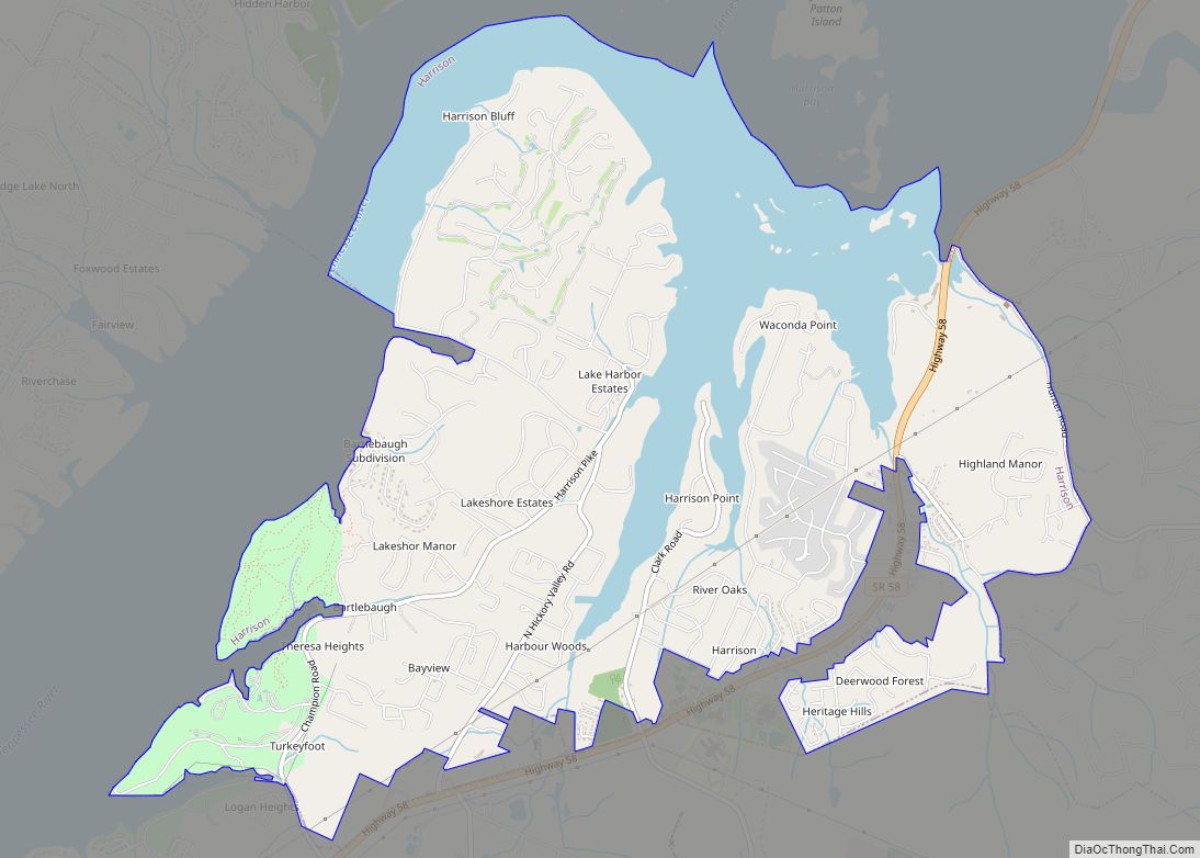
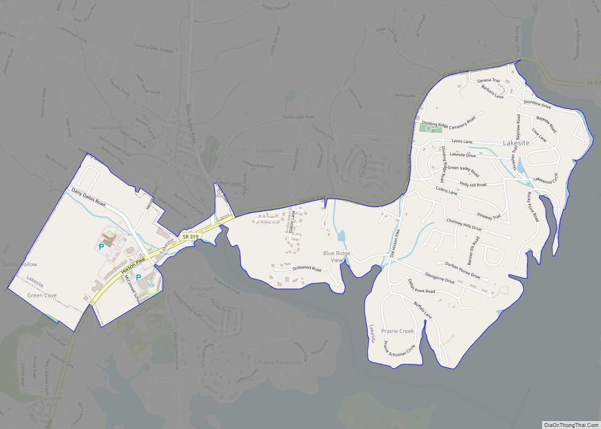
Online Interactive Map
Click on ![]() to view map in "full screen" mode.
to view map in "full screen" mode.
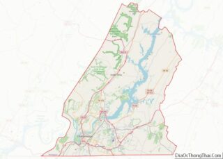
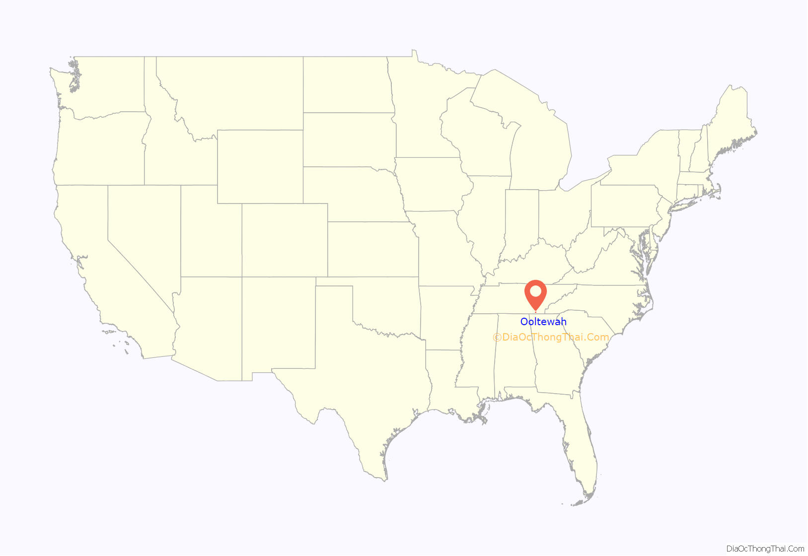
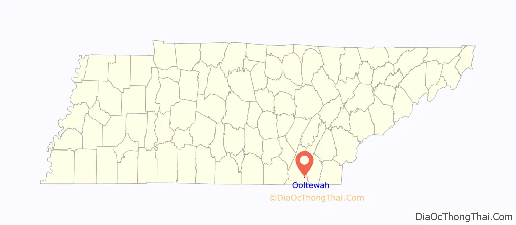
Ooltewah location map. Where is Ooltewah CDP?
History
Ooltewah was the county seat of James County, a former Tennessee county that went bankrupt in 1919 and was subsequently incorporated into Hamilton County. The former James County Courthouse located in the square in downtown Ooltewah is the community’s major landmark. It is listed on the National Register of Historic Places.
Alfred Cate (1822–1871), a resident of Ooltewah, was a prominent Southern Unionist and leader in the East Tennessee bridge-burning conspiracy. Cate and his men destroyed three Chattanooga-area railroad bridges on the night of November 8, 1861, in hopes of paving the way for a Union invasion of East Tennessee.
On November 24, 1863, the 4th Michigan Cavalry entered Ooltewah and captured seventeen Confederates, including two officers, and destroyed a train of four wagons. On the next day, the 4th Michigan Cavalry destroyed the Ooltewah railroad bridge, burned 4,000 pounds of flour, and captured a Confederate Lieutenant Colonel before moving on to Cleveland before nightfall.
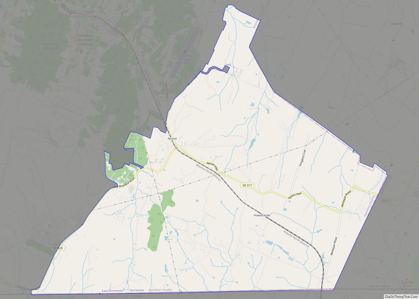
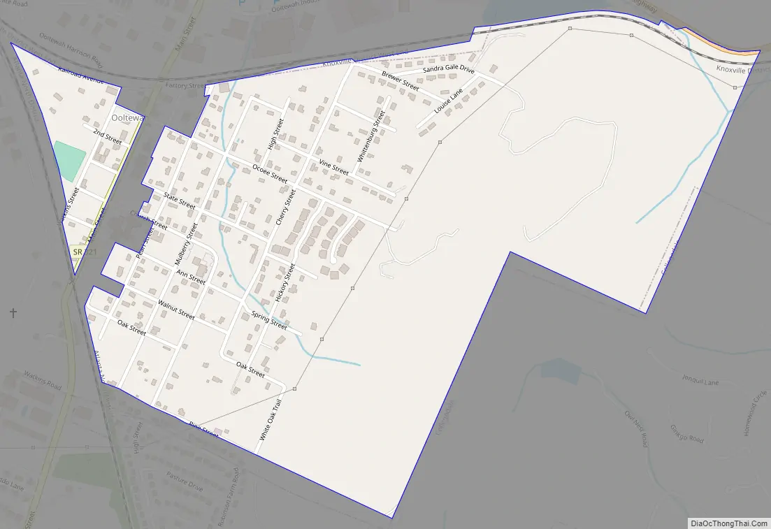
Ooltewah Road Map
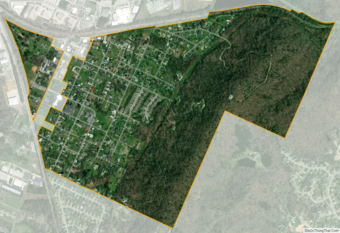
Ooltewah city Satellite Map
Geography
Ooltewah is located at 35°4′1″N 85°4′53″W / 35.06694°N 85.08139°W / 35.06694; -85.08139 (35.066834, -85.081421).
According to the United States Census Bureau, the CDP has a total area of 0.9 square miles (2.3 km), all land.
See also
Map of Tennessee State and its subdivision:- Anderson
- Bedford
- Benton
- Bledsoe
- Blount
- Bradley
- Campbell
- Cannon
- Carroll
- Carter
- Cheatham
- Chester
- Claiborne
- Clay
- Cocke
- Coffee
- Crockett
- Cumberland
- Davidson
- Decatur
- DeKalb
- Dickson
- Dyer
- Fayette
- Fentress
- Franklin
- Gibson
- Giles
- Grainger
- Greene
- Grundy
- Hamblen
- Hamilton
- Hancock
- Hardeman
- Hardin
- Hawkins
- Haywood
- Henderson
- Henry
- Hickman
- Houston
- Humphreys
- Jackson
- Jefferson
- Johnson
- Knox
- Lake
- Lauderdale
- Lawrence
- Lewis
- Lincoln
- Loudon
- Macon
- Madison
- Marion
- Marshall
- Maury
- McMinn
- McNairy
- Meigs
- Monroe
- Montgomery
- Moore
- Morgan
- Obion
- Overton
- Perry
- Pickett
- Polk
- Putnam
- Rhea
- Roane
- Robertson
- Rutherford
- Scott
- Sequatchie
- Sevier
- Shelby
- Smith
- Stewart
- Sullivan
- Sumner
- Tipton
- Trousdale
- Unicoi
- Union
- Van Buren
- Warren
- Washington
- Wayne
- Weakley
- White
- Williamson
- Wilson
- Alabama
- Alaska
- Arizona
- Arkansas
- California
- Colorado
- Connecticut
- Delaware
- District of Columbia
- Florida
- Georgia
- Hawaii
- Idaho
- Illinois
- Indiana
- Iowa
- Kansas
- Kentucky
- Louisiana
- Maine
- Maryland
- Massachusetts
- Michigan
- Minnesota
- Mississippi
- Missouri
- Montana
- Nebraska
- Nevada
- New Hampshire
- New Jersey
- New Mexico
- New York
- North Carolina
- North Dakota
- Ohio
- Oklahoma
- Oregon
- Pennsylvania
- Rhode Island
- South Carolina
- South Dakota
- Tennessee
- Texas
- Utah
- Vermont
- Virginia
- Washington
- West Virginia
- Wisconsin
- Wyoming