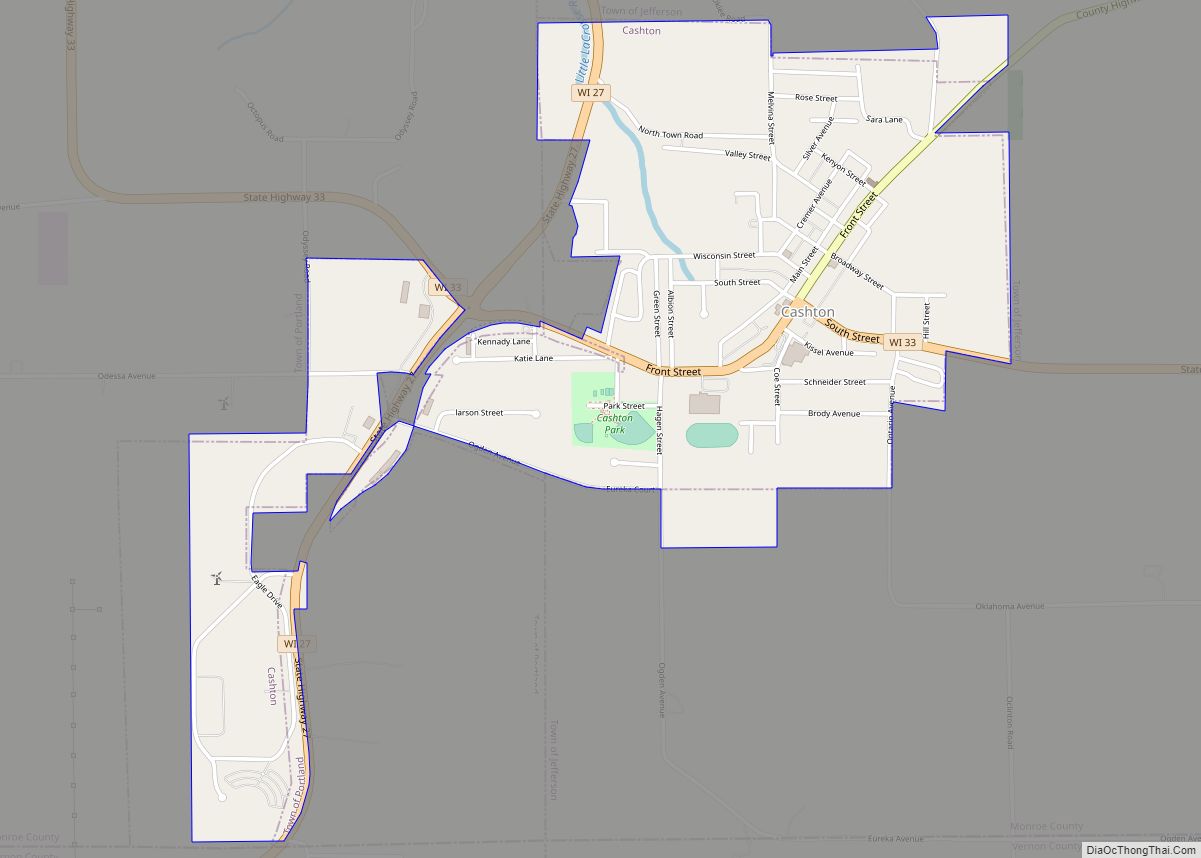
Cashton is a village in Monroe County, Wisconsin, United States. The population was 1,158 at the 2020 census.
| Name: | Cashton village |
|---|---|
| LSAD Code: | 47 |
| LSAD Description: | village (suffix) |
| State: | Wisconsin |
| County: | Monroe County |
| Elevation: | 1,362 ft (415 m) |
| Total Area: | 1.27 sq mi (3.30 km²) |
| Land Area: | 1.27 sq mi (3.30 km²) |
| Water Area: | 0.00 sq mi (0.00 km²) |
| Total Population: | 1,243 |
| Population Density: | 908.2/sq mi (350.7/km²) |
| Area code: | 608 |
| FIPS code: | 5512950 |
| GNISfeature ID: | 1562772 |
| Website: | www.cashton.com |
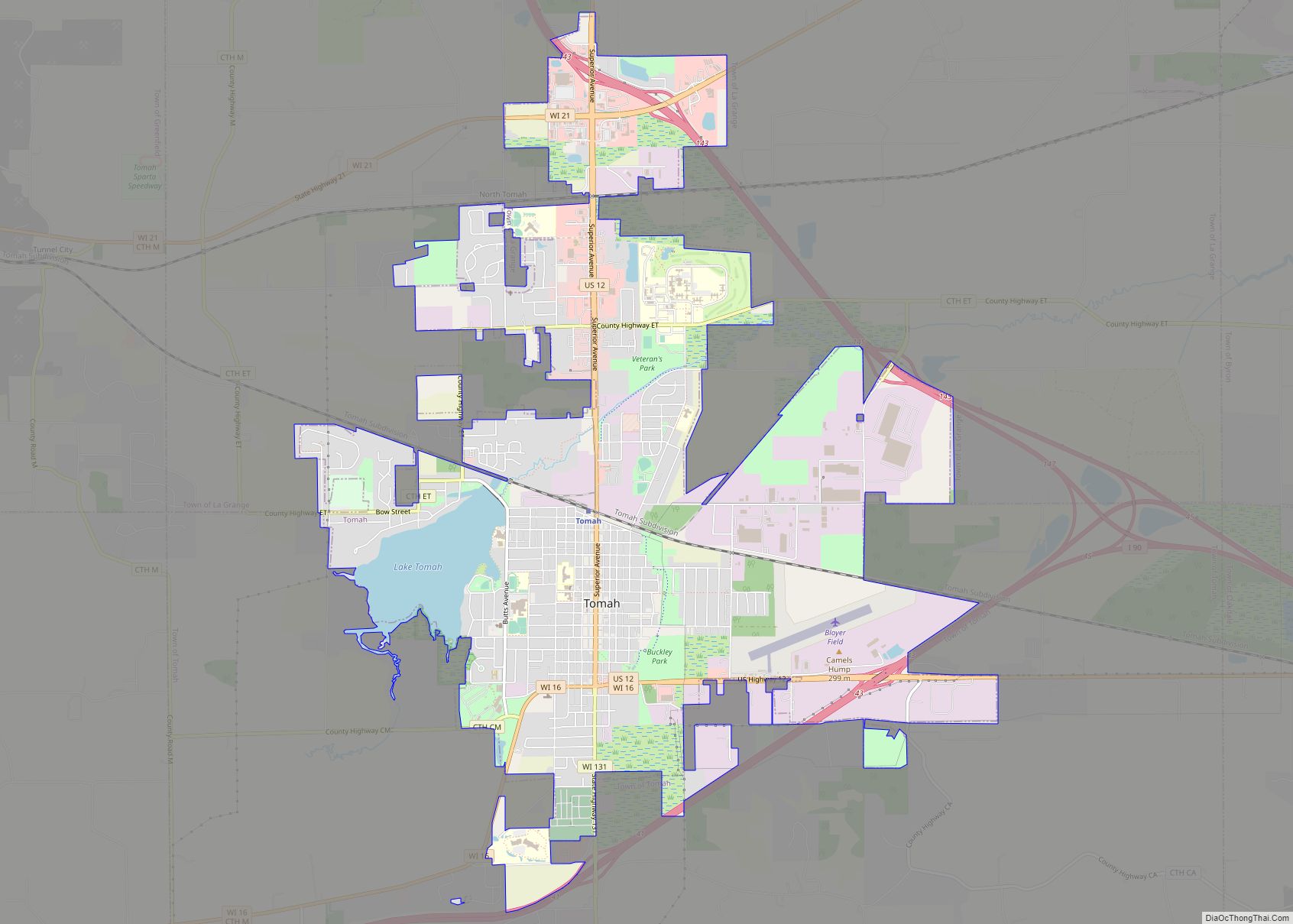
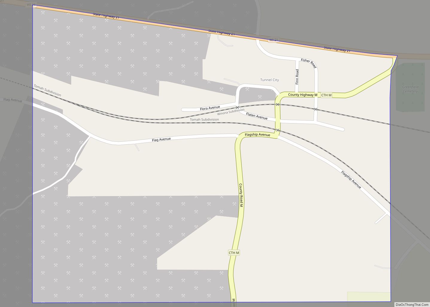
Online Interactive Map
Click on ![]() to view map in "full screen" mode.
to view map in "full screen" mode.
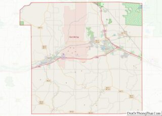
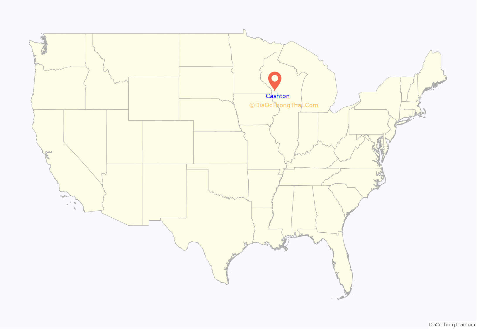
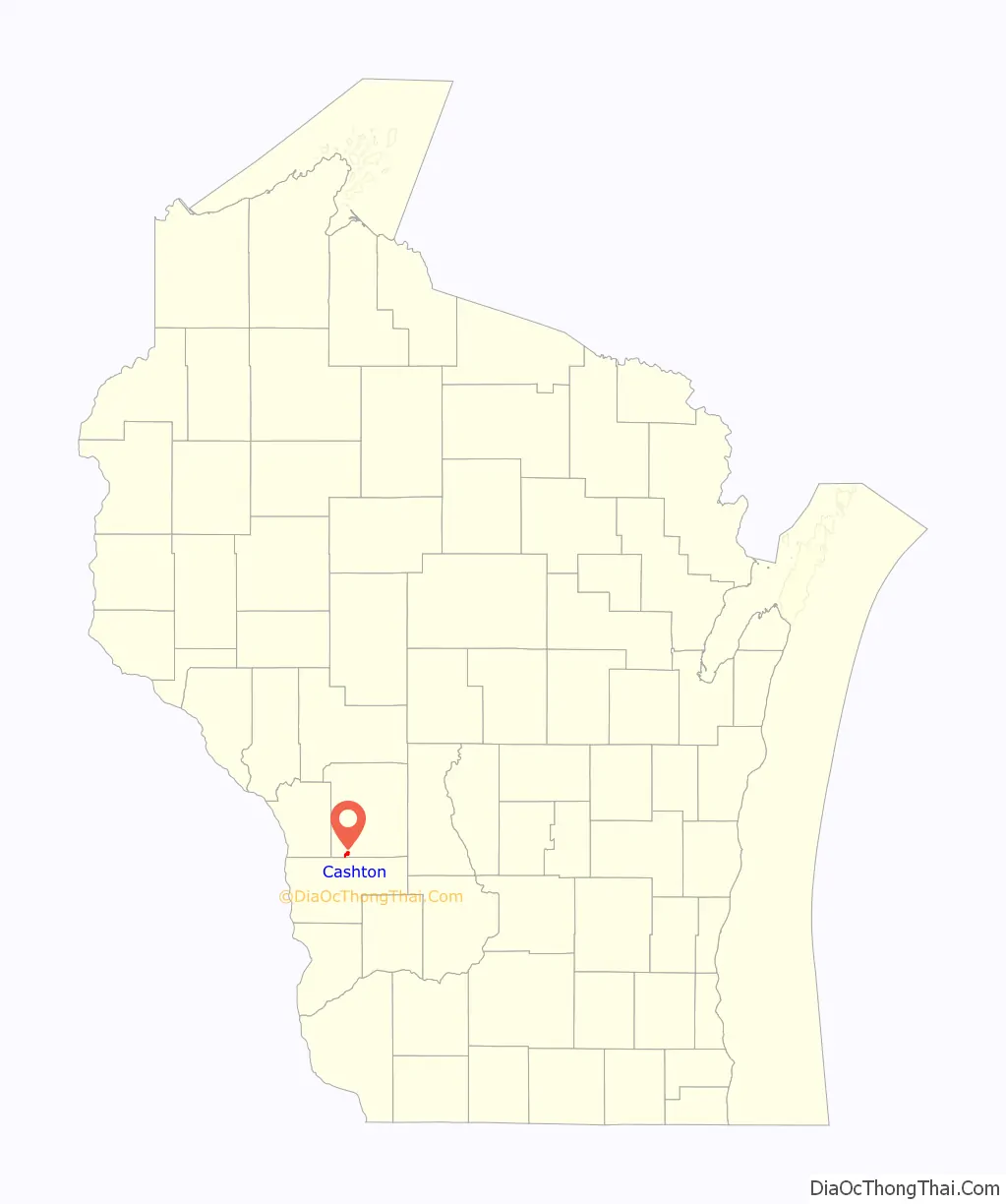
Cashton location map. Where is Cashton village?
History
The settlement began in 1854 when Thompson Hazen established an inn at a nearby bend in the stagecoach road from Prairie du Chien to Black River Falls, Wisconsin. The location was then known as Hazen’s Corners. In 1879, the Chicago, Milwaukee, and St. Paul Railroad built a branch line from Sparta to Viroqua, Wisconsin through the area, drawing additional settlers. The same year, local merchant William H. H. Cash spearheaded construction of a railroad depot and had the village platted, renaming it Cashton.
The rural area around Cashton began to attract many Amish farmers in the late 1960s, and it is now the largest Amish settlement in Wisconsin.
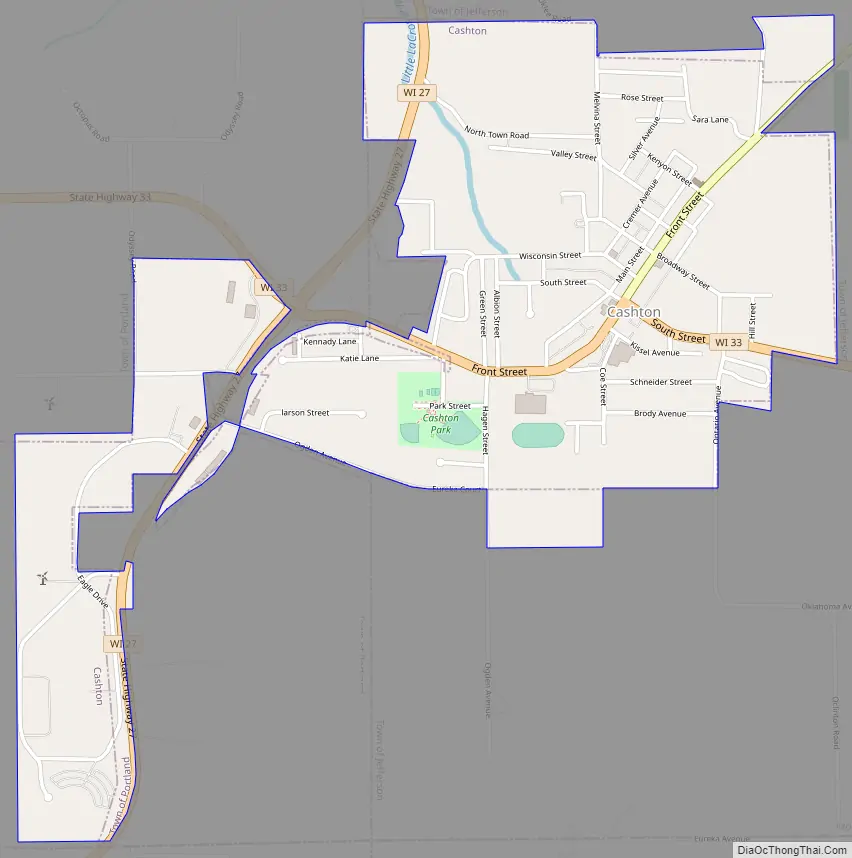
Cashton Road Map
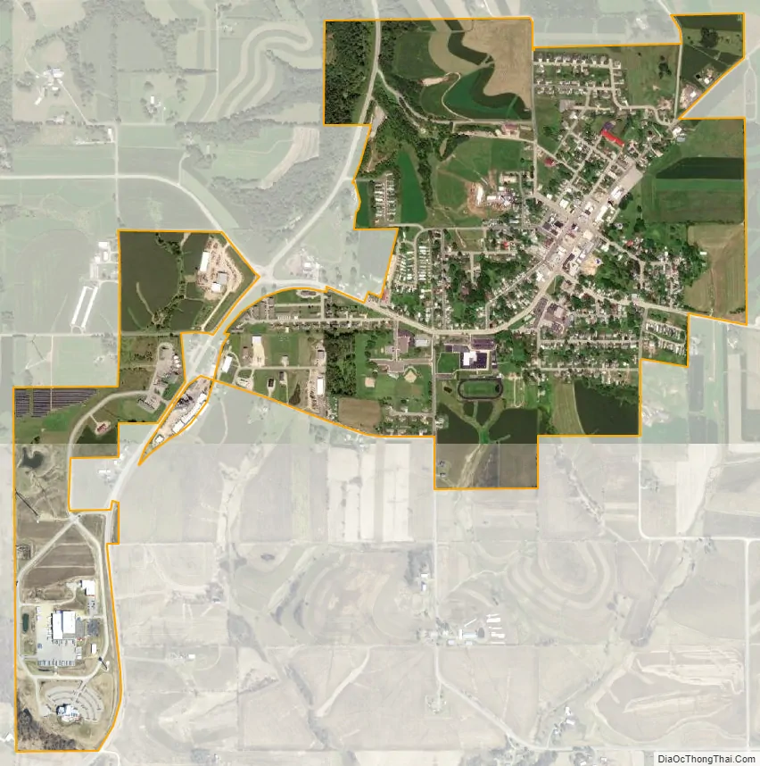
Cashton city Satellite Map
Geography
Cashton is located at 43°44′35″N 90°46′54″W / 43.74306°N 90.78167°W / 43.74306; -90.78167 (43.743057, -90.781578).
According to the United States Census Bureau, the village has a total area of 1.32 square miles (3.42 km), all of it land.
See also
Map of Wisconsin State and its subdivision:- Adams
- Ashland
- Barron
- Bayfield
- Brown
- Buffalo
- Burnett
- Calumet
- Chippewa
- Clark
- Columbia
- Crawford
- Dane
- Dodge
- Door
- Douglas
- Dunn
- Eau Claire
- Florence
- Fond du Lac
- Forest
- Grant
- Green
- Green Lake
- Iowa
- Iron
- Jackson
- Jefferson
- Juneau
- Kenosha
- Kewaunee
- La Crosse
- Lafayette
- Lake Michigan
- Lake Superior
- Langlade
- Lincoln
- Manitowoc
- Marathon
- Marinette
- Marquette
- Menominee
- Milwaukee
- Monroe
- Oconto
- Oneida
- Outagamie
- Ozaukee
- Pepin
- Pierce
- Polk
- Portage
- Price
- Racine
- Richland
- Rock
- Rusk
- Saint Croix
- Sauk
- Sawyer
- Shawano
- Sheboygan
- Taylor
- Trempealeau
- Vernon
- Vilas
- Walworth
- Washburn
- Washington
- Waukesha
- Waupaca
- Waushara
- Winnebago
- Wood
- Alabama
- Alaska
- Arizona
- Arkansas
- California
- Colorado
- Connecticut
- Delaware
- District of Columbia
- Florida
- Georgia
- Hawaii
- Idaho
- Illinois
- Indiana
- Iowa
- Kansas
- Kentucky
- Louisiana
- Maine
- Maryland
- Massachusetts
- Michigan
- Minnesota
- Mississippi
- Missouri
- Montana
- Nebraska
- Nevada
- New Hampshire
- New Jersey
- New Mexico
- New York
- North Carolina
- North Dakota
- Ohio
- Oklahoma
- Oregon
- Pennsylvania
- Rhode Island
- South Carolina
- South Dakota
- Tennessee
- Texas
- Utah
- Vermont
- Virginia
- Washington
- West Virginia
- Wisconsin
- Wyoming