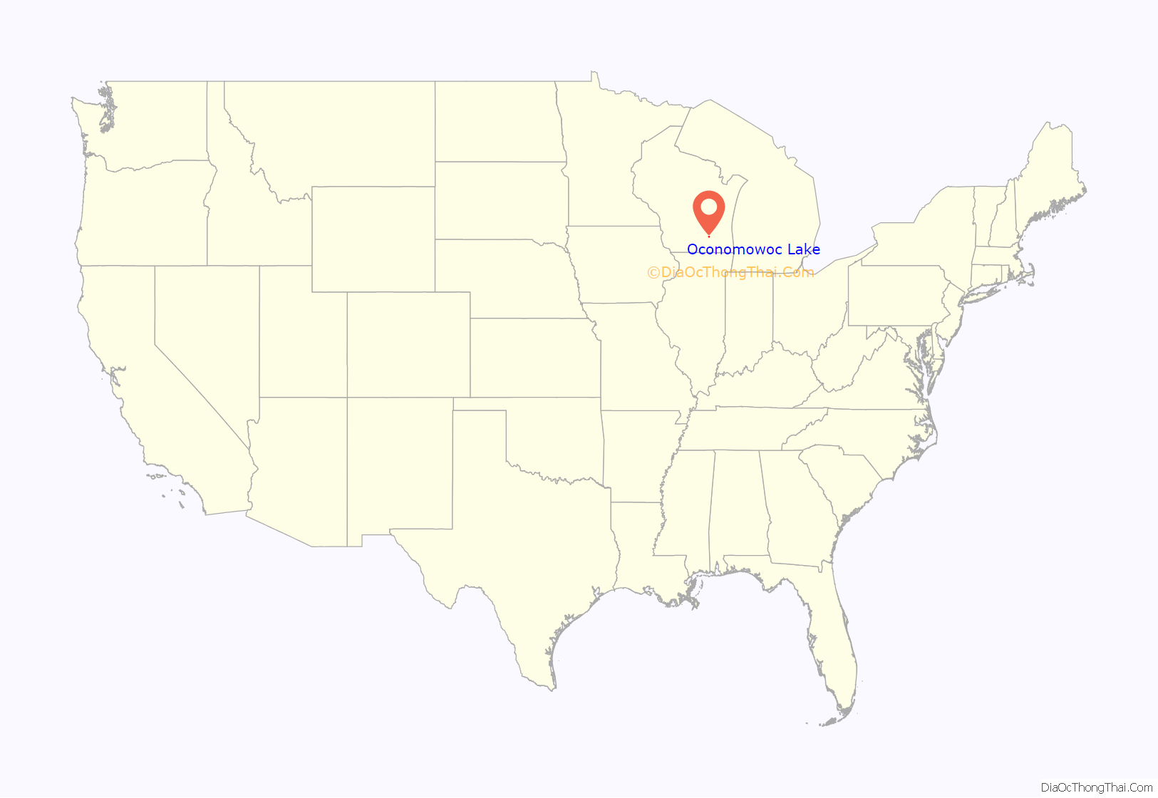
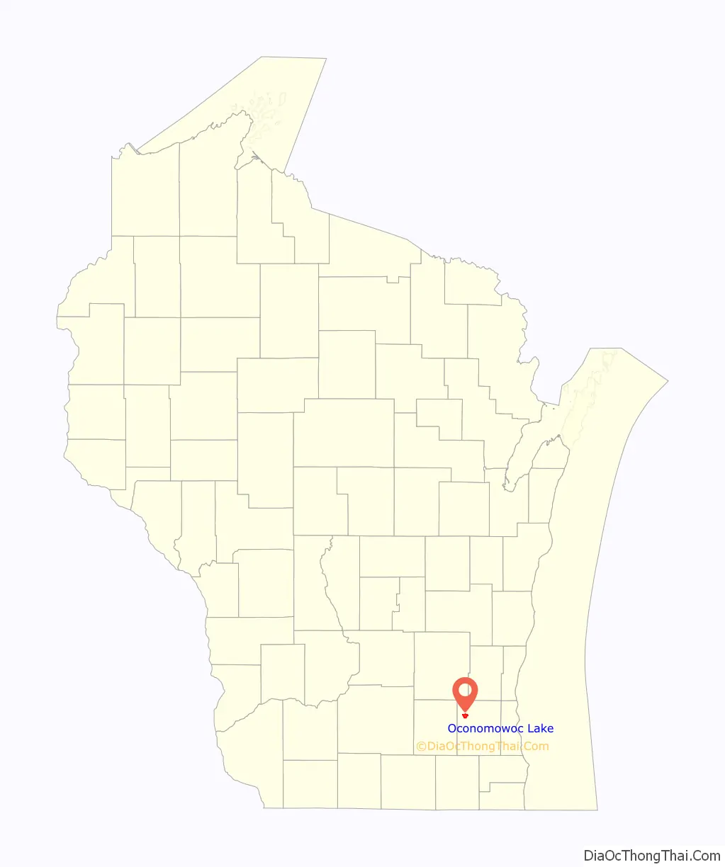
Oconomowoc Lake is a village in Waukesha County, Wisconsin, United States. Located just outside the City of Oconomowoc, the village includes the residential area encircling Oconomowoc Lake.
Around the turn of the 20th century, the area become known as a summer retreat for wealthy residents of Milwaukee and Chicago. The population was 566 at the 2020 census, and has remained one of the wealthiest jurisdictions in the state of Wisconsin.
| Name: | Oconomowoc Lake village |
|---|---|
| LSAD Code: | 47 |
| LSAD Description: | village (suffix) |
| State: | Wisconsin |
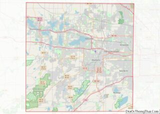
| County: | Waukesha County |
| Incorporated: | 1959 |
| Elevation: | 899 ft (274 m) |
| Total Area: | 3.24 sq mi (8.38 km²) |
| Land Area: | 1.92 sq mi (4.97 km²) |
| Water Area: | 1.32 sq mi (3.41 km²) |
| Total Population: | 566 |
| Population Density: | 312.50/sq mi (120.68/km²) |
| Area code: | 262 |
| FIPS code: | 5559300 |
| GNISfeature ID: | 1570738 |
Online Interactive Map
Click on ![]() to view map in "full screen" mode.
to view map in "full screen" mode.
Oconomowoc Lake location map. Where is Oconomowoc Lake village?
History
Development of the Oconomowoc lakeshore began in 1858 with the newly arrived Gifford family, who built a large summer home near the present-day site of the Oconomowoc Lake Club. Train service to Oconomowoc was initiated in the same year, allowing wealthy families from Chicago and Milwaukee to tour “Lake Country” on weekends. In 1878, the Giffords converted their property into the Gifford Hotel, a 100-acre (0.40 km) luxury summer retreat for Milwaukee’s elite. When the hotel closed in 1910, it had lured many well-heeled families to build their own summer homes along the lakefront.
By 1910, prominent homeowners along the lakefront included Philip Armour of Chicago’s meatpacking conglomerate, Frederick Pabst of the Pabst brewing family, and Frederick Miller of the Miller Brewing Company.
In 1934, the “Unofficial Village of Oconomowoc Lake” was created. The incorporation process started in 1952. The area was initially a part of the towns of Summit and Oconomowoc. The incorporation process was made final after going through a number of courts and a resident vote was held. 234 votes were taken with 192 voting in favor of incorporation.
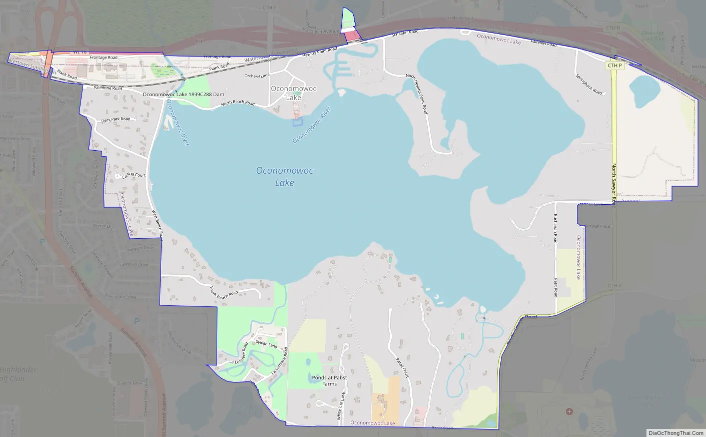
Oconomowoc Lake Road Map
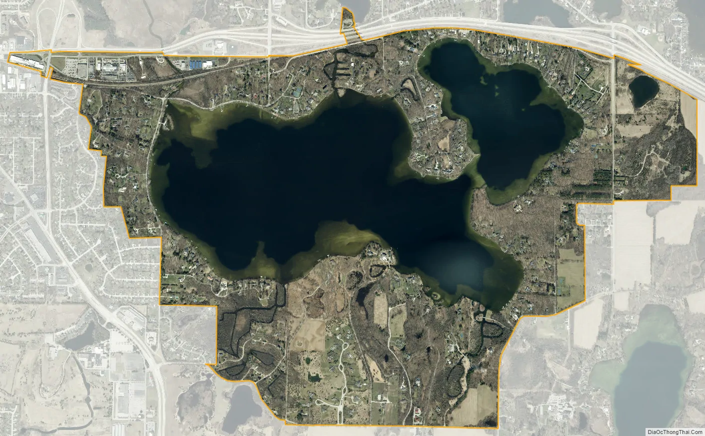
Oconomowoc Lake city Satellite Map
Geography
Oconomowoc Lake is located at 43°5′23″N 88°27′38″W / 43.08972°N 88.46056°W / 43.08972; -88.46056 (43.089780, −88.460587).
According to the United States Census Bureau, the village has a total area of 3.30 square miles (8.55 km), of which, 1.98 square miles (5.13 km) of it is land and 1.32 square miles (3.42 km) is water.
See also
Map of Wisconsin State and its subdivision:- Adams
- Ashland
- Barron
- Bayfield
- Brown
- Buffalo
- Burnett
- Calumet
- Chippewa
- Clark
- Columbia
- Crawford
- Dane
- Dodge
- Door
- Douglas
- Dunn
- Eau Claire
- Florence
- Fond du Lac
- Forest
- Grant
- Green
- Green Lake
- Iowa
- Iron
- Jackson
- Jefferson
- Juneau
- Kenosha
- Kewaunee
- La Crosse
- Lafayette
- Lake Michigan
- Lake Superior
- Langlade
- Lincoln
- Manitowoc
- Marathon
- Marinette
- Marquette
- Menominee
- Milwaukee
- Monroe
- Oconto
- Oneida
- Outagamie
- Ozaukee
- Pepin
- Pierce
- Polk
- Portage
- Price
- Racine
- Richland
- Rock
- Rusk
- Saint Croix
- Sauk
- Sawyer
- Shawano
- Sheboygan
- Taylor
- Trempealeau
- Vernon
- Vilas
- Walworth
- Washburn
- Washington
- Waukesha
- Waupaca
- Waushara
- Winnebago
- Wood
- Alabama
- Alaska
- Arizona
- Arkansas
- California
- Colorado
- Connecticut
- Delaware
- District of Columbia
- Florida
- Georgia
- Hawaii
- Idaho
- Illinois
- Indiana
- Iowa
- Kansas
- Kentucky
- Louisiana
- Maine
- Maryland
- Massachusetts
- Michigan
- Minnesota
- Mississippi
- Missouri
- Montana
- Nebraska
- Nevada
- New Hampshire
- New Jersey
- New Mexico
- New York
- North Carolina
- North Dakota
- Ohio
- Oklahoma
- Oregon
- Pennsylvania
- Rhode Island
- South Carolina
- South Dakota
- Tennessee
- Texas
- Utah
- Vermont
- Virginia
- Washington
- West Virginia
- Wisconsin
- Wyoming