Oconomowoc (/əˈkɒnəməˌwɒk/ ə-KON-ə-mə-wok) is a city in Waukesha County, Wisconsin, United States. The name was derived from Coo-no-mo-wauk, the Potawatomi term for “waterfall.” The population was 18,203 at the 2020 census. The city is partially adjacent to the Town of Oconomowoc and near the village of Oconomowoc Lake, Wisconsin.
| Name: | Oconomowoc city |
|---|---|
| LSAD Code: | 25 |
| LSAD Description: | city (suffix) |
| State: | Wisconsin |
| County: | Waukesha County |
| Elevation: | 823 ft (251 m) |
| Total Area: | 12.43 sq mi (32.19 km²) |
| Land Area: | 11.75 sq mi (30.44 km²) |
| Water Area: | 0.68 sq mi (1.76 km²) |
| Total Population: | 18,203 |
| Population Density: | 1,445.07/sq mi (557.93/km²) |
| ZIP code: | 53066 |
| Area code: | 262 |
| FIPS code: | 5559250 |
| Website: | oconomowoc-wi.gov |
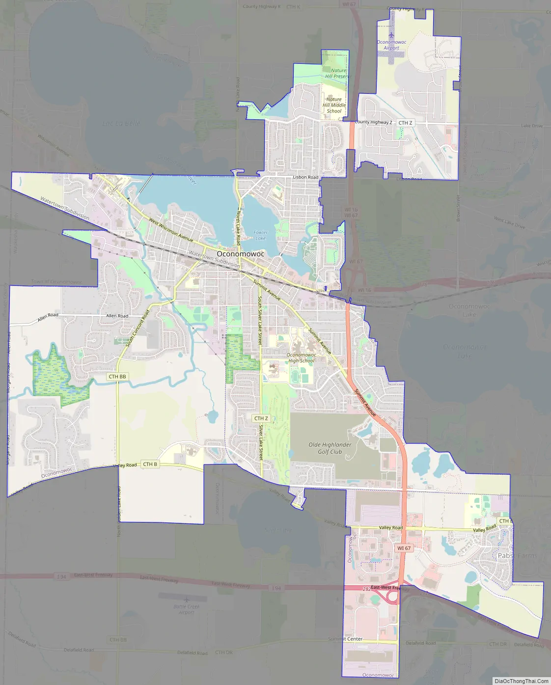
Online Interactive Map
Click on ![]() to view map in "full screen" mode.
to view map in "full screen" mode.
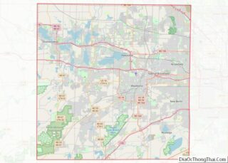
Oconomowoc location map. Where is Oconomowoc city?


History
Before 1700, this region was inhabited by Potawatomi peoples descended from Woodland Indians known as “mound builders”. There are also reports that the Sauk Indian chief Black Hawk had a campsite on Oconomowoc Lake.
The first white person recorded in the area was Amable (sometimes spelled “Aumable”) Vicau, brother-in-law of Solomon Juneau, one of the founders of Milwaukee. Vicau established a trading post in 1827. White settlers soon followed, beginning in 1830.
In April 1837, New York native Charles Sheldon staked a 160-acre claim on the eastern shore of what is now Fowler Lake, registering it with the Land Bank of Milwaukee on April 21, 1837. A few days later, H.W. Blanchard acquired a claim adjacent to that of Sheldon on the other side of the lake, which he later sold off to Philo Brewer. Brewer constructed what some consider to be the first residence within Oconomowoc’s current legal limits, a site located at what is now 517 N. Lake Road, between La Belle and Fowler lakes. The first recorded birth was that of Eliza Jane Dewey on January 19, 1840, in the lodgings above a chair factory located at 116 N. Walnut. The first recorded death was that of Jerusha Foster, who died somewhere between the ages of 30 and 36 on March 19, 1841. Initially buried at Zion Church point, she was eventually re-interred at Nashotah Mission.
Oconomowoc was incorporated as a town in 1844, although residents had to go to Summit to get their mail until 1845. Travel and communication links between the new town and nearby cities were quickly established. The Watertown Plank Road was extended to connect Oconomowoc to the nearby towns of Milwaukee, Waukesha, Pewaukee, and Watertown in 1850. Such infrastructure encouraged further settlement, and by 1853 the town grew to a population of 250, with ten stores, three hotels, one gristmill, and one sawmill (both located near the present Lake Road bridge), and a schoolhouse. The first passenger train from Milwaukee arrived in Oconomowoc on December 14, 1854, as part of the Milwaukee and Watertown Railroad Company’s rapidly expanding Milwaukee & Mississippi line.
In the 1870s, Oconomowoc started to become a summer resort town for wealthy families from the Midwest. Large houses were established around the town’s lakes, particularly Oconomowoc Lake and Lac La Belle. The population grew so much that Oconomowoc incorporated as a city in 1865, and by 1880 it had a population of 3,000. In August 1899 a professional golf tournament hosted by the Oconomowoc Country Club was won by Harry Turpie.
In 2003, Oconomowoc acquired Pabst Farms from the Town of Summit. Pabst Farms, which had previously been owned by the Pabst family, is being developed as a mixture of commercial and residential property. On April 2, 2008, a gas line exploded just west of downtown, destroying the First Baptist Church on West Wisconsin Avenue. The church, which was built in 1913, was completely destroyed, except for the frame of its bell tower, which later had to be torn down as it was at risk of collapse. The source of the explosion was an old gas line that had been capped off sometime in 1972–1973; it ruptured after having been struck by a backhoe as utility work was being done on Wisconsin Avenue in preparation for reconstruction of the street.
Oconomowoc Road Map
Oconomowoc city Satellite Map

Geography
Oconomowoc is located at 43°6′31″N 88°29′49″W / 43.10861°N 88.49694°W / 43.10861; -88.49694 (43.108814, −88.497019). It is located in the Lake Country area of Waukesha County. According to the United States Census Bureau, the city has a total area of 12.18 square miles (31.55 km), of which 11.54 square miles (29.89 km) is land and 0.64 square miles (1.66 km) is water.
See also
Map of Wisconsin State and its subdivision:- Adams
- Ashland
- Barron
- Bayfield
- Brown
- Buffalo
- Burnett
- Calumet
- Chippewa
- Clark
- Columbia
- Crawford
- Dane
- Dodge
- Door
- Douglas
- Dunn
- Eau Claire
- Florence
- Fond du Lac
- Forest
- Grant
- Green
- Green Lake
- Iowa
- Iron
- Jackson
- Jefferson
- Juneau
- Kenosha
- Kewaunee
- La Crosse
- Lafayette
- Lake Michigan
- Lake Superior
- Langlade
- Lincoln
- Manitowoc
- Marathon
- Marinette
- Marquette
- Menominee
- Milwaukee
- Monroe
- Oconto
- Oneida
- Outagamie
- Ozaukee
- Pepin
- Pierce
- Polk
- Portage
- Price
- Racine
- Richland
- Rock
- Rusk
- Saint Croix
- Sauk
- Sawyer
- Shawano
- Sheboygan
- Taylor
- Trempealeau
- Vernon
- Vilas
- Walworth
- Washburn
- Washington
- Waukesha
- Waupaca
- Waushara
- Winnebago
- Wood
- Alabama
- Alaska
- Arizona
- Arkansas
- California
- Colorado
- Connecticut
- Delaware
- District of Columbia
- Florida
- Georgia
- Hawaii
- Idaho
- Illinois
- Indiana
- Iowa
- Kansas
- Kentucky
- Louisiana
- Maine
- Maryland
- Massachusetts
- Michigan
- Minnesota
- Mississippi
- Missouri
- Montana
- Nebraska
- Nevada
- New Hampshire
- New Jersey
- New Mexico
- New York
- North Carolina
- North Dakota
- Ohio
- Oklahoma
- Oregon
- Pennsylvania
- Rhode Island
- South Carolina
- South Dakota
- Tennessee
- Texas
- Utah
- Vermont
- Virginia
- Washington
- West Virginia
- Wisconsin
- Wyoming