Pocahontas is a town in Tazewell County, Virginia, United States. It was named for Chief Powhatan’s daughter, Pocahontas, who lived in the 17th-century Jamestown Settlement. The town was founded as a company mining town by the Southwest Virginia Improvement Company in 1881. It was the first company mining town in Virginia. The post office was established on June 30, 1882.
The population was 269 at the 2020 census. It is part of the Bluefield, WV-VA micropolitan area, which has a population of 106,363.
| Name: | Pocahontas town |
|---|---|
| LSAD Code: | 43 |
| LSAD Description: | town (suffix) |
| State: | Virginia |
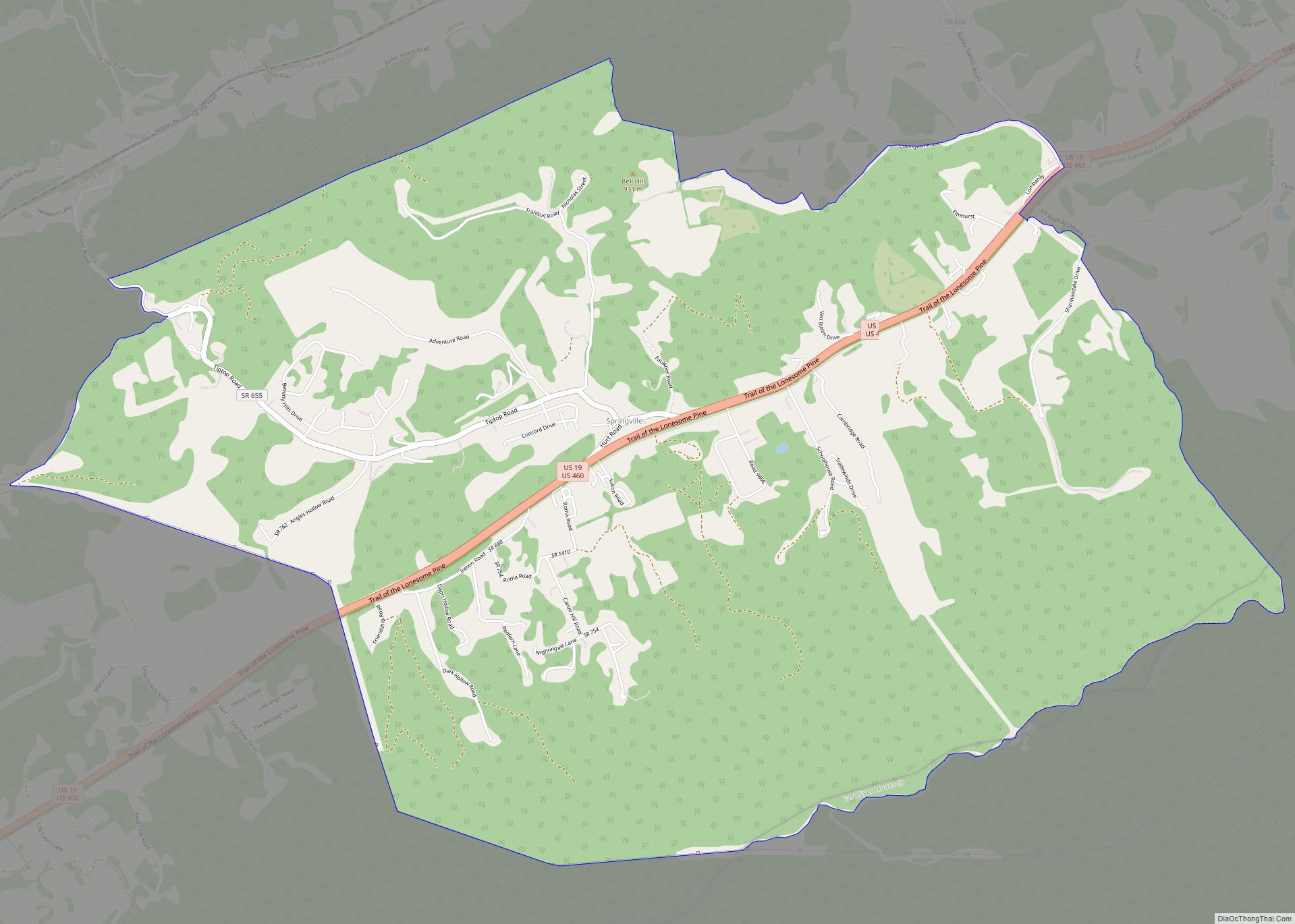
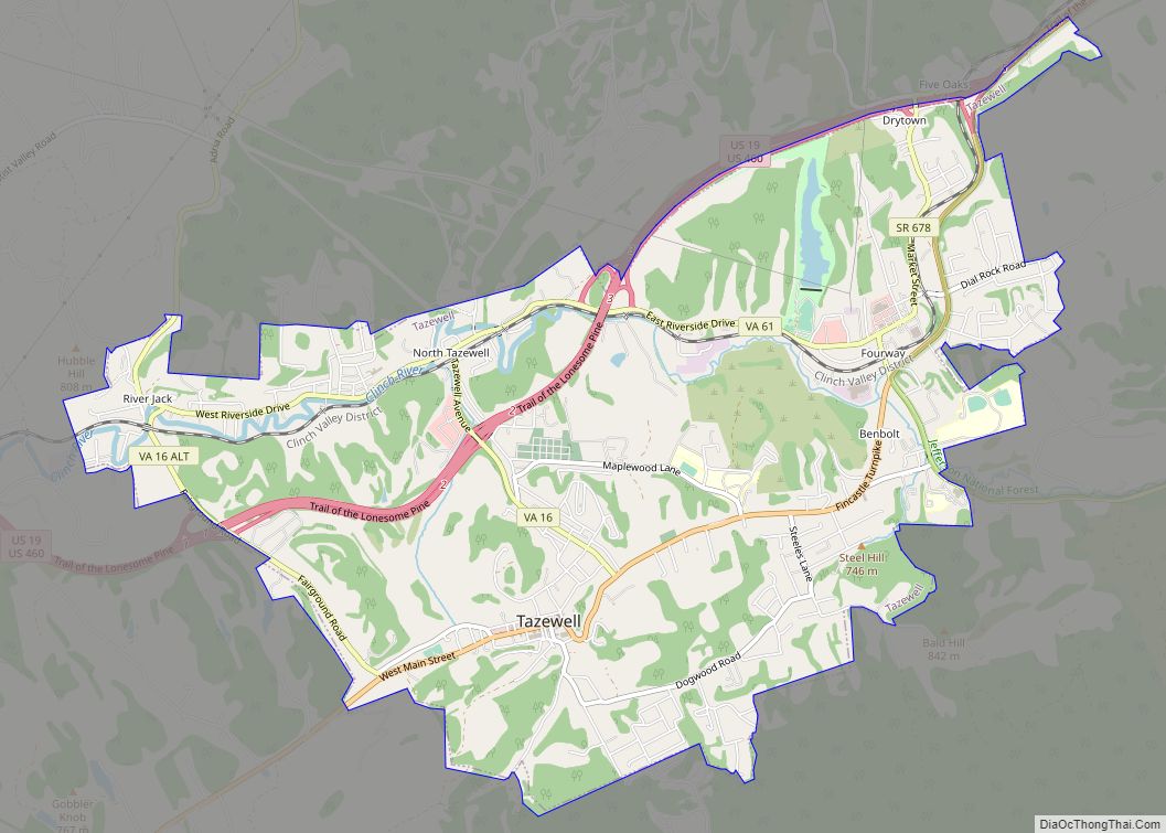
| County: | Tazewell County |
| Elevation: | 2,330 ft (710 m) |
| Total Area: | 0.58 sq mi (1.50 km²) |
| Land Area: | 0.57 sq mi (1.48 km²) |
| Water Area: | 0.01 sq mi (0.03 km²) |
| Total Population: | 389 |
| Population Density: | 619.30/sq mi (239.14/km²) |
| ZIP code: | 24635 |
| Area code: | 276 |
| FIPS code: | 5163288 |
| GNISfeature ID: | 1493440 |
| Website: | http://pocahontasva.org |
Online Interactive Map
Click on ![]() to view map in "full screen" mode.
to view map in "full screen" mode.
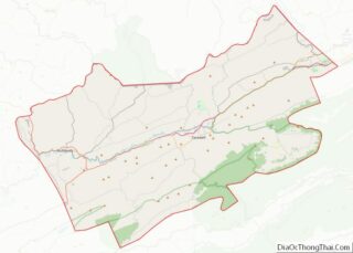
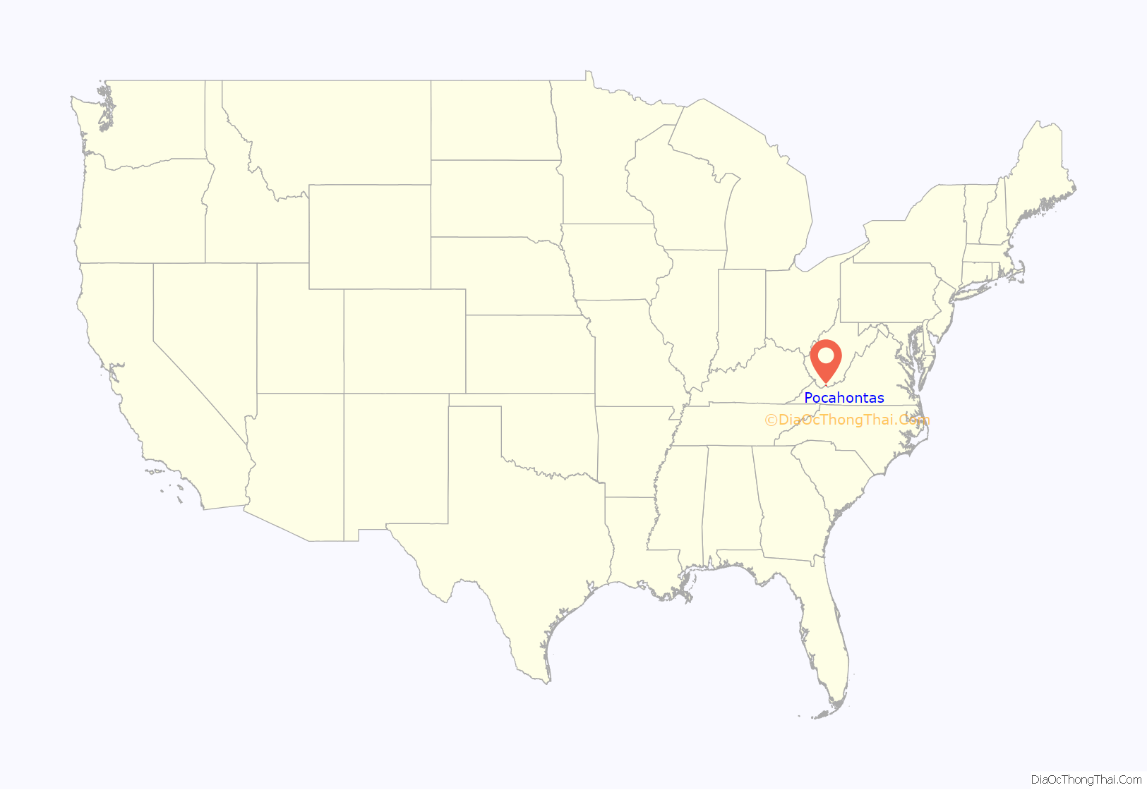
Pocahontas location map. Where is Pocahontas town?

History
Coal was known to exist in the western part of Virginia as early as 1750 when the explorer Dr. Thomas Walker observed coal outcrops on Flat Top Mountain in western Virginia. His findings went largely unnoticed for nearly 125 years. in 1861, Confederate Major Jedediah “Jed.” Hotchkiss observed the same outcrops while he was serving as a topographical engineer for General Robert E. Lee. In 1873, Hotchkiss hired Isiah Arnold Welch to make a survey of timber and coal in the Flat Top Mountain area. Welch’s survey began at the residence of Jordan Nelson who was a local blacksmith. In addition to using the coal from a large outcropping on his property, he also sold it to people who would come and purchase it by the bushel. Locals feared actively mining the coal would cause the seam to give out. When the mine closed in 1955 after 73 years of continuous production the total amount of coal mined over 44 million tons of coal were shipped from the mine.
The depression of 1873 delayed further development until 1881. Hotchkiss, who was an advocate of Virginia industrialism, urged Frederick J. Kimball, a partner in the investment firm in Philadelphia that established the Norfolk and Western Railroad and later the railroad’s President, to extend the railroad from the New River Depot near Radford, Virginia to the coal fields of Southwest Virginia and Southern West Virginia. The investment firm from Philadelphia financed both the extension of the railroad and the Southwest Virginia Improvement Company.
The was established in 1881 by The Southwest Virginia Improvement Company under the direction of Mine Superintendent William Arthur Lathrop and architect Charles W. Bolton. At this time the railroad line of Norfolk & Western was still about 50 miles away from the town. Two hundred Hungarian, Swedish, and German immigrant workers, recruited from Castle Garden, New York, arrived in January 1882. They and native workers from Virginia, North Carolina and West Virginia lived in tents set up among the cleared laurel thickets of Powell’s Bottom which became the location of the town.
On June 30, 1882, Powell’s Bottom officially became Pocahontas when the post office was established with William A. Lathrop its first postmaster. The first house in Pocahontas was finished in October 1882. The house, located at 181 W. Water St. is still standing and is a private residence as of October 2022. The railroad arrived in March 1883. The first carload was used as fuel for the N&W railroad and shipped on March 12, 1883. The Virginia Legislature granted a charter for the town on January 31, 1884.
The railroad line constructed to Pocahontas helped start this region’s coal boom in the late 19th century. The Norfolk and Western Railroad (reorganized as the Norfolk and Western Railway in 1896) (now Norfolk Southern) became nationally prominent during the 1880s primarily due to hauling the coal from the Pocahontas-Flat Top coal region. The Pocahontas large, two-state coal region was named after this town. The town reached its peak of population in 1920 and has declined markedly since 1960.
The Virginia Department of Housing and Community Development gave the town a $1,000,000 grant to help fund their downtown revitalization. In 2012, a lawsuit was filed on behalf of Historic Pocahontas to preserve buildings slated for demolition and redevelop them instead. The lawsuit stopped the revitalization project, which was never completed. In 2016, the lawsuit was dismissed, as one of the historic buildings had deteriorated for public safety after much of the building had caved in.
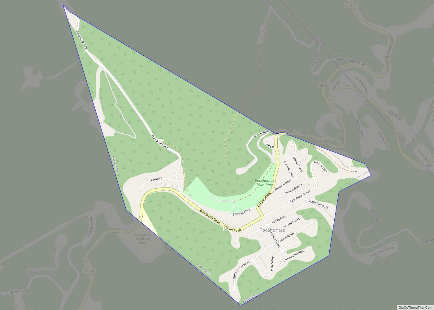
Pocahontas Road Map
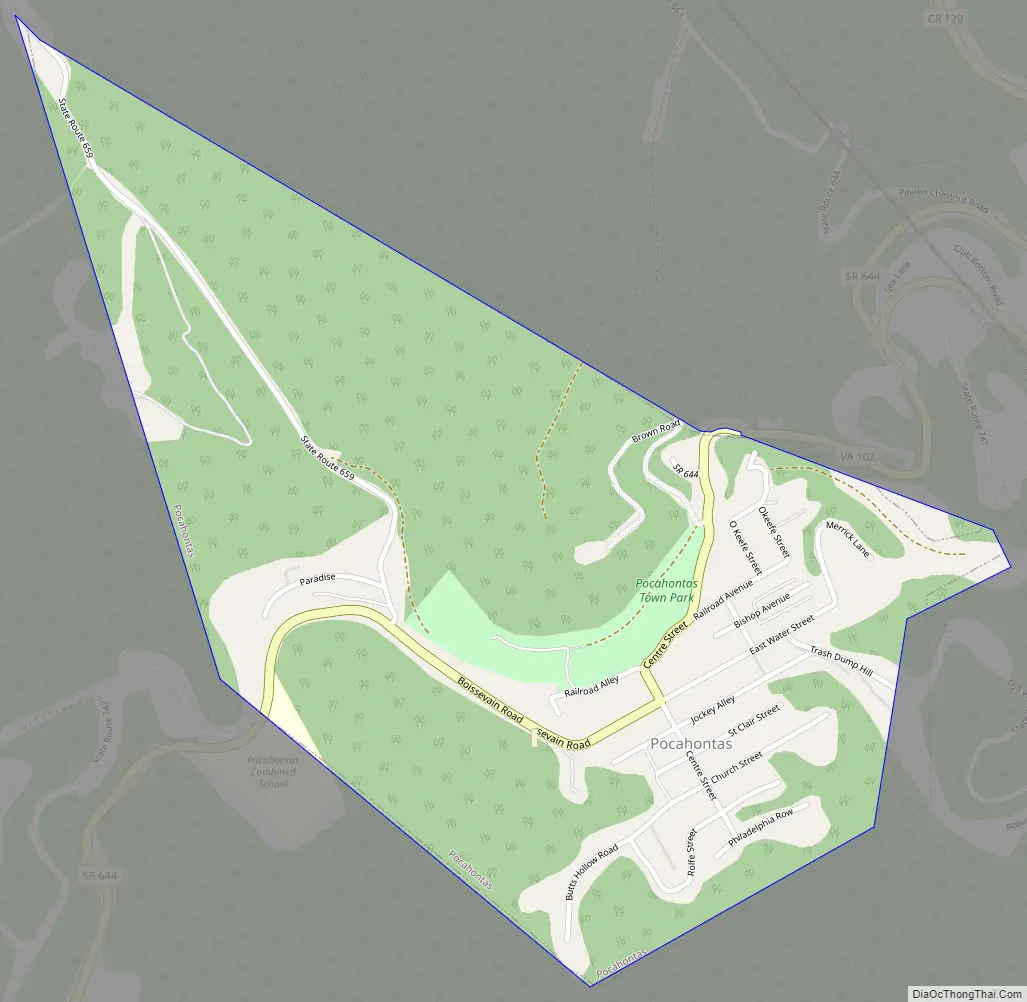
Pocahontas city Satellite Map

Geography
According to the United States Census Bureau, the town has a total area of 0.6 square mile (1.6 km), all land.
See also
Map of Virginia State and its subdivision:- Accomack
- Albemarle
- Alexandria
- Alleghany
- Amelia
- Amherst
- Appomattox
- Arlington
- Augusta
- Bath
- Bedford
- Bedford City
- Bland
- Botetourt
- Bristol
- Brunswick
- Buchanan
- Buckingham
- Buena Vista
- Campbell
- Caroline
- Carroll
- Charles City
- Charlotte
- Charlottesville
- Chesapeake
- Chesterfield
- Clarke
- Clifton Forge City
- Colonial Heights
- Covington
- Craig
- Culpeper
- Cumberland
- Danville
- Dickenson
- Dinwiddie
- Emporia
- Essex
- Fairfax
- Fairfax City
- Falls Church
- Fauquier
- Floyd
- Fluvanna
- Franklin
- Frederick
- Fredericksburg
- Galax
- Giles
- Gloucester
- Goochland
- Grayson
- Greene
- Greensville
- Halifax
- Hampton
- Hanover
- Harrisonburg
- Henrico
- Henry
- Highland
- Hopewell
- Isle of Wight
- James City
- King and Queen
- King George
- King William
- Lancaster
- Lee
- Lexington
- Loudoun
- Louisa
- Lunenburg
- Lynchburg
- Madison
- Manassas
- Manassas Park
- Martinsville
- Mathews
- Mecklenburg
- Middlesex
- Montgomery
- Nelson
- New Kent
- Newport News
- Norfolk
- Northampton
- Northumberland
- Norton
- Nottoway
- Orange
- Page
- Patrick
- Petersburg
- Pittsylvania
- Poquoson
- Portsmouth
- Powhatan
- Prince Edward
- Prince George
- Prince William
- Pulaski
- Radford
- Rappahannock
- Richmond
- Roanoke
- Roanoke City
- Rockbridge
- Rockingham
- Russell
- Salem
- Scott
- Shenandoah
- Smyth
- Southampton
- Spotsylvania
- Stafford
- Staunton
- Suffolk
- Surry
- Sussex
- Tazewell
- Virginia Beach
- Warren
- Washington
- Waynesboro
- Westmoreland
- Williamsburg
- Winchester
- Wise
- Wythe
- York
- Alabama
- Alaska
- Arizona
- Arkansas
- California
- Colorado
- Connecticut
- Delaware
- District of Columbia
- Florida
- Georgia
- Hawaii
- Idaho
- Illinois
- Indiana
- Iowa
- Kansas
- Kentucky
- Louisiana
- Maine
- Maryland
- Massachusetts
- Michigan
- Minnesota
- Mississippi
- Missouri
- Montana
- Nebraska
- Nevada
- New Hampshire
- New Jersey
- New Mexico
- New York
- North Carolina
- North Dakota
- Ohio
- Oklahoma
- Oregon
- Pennsylvania
- Rhode Island
- South Carolina
- South Dakota
- Tennessee
- Texas
- Utah
- Vermont
- Virginia
- Washington
- West Virginia
- Wisconsin
- Wyoming