Bluefield is a town in Tazewell County, Virginia, United States, located along the Bluestone River. The population was 5,096 at the 2020 census. It is part of the Bluefield WV-VA micropolitan area which has a population of 106,363 in 2020.
| Name: | Bluefield town |
|---|---|
| LSAD Code: | 43 |
| LSAD Description: | town (suffix) |
| State: | Virginia |
| County: | Tazewell County |
| Founded: | 1860s |
| Incorporated: | 1883 |
| Elevation: | 2,369 ft (722 m) |
| Land Area: | 9.49 sq mi (24.59 km²) |
| Water Area: | 0.01 sq mi (0.01 km²) |
| Population Density: | 537/sq mi (207.2/km²) |
| ZIP code: | 24605 |
| Area code: | 276 |
| FIPS code: | 5108152 |
| GNISfeature ID: | 1481874 |
| Website: | http://www.bluefieldva.org/ |
Online Interactive Map
Click on ![]() to view map in "full screen" mode.
to view map in "full screen" mode.
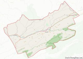
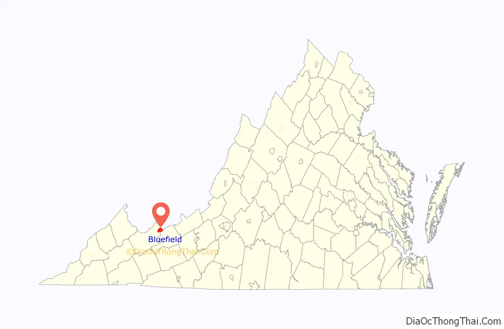
Bluefield location map. Where is Bluefield town?

History
Bluefield has not always borne the name Bluefield. The town developed around a small post office named “Pin Hook” in the 1860s, named for a small creek that ran through the community. For a brief time it was known as the community of Harman, named after a Civil War hero from the area who had been shot during the Battle of Cloyd’s Mountain in Pulaski County, Virginia.
Later, after coal was discovered and a company was formed to build a railroad to the Pocahontas Coalfields, the community’s name was changed again to “Graham” to honor Col. Thomas Graham, a Philadelphia capitalist. The town was first chartered by the Commonwealth of Virginia as the town of Graham in 1884. The Norfolk and Western railroad chose Bluefield, West Virginia over Graham as the place to build its regional headquarters and main docking yards for the Pocahontas region. As a result, Bluefield, West Virginia grew at a much faster rate than did Graham.
Graham operated under that name until a referendum on June 10, 1924, voted to change its name to Bluefield, Virginia. The name change was celebrated in a mock marriage ceremony held in the city park between officials of Bluefield, Virginia, and Bluefield, West Virginia, to celebrate the renaming of Graham. Its community had borders then that are roughly the same as the downtown area alongside the railroad of today’s Bluefield, Virginia.
Graham continued to hope for development as a major city in the region; it tried to attract a steel refining industry alongside the railyards. The Great Depression of the 1930s caused development in the region to come to a halt. The current Bluefield did not start to expand beyond the downtown area until the 1950s, when it annexed the small town of West Graham, Virginia to the west. It also began to develop land in the more open rural foothills to the south of the city.
As the largest town in Tazewell County, Virginia, Bluefield has expanded since the 1990s and the first decade of the new millennium. After a series of devastating floods in the early 21st century, the town has relocated its town council chambers and police department from the flood-prone historic downtown area to the southernmost point in the city at the foot of East River Mountain. The area has been developed with a Wal-Mart, the headquarters of First Community Bank, strip malls, and a medical center operating along U.S. Route 460.
Bluefield’s most prominent residents are Bill Dudley, an NFL Hall of Famer; New York Giants RB Ahmad Bradshaw; and the widow of actor Lorne Greene, who previously lived in a mansion atop a hill overlooking the Sanders house. This is considered one of the most significant historic homes in the city.
The Walter McDonald Sanders House and Alexander St. Clair House are listed on the National Register of Historic Places.
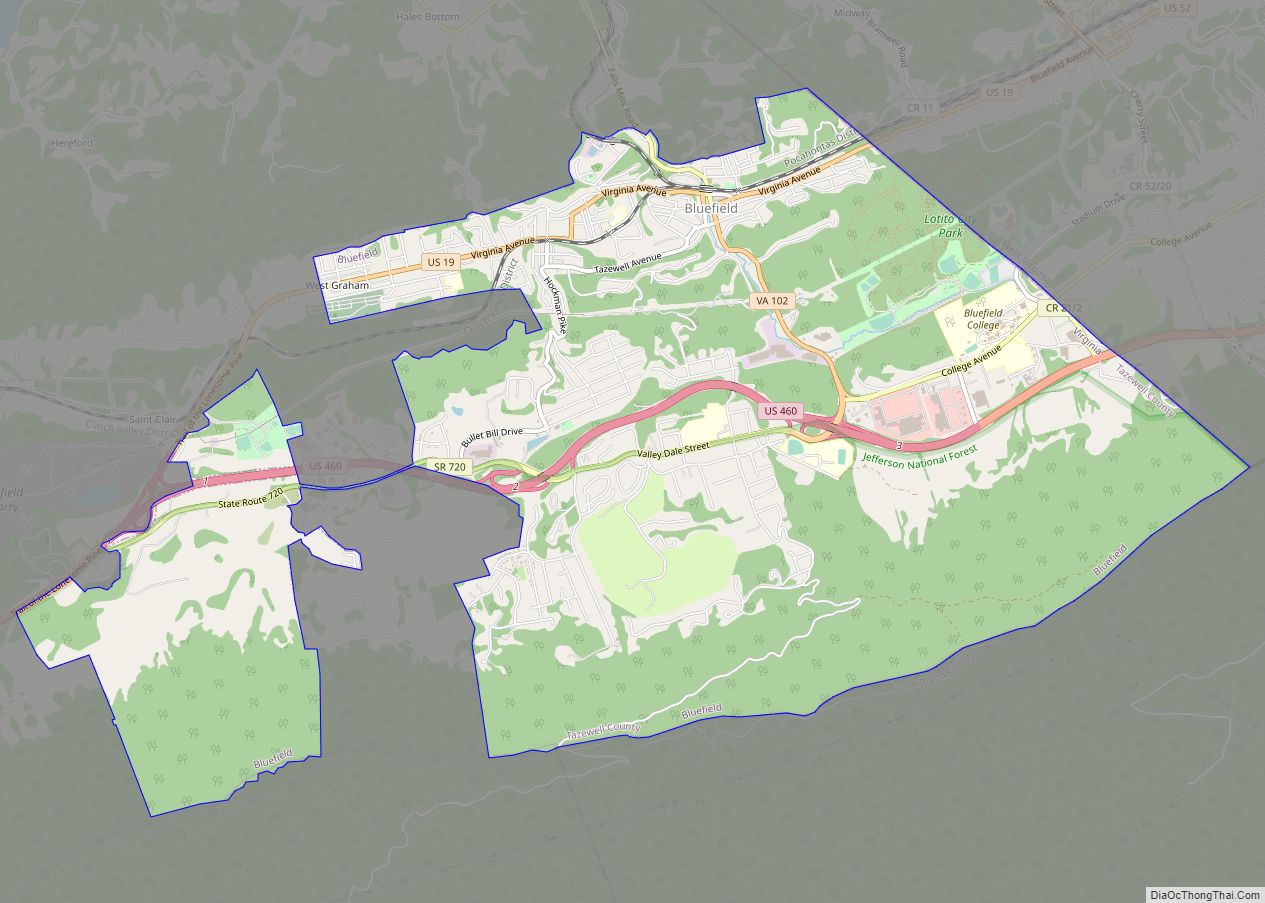
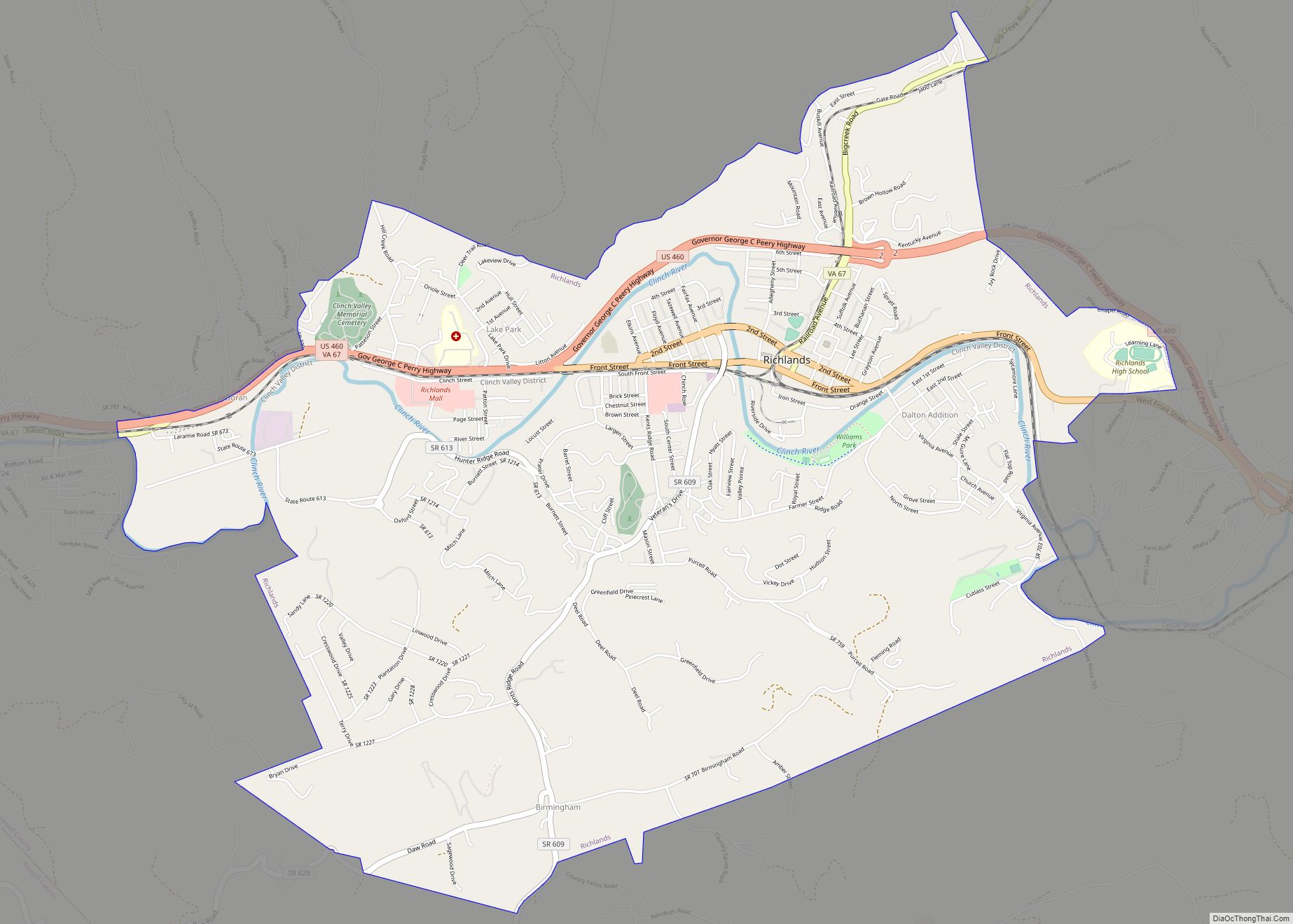
Bluefield Road Map
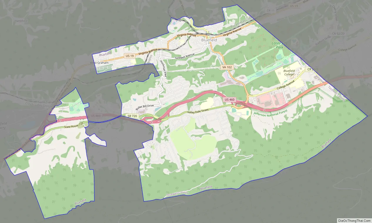
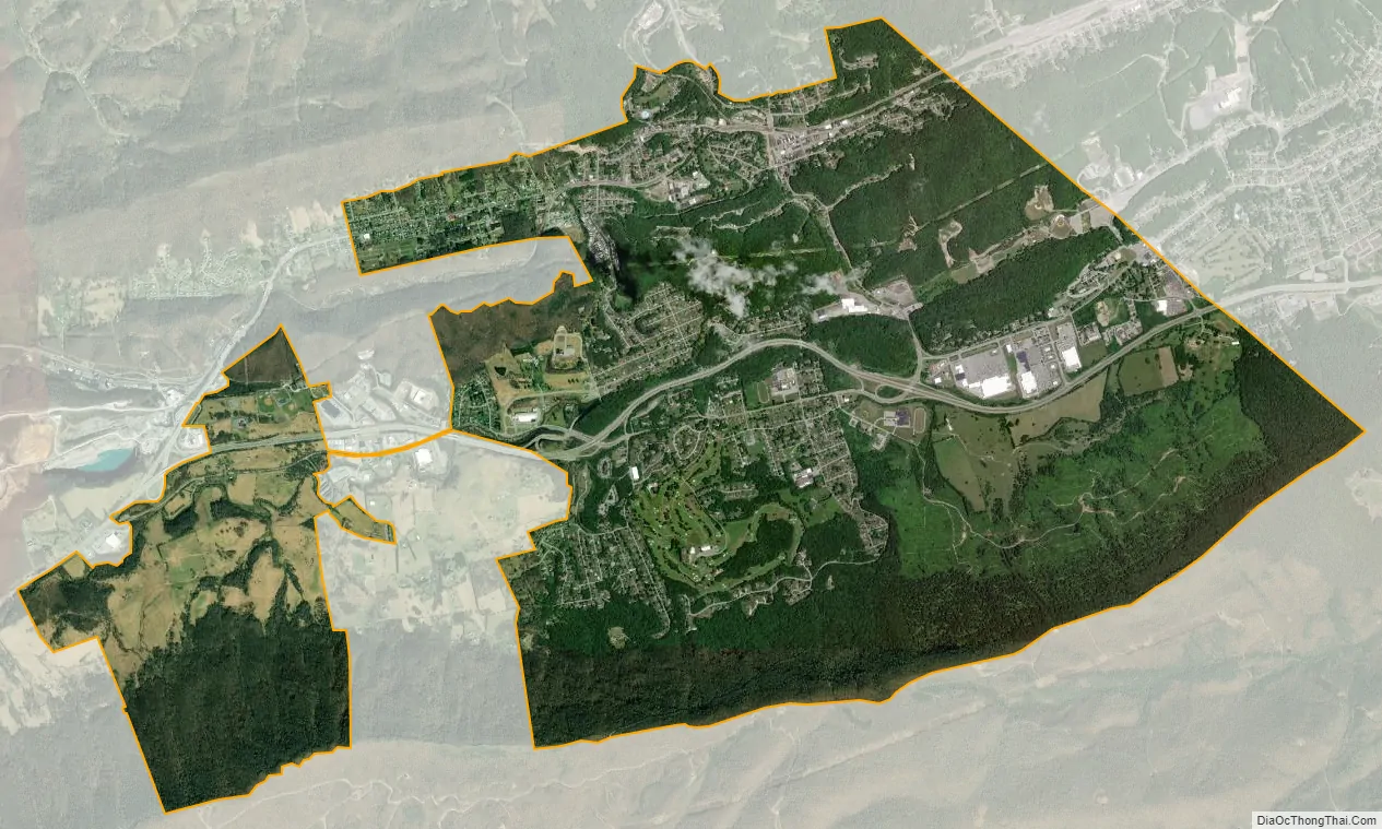
Bluefield city Satellite Map
Geography
Bluefield is located at 37°14′39″N 81°16′30″W / 37.24417°N 81.27500°W / 37.24417; -81.27500 (37.244195, −81.274926).
According to the United States Census Bureau, the town has a total area of 800.0 square miles (19.6 km), all land.
See also
Map of Virginia State and its subdivision:- Accomack
- Albemarle
- Alexandria
- Alleghany
- Amelia
- Amherst
- Appomattox
- Arlington
- Augusta
- Bath
- Bedford
- Bedford City
- Bland
- Botetourt
- Bristol
- Brunswick
- Buchanan
- Buckingham
- Buena Vista
- Campbell
- Caroline
- Carroll
- Charles City
- Charlotte
- Charlottesville
- Chesapeake
- Chesterfield
- Clarke
- Clifton Forge City
- Colonial Heights
- Covington
- Craig
- Culpeper
- Cumberland
- Danville
- Dickenson
- Dinwiddie
- Emporia
- Essex
- Fairfax
- Fairfax City
- Falls Church
- Fauquier
- Floyd
- Fluvanna
- Franklin
- Frederick
- Fredericksburg
- Galax
- Giles
- Gloucester
- Goochland
- Grayson
- Greene
- Greensville
- Halifax
- Hampton
- Hanover
- Harrisonburg
- Henrico
- Henry
- Highland
- Hopewell
- Isle of Wight
- James City
- King and Queen
- King George
- King William
- Lancaster
- Lee
- Lexington
- Loudoun
- Louisa
- Lunenburg
- Lynchburg
- Madison
- Manassas
- Manassas Park
- Martinsville
- Mathews
- Mecklenburg
- Middlesex
- Montgomery
- Nelson
- New Kent
- Newport News
- Norfolk
- Northampton
- Northumberland
- Norton
- Nottoway
- Orange
- Page
- Patrick
- Petersburg
- Pittsylvania
- Poquoson
- Portsmouth
- Powhatan
- Prince Edward
- Prince George
- Prince William
- Pulaski
- Radford
- Rappahannock
- Richmond
- Roanoke
- Roanoke City
- Rockbridge
- Rockingham
- Russell
- Salem
- Scott
- Shenandoah
- Smyth
- Southampton
- Spotsylvania
- Stafford
- Staunton
- Suffolk
- Surry
- Sussex
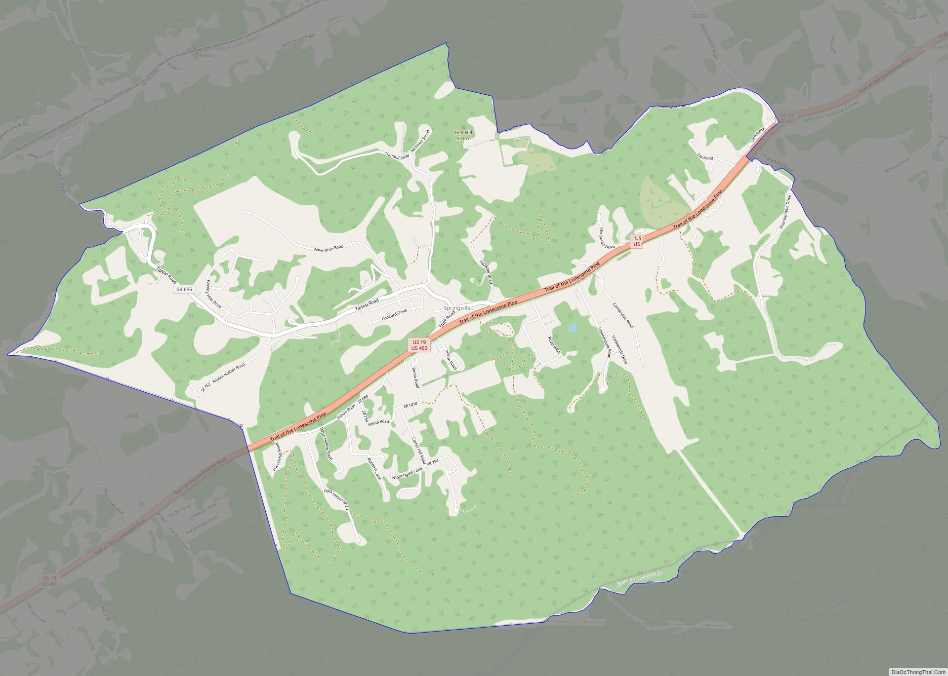
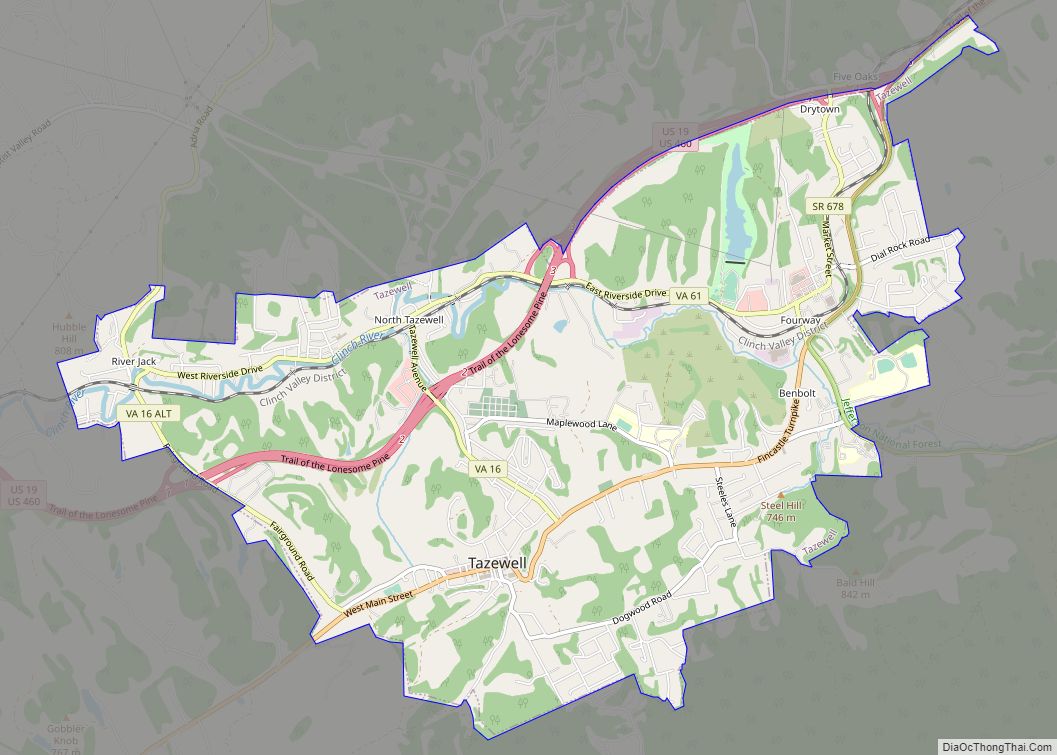
- Tazewell
- Virginia Beach
- Warren
- Washington
- Waynesboro
- Westmoreland
- Williamsburg
- Winchester
- Wise
- Wythe
- York
- Alabama
- Alaska
- Arizona
- Arkansas
- California
- Colorado
- Connecticut
- Delaware
- District of Columbia
- Florida
- Georgia
- Hawaii
- Idaho
- Illinois
- Indiana
- Iowa
- Kansas
- Kentucky
- Louisiana
- Maine
- Maryland
- Massachusetts
- Michigan
- Minnesota
- Mississippi
- Missouri
- Montana
- Nebraska
- Nevada
- New Hampshire
- New Jersey
- New Mexico
- New York
- North Carolina
- North Dakota
- Ohio
- Oklahoma
- Oregon
- Pennsylvania
- Rhode Island
- South Carolina
- South Dakota
- Tennessee
- Texas
- Utah
- Vermont
- Virginia
- Washington
- West Virginia
- Wisconsin
- Wyoming