Alcona County (/ælˈkoʊnə/ al-KOH-nə) is a county of the U.S. state of Michigan. As of the 2020 Census, the population was 10,167. Its county seat is Harrisville. Alphabetically it is the first county in Michigan; as its flag states, it is the “First of 83”.
| Name: | Alcona County |
|---|---|
| FIPS code: | 26-001 |
| State: | Michigan |
| Founded: | established 1840 organized 1869 |
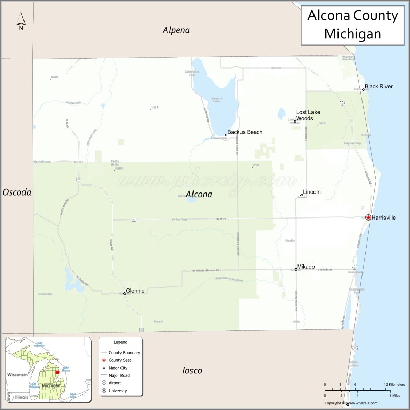
| Seat: | Harrisville |
| Largest city: | Harrisville |
| Total Area: | 1,791 sq mi (4,640 km²) |
| Land Area: | 675 sq mi (1,750 km²) |
| Total Population: | 10,167 |
| Population Density: | 16/sq mi (6/km²) |
| Time zone: | UTC−5 (Eastern) |
| Summer Time Zone (DST): | UTC−4 (EDT) |
| Website: | alconacountymi.com |
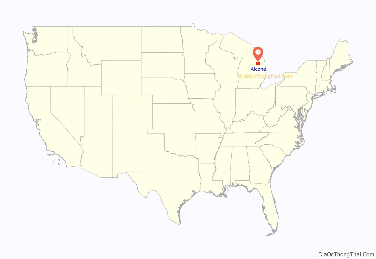
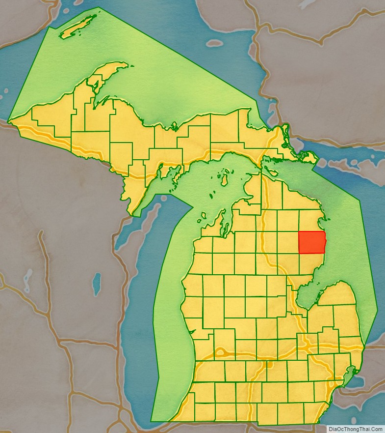
Alcona County location map. Where is Alcona County?
History
The county was created by the state legislature on April 1, 1840. It was at first named Negwegon County, after the name of a well-known Chippewa chief, also known as “Little Wing”. He was honored as having been an American ally against the British in the War of 1812.
It was renamed to Alcona County on March 8, 1843, after a neologism created by Henry Rowe Schoolcraft from parts of words from Native American languages, plus Arabic, Greek and Latin. These were amalgamated to mean “fine or excellent plain”. He was an influential US Indian agent and geographer.
Alcona County was initially attached to Mackinac County for purposes of revenue, taxation, and judicial matters. The attachment shifted to Cheboygan County in 1853, to Alpena County in 1857, to Iosco County in 1858, and to Alpena County in 1859.
Harrisville Township, then comprising the entire county, was organized in 1860. County government was organized in 1869, becoming effective on May 8, 1869. The county’s slogan on its seal (a single gold star on a green field in the shape of Alcona County) is “First of 83,” which refers to its place alphabetically among Michigan counties.
In 2007, Alcona County was forced to explore options to remedy a major budget shortfall resulting from an official’s embezzlement. Former County Treasurer Thomas Katona pleaded guilty in June 2007 to charges that he embezzled more than 1.2 million dollars from county funds to invest them in a Nigerian scam which he fell for.
Katona was sentenced to 9–14 years imprisonment on June 12, 2007, by the 23rd Circuit Court. Judge William Myles said Katona’s crimes warranted more severe punishment than called for in state sentencing guidelines, due to the amount of money involved and the number of victims in the case.
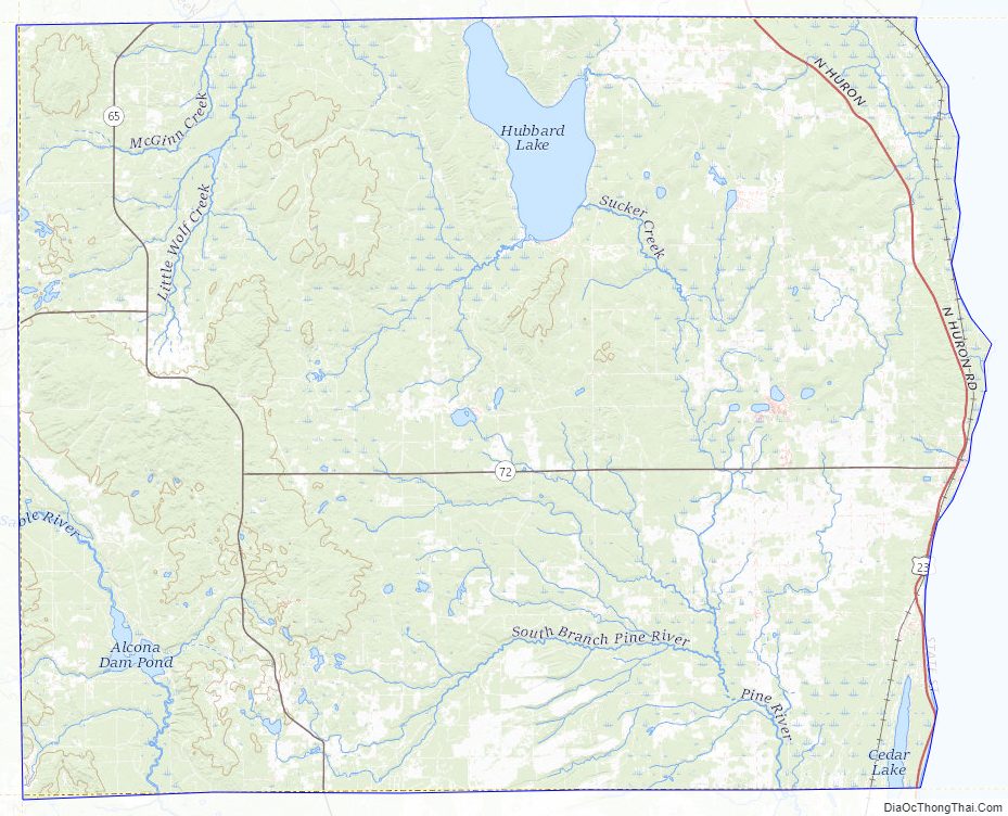
Alcona County Road Map
Geography
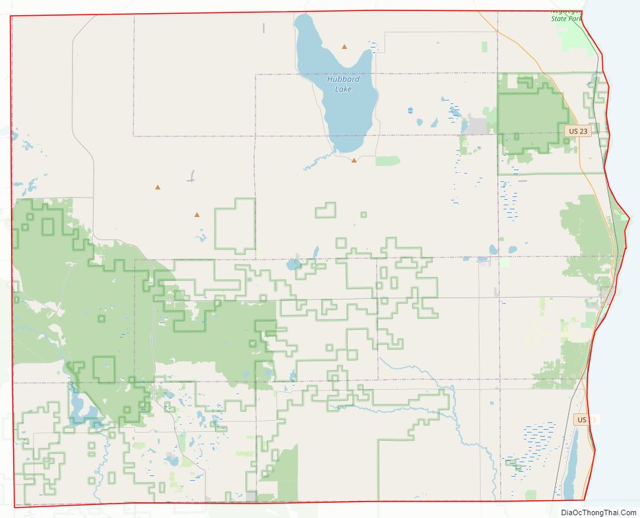
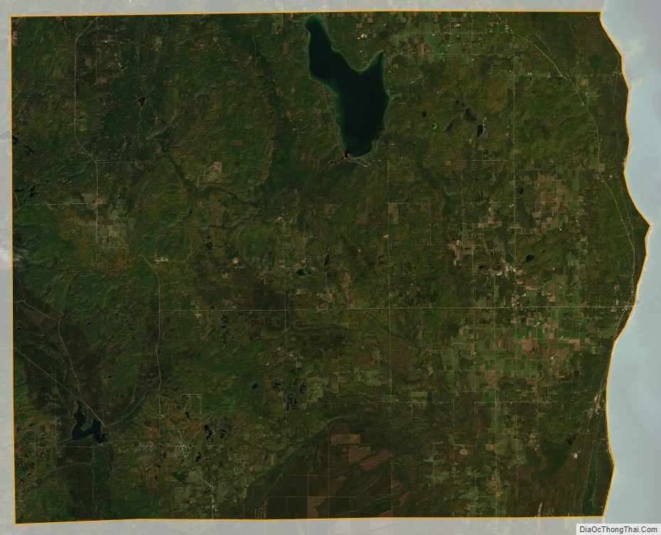
According to the US Census Bureau, the county has a total area of 1,791 square miles (4,640 km), of which 675 square miles (1,750 km) is land and 1,116 square miles (2,890 km) (62%) is water.
The area is part of the Au Sable State Forest, specifically the Grayling FMU (Alcona, Crawford, Oscoda, and northern Iosco counties). The county is considered to be part of Northern Michigan.
Alcona County has a shoreline on Lake Huron. Through Lake Huron, Alcona County has a water boundary with the Canadian province of Ontario. The Au Sable River flows through the southwest of the county.
Lakes
Lakes in the county include:
- Lake Huron
- Alcona Lake
- Badger Lake
- Bear Lake
- Brownlee Lake
- Byron Lake
- Cedar Lake
- Clear Lake
- Crooked Lake
- Crystal Lake
- Curtis Lake
- Honawan Lake
- Horseshoe Lake
- Hubbard Lake, one of the state’s twenty largest inland lakes.
- Hunter Lake
- Indian Lake
- Jenkins lake
- Jewell Lake
- Lost Lake
- North Hoist Lake
- North Lake
- O’Brien Lake
- Poplar Lake
- Reid Lake
- South Hoist Lake
- Tompson Lake
Adjacent counties
- Alpena County – north
- Iosco County – south
- Ogemaw County – southwest
- Oscoda County – west
- Montmorency County – northwest
National protected area
- Huron National Forest (part)
Alcona County Topographic Map
Alcona County Satellite Map
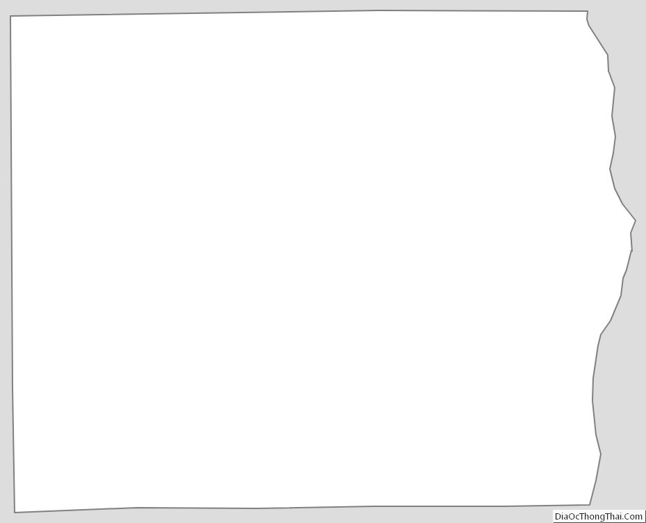
Alcona County Outline Map
See also
Map of Michigan State and its subdivision:- Alcona
- Alger
- Allegan
- Alpena
- Antrim
- Arenac
- Baraga
- Barry
- Bay
- Benzie
- Berrien
- Branch
- Calhoun
- Cass
- Charlevoix
- Cheboygan
- Chippewa
- Clare
- Clinton
- Crawford
- Delta
- Dickinson
- Eaton
- Emmet
- Genesee
- Gladwin
- Gogebic
- Grand Traverse
- Gratiot
- Hillsdale
- Houghton
- Huron
- Ingham
- Ionia
- Iosco
- Iron
- Isabella
- Jackson
- Kalamazoo
- Kalkaska
- Kent
- Keweenaw
- Lake
- Lake Hurron
- Lake Michigan
- Lake St. Clair
- Lake Superior
- Lapeer
- Leelanau
- Lenawee
- Livingston
- Luce
- Mackinac
- Macomb
- Manistee
- Marquette
- Mason
- Mecosta
- Menominee
- Midland
- Missaukee
- Monroe
- Montcalm
- Montmorency
- Muskegon
- Newaygo
- Oakland
- Oceana
- Ogemaw
- Ontonagon
- Osceola
- Oscoda
- Otsego
- Ottawa
- Presque Isle
- Roscommon
- Saginaw
- Saint Clair
- Saint Joseph
- Sanilac
- Schoolcraft
- Shiawassee
- Tuscola
- Van Buren
- Washtenaw
- Wayne
- Wexford
- Alabama
- Alaska
- Arizona
- Arkansas
- California
- Colorado
- Connecticut
- Delaware
- District of Columbia
- Florida
- Georgia
- Hawaii
- Idaho
- Illinois
- Indiana
- Iowa
- Kansas
- Kentucky
- Louisiana
- Maine
- Maryland
- Massachusetts
- Michigan
- Minnesota
- Mississippi
- Missouri
- Montana
- Nebraska
- Nevada
- New Hampshire
- New Jersey
- New Mexico
- New York
- North Carolina
- North Dakota
- Ohio
- Oklahoma
- Oregon
- Pennsylvania
- Rhode Island
- South Carolina
- South Dakota
- Tennessee
- Texas
- Utah
- Vermont
- Virginia
- Washington
- West Virginia
- Wisconsin
- Wyoming