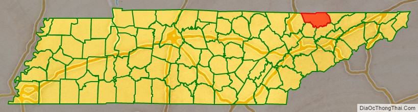
Claiborne County is a county located in the U.S. state of Tennessee. As of the 2020 census, the population was 32,043. Its county seat is Tazewell.
| Name: | Claiborne County |
|---|---|
| FIPS code: | 47-025 |
| State: | Tennessee |
| Founded: | October 29, 1801 |
| Named for: | William C. C. Claiborne |
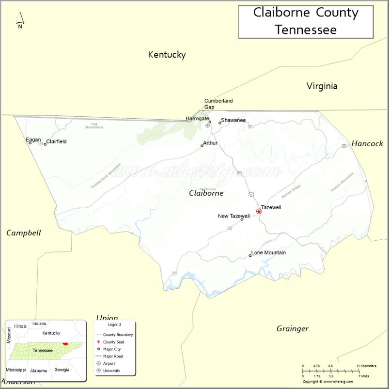
| Seat: | Tazewell |
| Largest city: | Harrogate |
| Total Area: | 442 sq mi (1,140 km²) |
| Land Area: | 435,043 sq mi (1,126,760 km²) |
| Total Population: | 32,043 |
| Population Density: | 74/sq mi (29/km²) |
| Time zone: | UTC−5 (Eastern) |
| Summer Time Zone (DST): | UTC−4 (EDT) |
| Website: | www.claibornecountytn.gov |
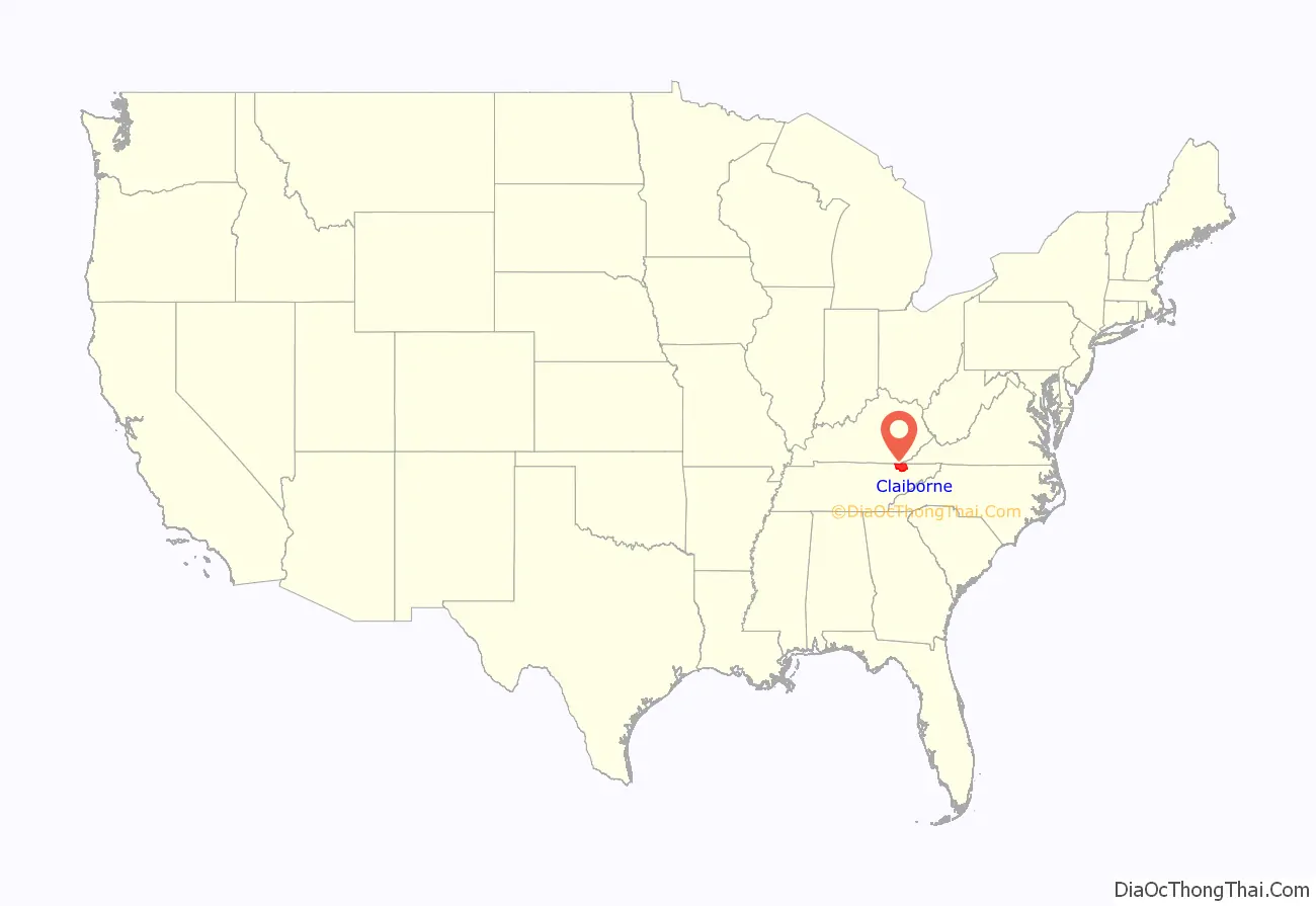
Claiborne County location map. Where is Claiborne County?
History
Claiborne County was established on October 29, 1801, created from Grainger and Hawkins counties and extended the southern boundary to Anderson County. It was named for Virginia tidewater aristocrat William C. C. Claiborne, one of the first judges of the Tennessee Superior Court and one of the first representatives in U.S. Congress from Tennessee.
Like a few other East Tennessee counties, Claiborne County was largely opposed to secession on the eve of the Civil War. In Tennessee’s Ordinance of Secession referendum on June 8, 1861, the county’s residents voted against secession by a margin of 1,243 to 250.
The Four Seasons Hotel was built on the location of present-day Lincoln Memorial University in 1892 by an English land company, the American Association Limited, which was led locally by flamboyant businessman Alexander Arthur. At the time, it was reported by its promoters to be the largest hotel in the United States. The main building was four stories high with a lobby 75 feet square and a dining room 50 feet by 160 feet. It was reported to contain 700 rooms. Also included in the complex were a hospital, an inn, a sanitarium, and other smaller buildings. The hotel was not a success and was demolished in 1895. During its operation, the Four Seasons Hotel offered buggy rides to nearby English Cave, which had been improved with wooden stairways, walkways, and bridges. The rotting remains of these wooden structures can still be seen in the cave.
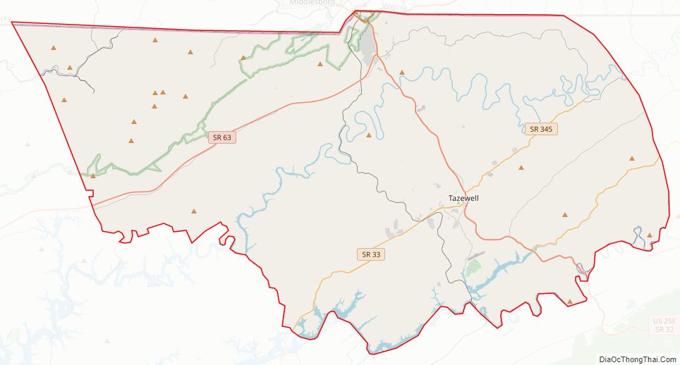
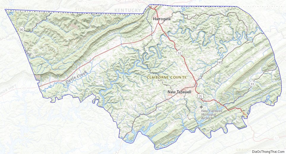
Claiborne County Road Map
Geography
According to the U.S. Census Bureau, the county has a total area of 442 square miles (1,140 km), of which 435 square miles (1,130 km) is land and 7.0 square miles (18 km) (1.6%) is water. Major Waterways include the Powell River and Clinch River, which forms part of Norris Lake. Major high points are Bryson Mountain, Powell Mountain, Lone Mountain, Raven Hill, and Wallen Ridge.
Adjacent counties
- Bell County, Kentucky (north)
- Lee County, Virginia (northeast)
- Hancock County (east)
- Grainger County (southeast)
- Union County (southwest)
- Campbell County (west)
- Whitley County, Kentucky (northwest)
National protected area
- Cumberland Gap National Historical Park (part)
State protected areas
- Cumberland Trail (part)
- Powell River Preserve State Natural Area
Claiborne County Topographic Map
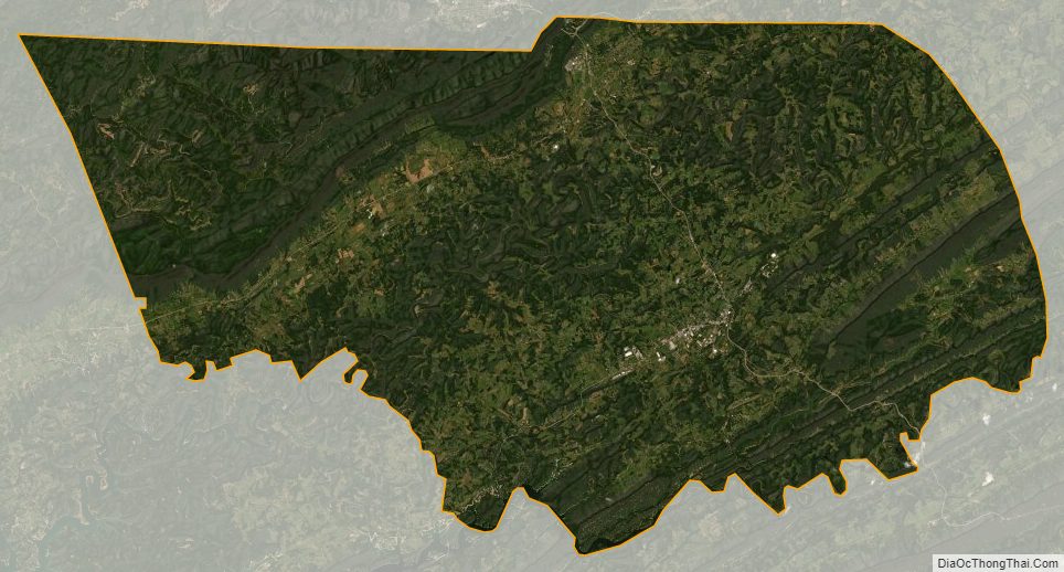
Claiborne County Satellite Map
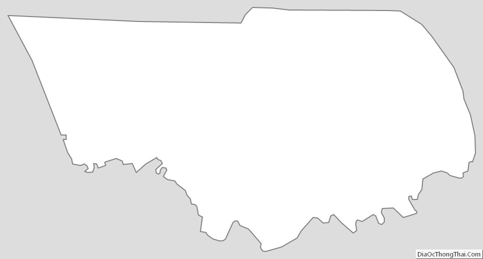
Claiborne County Outline Map
See also
Map of Tennessee State and its subdivision:- Anderson
- Bedford
- Benton
- Bledsoe
- Blount
- Bradley
- Campbell
- Cannon
- Carroll
- Carter
- Cheatham
- Chester
- Claiborne
- Clay
- Cocke
- Coffee
- Crockett
- Cumberland
- Davidson
- Decatur
- DeKalb
- Dickson
- Dyer
- Fayette
- Fentress
- Franklin
- Gibson
- Giles
- Grainger
- Greene
- Grundy
- Hamblen
- Hamilton
- Hancock
- Hardeman
- Hardin
- Hawkins
- Haywood
- Henderson
- Henry
- Hickman
- Houston
- Humphreys
- Jackson
- Jefferson
- Johnson
- Knox
- Lake
- Lauderdale
- Lawrence
- Lewis
- Lincoln
- Loudon
- Macon
- Madison
- Marion
- Marshall
- Maury
- McMinn
- McNairy
- Meigs
- Monroe
- Montgomery
- Moore
- Morgan
- Obion
- Overton
- Perry
- Pickett
- Polk
- Putnam
- Rhea
- Roane
- Robertson
- Rutherford
- Scott
- Sequatchie
- Sevier
- Shelby
- Smith
- Stewart
- Sullivan
- Sumner
- Tipton
- Trousdale
- Unicoi
- Union
- Van Buren
- Warren
- Washington
- Wayne
- Weakley
- White
- Williamson
- Wilson
- Alabama
- Alaska
- Arizona
- Arkansas
- California
- Colorado
- Connecticut
- Delaware
- District of Columbia
- Florida
- Georgia
- Hawaii
- Idaho
- Illinois
- Indiana
- Iowa
- Kansas
- Kentucky
- Louisiana
- Maine
- Maryland
- Massachusetts
- Michigan
- Minnesota
- Mississippi
- Missouri
- Montana
- Nebraska
- Nevada
- New Hampshire
- New Jersey
- New Mexico
- New York
- North Carolina
- North Dakota
- Ohio
- Oklahoma
- Oregon
- Pennsylvania
- Rhode Island
- South Carolina
- South Dakota
- Tennessee
- Texas
- Utah
- Vermont
- Virginia
- Washington
- West Virginia
- Wisconsin
- Wyoming