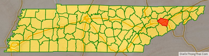
Jefferson County is an exurban county located in the U.S. state of Tennessee. As of the 2020 census, the population was 54,683. Its county seat is Dandridge. Jefferson County is part of the Morristown Metropolitan Statistical Area with neighboring Grainger and Hamblen counties. The county, along with the Morristown MSA, is included in the Knoxville-Morristown-Sevierville Combined Statistical Area.
| Name: | Jefferson County |
|---|---|
| FIPS code: | 47-089 |
| State: | Tennessee |
| Founded: | June 11, 1792 |
| Named for: | Thomas Jefferson |
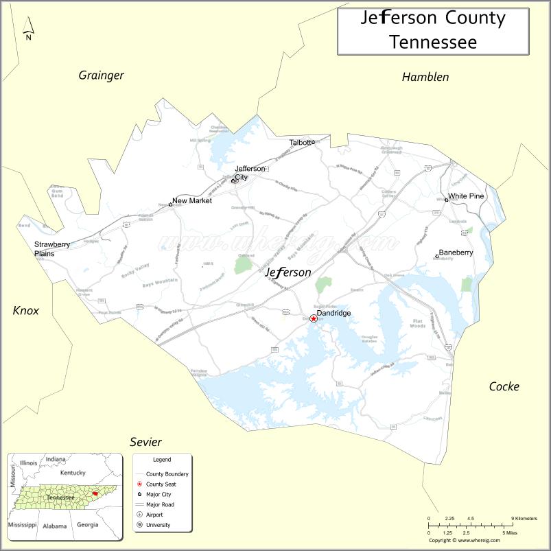
| Seat: | Dandridge |
| Largest city: | Jefferson City |
| Total Area: | 314 sq mi (810 km²) |
| Land Area: | 274 sq mi (710 km²) |
| Total Population: | 54,683 |
| Population Density: | 195/sq mi (75/km²) |
| Time zone: | UTC−5 (Eastern) |
| Summer Time Zone (DST): | UTC−4 (EDT) |
| Website: | jeffersoncountytn.gov |
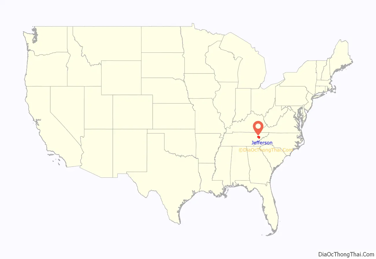
Jefferson County location map. Where is Jefferson County?
History
Jefferson County was established on June 11, 1792, by William Blount, Governor of the Southwest Territory. It had been a part of Caswell County during the State of Franklin period (1784–1789). Its county seat, Dandridge, was settled in 1783.
On the eve of the Civil War, Jefferson County, like most other counties in mountainous East Tennessee, was opposed to secession. In Tennessee’s Ordinance of Secession referendum on June 8, 1861, Jefferson County voters rejected secession by a margin of 1,987 to 603. A railroad bridge at Strawberry Plains was among those targeted by the East Tennessee bridge-burning conspiracy in November 1861. This led to internal conflict in the area throughout the war, with men from the county enlisting in both of the rival armies.
On October 2, 2013, on I-40 in Jefferson County near the I-40 and I-81 split, a multi-vehicle collision involving a church bus, a tractor-trailer, and a SUV occurred at mile marker 423. Tennessee Highway Patrol officials discovered that the church bus had blown a tire, leading it to merge into oncoming traffic, clipping the SUV and colliding with the semi-truck, causing it to burst into flames. The accident resulted in 8 fatalities and 14 injuries.
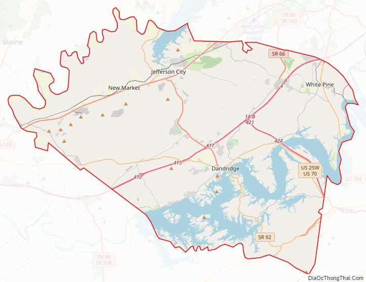
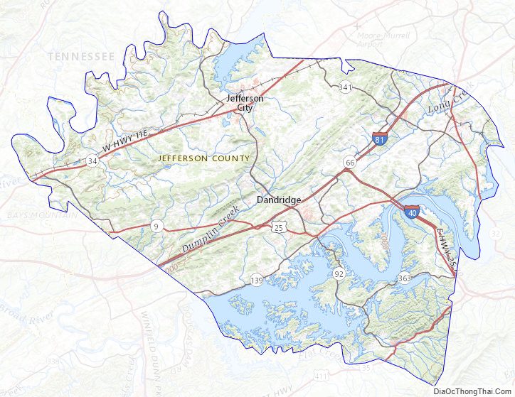
Jefferson County Road Map
Geography
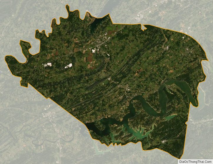
According to the U.S. Census Bureau, the county has a total area of 314 square miles (810 km), of which 274 square miles (710 km) is land and 40 square miles (100 km) (13%) is water. The county is affected by two artificial lakes: Douglas Lake, created by the damming of the French Broad River in the south, and Cherokee Lake, created by the damming of the Holston River in the north.
Adjacent counties
- Hamblen County (northeast)
- Cocke County (southeast)
- Sevier County (south)
- Knox County (west)
- Grainger County (north)
State protected areas
- Henderson Island Refuge
Transportation
- I-40
- I-81
- US 11E
- US 25E
- US 25W
- US 411
- SR 9
- SR 32
- SR 34
- SR 35
- SR 66
- SR 92
- SR 113
- SR 139
- SR 341
- SR 363
Jefferson County Topographic Map
Jefferson County Satellite Map
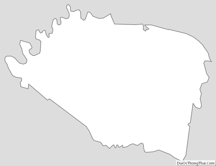
Jefferson County Outline Map
See also
Map of Tennessee State and its subdivision:- Anderson
- Bedford
- Benton
- Bledsoe
- Blount
- Bradley
- Campbell
- Cannon
- Carroll
- Carter
- Cheatham
- Chester
- Claiborne
- Clay
- Cocke
- Coffee
- Crockett
- Cumberland
- Davidson
- Decatur
- DeKalb
- Dickson
- Dyer
- Fayette
- Fentress
- Franklin
- Gibson
- Giles
- Grainger
- Greene
- Grundy
- Hamblen
- Hamilton
- Hancock
- Hardeman
- Hardin
- Hawkins
- Haywood
- Henderson
- Henry
- Hickman
- Houston
- Humphreys
- Jackson
- Jefferson
- Johnson
- Knox
- Lake
- Lauderdale
- Lawrence
- Lewis
- Lincoln
- Loudon
- Macon
- Madison
- Marion
- Marshall
- Maury
- McMinn
- McNairy
- Meigs
- Monroe
- Montgomery
- Moore
- Morgan
- Obion
- Overton
- Perry
- Pickett
- Polk
- Putnam
- Rhea
- Roane
- Robertson
- Rutherford
- Scott
- Sequatchie
- Sevier
- Shelby
- Smith
- Stewart
- Sullivan
- Sumner
- Tipton
- Trousdale
- Unicoi
- Union
- Van Buren
- Warren
- Washington
- Wayne
- Weakley
- White
- Williamson
- Wilson
- Alabama
- Alaska
- Arizona
- Arkansas
- California
- Colorado
- Connecticut
- Delaware
- District of Columbia
- Florida
- Georgia
- Hawaii
- Idaho
- Illinois
- Indiana
- Iowa
- Kansas
- Kentucky
- Louisiana
- Maine
- Maryland
- Massachusetts
- Michigan
- Minnesota
- Mississippi
- Missouri
- Montana
- Nebraska
- Nevada
- New Hampshire
- New Jersey
- New Mexico
- New York
- North Carolina
- North Dakota
- Ohio
- Oklahoma
- Oregon
- Pennsylvania
- Rhode Island
- South Carolina
- South Dakota
- Tennessee
- Texas
- Utah
- Vermont
- Virginia
- Washington
- West Virginia
- Wisconsin
- Wyoming