Putnam County is the least extensive county in the U.S. state of Illinois. According to the 2010 census, it had a population of 6,006. The county seat is Hennepin. The county was formed in 1825 out of Fulton County and named after Israel Putnam, who was a general in the American Revolution. Putnam County is part of the Ottawa, IL Micropolitan Statistical Area.
| Name: | Putnam County |
|---|---|
| FIPS code: | 17-155 |
| State: | Illinois |
| Founded: | 1825 |
| Named for: | Israel Putnam |
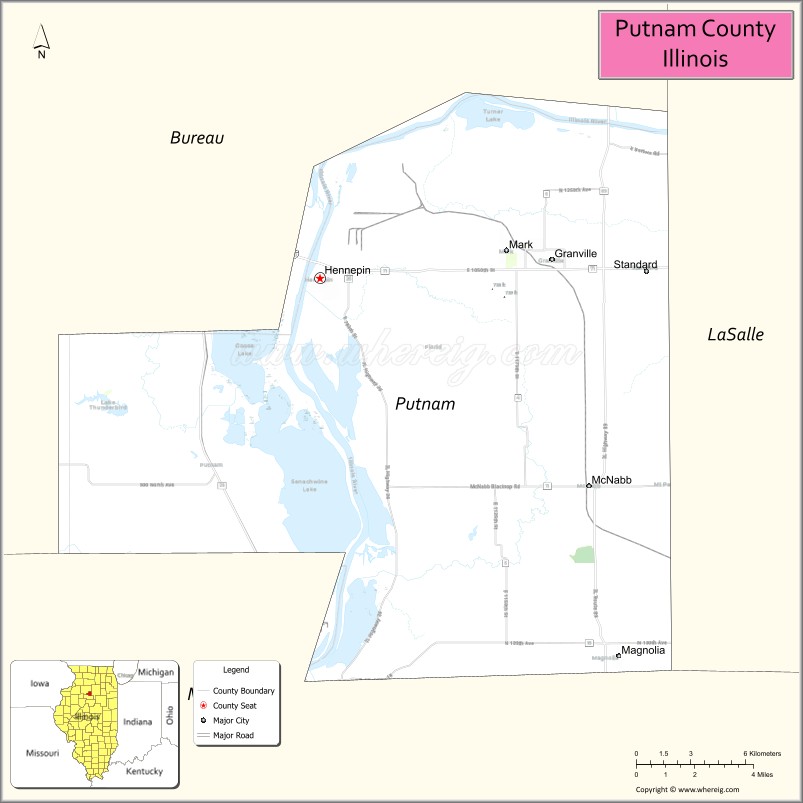
| Seat: | Hennepin |
| Total Area: | 172 sq mi (450 km²) |
| Land Area: | 160 sq mi (400 km²) |
| Total Population: | 6,006 |
| Population Density: | 35/sq mi (13/km²) |
| Time zone: | UTC−6 (Central) |
| Summer Time Zone (DST): | UTC−5 (CDT) |
| Website: | www.co.putnam.il.us |
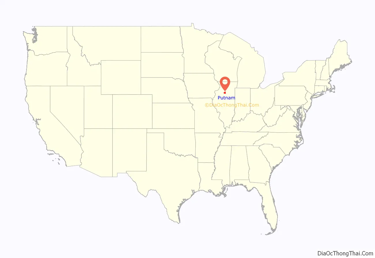
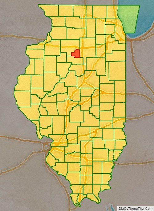
Putnam County location map. Where is Putnam County?
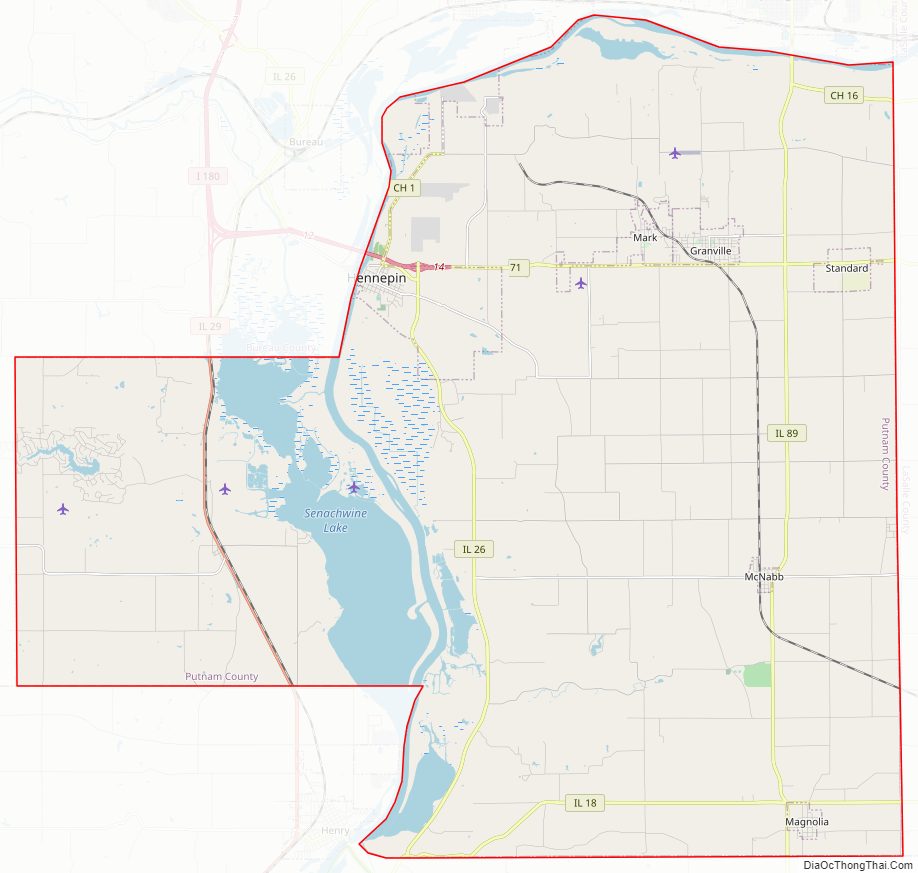
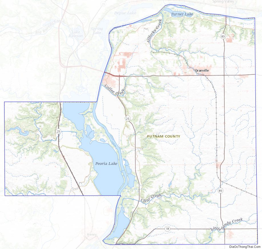
Putnam County Road Map
Geography
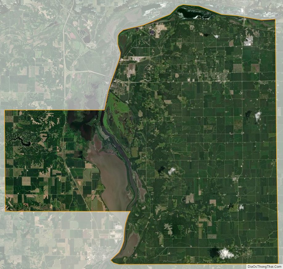
According to the U.S. Census Bureau, the county has a total area of 172 square miles (450 km), of which 160 square miles (410 km) is land and 12 square miles (31 km) (7.0%) is water. It is the smallest county in Illinois by area.
Climate and weather
In recent years, average temperatures in the county seat of Hennepin have ranged from a low of 13 °F (−11 °C) in January to a high of 86 °F (30 °C) in July, although a record low of −30 °F (−34 °C) was recorded in January 1999 and a record high of 104 °F (40 °C) was recorded in June 1988. Average monthly precipitation ranged from 1.14 inches (29 mm) in January to 4.32 inches (110 mm) in August.
Major highways
- Interstate 180
- Illinois Route 18
- Illinois Route 26
- Illinois Route 29
- Illinois Route 71
- Illinois Route 89
Adjacent counties
- Bureau County (northwest)
- LaSalle County (east)
- Marshall County (south)
Putnam County at the time of its creation in 1825
The county split in two portions, 1827-1831
Putnam County between 1831 and 1837
Putnam between 1837 and 1839
Putnam in 1839, reduced to its present borders
Putnam County Topographic Map
Putnam County Satellite Map
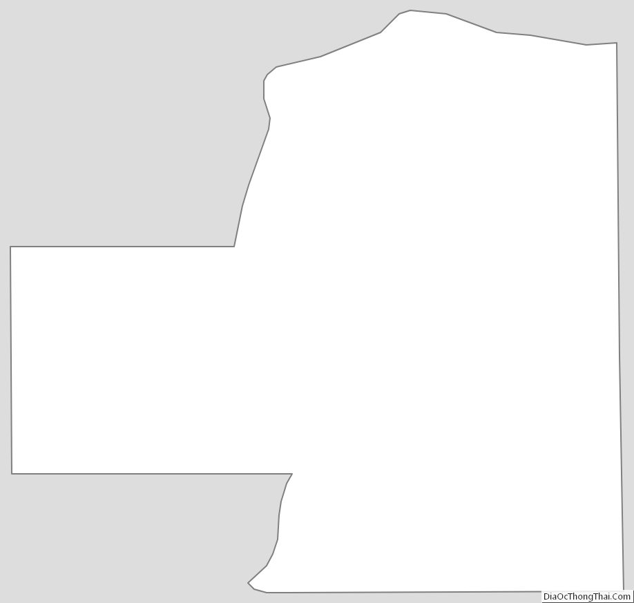
Putnam County Outline Map
See also
Map of Illinois State and its subdivision:- Adams
- Alexander
- Bond
- Boone
- Brown
- Bureau
- Calhoun
- Carroll
- Cass
- Champaign
- Christian
- Clark
- Clay
- Clinton
- Coles
- Cook
- Crawford
- Cumberland
- De Kalb
- De Witt
- Douglas
- Dupage
- Edgar
- Edwards
- Effingham
- Fayette
- Ford
- Franklin
- Fulton
- Gallatin
- Greene
- Grundy
- Hamilton
- Hancock
- Hardin
- Henderson
- Henry
- Iroquois
- Jackson
- Jasper
- Jefferson
- Jersey
- Jo Daviess
- Johnson
- Kane
- Kankakee
- Kendall
- Knox
- La Salle
- Lake
- Lake Michigan
- Lawrence
- Lee
- Livingston
- Logan
- Macon
- Macoupin
- Madison
- Marion
- Marshall
- Mason
- Massac
- McDonough
- McHenry
- McLean
- Menard
- Mercer
- Monroe
- Montgomery
- Morgan
- Moultrie
- Ogle
- Peoria
- Perry
- Piatt
- Pike
- Pope
- Pulaski
- Putnam
- Randolph
- Richland
- Rock Island
- Saint Clair
- Saline
- Sangamon
- Schuyler
- Scott
- Shelby
- Stark
- Stephenson
- Tazewell
- Union
- Vermilion
- Wabash
- Warren
- Washington
- Wayne
- White
- Whiteside
- Will
- Williamson
- Winnebago
- Woodford
- Alabama
- Alaska
- Arizona
- Arkansas
- California
- Colorado
- Connecticut
- Delaware
- District of Columbia
- Florida
- Georgia
- Hawaii
- Idaho
- Illinois
- Indiana
- Iowa
- Kansas
- Kentucky
- Louisiana
- Maine
- Maryland
- Massachusetts
- Michigan
- Minnesota
- Mississippi
- Missouri
- Montana
- Nebraska
- Nevada
- New Hampshire
- New Jersey
- New Mexico
- New York
- North Carolina
- North Dakota
- Ohio
- Oklahoma
- Oregon
- Pennsylvania
- Rhode Island
- South Carolina
- South Dakota
- Tennessee
- Texas
- Utah
- Vermont
- Virginia
- Washington
- West Virginia
- Wisconsin
- Wyoming