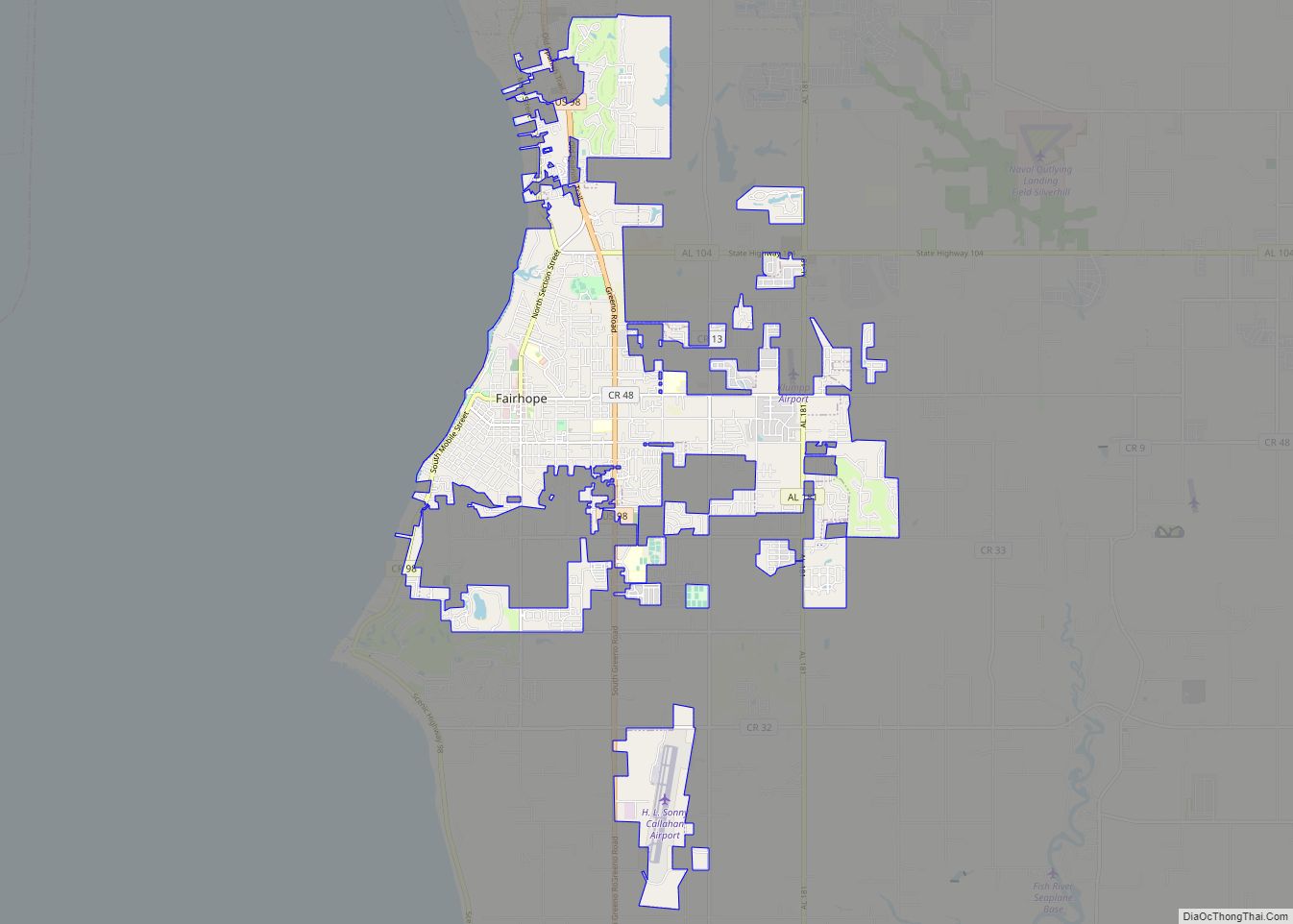
Fairhope is a city in Baldwin County, Alabama, United States, located on the eastern shoreline of Mobile Bay. The 2020 Census lists the population of the city as 22,477. Fairhope is a principal city of the Daphne-Fairhope-Foley metropolitan area, which includes all of Baldwin County.
| Name: | Fairhope city |
|---|---|
| LSAD Code: | 25 |
| LSAD Description: | city (suffix) |
| State: | Alabama |
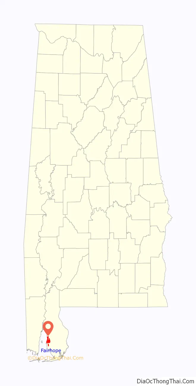
| County: | Baldwin County |
| Elevation: | 122 ft (37 m) |
| Total Area: | 14.53 sq mi (37.64 km²) |
| Land Area: | 14.47 sq mi (37.49 km²) |
| Water Area: | 0.06 sq mi (0.14 km²) |
| Total Population: | 22,477 |
| Population Density: | 1,552.82/sq mi (599.53/km²) |
| ZIP code: | 36532–36533 |
| Area code: | 251 |
| FIPS code: | 0125240 |
| GNISfeature ID: | 0118120 |
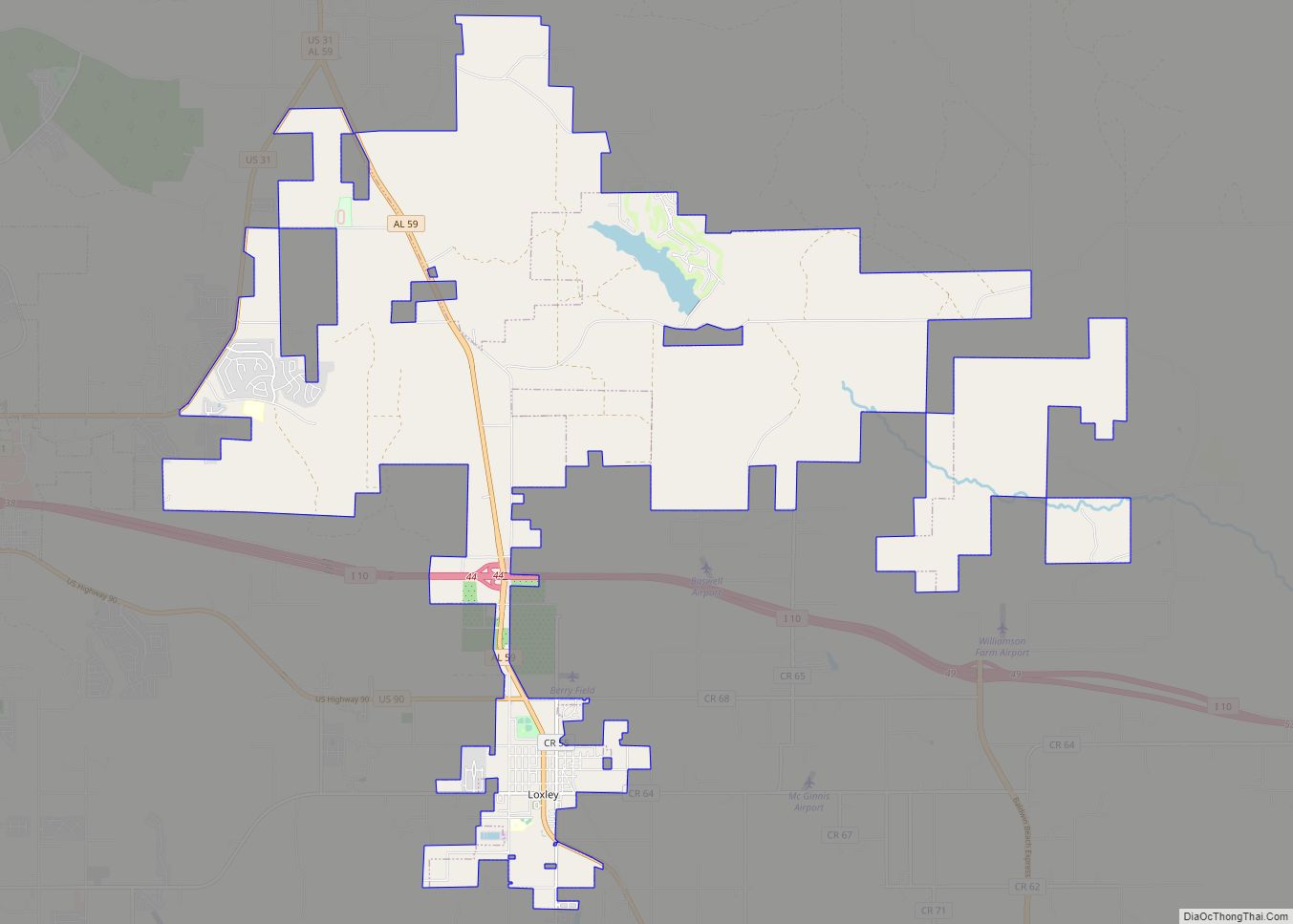
Online Interactive Map
Click on ![]() to view map in "full screen" mode.
to view map in "full screen" mode.
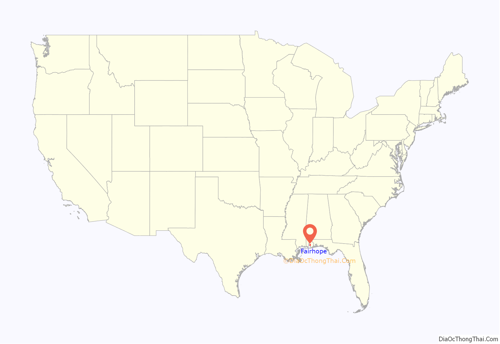
Fairhope location map. Where is Fairhope city?
History
Fairhope was founded in November 1894 on the site of the former Alabama City as a Georgist “Single-Tax” colony by the Fairhope Industrial Association, a group of 28 followers of economist Henry George who had incorporated earlier that year in Des Moines, Iowa. Their corporate constitution explained their purpose in founding a new colony:
In forming their demonstration project, they pooled their funds to purchase land at “Stapleton’s pasture” on the eastern shore of Mobile Bay and then divided it into a number of long-term leaseholds. The corporation paid all governmental taxes from rents paid by the lessees, thus simulating a single-tax. The purpose of the single-tax colony was to eliminate disincentives for productive use of land and thereby retain the value of land for the community.
“Fairhope Avenue” was one of the properties on the 1910 version of the board game The Landlord’s Game, a precursor of Monopoly.
In 1907, educator Marietta Johnson founded the School for Organic Education in Fairhope. The school was praised in John Dewey’s influential 1915 book Schools of Tomorrow. Dewey and Johnson were founding members of the Progressive Education Association.
Fairhope became a popular wintering spot for artists and intellectuals. Sherwood Anderson, Clarence Darrow, Wharton Esherick, Carl Zigrosser, and Upton Sinclair were among its notable visitors.
The Fairhope Single-Tax Corporation still operates, with 1,800 leaseholds covering more than 4,000 acres (16 km) in and around the current city of Fairhope. Despite the ideals of the corporation, the town has transitioned from utopian experiment to artists’ and intellectuals’ colony to boutique resort and affluent suburb of Mobile. White flight from nearby Mobile has caused the population of Baldwin County to almost triple since the 1940s, and particularly since desegregation, contributing to the mostly-White demographics of Daphne, Fairhope, and Spanish Fort.
In 2019 the New York Times termed Fairhope to be “A Southern Town That’s Been Holding On to Its Charm, for More Than a Century”.
Fairhope Road Map
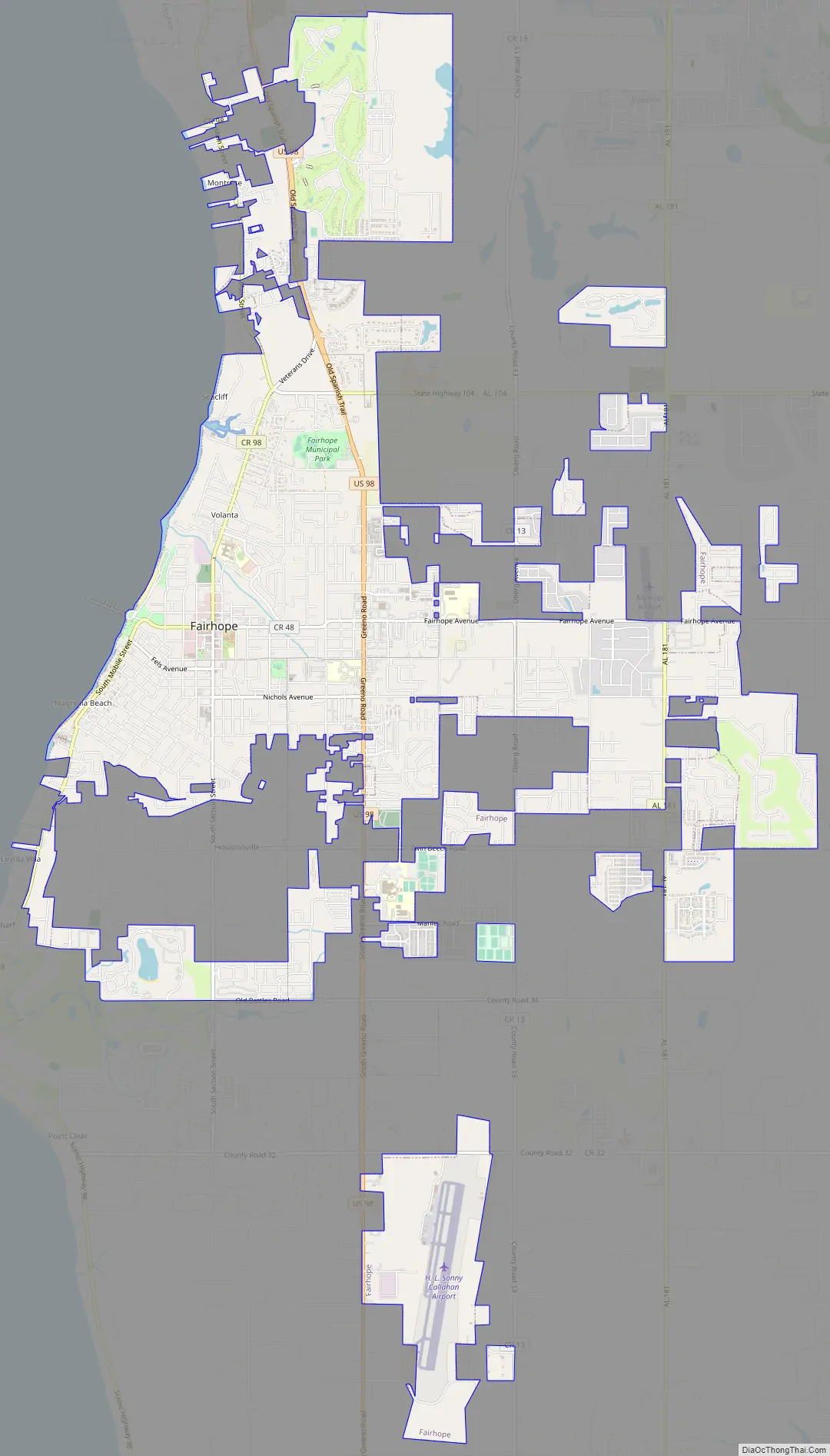
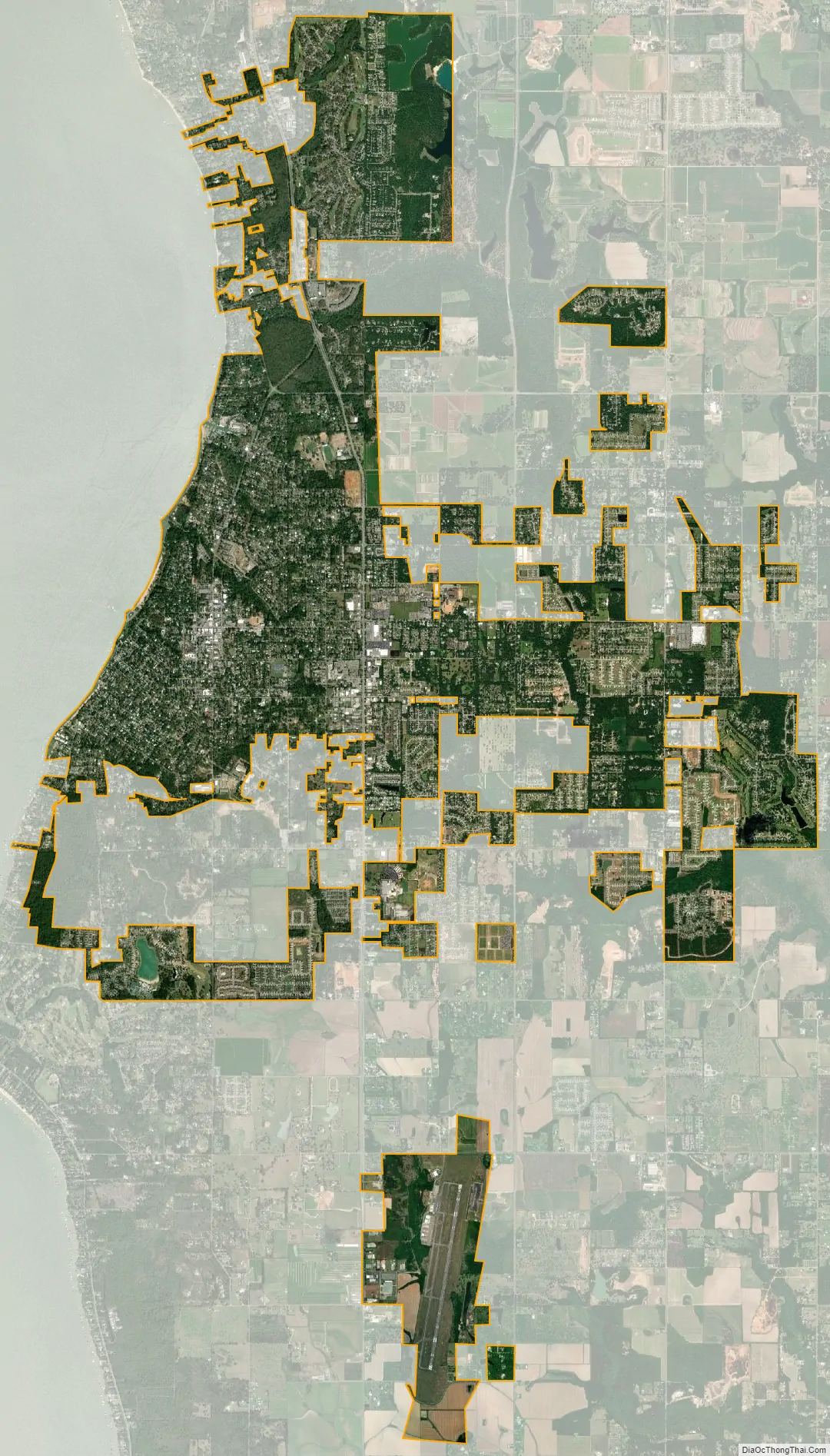
Fairhope city Satellite Map
Geography
Fairhope is located on the shore of Mobile Bay. It is located 6 miles (10 km) south of Daphne and 10 miles (16 km) south of Spanish Fort. U.S. Route 98 (Greeno Road) runs north–south through the city. It lies on a sloping plateau.
According to the U.S. Census Bureau, the city has a total area of 12.0 square miles (31.1 km), of which 0.019 square mile (0.05 km), or 0.16%, is water. Its elevation ranges from sea level at the bay to 122 feet (37 m) in the city center.
Climate
Fairhope has a humid subtropical climate. It experiences hot, humid summers and generally mild winters, with average temperatures ranging from 90 °F (32 °C) in the summer to 50.4 °F (10.2 °C) during winter.
See also
Map of Alabama State and its subdivision:- Autauga
- Baldwin
- Barbour
- Bibb
- Blount
- Bullock
- Butler
- Calhoun
- Chambers
- Cherokee
- Chilton
- Choctaw
- Clarke
- Clay
- Cleburne
- Coffee
- Colbert
- Conecuh
- Coosa
- Covington
- Crenshaw
- Cullman
- Dale
- Dallas
- De Kalb
- Elmore
- Escambia
- Etowah
- Fayette
- Franklin
- Geneva
- Greene
- Hale
- Henry
- Houston
- Jackson
- Jefferson
- Lamar
- Lauderdale
- Lawrence
- Lee
- Limestone
- Lowndes
- Macon
- Madison
- Marengo
- Marion
- Marshall
- Mobile
- Monroe
- Montgomery
- Morgan
- Perry
- Pickens
- Pike
- Randolph
- Russell
- Saint Clair
- Shelby
- Sumter
- Talladega
- Tallapoosa
- Tuscaloosa
- Walker
- Washington
- Wilcox
- Winston
- Alabama
- Alaska
- Arizona
- Arkansas
- California
- Colorado
- Connecticut
- Delaware
- District of Columbia
- Florida
- Georgia
- Hawaii
- Idaho
- Illinois
- Indiana
- Iowa
- Kansas
- Kentucky
- Louisiana
- Maine
- Maryland
- Massachusetts
- Michigan
- Minnesota
- Mississippi
- Missouri
- Montana
- Nebraska
- Nevada
- New Hampshire
- New Jersey
- New Mexico
- New York
- North Carolina
- North Dakota
- Ohio
- Oklahoma
- Oregon
- Pennsylvania
- Rhode Island
- South Carolina
- South Dakota
- Tennessee
- Texas
- Utah
- Vermont
- Virginia
- Washington
- West Virginia
- Wisconsin
- Wyoming