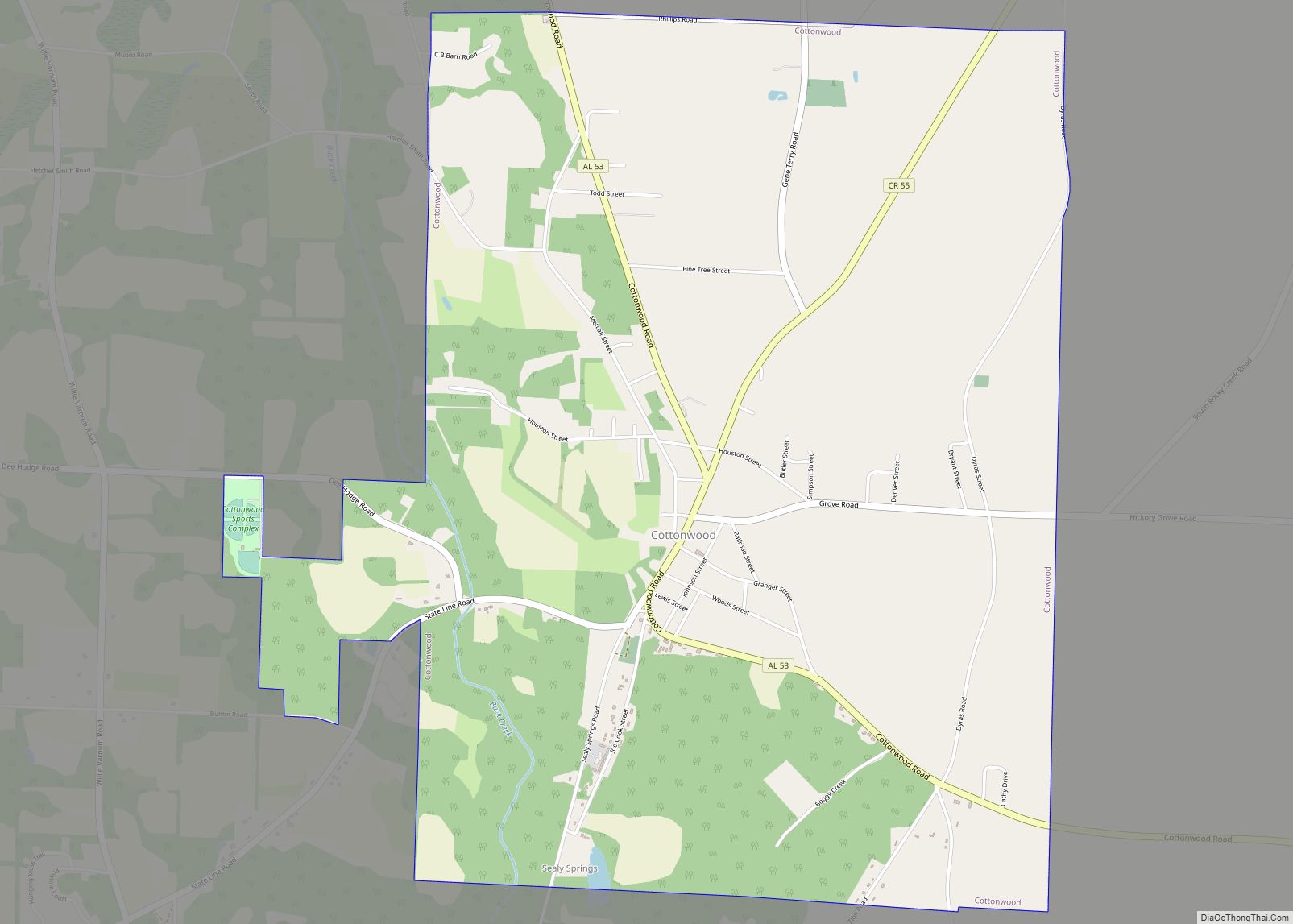
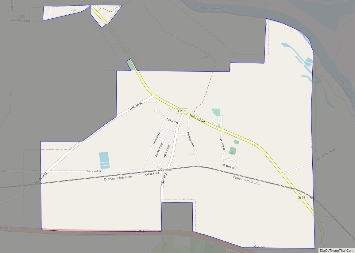
Gordon is a town in Houston County, Alabama, United States. It was incorporated in February 1872. It is part of the Dothan, Alabama Metropolitan Statistical Area. At the 2010 census the population was 332, down from 408 in 2000.
| Name: | Gordon town |
|---|---|
| LSAD Code: | 43 |
| LSAD Description: | town (suffix) |
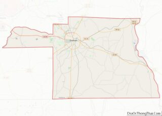
| State: | Alabama |
| County: | Houston County |
| Elevation: | 184 ft (56 m) |
| Total Area: | 2.92 sq mi (7.56 km²) |
| Land Area: | 2.92 sq mi (7.56 km²) |
| Water Area: | 0.00 sq mi (0.00 km²) |
| Total Population: | 294 |
| Population Density: | 100.68/sq mi (38.87/km²) |
| ZIP code: | 36343 |
| Area code: | 334 |
| FIPS code: | 0130760 |
| GNISfeature ID: | 0157967 |
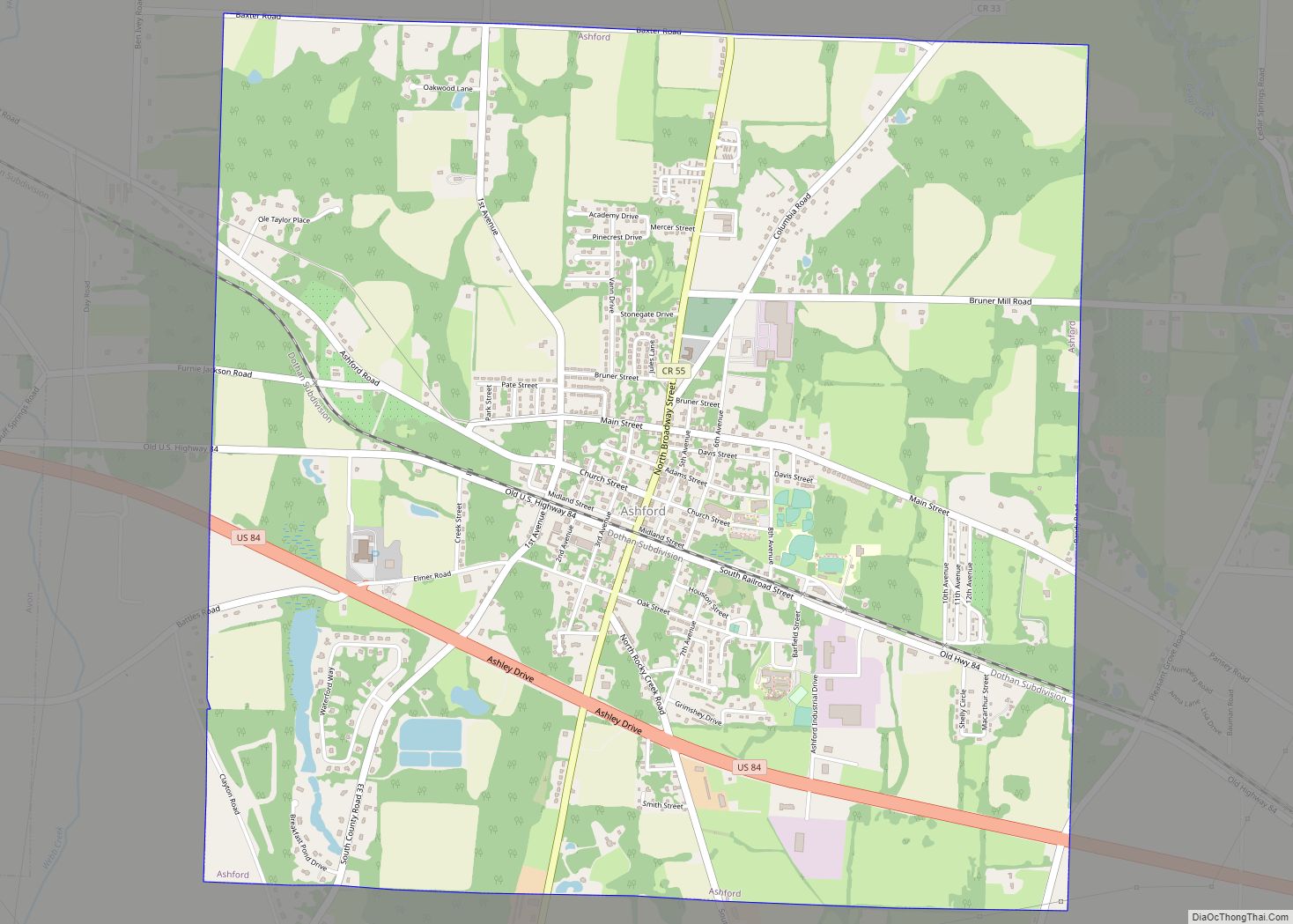
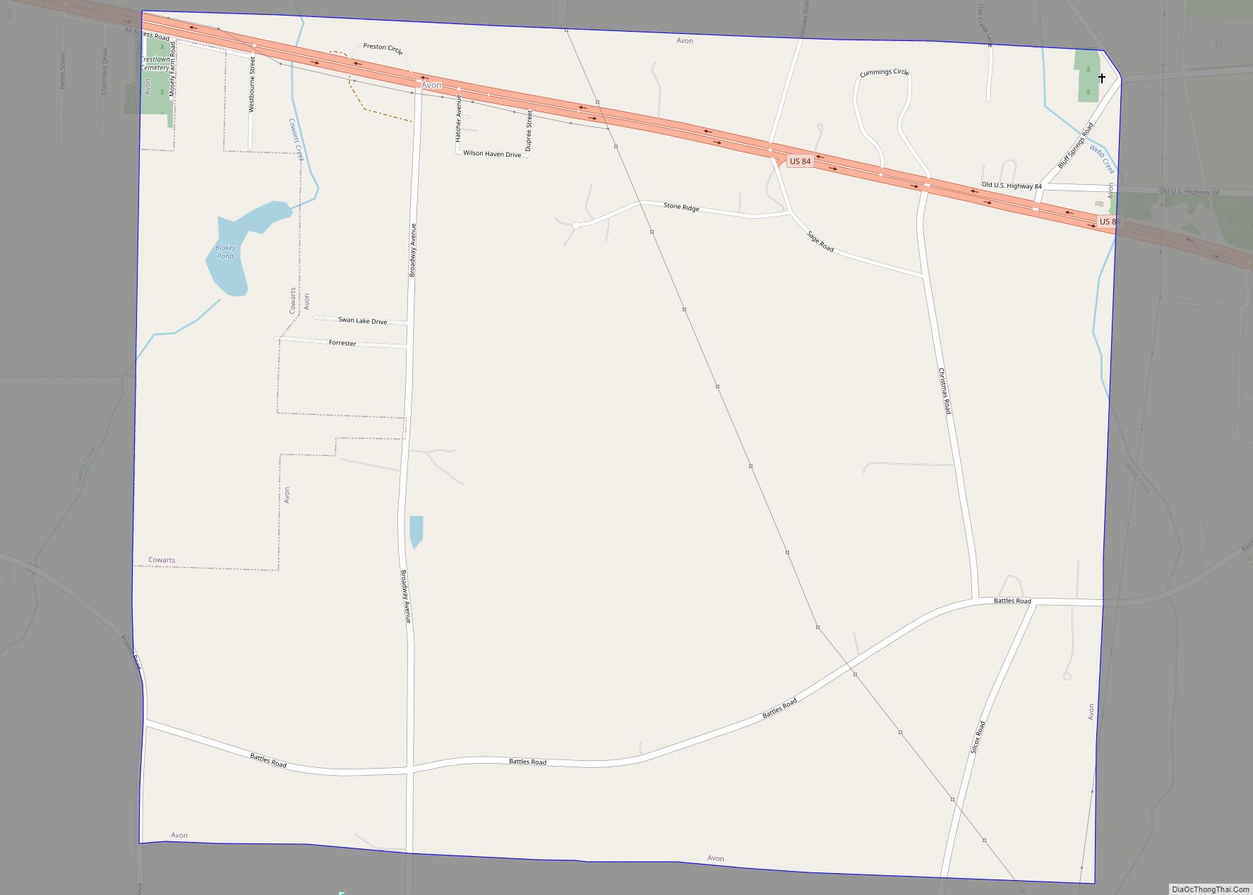
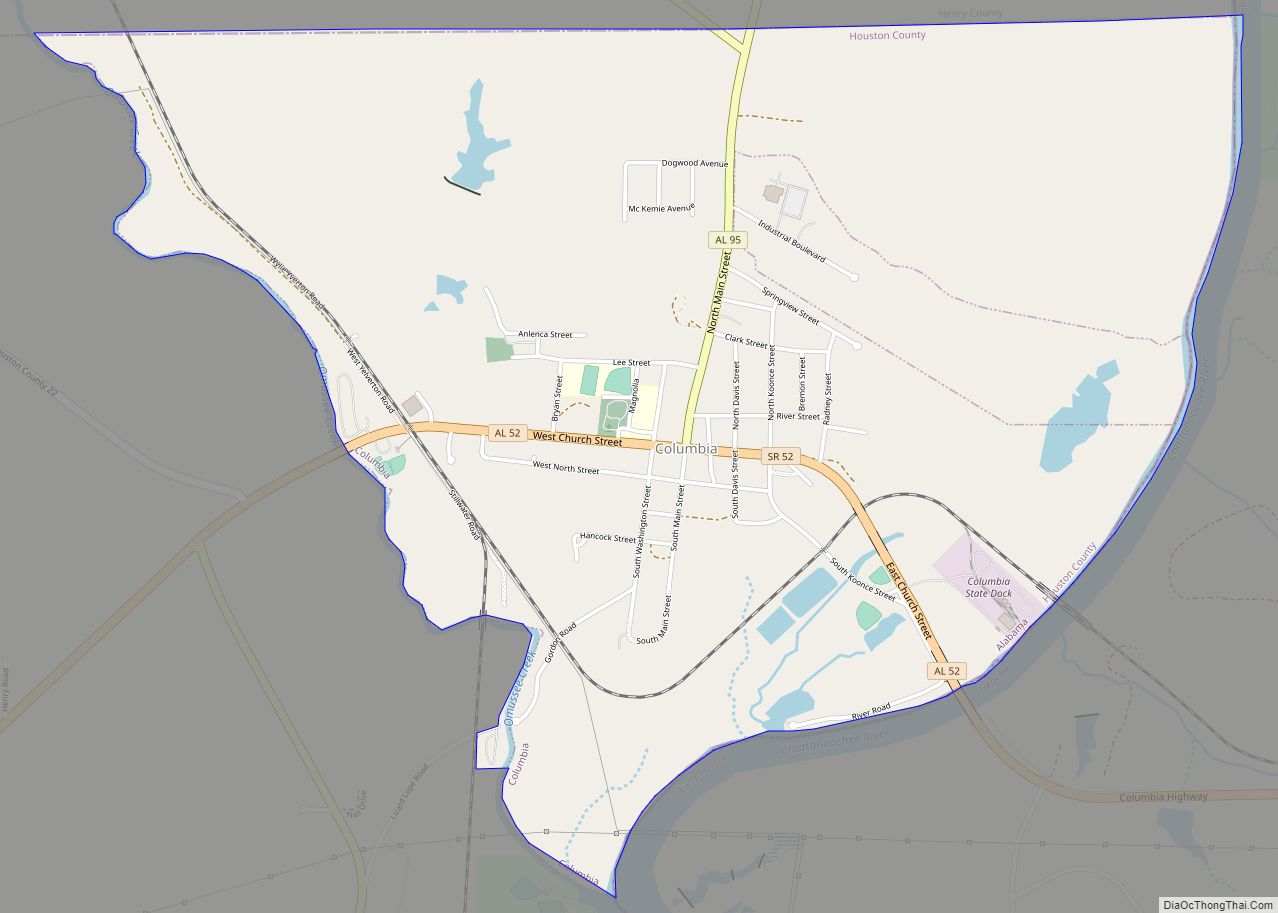
Online Interactive Map
Click on ![]() to view map in "full screen" mode.
to view map in "full screen" mode.
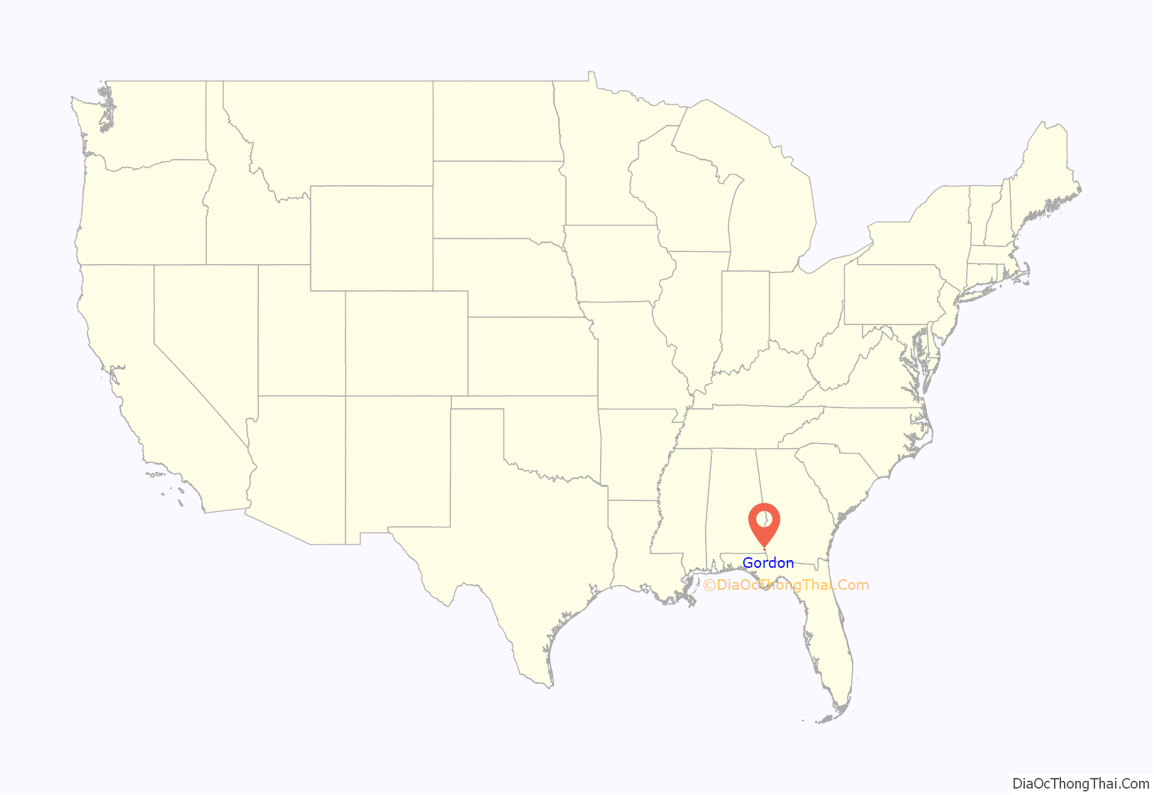
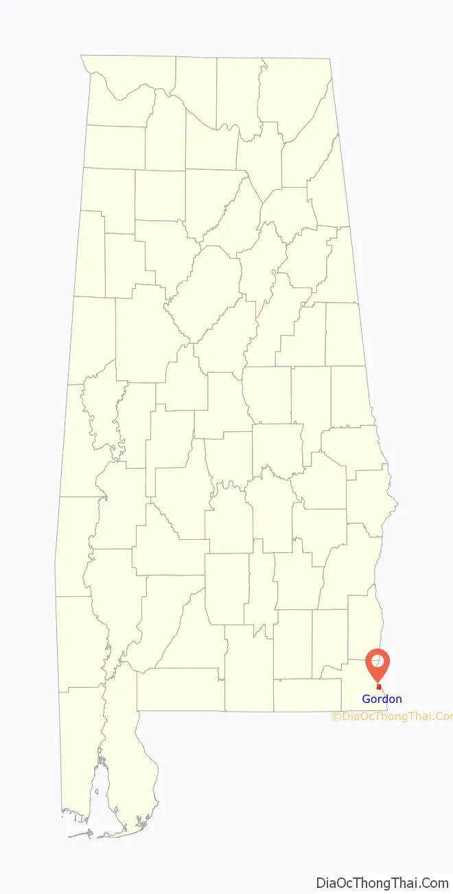
Gordon location map. Where is Gordon town?
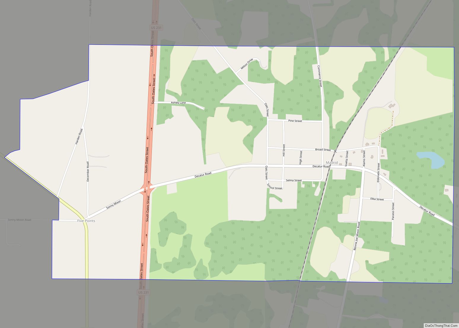
Gordon Road Map

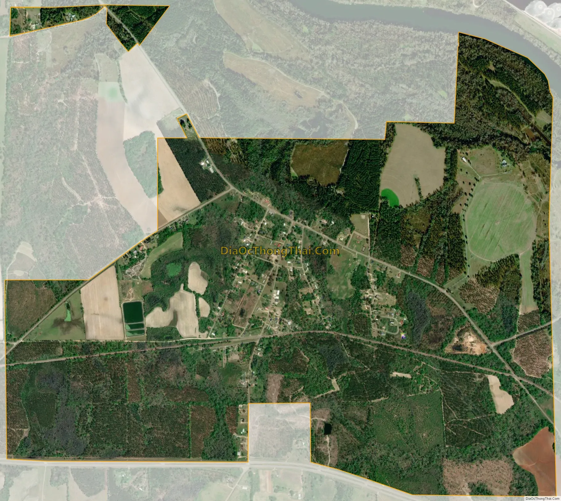
Gordon city Satellite Map
Geography
Gordon is located in eastern Houston County at 31°8′35″N 85°5′46″W / 31.14306°N 85.09611°W / 31.14306; -85.09611 (31.143171, -85.096114). It is bordered to the northeast by the Chattahoochee River, which forms the Alabama–Georgia border, and to the south by U.S. Route 84. US 84 leads west 19 miles (31 km) to Dothan and southeast 36 miles (58 km) to Bainbridge, Georgia. Alabama State Route 95 passes through the north and east sides of Gordon, leading north 12 miles (19 km) to Columbia and south 11 miles (18 km) to the Florida state line.
According to the U.S. Census Bureau, Gordon has a total area of 3.2 square miles (8.3 km), all land.
See also
Map of Alabama State and its subdivision:- Autauga
- Baldwin
- Barbour
- Bibb
- Blount
- Bullock
- Butler
- Calhoun
- Chambers
- Cherokee
- Chilton
- Choctaw
- Clarke
- Clay
- Cleburne
- Coffee
- Colbert
- Conecuh
- Coosa
- Covington
- Crenshaw
- Cullman
- Dale
- Dallas
- De Kalb
- Elmore
- Escambia
- Etowah
- Fayette
- Franklin
- Geneva
- Greene
- Hale
- Henry
- Houston
- Jackson
- Jefferson
- Lamar
- Lauderdale
- Lawrence
- Lee
- Limestone
- Lowndes
- Macon
- Madison
- Marengo
- Marion
- Marshall
- Mobile
- Monroe
- Montgomery
- Morgan
- Perry
- Pickens
- Pike
- Randolph
- Russell
- Saint Clair
- Shelby
- Sumter
- Talladega
- Tallapoosa
- Tuscaloosa
- Walker
- Washington
- Wilcox
- Winston
- Alabama
- Alaska
- Arizona
- Arkansas
- California
- Colorado
- Connecticut
- Delaware
- District of Columbia
- Florida
- Georgia
- Hawaii
- Idaho
- Illinois
- Indiana
- Iowa
- Kansas
- Kentucky
- Louisiana
- Maine
- Maryland
- Massachusetts
- Michigan
- Minnesota
- Mississippi
- Missouri
- Montana
- Nebraska
- Nevada
- New Hampshire
- New Jersey
- New Mexico
- New York
- North Carolina
- North Dakota
- Ohio
- Oklahoma
- Oregon
- Pennsylvania
- Rhode Island
- South Carolina
- South Dakota
- Tennessee
- Texas
- Utah
- Vermont
- Virginia
- Washington
- West Virginia
- Wisconsin
- Wyoming