Greenville is a city and the county seat of Butler County, Alabama, United States. At the 2020 census, the population was 7,374. Greenville is known as the Camellia City, wherein originated the movement to change the official Alabama state flower from the goldenrod to the camellia with legislative sponsors LaMont Glass and H.B. Taylor.
| Name: | Greenville city |
|---|---|
| LSAD Code: | 25 |
| LSAD Description: | city (suffix) |
| State: | Alabama |
| County: | Butler County |
| Founded: | 1819 |
| Elevation: | 440 ft (134 m) |
| Total Area: | 21.53 sq mi (55.76 km²) |
| Land Area: | 21.35 sq mi (55.31 km²) |
| Water Area: | 0.18 sq mi (0.46 km²) |
| Total Population: | 7,374 |
| Population Density: | 345.32/sq mi (133.33/km²) |
| ZIP code: | 36037 |
| Area code: | 334 |
| FIPS code: | 0131912 |
| GNISfeature ID: | 0119376 |
| Website: | greenvilleal.gov |
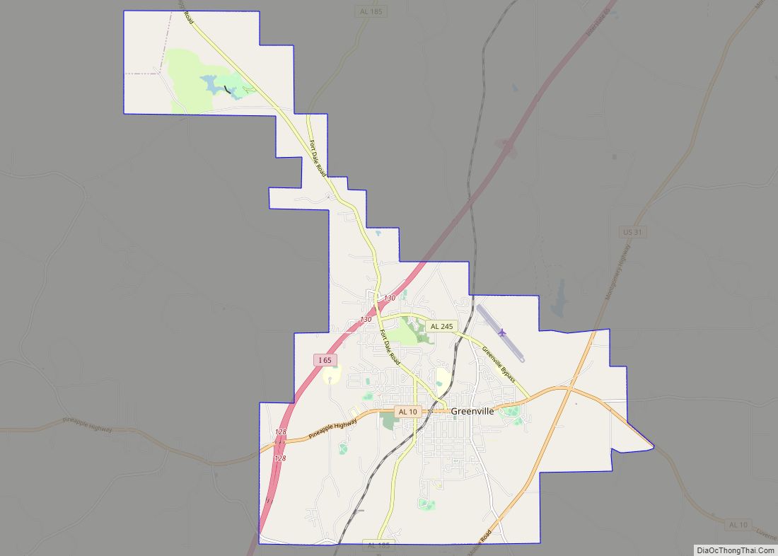
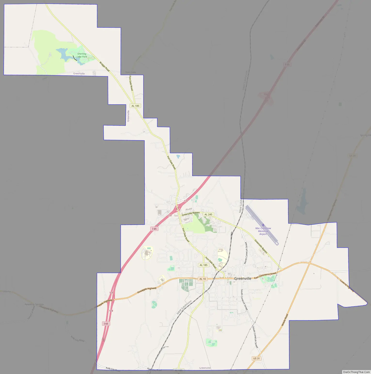
Online Interactive Map
Click on ![]() to view map in "full screen" mode.
to view map in "full screen" mode.
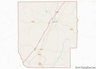
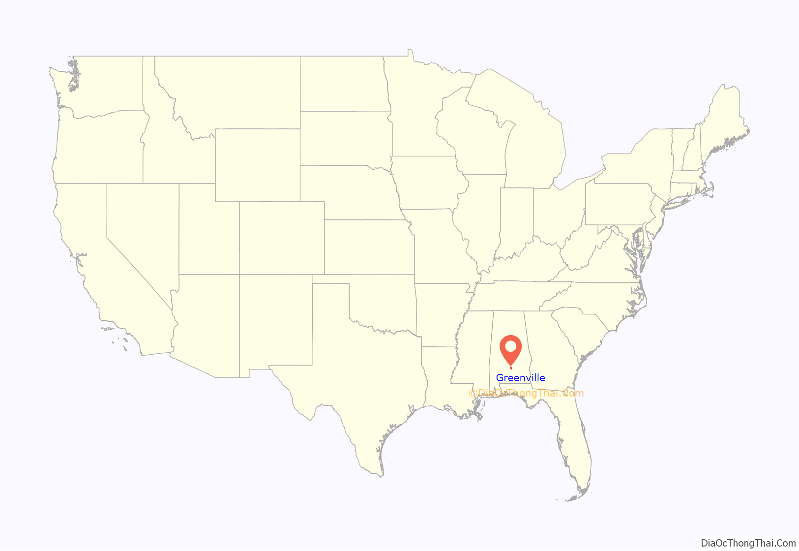
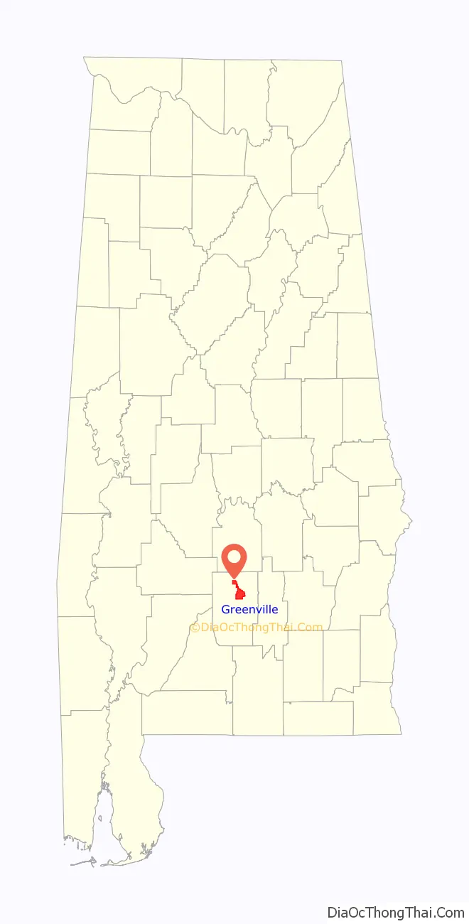
Greenville location map. Where is Greenville city?
History
Greenville was first settled in 1819. Its original name was Buttsville, but after becoming the county seat in 1822, its name was changed to Greenville, in remembrance of the former locale in South Carolina of many of the original settlers. The first county seat was at Fort Dale, a fortification that was named for Sam Dale, who fought to defend the area during the Creek War. The site of Fort Dale lies on the north of the city near the Fort Dale Cemetery, along what is now Alabama Highway 185.
The namesake of the county, Captain William Butler, was killed during the Creek War. He is buried in the Pioneer Cemetery, which is across from the oldest church in Butler County, the First United Methodist Church of Greenville.
During World War II, a satellite camp for German prisoners was based in Greenville.
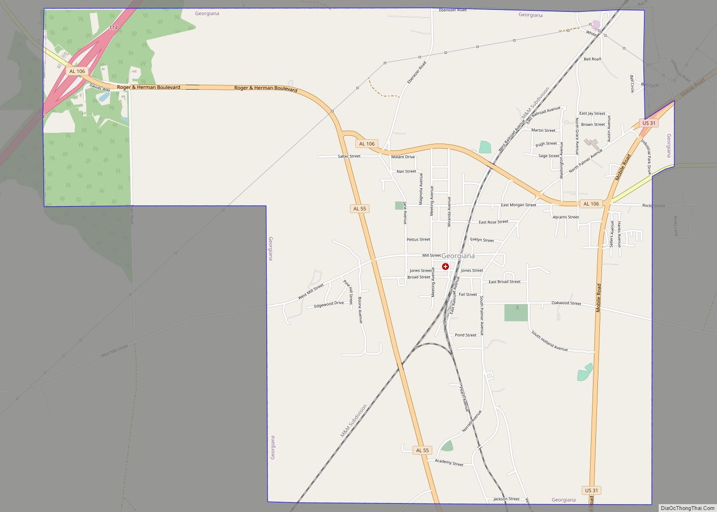
Greenville Road Map
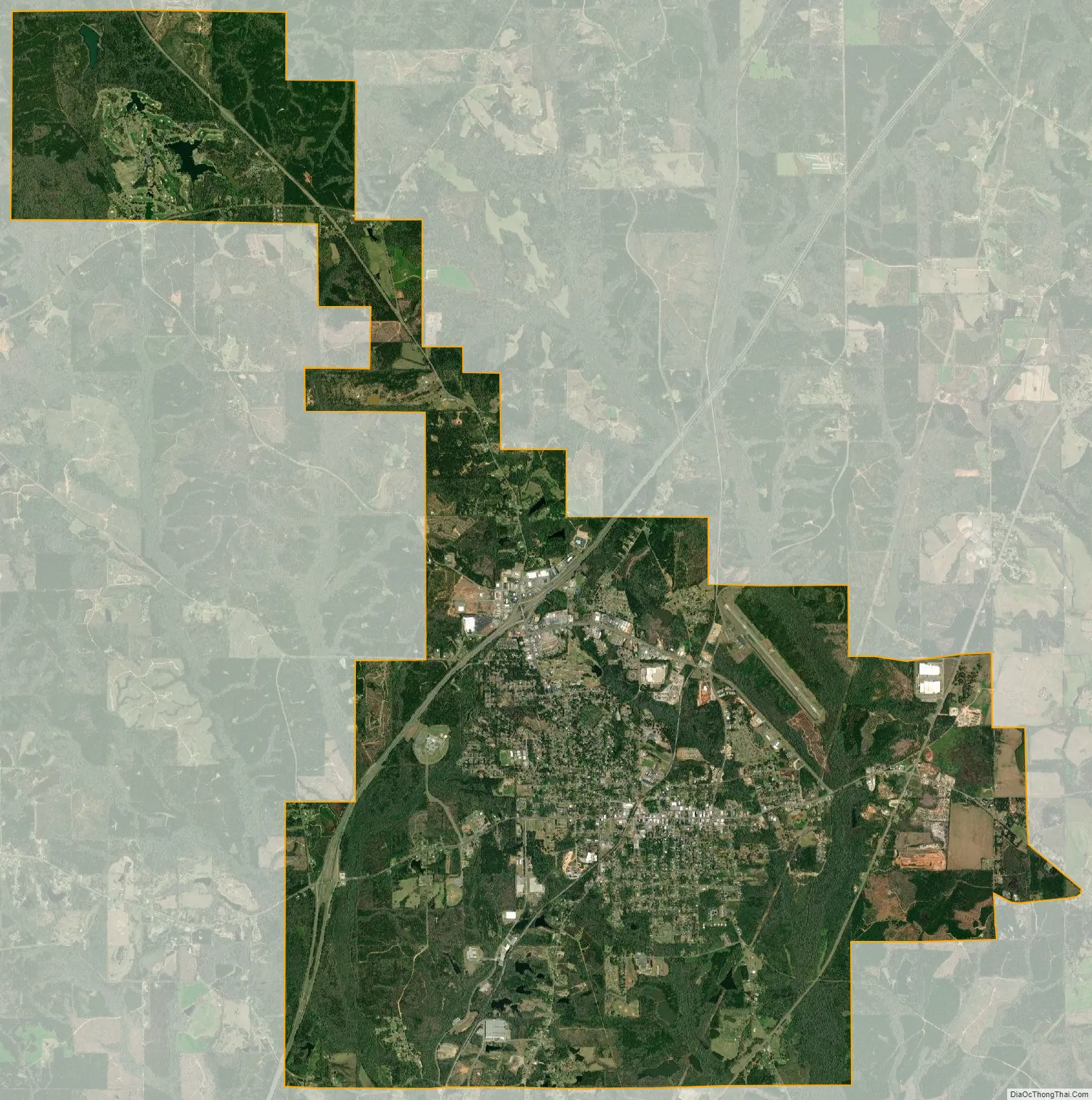
Greenville city Satellite Map
Geography
Interstate 65 and U.S. Route 31 pass through the city. Montgomery, the state capital, is 44 miles (71 km) northeast, the closest city to Greenville with a population above 50,000.
According to the U.S. Census Bureau, Greenville has a total area of 21.5 square miles (55.8 km), of which 21.4 square miles (55.3 km) is land and 0.19 square miles (0.5 km), or 0.82%, is water.
Climate
The city of Greenville has a humid subtropical climate, with an average high temperature of 77.3 °F (25.2 °C) and an average low temperature of 53.8 °F (12.1 °C). The city averages 4.80 inches (122 mm) of precipitation per month.
See also
Map of Alabama State and its subdivision:- Autauga
- Baldwin
- Barbour
- Bibb
- Blount
- Bullock
- Butler
- Calhoun
- Chambers
- Cherokee
- Chilton
- Choctaw
- Clarke
- Clay
- Cleburne
- Coffee
- Colbert
- Conecuh
- Coosa
- Covington
- Crenshaw
- Cullman
- Dale
- Dallas
- De Kalb
- Elmore
- Escambia
- Etowah
- Fayette
- Franklin
- Geneva
- Greene
- Hale
- Henry
- Houston
- Jackson
- Jefferson
- Lamar
- Lauderdale
- Lawrence
- Lee
- Limestone
- Lowndes
- Macon
- Madison
- Marengo
- Marion
- Marshall
- Mobile
- Monroe
- Montgomery
- Morgan
- Perry
- Pickens
- Pike
- Randolph
- Russell
- Saint Clair
- Shelby
- Sumter
- Talladega
- Tallapoosa
- Tuscaloosa
- Walker
- Washington
- Wilcox
- Winston
- Alabama
- Alaska
- Arizona
- Arkansas
- California
- Colorado
- Connecticut
- Delaware
- District of Columbia
- Florida
- Georgia
- Hawaii
- Idaho
- Illinois
- Indiana
- Iowa
- Kansas
- Kentucky
- Louisiana
- Maine
- Maryland
- Massachusetts
- Michigan
- Minnesota
- Mississippi
- Missouri
- Montana
- Nebraska
- Nevada
- New Hampshire
- New Jersey
- New Mexico
- New York
- North Carolina
- North Dakota
- Ohio
- Oklahoma
- Oregon
- Pennsylvania
- Rhode Island
- South Carolina
- South Dakota
- Tennessee
- Texas
- Utah
- Vermont
- Virginia
- Washington
- West Virginia
- Wisconsin
- Wyoming