Highland Lake is a town in Blount County, Alabama, United States. At the 2020 census, the population was 412.
| Name: | Highland Lake town |
|---|---|
| LSAD Code: | 43 |
| LSAD Description: | town (suffix) |
| State: | Alabama |
| County: | Blount County |
| Elevation: | 892 ft (272 m) |
| Total Area: | 1.99 sq mi (5.15 km²) |
| Land Area: | 1.63 sq mi (4.23 km²) |
| Water Area: | 0.36 sq mi (0.92 km²) |
| Total Population: | 412 |
| Population Density: | 252.45/sq mi (97.49/km²) |
| ZIP code: | 35121 |
| Area code: | 205, 659 |
| FIPS code: | 0134480 |
| GNISfeature ID: | 1669445 |
| Website: | townofhighlandlake.com |
Online Interactive Map
Click on ![]() to view map in "full screen" mode.
to view map in "full screen" mode.
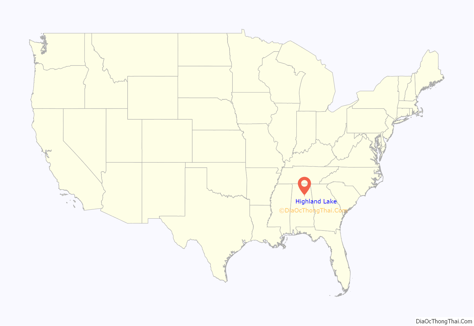
Highland Lake location map. Where is Highland Lake town?
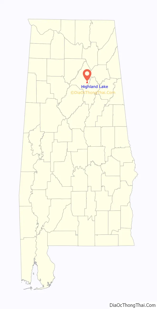
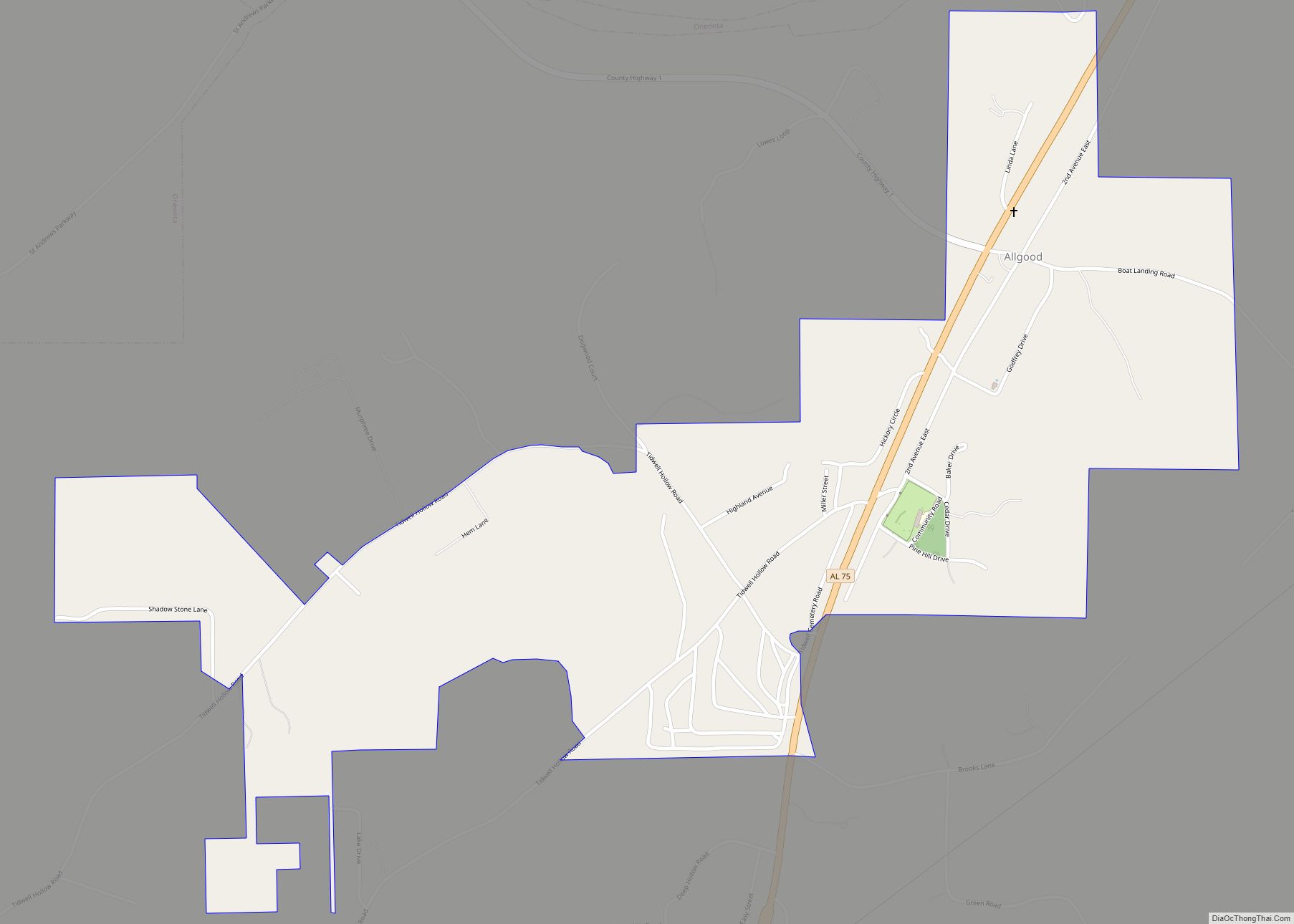
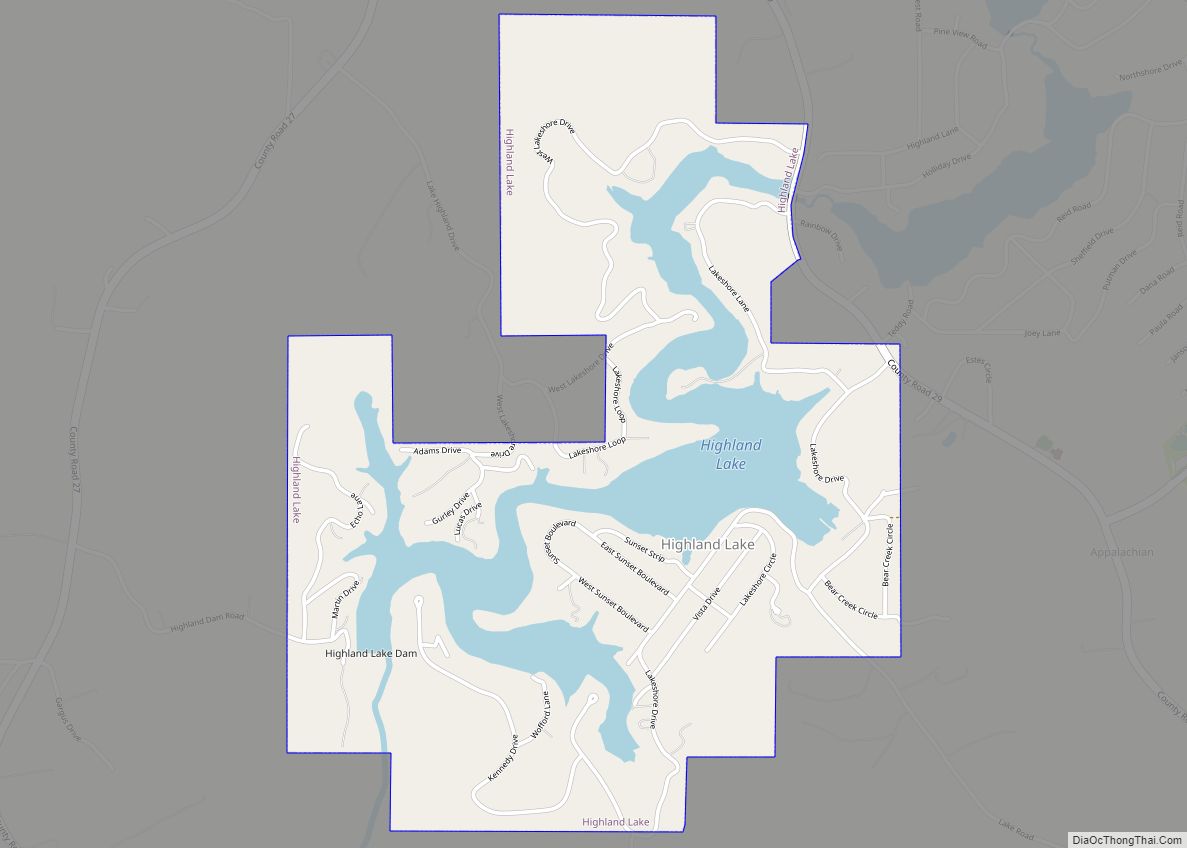
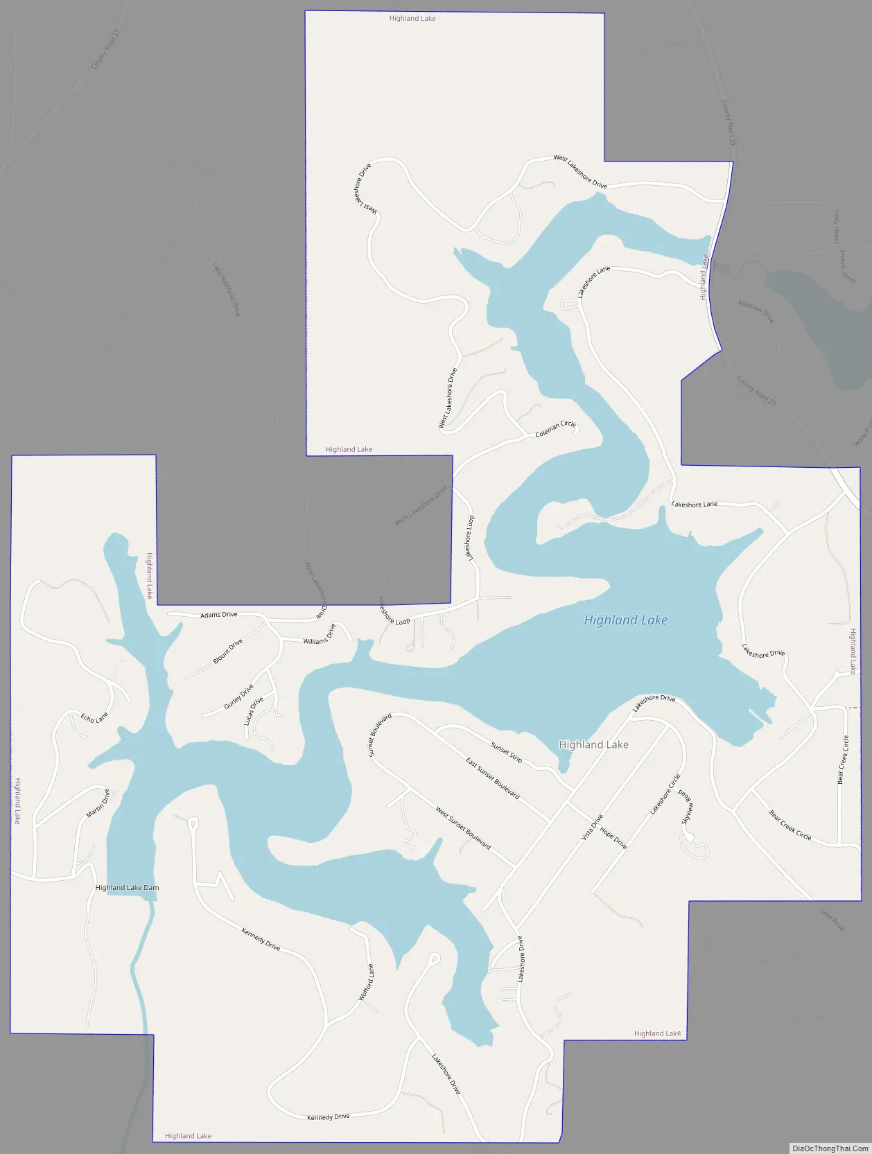
Highland Lake Road Map
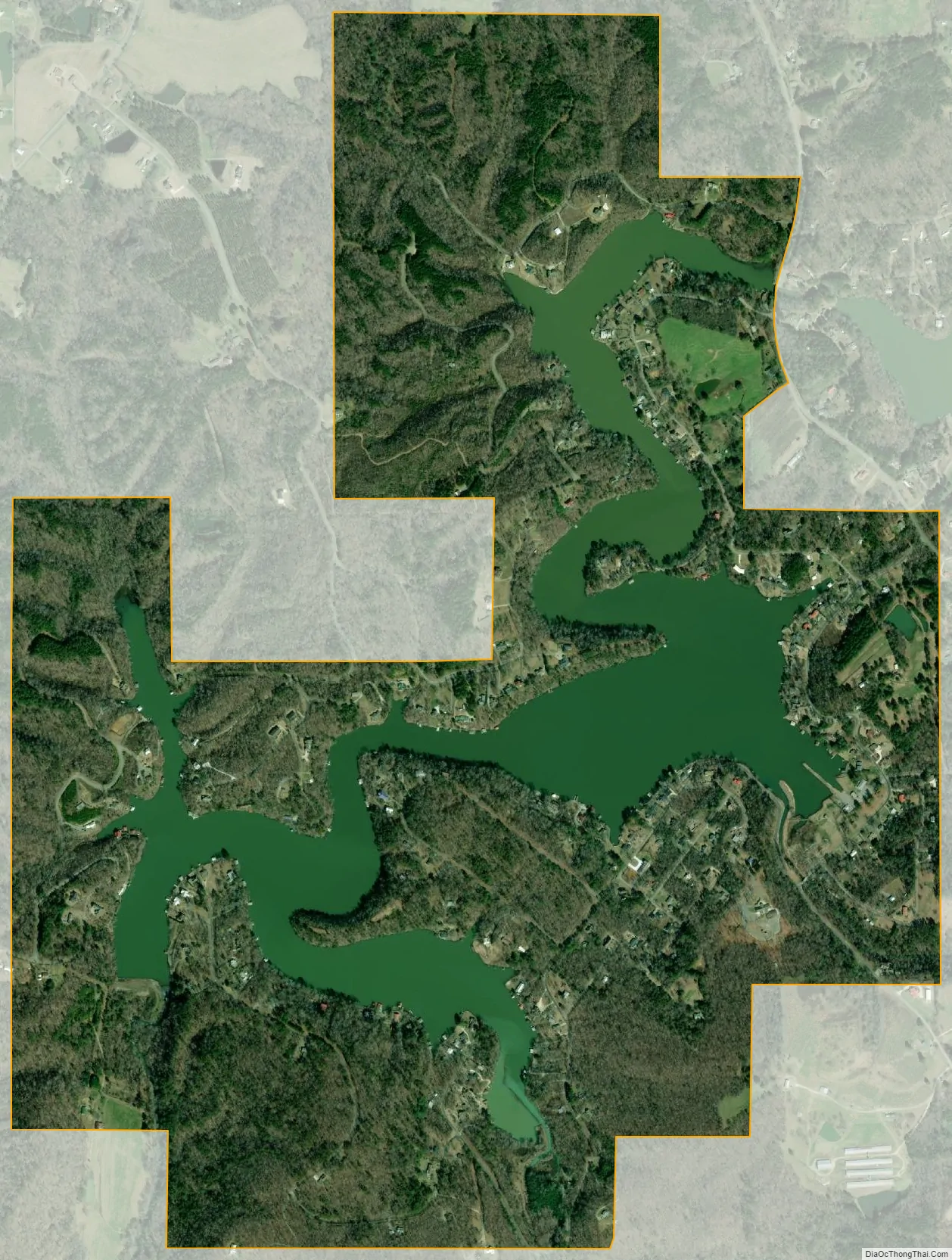
Highland Lake city Satellite Map
Geography
Highland Lake is located in eastern Blount County at 33°53’3.376″ North, 86°25’19.744″ West (33.884271, -86.422151). The town consists of homes built around Highland Lake, a reservoir on the Blackburn Fork of the Little Warrior River. The lake, at an elevation of 895 feet (273 m) above sea level, is in a valley between Blount Mountain to the southeast and Straight Mountain to the northwest. The town is 7 miles (11 km) southwest of Oneonta, the county seat, along County Road 29.
According to the U.S. Census Bureau, the town of Highland Lake has a total area of 2.0 square miles (5.2 km), of which 1.6 square miles (4.2 km) is land and 0.35 square miles (0.9 km), or 17.97%, is water.
See also
Map of Alabama State and its subdivision:- Autauga
- Baldwin
- Barbour
- Bibb
- Blount
- Bullock
- Butler
- Calhoun
- Chambers
- Cherokee
- Chilton
- Choctaw
- Clarke
- Clay
- Cleburne
- Coffee
- Colbert
- Conecuh
- Coosa
- Covington
- Crenshaw
- Cullman
- Dale
- Dallas
- De Kalb
- Elmore
- Escambia
- Etowah
- Fayette
- Franklin
- Geneva
- Greene
- Hale
- Henry
- Houston
- Jackson
- Jefferson
- Lamar
- Lauderdale
- Lawrence
- Lee
- Limestone
- Lowndes
- Macon
- Madison
- Marengo
- Marion
- Marshall
- Mobile
- Monroe
- Montgomery
- Morgan
- Perry
- Pickens
- Pike
- Randolph
- Russell
- Saint Clair
- Shelby
- Sumter
- Talladega
- Tallapoosa
- Tuscaloosa
- Walker
- Washington
- Wilcox
- Winston
- Alabama
- Alaska
- Arizona
- Arkansas
- California
- Colorado
- Connecticut
- Delaware
- District of Columbia
- Florida
- Georgia
- Hawaii
- Idaho
- Illinois
- Indiana
- Iowa
- Kansas
- Kentucky
- Louisiana
- Maine
- Maryland
- Massachusetts
- Michigan
- Minnesota
- Mississippi
- Missouri
- Montana
- Nebraska
- Nevada
- New Hampshire
- New Jersey
- New Mexico
- New York
- North Carolina
- North Dakota
- Ohio
- Oklahoma
- Oregon
- Pennsylvania
- Rhode Island
- South Carolina
- South Dakota
- Tennessee
- Texas
- Utah
- Vermont
- Virginia
- Washington
- West Virginia
- Wisconsin
- Wyoming