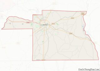
Madrid (/ˈmædrɪd/ MAD-rid) is a town in Houston County, Alabama, United States. It is part of the Dothan, Alabama Metropolitan Statistical Area. At the 2010 census the population was 350, up from 303 in 2000.
| Name: | Madrid town |
|---|---|
| LSAD Code: | 43 |
| LSAD Description: | town (suffix) |
| State: | Alabama |
| County: | Houston County |
| Elevation: | 164 ft (50 m) |
| Total Area: | 1.75 sq mi (4.52 km²) |
| Land Area: | 1.75 sq mi (4.52 km²) |
| Water Area: | 0.00 sq mi (0.00 km²) |
| Total Population: | 265 |
| Population Density: | 151.69/sq mi (58.57/km²) |
| ZIP code: | 36320 |
| Area code: | 334 |
| FIPS code: | 0145904 |
| GNISfeature ID: | 0122197 |
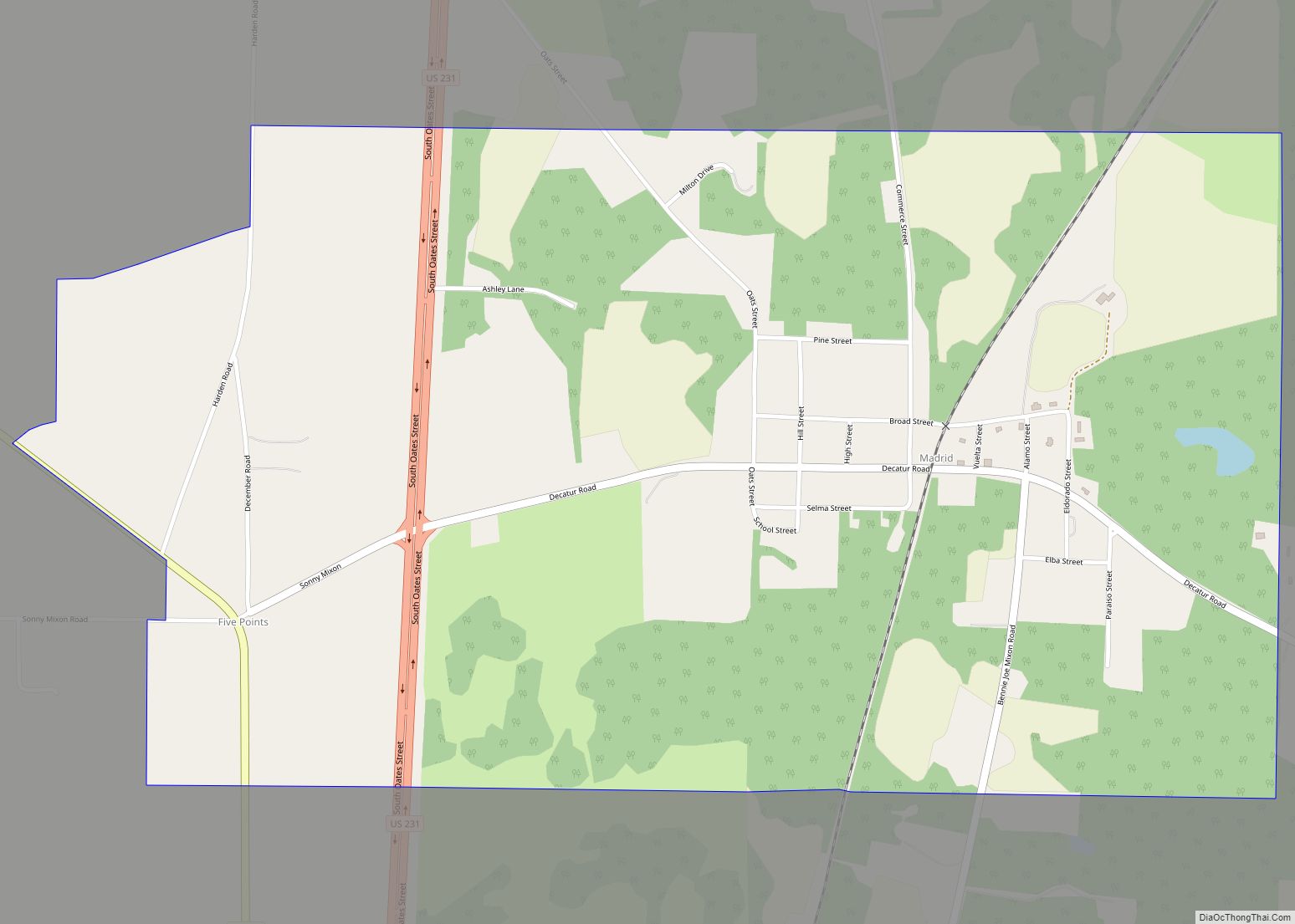
Online Interactive Map
Click on ![]() to view map in "full screen" mode.
to view map in "full screen" mode.
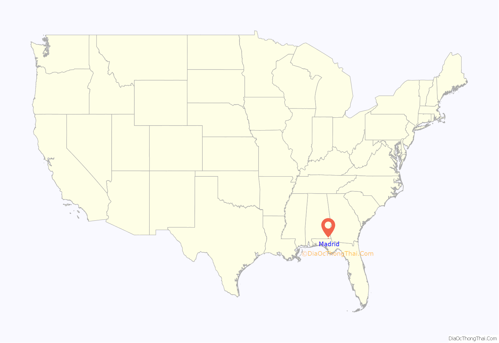
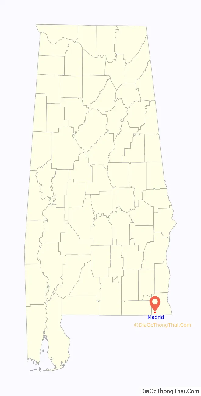
Madrid location map. Where is Madrid town?
History
Madrid was founded in 1905 by land speculator J.B. Dell and Ed Watford Sr. J.B. bought much land around the intersection of the Bay Line Railroad and a dirt road. He and his partner (who may be Ed Watford) divided the land into lots for sale.
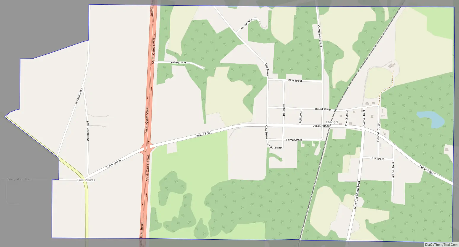
Madrid Road Map
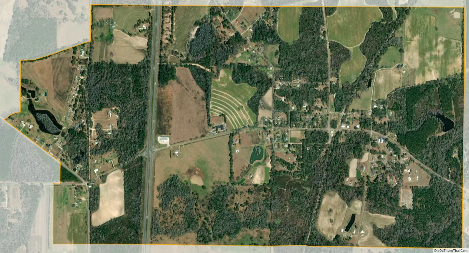
Madrid city Satellite Map
Geography
Madrid is located in southwestern Houston County at 31°02′06″N 85°23′50″W / 31.034941°N 85.397222°W / 31.034941; -85.397222. U.S. Route 231 passes through the west side of the town, leading north 13 miles (21 km) to Dothan and south 18 miles (29 km) to Cottondale, Florida.
According to the U.S. Census Bureau, the town has a total area of 1.9 square miles (5.0 km), all land.
See also
Map of Alabama State and its subdivision:- Autauga
- Baldwin
- Barbour
- Bibb
- Blount
- Bullock
- Butler
- Calhoun
- Chambers
- Cherokee
- Chilton
- Choctaw
- Clarke
- Clay
- Cleburne
- Coffee
- Colbert
- Conecuh
- Coosa
- Covington
- Crenshaw
- Cullman
- Dale
- Dallas
- De Kalb
- Elmore
- Escambia
- Etowah
- Fayette
- Franklin
- Geneva
- Greene
- Hale
- Henry
- Houston
- Jackson
- Jefferson
- Lamar
- Lauderdale
- Lawrence
- Lee
- Limestone
- Lowndes
- Macon
- Madison
- Marengo
- Marion
- Marshall
- Mobile
- Monroe
- Montgomery
- Morgan
- Perry
- Pickens
- Pike
- Randolph
- Russell
- Saint Clair
- Shelby
- Sumter
- Talladega
- Tallapoosa
- Tuscaloosa
- Walker
- Washington
- Wilcox
- Winston
- Alabama
- Alaska
- Arizona
- Arkansas
- California
- Colorado
- Connecticut
- Delaware
- District of Columbia
- Florida
- Georgia
- Hawaii
- Idaho
- Illinois
- Indiana
- Iowa
- Kansas
- Kentucky
- Louisiana
- Maine
- Maryland
- Massachusetts
- Michigan
- Minnesota
- Mississippi
- Missouri
- Montana
- Nebraska
- Nevada
- New Hampshire
- New Jersey
- New Mexico
- New York
- North Carolina
- North Dakota
- Ohio
- Oklahoma
- Oregon
- Pennsylvania
- Rhode Island
- South Carolina
- South Dakota
- Tennessee
- Texas
- Utah
- Vermont
- Virginia
- Washington
- West Virginia
- Wisconsin
- Wyoming