Newville is a town in Henry County, Alabama, United States. It is part of the Dothan, Alabama Metropolitan Statistical Area. At the 2020 census, the population was 544.
| Name: | Newville town |
|---|---|
| LSAD Code: | 43 |
| LSAD Description: | town (suffix) |
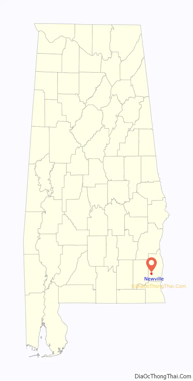
| State: | Alabama |
| County: | Henry County |
| Elevation: | 397 ft (121 m) |
| Total Area: | 4.02 sq mi (10.41 km²) |
| Land Area: | 4.02 sq mi (10.41 km²) |
| Water Area: | 0.00 sq mi (0.00 km²) |
| Total Population: | 544 |
| Population Density: | 135.39/sq mi (52.27/km²) |
| ZIP code: | 36353 |
| Area code: | 334 |
| FIPS code: | 0154600 |
| GNISfeature ID: | 0152690 |
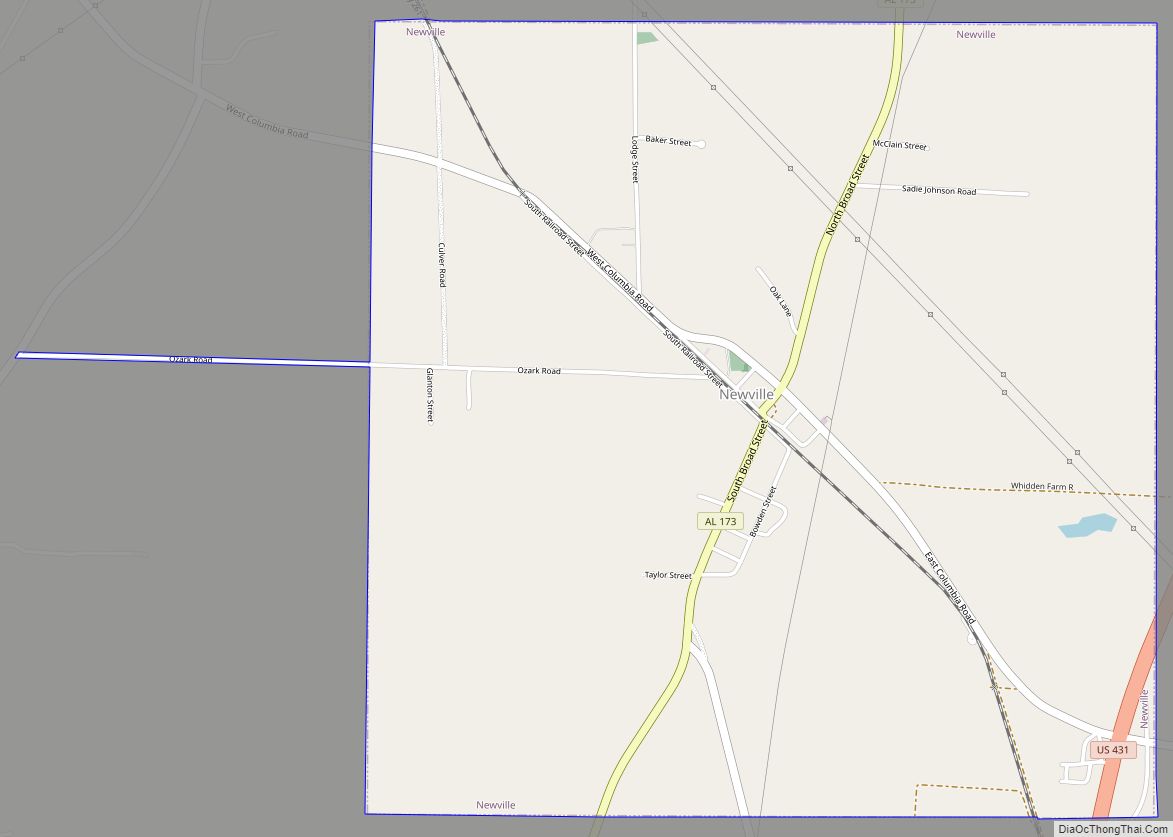
Online Interactive Map
Click on ![]() to view map in "full screen" mode.
to view map in "full screen" mode.
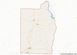
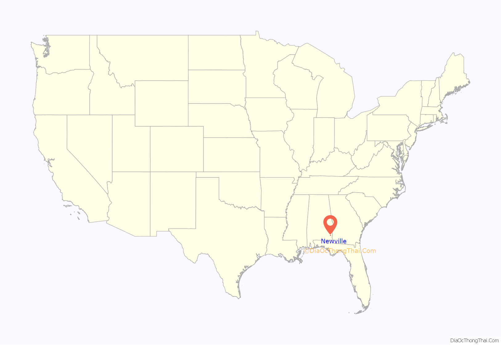
Newville location map. Where is Newville town?
History
James Madison Wells founded a village called “Wells” c. 1882. When the Abbeville Southern Railroad laid tracks through the town in 1893, its name was changed to “Wells Station”. The post office was built in 1894. Wells Station incorporated as “Newville” in 1903.
The town of Newville became prosperous with merchants, banks, lodges, doctors, churches, Newville High School, Rosenwald High School, societies, a newspaper, a depot, sawmills, cotton gins, mule stables and all the elements required by a developing town. Newville’s slow decline commenced after the Great Depression due to farm mechanization and loss of commerce.
Newville Baptist Church Cemetery
James M. and Catherine Wells donated one-half acre of land in 1887 for the site of the church and cemetery. The oldest known grave is that of William Y. Kirkland who died April 10, 1891. The church paid W.M. Harris fifty dollars in 1901 for two and one-half acres of land for the cemetery. In 1947, burial spaces were sold for 25 center per square foot. Nancy Price gave the church one acre of land for the cemetery in 1958. There are over 700 marked and unmarked graves. The Newville Cemetery was listed on the Alabama Historic Cemetery Register in 2005.
Newville High School
The first known school in Newville was at Center Church in 1881. When Grange Hall was built in 1891, church service and school were held on the first floor. In 1913, Grange Hall was torn down and the wood was used to build a school. Newville Public School became Newville Junior High in 1920. In 1923, it was decided to build a modern brick school. Newville High School was opened in 1929. The school building at Concord was moved to Newville in 1935. In 1936, the school building burned. A new structure was built with five rooms and a large auditorium. In 1938, the Works Progress Administration built the vocational building. When bathrooms were added in 1944, Newville School became one of the most modern buildings in Henry County. The Newville High School band was organized in 1961. In 1968, Newville High School closed.
Newville Rosenwald School
In 1894, the first known black school in Newville was organized and a building was built. The Jacksonian Enterprise School opened in May 1894. Parents and patrons financially supported this school. The school library contained more books than any school in this part of the country. The school grounds included Store’s Grove, a circular grove of 104 oak trees with a 30-foot avenue running through the middle of it. Each tree was named in honor of a patron. In 1919, the Newville Community requested assistance for the school. They received it from the Rosenwald Foundation. A new school was built and named “Newville Rosenwald School”. The Henry County Board of Education began to contribute to the finances of Newville Rosenwald School about 1922. During the late 1940s, Newville Rosenwald School became a high school. It was about this time that the original school burned down and a new building was constructed. In 1968 Rosenwald High School was closed.
Newville Road Map
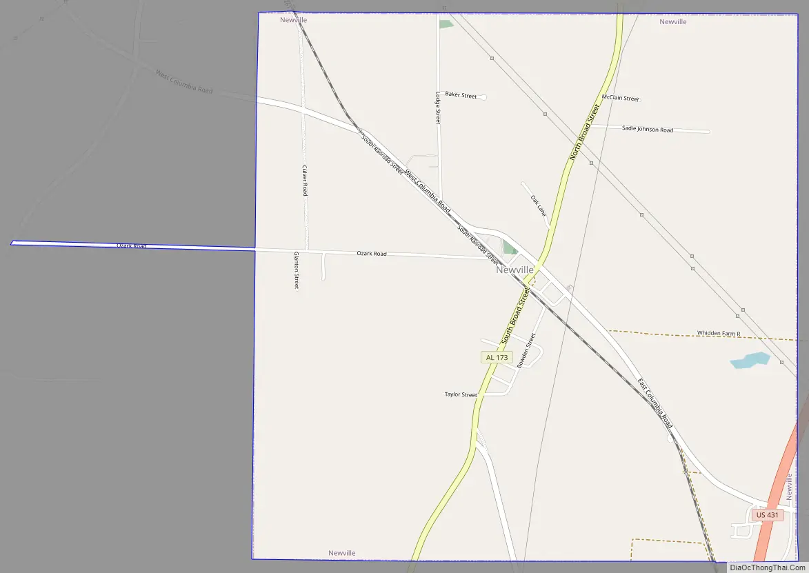
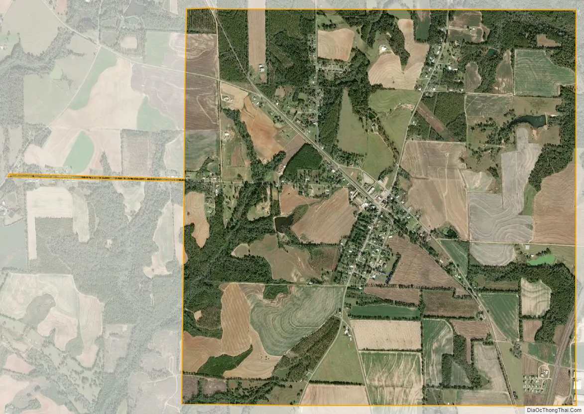
Newville city Satellite Map
Geography
Newville is located in southwestern Henry County at 31°25′19″N 85°20′11″W / 31.42194°N 85.33639°W / 31.42194; -85.33639 (31.421841, -85.336434). Alabama State Route 173 passes through the center of town as Broad Street, leading north 13 miles (21 km) to Abbeville and south 6 miles (10 km) to Headland. U.S. Route 431, a four-lane highway, cuts through the southeast corner of Newville, also connecting Newville and Headland. Dothan is 15 miles (24 km) to the south via US 431.
According to the U.S. Census Bureau, Newville has a total area of 4.0 square miles (10.4 km), all land.
See also
Map of Alabama State and its subdivision:- Autauga
- Baldwin
- Barbour
- Bibb
- Blount
- Bullock
- Butler
- Calhoun
- Chambers
- Cherokee
- Chilton
- Choctaw
- Clarke
- Clay
- Cleburne
- Coffee
- Colbert
- Conecuh
- Coosa
- Covington
- Crenshaw
- Cullman
- Dale
- Dallas
- De Kalb
- Elmore
- Escambia
- Etowah
- Fayette
- Franklin
- Geneva
- Greene
- Hale
- Henry
- Houston
- Jackson
- Jefferson
- Lamar
- Lauderdale
- Lawrence
- Lee
- Limestone
- Lowndes
- Macon
- Madison
- Marengo
- Marion
- Marshall
- Mobile
- Monroe
- Montgomery
- Morgan
- Perry
- Pickens
- Pike
- Randolph
- Russell
- Saint Clair
- Shelby
- Sumter
- Talladega
- Tallapoosa
- Tuscaloosa
- Walker
- Washington
- Wilcox
- Winston
- Alabama
- Alaska
- Arizona
- Arkansas
- California
- Colorado
- Connecticut
- Delaware
- District of Columbia
- Florida
- Georgia
- Hawaii
- Idaho
- Illinois
- Indiana
- Iowa
- Kansas
- Kentucky
- Louisiana
- Maine
- Maryland
- Massachusetts
- Michigan
- Minnesota
- Mississippi
- Missouri
- Montana
- Nebraska
- Nevada
- New Hampshire
- New Jersey
- New Mexico
- New York
- North Carolina
- North Dakota
- Ohio
- Oklahoma
- Oregon
- Pennsylvania
- Rhode Island
- South Carolina
- South Dakota
- Tennessee
- Texas
- Utah
- Vermont
- Virginia
- Washington
- West Virginia
- Wisconsin
- Wyoming