Orange Beach is a resort city in Baldwin County, Alabama, United States. As of the 2020 Census, the population was 8,095.
| Name: | Orange Beach city |
|---|---|
| LSAD Code: | 25 |
| LSAD Description: | city (suffix) |
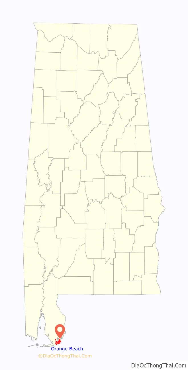
| State: | Alabama |
| County: | Baldwin County |
| Elevation: | 0 ft (0 m) |
| Total Area: | 15.95 sq mi (41.30 km²) |
| Land Area: | 14.71 sq mi (38.11 km²) |
| Water Area: | 1.23 sq mi (3.20 km²) |
| Total Population: | 8,095 |
| Population Density: | 550.19/sq mi (212.43/km²) |
| ZIP code: | 36561 |
| Area code: | 251 |
| FIPS code: | 0157144 |
| GNISfeature ID: | 0124297 |
| Website: | www.cityoforangebeach.com |
Online Interactive Map
Click on ![]() to view map in "full screen" mode.
to view map in "full screen" mode.
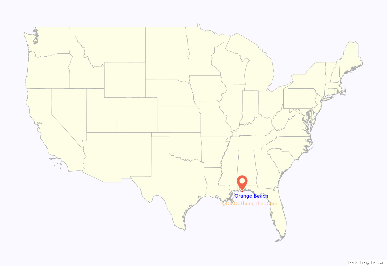
Orange Beach location map. Where is Orange Beach city?
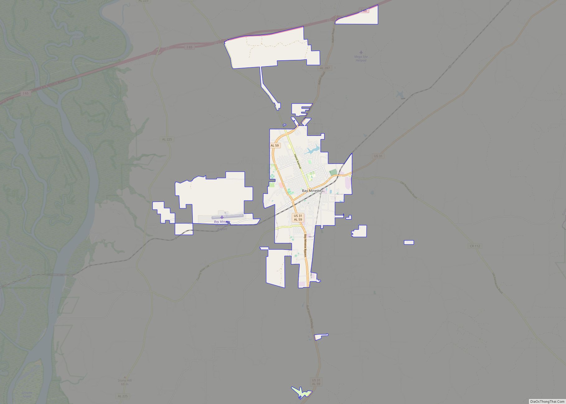
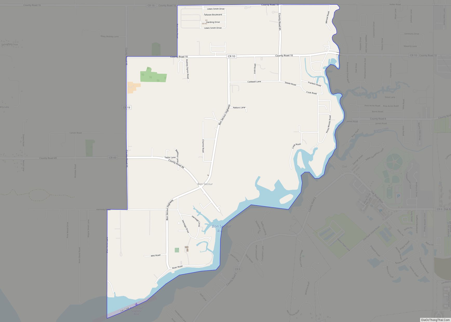
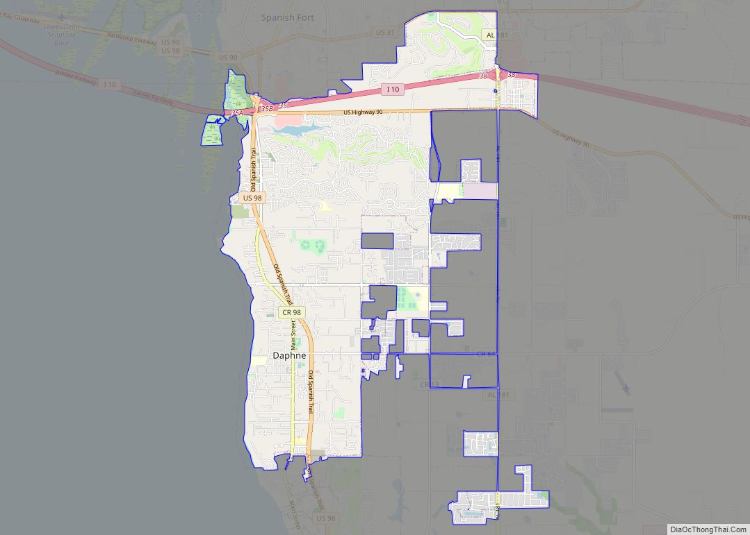
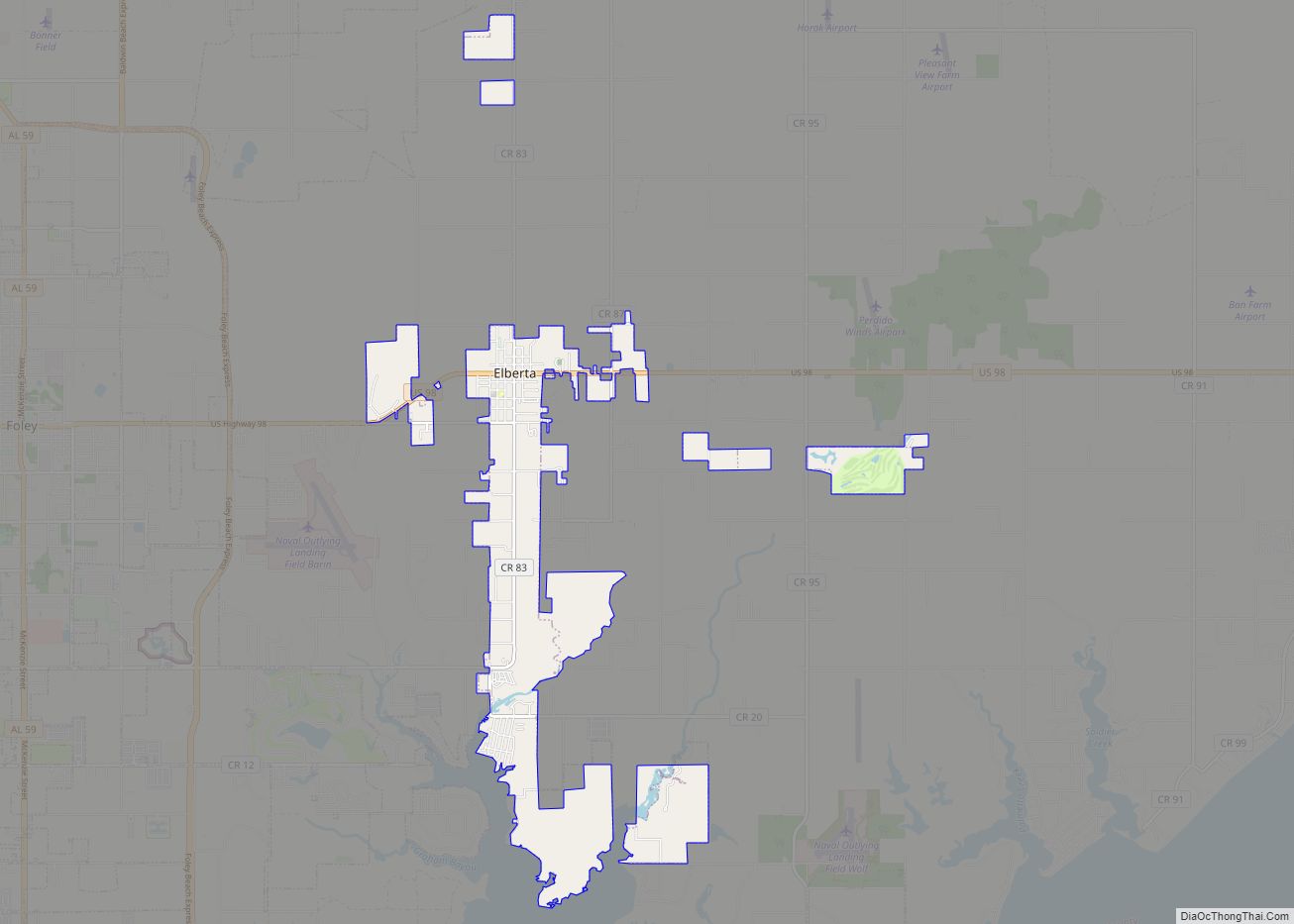
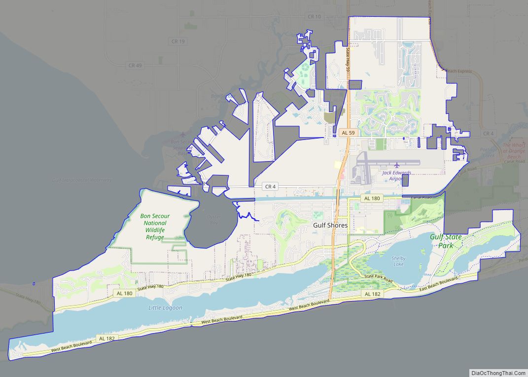
Orange Beach Road Map
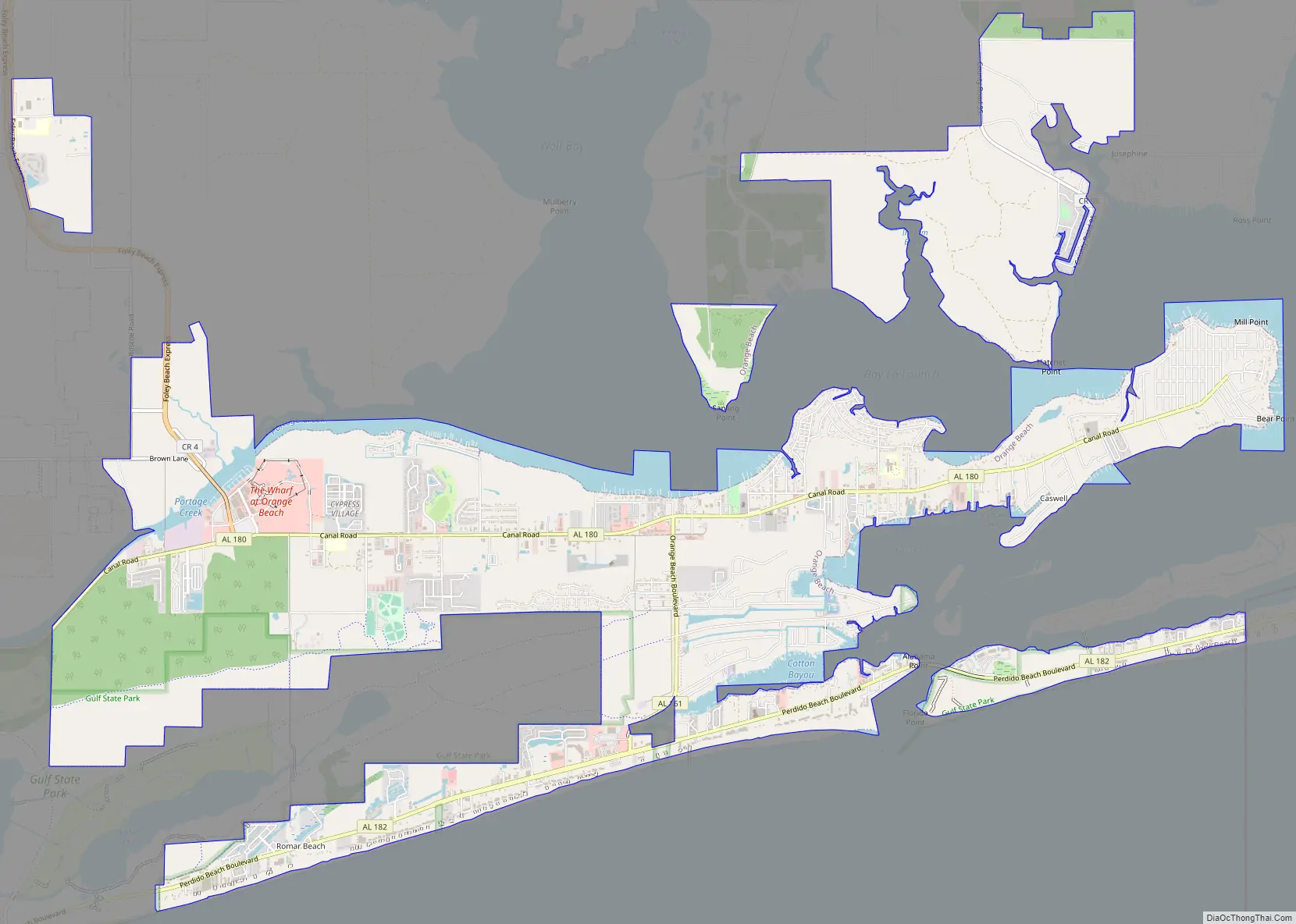
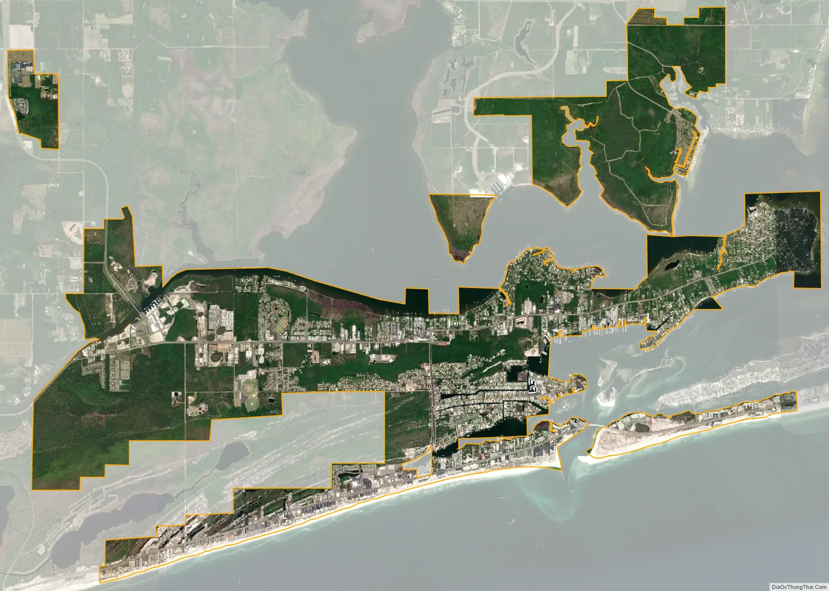
Orange Beach city Satellite Map
Geography
Orange Beach is located along the Gulf of Mexico, and is the easternmost community on Alabama’s Gulf Coast, with Florida‘s Perdido Key bordering it to the east. The city of Gulf Shores is to the west.
According to the United States Census Bureau, the city has a total area of 15.9 square miles (41.3 km), of which 14.7 square miles (38.1 km) is land and 1.2 square miles (3.2 km), or 7.83%, is water.
Climate
Orange Beach has a humid subtropical climate, with mild-to-warm winters, and hot and humid summers.
See also
Map of Alabama State and its subdivision:- Autauga
- Baldwin
- Barbour
- Bibb
- Blount
- Bullock
- Butler
- Calhoun
- Chambers
- Cherokee
- Chilton
- Choctaw
- Clarke
- Clay
- Cleburne
- Coffee
- Colbert
- Conecuh
- Coosa
- Covington
- Crenshaw
- Cullman
- Dale
- Dallas
- De Kalb
- Elmore
- Escambia
- Etowah
- Fayette
- Franklin
- Geneva
- Greene
- Hale
- Henry
- Houston
- Jackson
- Jefferson
- Lamar
- Lauderdale
- Lawrence
- Lee
- Limestone
- Lowndes
- Macon
- Madison
- Marengo
- Marion
- Marshall
- Mobile
- Monroe
- Montgomery
- Morgan
- Perry
- Pickens
- Pike
- Randolph
- Russell
- Saint Clair
- Shelby
- Sumter
- Talladega
- Tallapoosa
- Tuscaloosa
- Walker
- Washington
- Wilcox
- Winston
- Alabama
- Alaska
- Arizona
- Arkansas
- California
- Colorado
- Connecticut
- Delaware
- District of Columbia
- Florida
- Georgia
- Hawaii
- Idaho
- Illinois
- Indiana
- Iowa
- Kansas
- Kentucky
- Louisiana
- Maine
- Maryland
- Massachusetts
- Michigan
- Minnesota
- Mississippi
- Missouri
- Montana
- Nebraska
- Nevada
- New Hampshire
- New Jersey
- New Mexico
- New York
- North Carolina
- North Dakota
- Ohio
- Oklahoma
- Oregon
- Pennsylvania
- Rhode Island
- South Carolina
- South Dakota
- Tennessee
- Texas
- Utah
- Vermont
- Virginia
- Washington
- West Virginia
- Wisconsin
- Wyoming