Providence is a town in Marengo County, Alabama, United States. As of the 2020 United States census, the population was 167, down from 223 at the 2010 census. It incorporated sometime in the 1970s.
| Name: | Providence town |
|---|---|
| LSAD Code: | 43 |
| LSAD Description: | town (suffix) |
| State: | Alabama |
| County: | Marengo County |
| Elevation: | 98 ft (30 m) |
| Total Area: | 1.75 sq mi (4.52 km²) |
| Land Area: | 1.75 sq mi (4.52 km²) |
| Water Area: | 0.00 sq mi (0.00 km²) |
| Total Population: | 167 |
| Population Density: | 95.7/sq mi (36.95/km²) |
| FIPS code: | 0162688 |
| GNISfeature ID: | 0137658 |
Online Interactive Map
Click on ![]() to view map in "full screen" mode.
to view map in "full screen" mode.
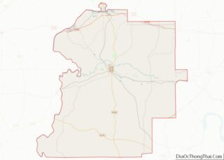
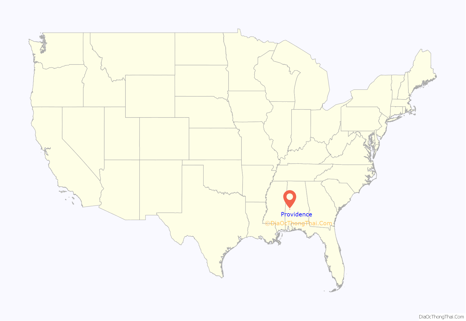
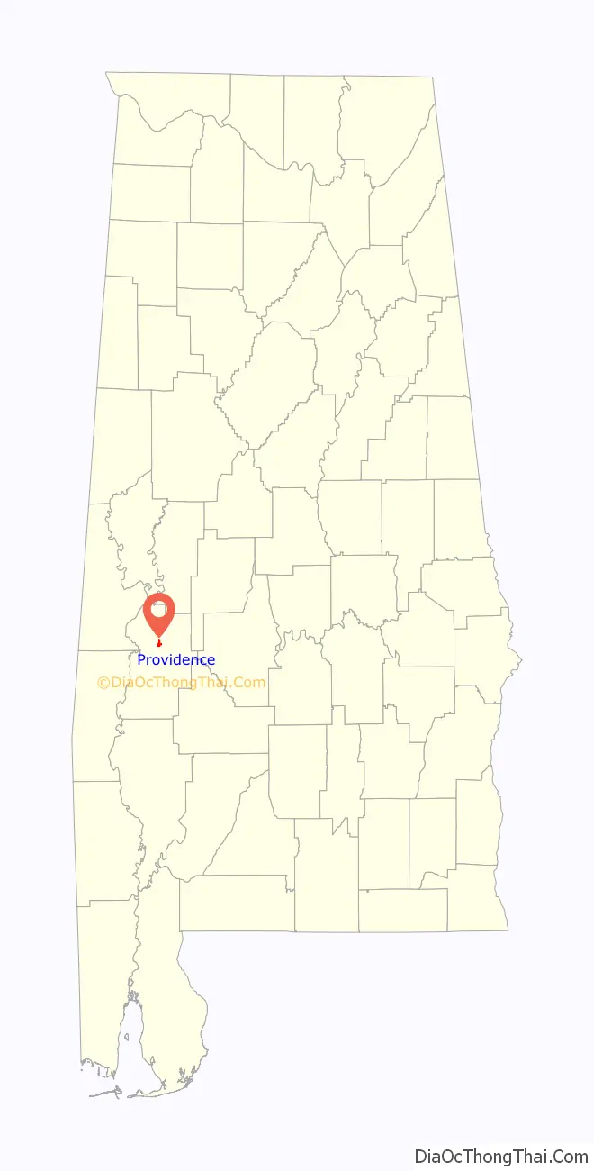
Providence location map. Where is Providence town?
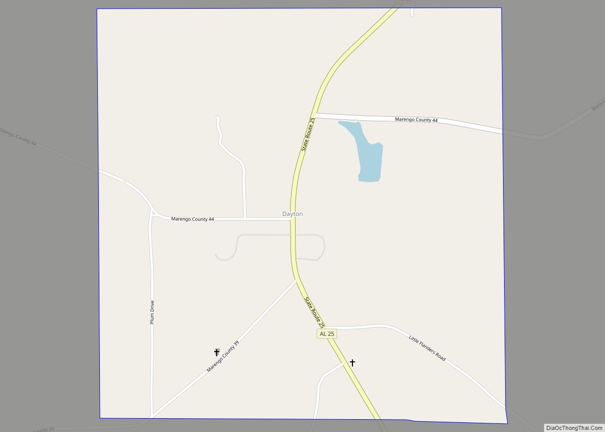
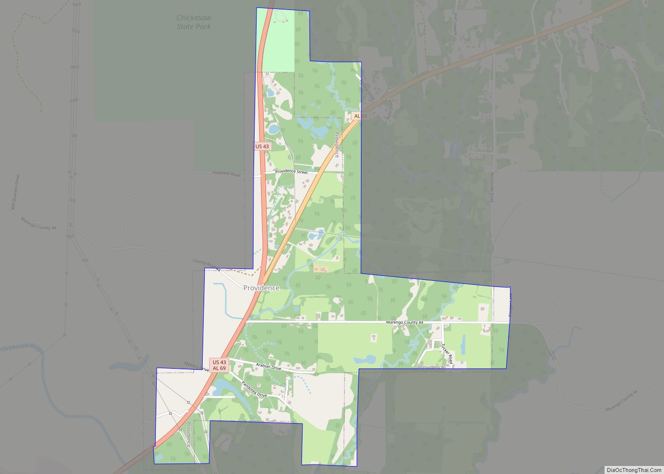
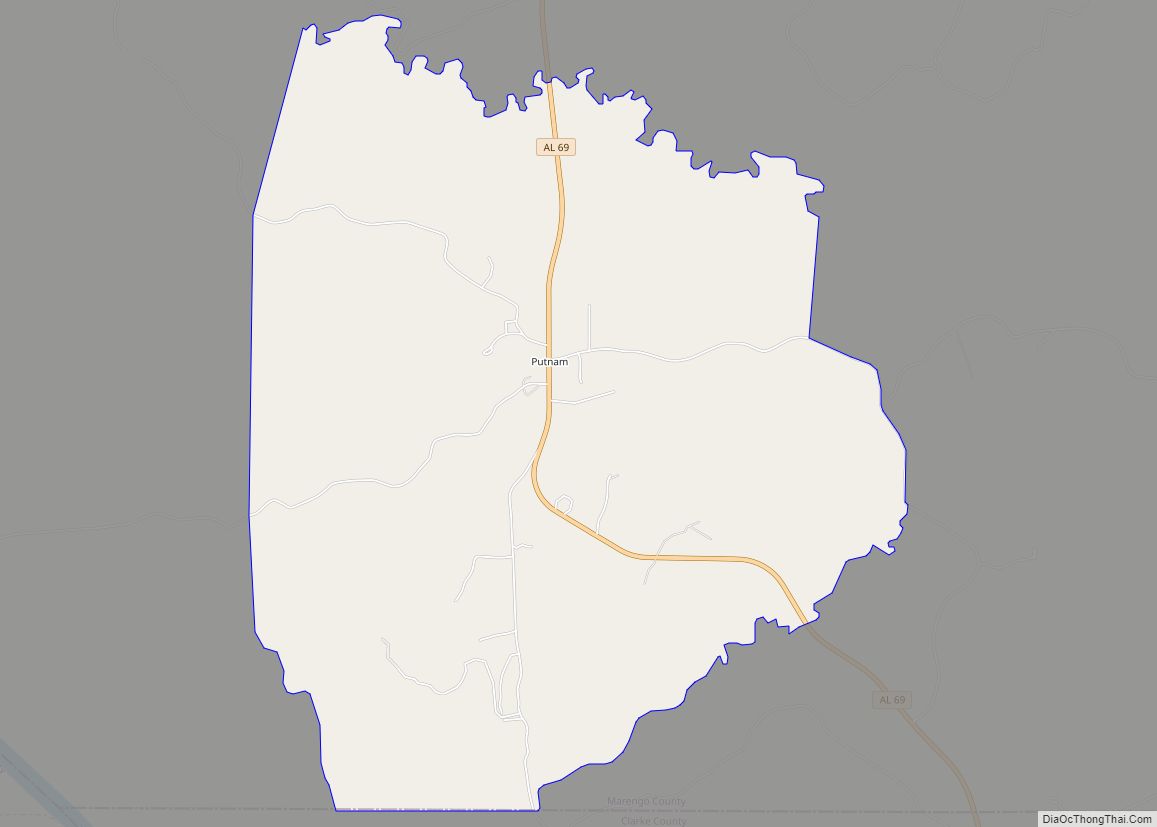
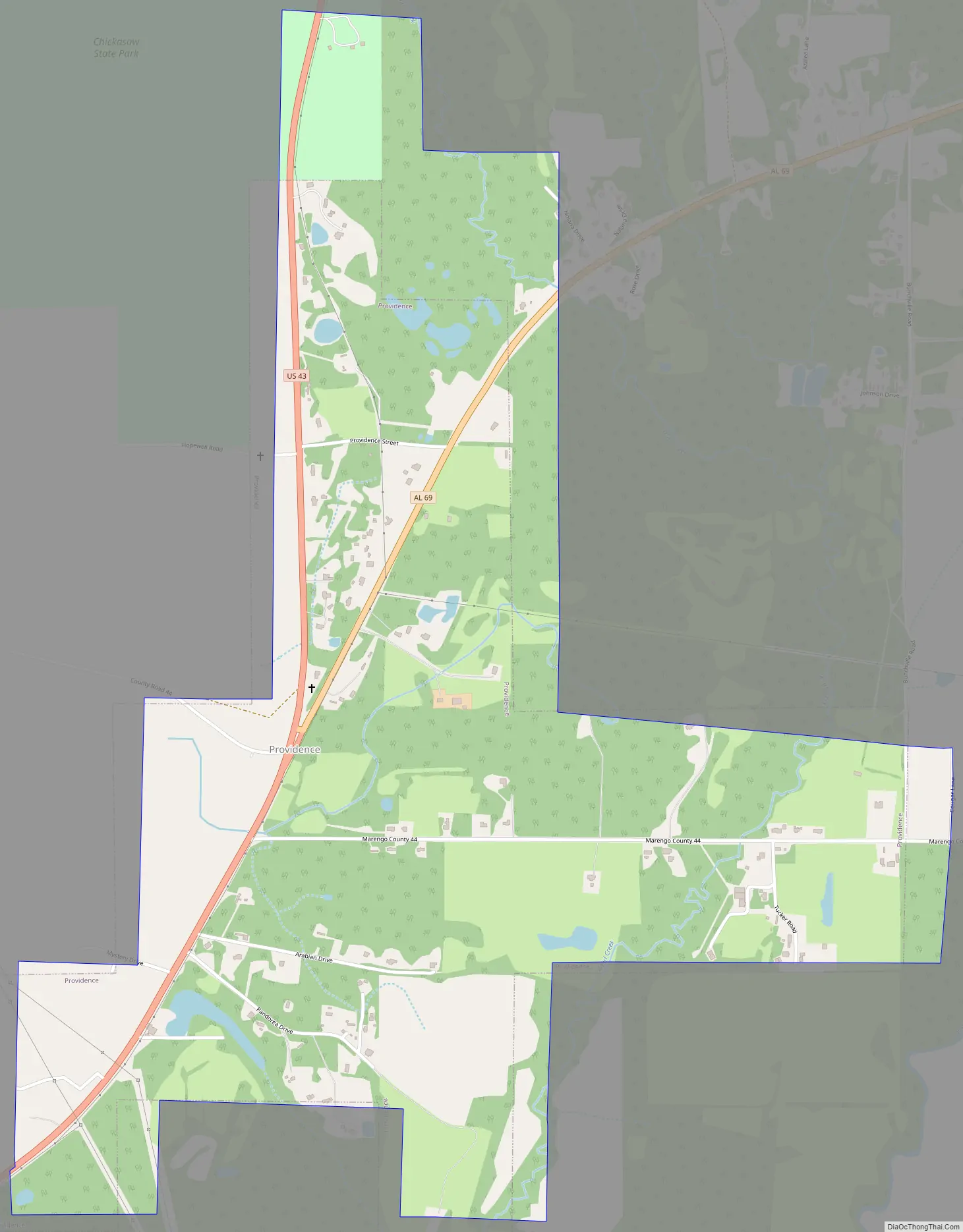
Providence Road Map
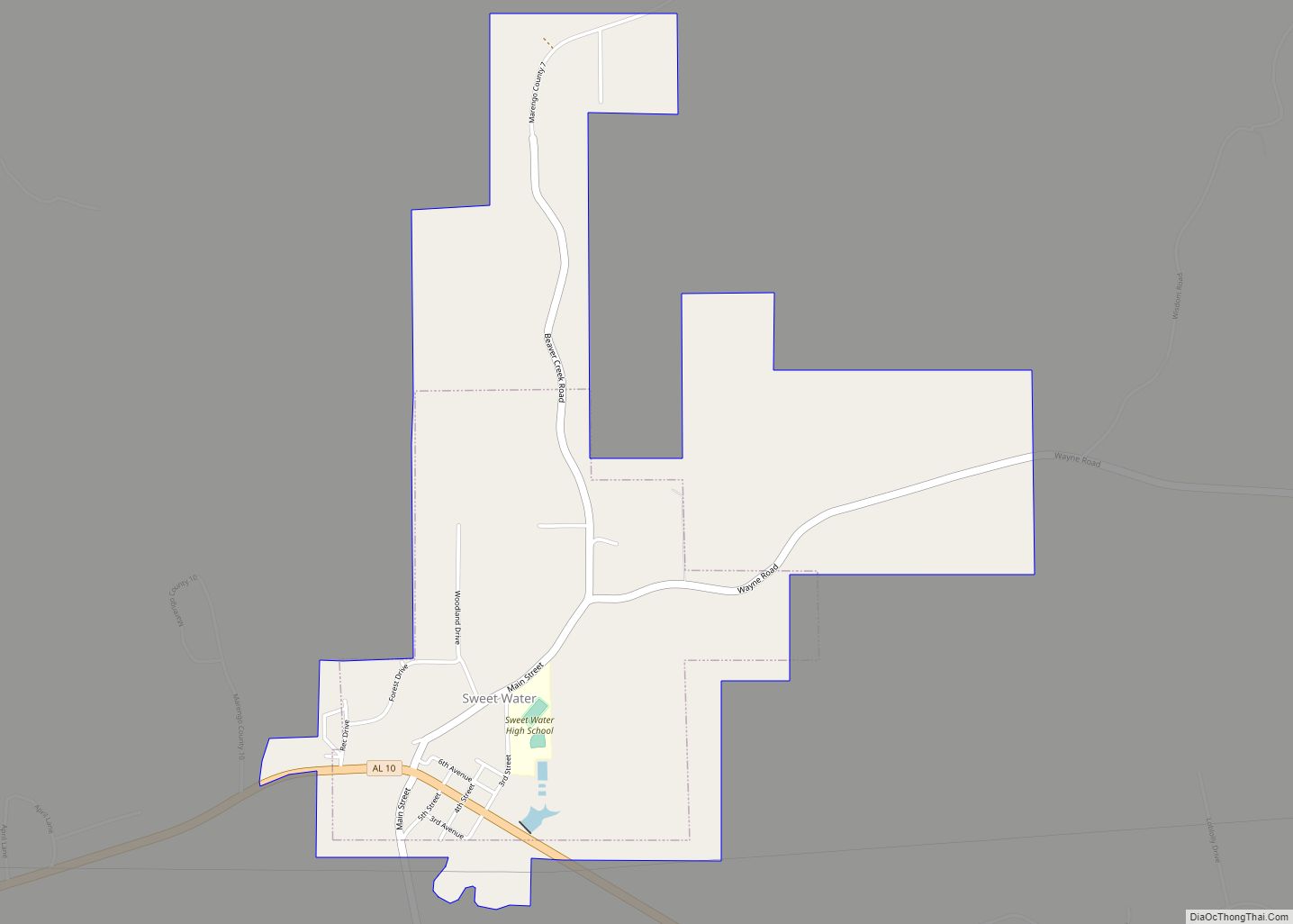
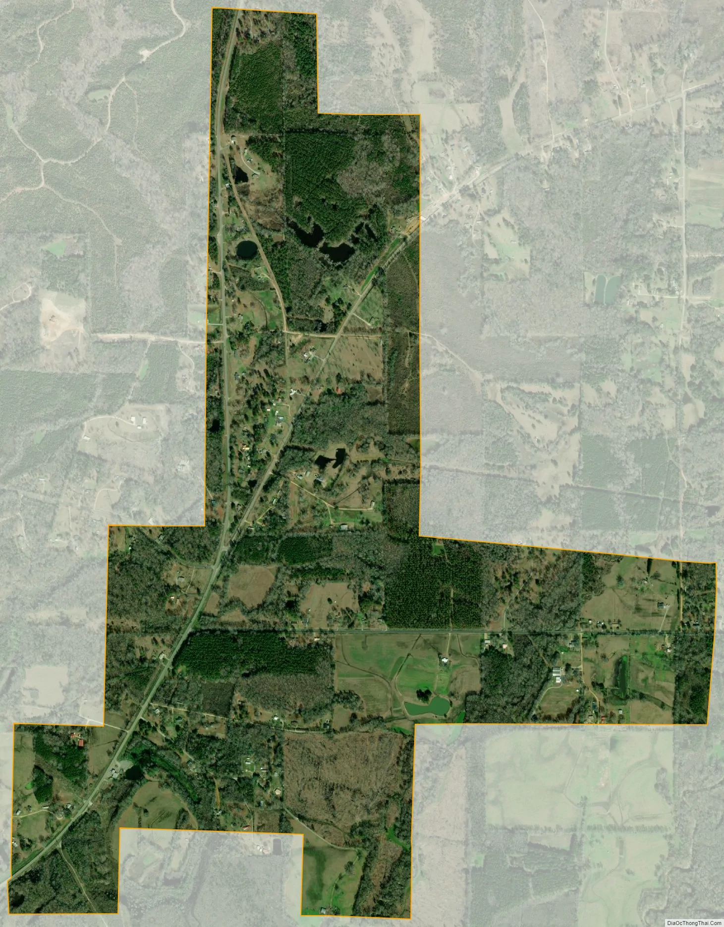
Providence city Satellite Map
Geography
Providence is located in north-central Marengo County at 32°20′56″N 87°46′42″W / 32.34889°N 87.77833°W / 32.34889; -87.77833 (32.348986, -87.778309), along U.S. Route 43. It is 3 miles (5 km) north of Linden, the county seat, and 13 miles (21 km) south of Demopolis, the largest city in the county. It is bordered to the north by Chickasaw State Park.
According to the U.S. Census Bureau, the town has a total area of 1.7 square miles (4.4 km), all land. Chickasaw Bogue, a small river, passes just south of the town, flowing west to the Tombigbee River.
See also
Map of Alabama State and its subdivision:- Autauga
- Baldwin
- Barbour
- Bibb
- Blount
- Bullock
- Butler
- Calhoun
- Chambers
- Cherokee
- Chilton
- Choctaw
- Clarke
- Clay
- Cleburne
- Coffee
- Colbert
- Conecuh
- Coosa
- Covington
- Crenshaw
- Cullman
- Dale
- Dallas
- De Kalb
- Elmore
- Escambia
- Etowah
- Fayette
- Franklin
- Geneva
- Greene
- Hale
- Henry
- Houston
- Jackson
- Jefferson
- Lamar
- Lauderdale
- Lawrence
- Lee
- Limestone
- Lowndes
- Macon
- Madison
- Marengo
- Marion
- Marshall
- Mobile
- Monroe
- Montgomery
- Morgan
- Perry
- Pickens
- Pike
- Randolph
- Russell
- Saint Clair
- Shelby
- Sumter
- Talladega
- Tallapoosa
- Tuscaloosa
- Walker
- Washington
- Wilcox
- Winston
- Alabama
- Alaska
- Arizona
- Arkansas
- California
- Colorado
- Connecticut
- Delaware
- District of Columbia
- Florida
- Georgia
- Hawaii
- Idaho
- Illinois
- Indiana
- Iowa
- Kansas
- Kentucky
- Louisiana
- Maine
- Maryland
- Massachusetts
- Michigan
- Minnesota
- Mississippi
- Missouri
- Montana
- Nebraska
- Nevada
- New Hampshire
- New Jersey
- New Mexico
- New York
- North Carolina
- North Dakota
- Ohio
- Oklahoma
- Oregon
- Pennsylvania
- Rhode Island
- South Carolina
- South Dakota
- Tennessee
- Texas
- Utah
- Vermont
- Virginia
- Washington
- West Virginia
- Wisconsin
- Wyoming