Slocomb is a city in Geneva County, Alabama, United States. It is part of the Dothan, Alabama Metropolitan Statistical Area. At the 2020 census, the population was 2,082. The community is named after postmaster Frank W. Slocomb.
Slocomb incorporated in 1901. Slocomb calls itself the “home of the tomato.” Slocomb High School mascot is the “Redtop”.
| Name: | Slocomb city |
|---|---|
| LSAD Code: | 25 |
| LSAD Description: | city (suffix) |
| State: | Alabama |
| County: | Geneva County |
| Elevation: | 285 ft (87 m) |
| Total Area: | 9.50 sq mi (24.60 km²) |
| Land Area: | 9.49 sq mi (24.58 km²) |
| Water Area: | 0.01 sq mi (0.03 km²) |
| Total Population: | 2,082 |
| Population Density: | 219.41/sq mi (84.72/km²) |
| ZIP code: | 36375 |
| Area code: | 334 |
| FIPS code: | 0171040 |
| GNISfeature ID: | 0126977 |
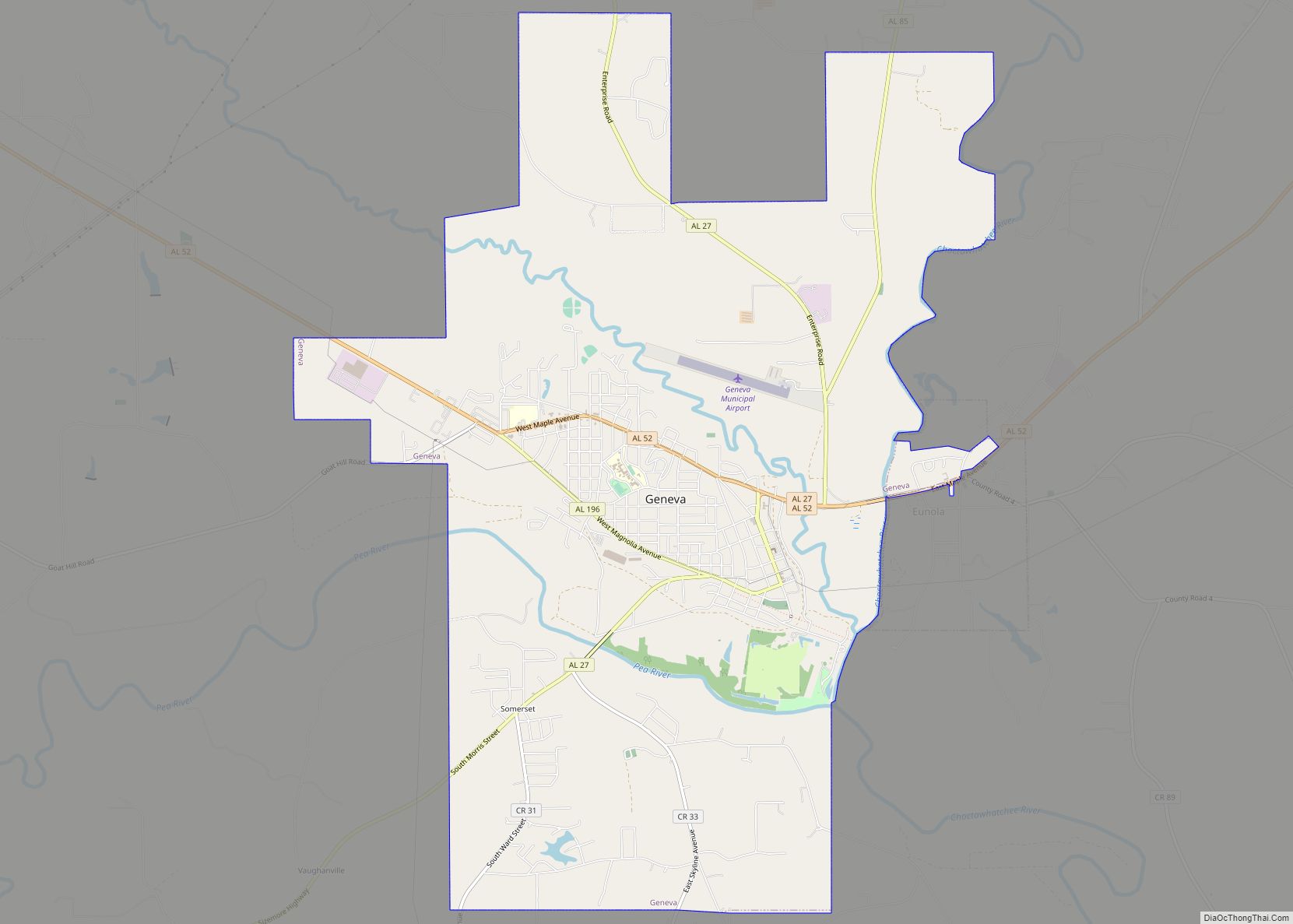
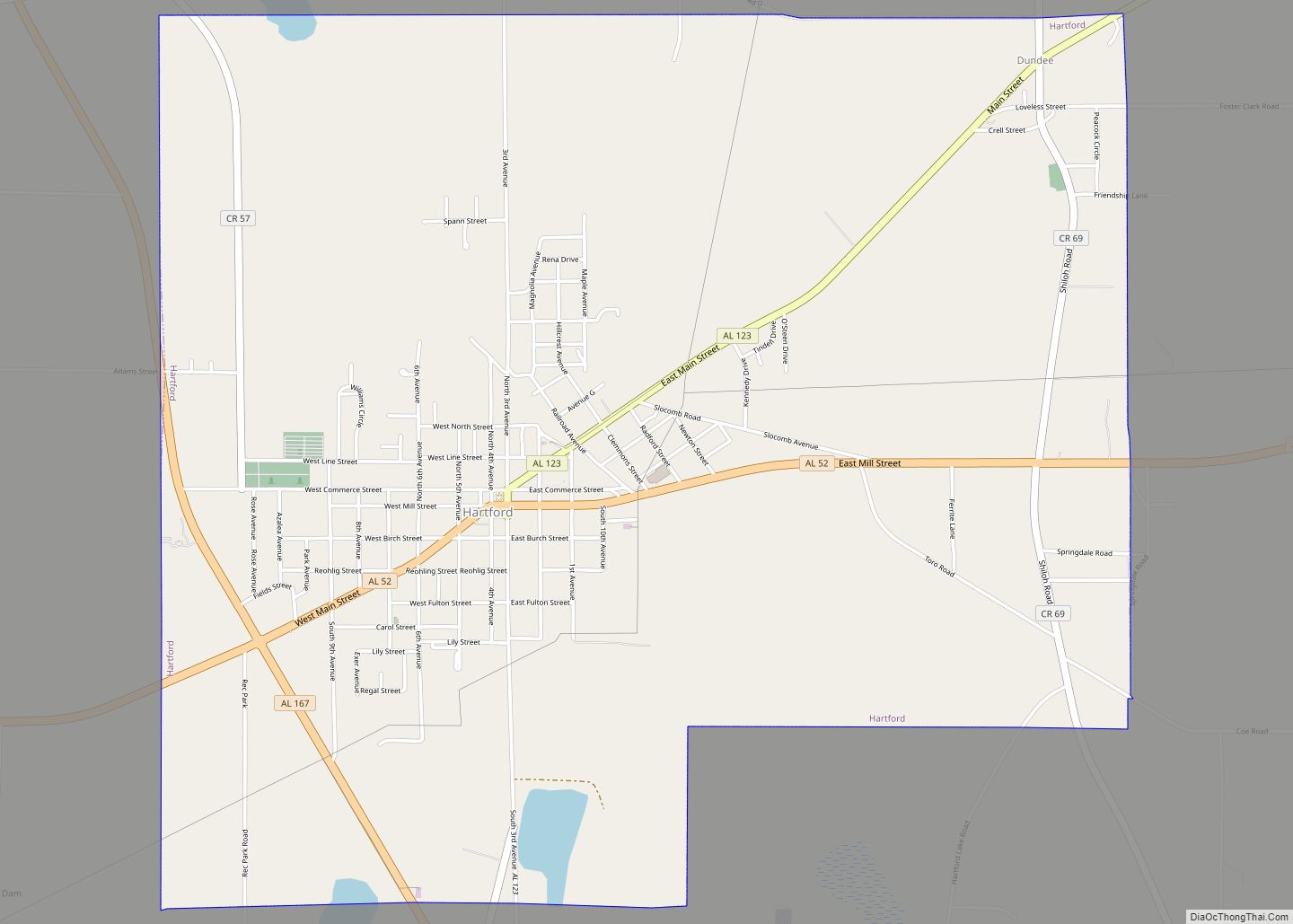
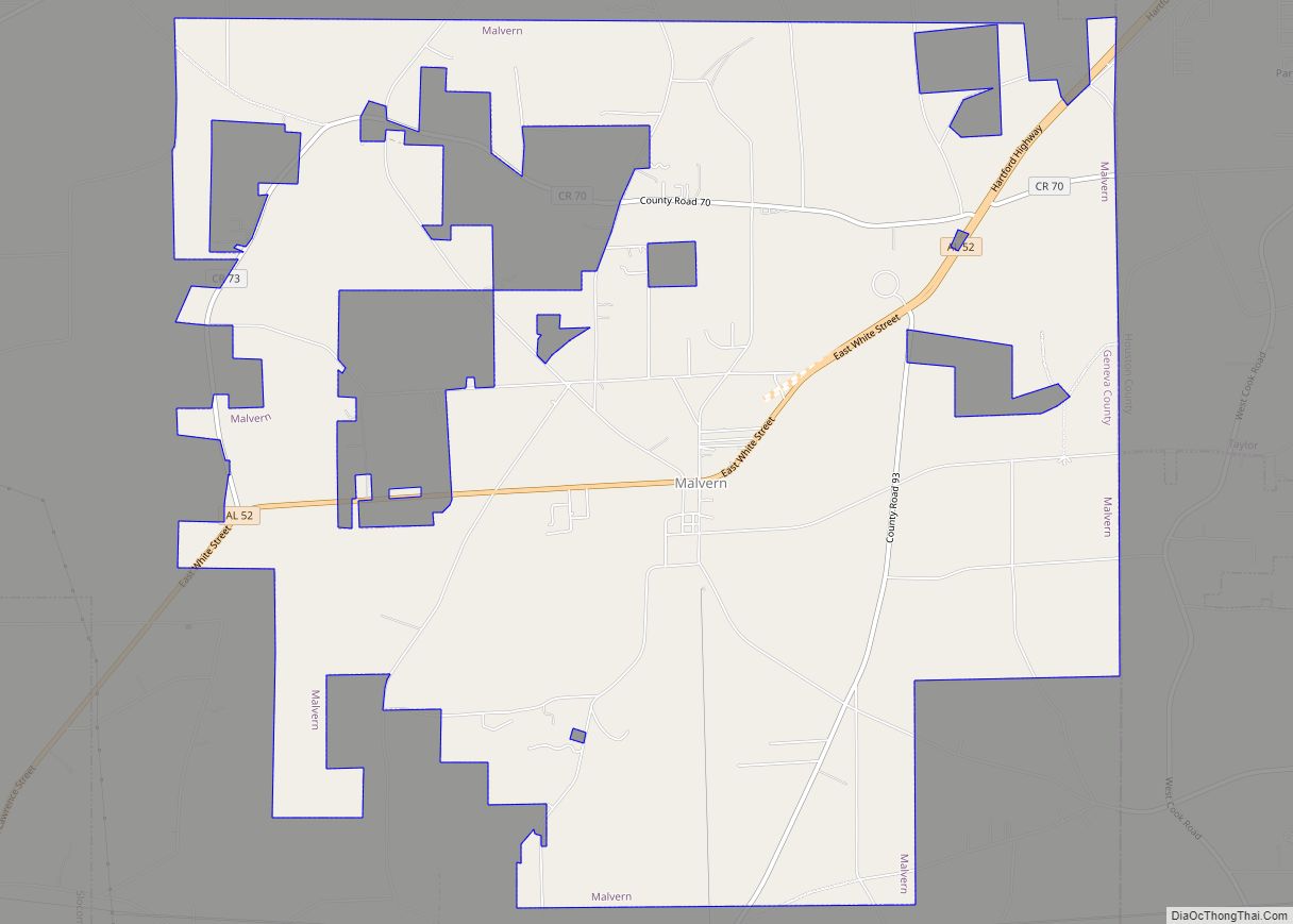
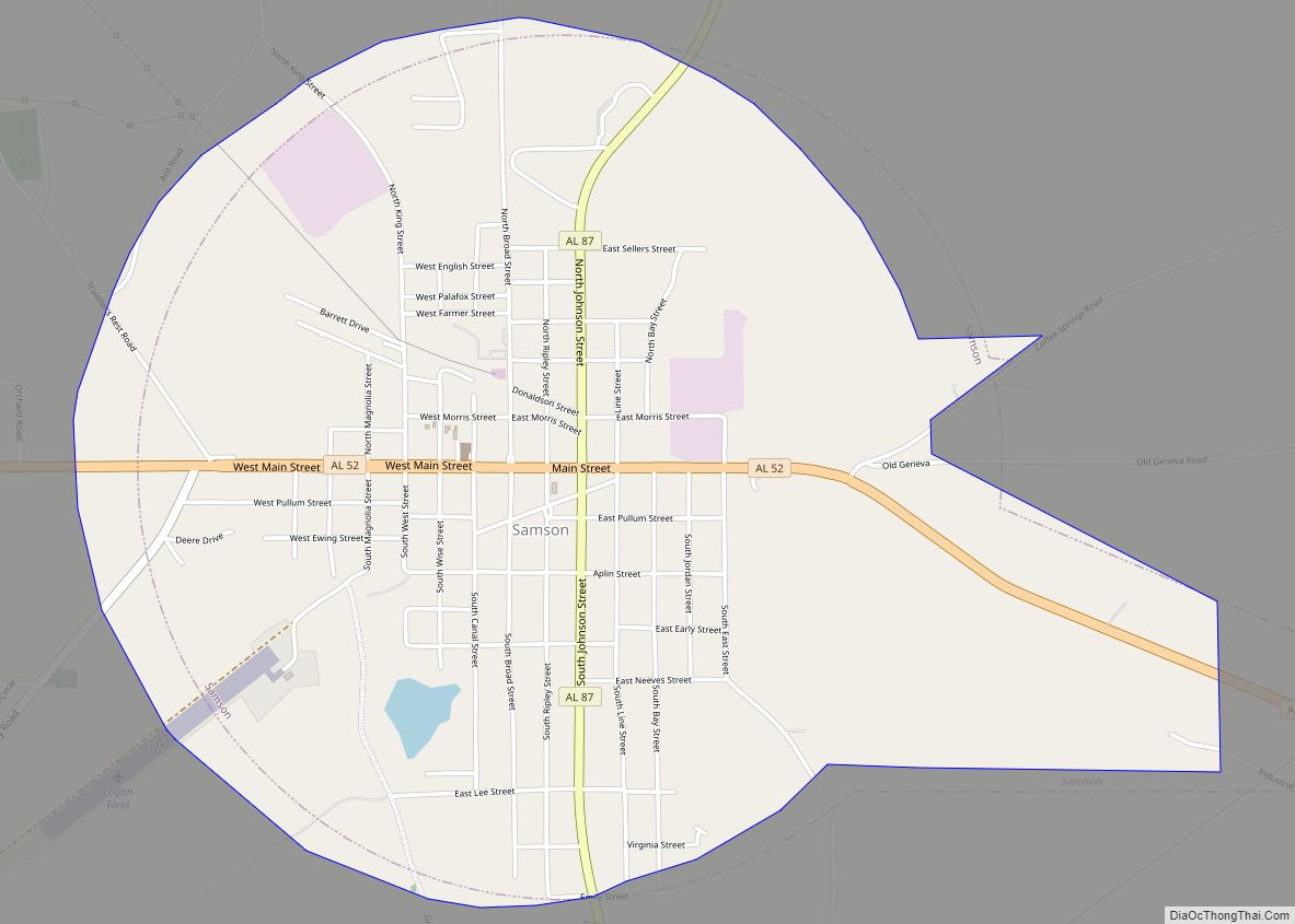
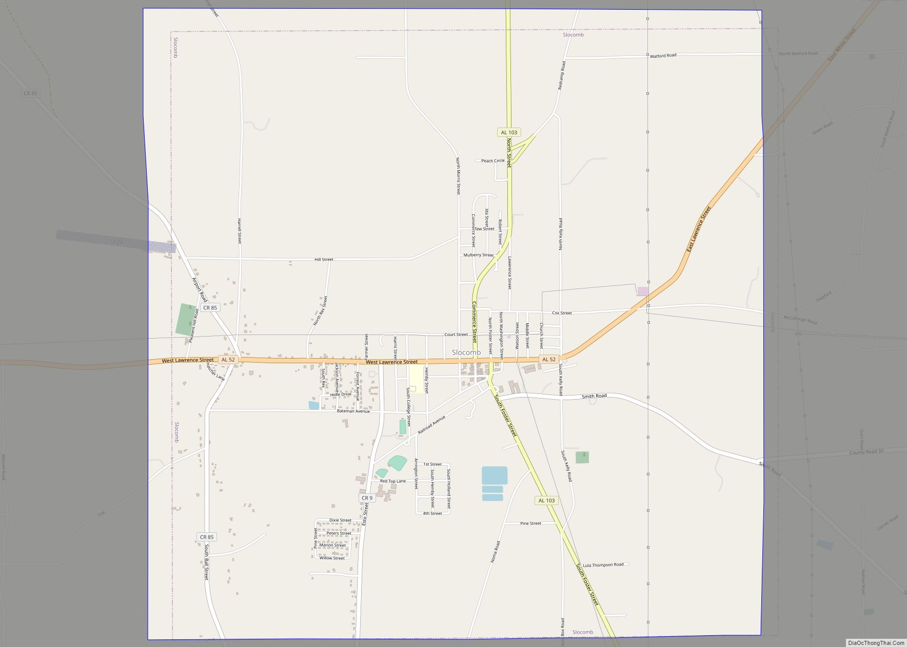
Online Interactive Map
Click on ![]() to view map in "full screen" mode.
to view map in "full screen" mode.
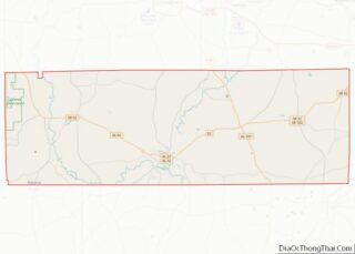
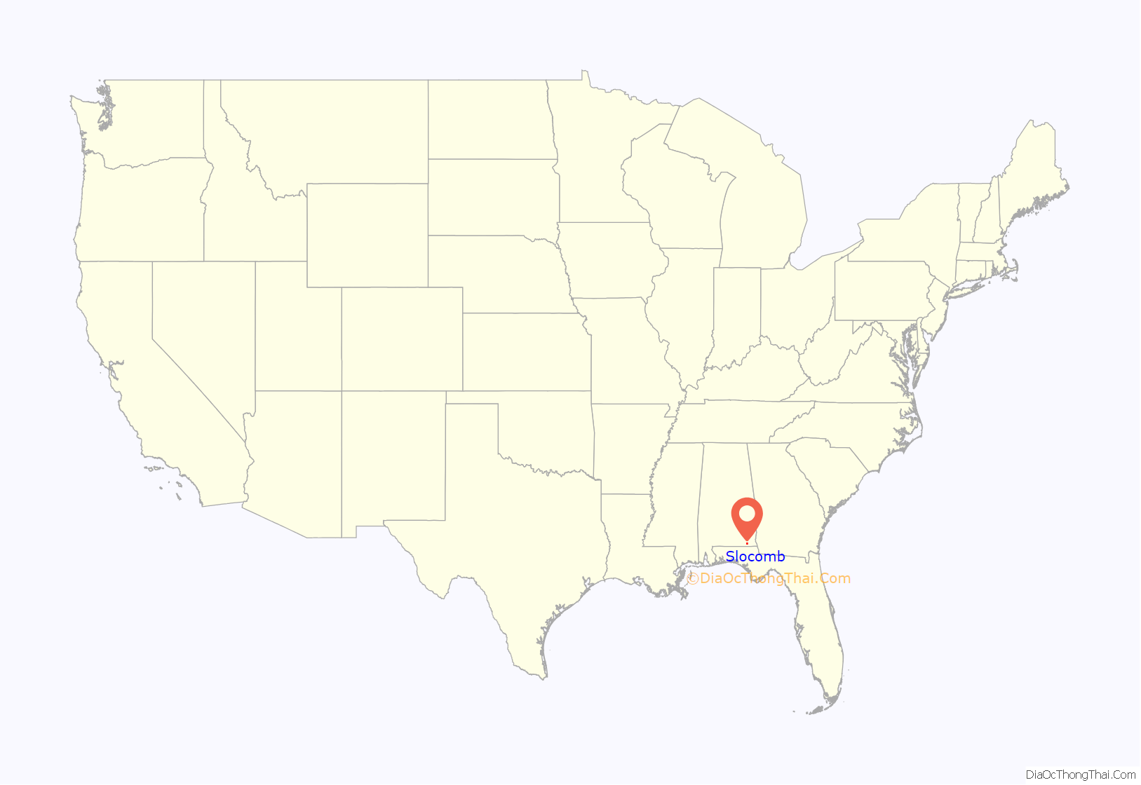
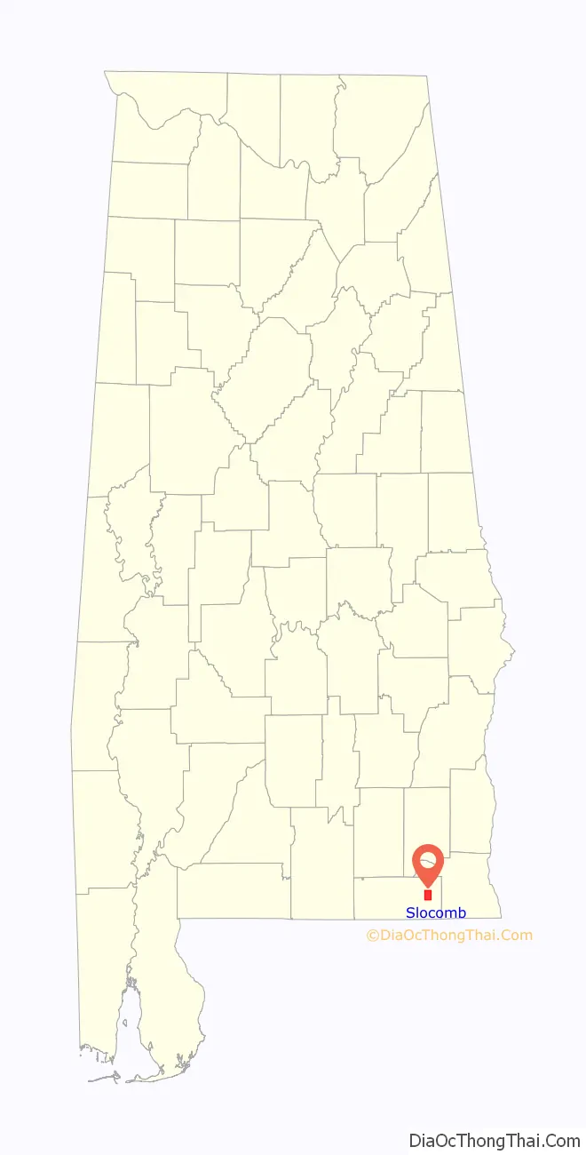
Slocomb location map. Where is Slocomb city?
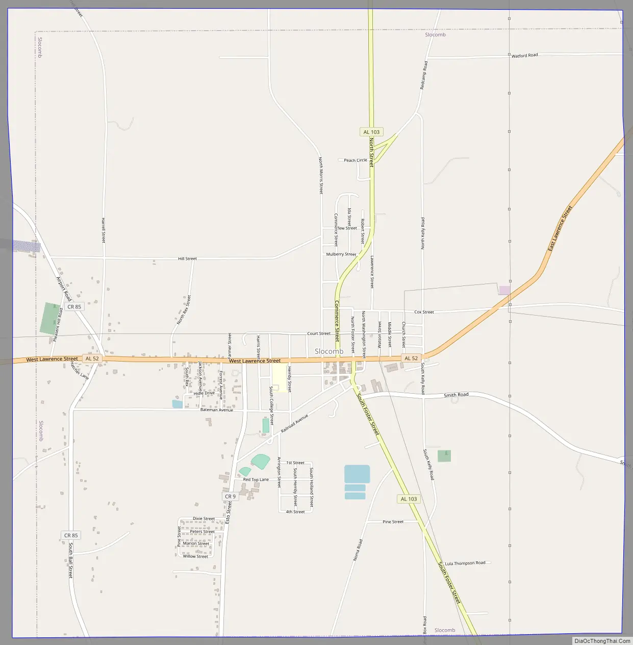
Slocomb Road Map
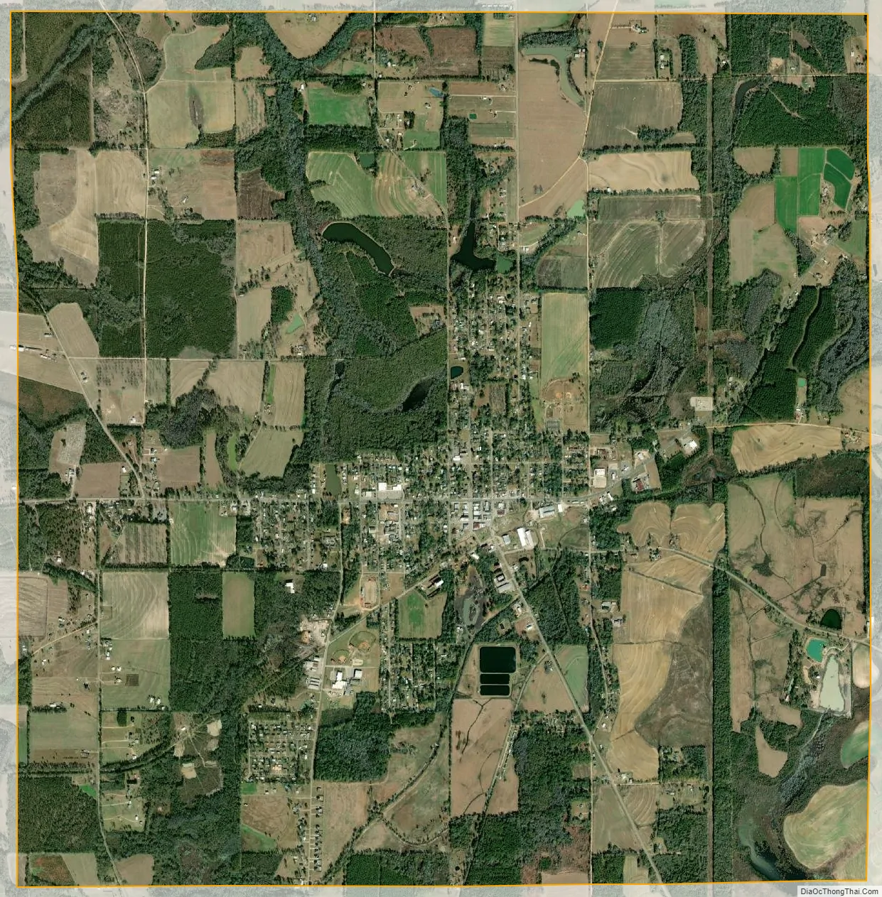
Slocomb city Satellite Map
Geography
Slocomb is located at 31°06′31″N 85°35′40″W / 31.108541°N 85.594307°W / 31.108541; -85.594307.
According to the U.S. Census Bureau, the city has a total area of 9.5 square miles (25 km), all land.
See also
Map of Alabama State and its subdivision:- Autauga
- Baldwin
- Barbour
- Bibb
- Blount
- Bullock
- Butler
- Calhoun
- Chambers
- Cherokee
- Chilton
- Choctaw
- Clarke
- Clay
- Cleburne
- Coffee
- Colbert
- Conecuh
- Coosa
- Covington
- Crenshaw
- Cullman
- Dale
- Dallas
- De Kalb
- Elmore
- Escambia
- Etowah
- Fayette
- Franklin
- Geneva
- Greene
- Hale
- Henry
- Houston
- Jackson
- Jefferson
- Lamar
- Lauderdale
- Lawrence
- Lee
- Limestone
- Lowndes
- Macon
- Madison
- Marengo
- Marion
- Marshall
- Mobile
- Monroe
- Montgomery
- Morgan
- Perry
- Pickens
- Pike
- Randolph
- Russell
- Saint Clair
- Shelby
- Sumter
- Talladega
- Tallapoosa
- Tuscaloosa
- Walker
- Washington
- Wilcox
- Winston
- Alabama
- Alaska
- Arizona
- Arkansas
- California
- Colorado
- Connecticut
- Delaware
- District of Columbia
- Florida
- Georgia
- Hawaii
- Idaho
- Illinois
- Indiana
- Iowa
- Kansas
- Kentucky
- Louisiana
- Maine
- Maryland
- Massachusetts
- Michigan
- Minnesota
- Mississippi
- Missouri
- Montana
- Nebraska
- Nevada
- New Hampshire
- New Jersey
- New Mexico
- New York
- North Carolina
- North Dakota
- Ohio
- Oklahoma
- Oregon
- Pennsylvania
- Rhode Island
- South Carolina
- South Dakota
- Tennessee
- Texas
- Utah
- Vermont
- Virginia
- Washington
- West Virginia
- Wisconsin
- Wyoming