Biggers is a town in Randolph County, Arkansas, United States. The population was 305 at the 2020 census.
| Name: | Biggers town |
|---|---|
| LSAD Code: | 43 |
| LSAD Description: | town (suffix) |
| State: | Arkansas |
| County: | Randolph County |
| Elevation: | 285 ft (87 m) |
| Total Area: | 1.02 sq mi (2.64 km²) |
| Land Area: | 1.00 sq mi (2.60 km²) |
| Water Area: | 0.02 sq mi (0.05 km²) |
| Total Population: | 305 |
| Population Density: | 304.39/sq mi (117.47/km²) |
| ZIP code: | 72413 |
| Area code: | 870 |
| FIPS code: | 0506040 |
| GNISfeature ID: | 2405264 |
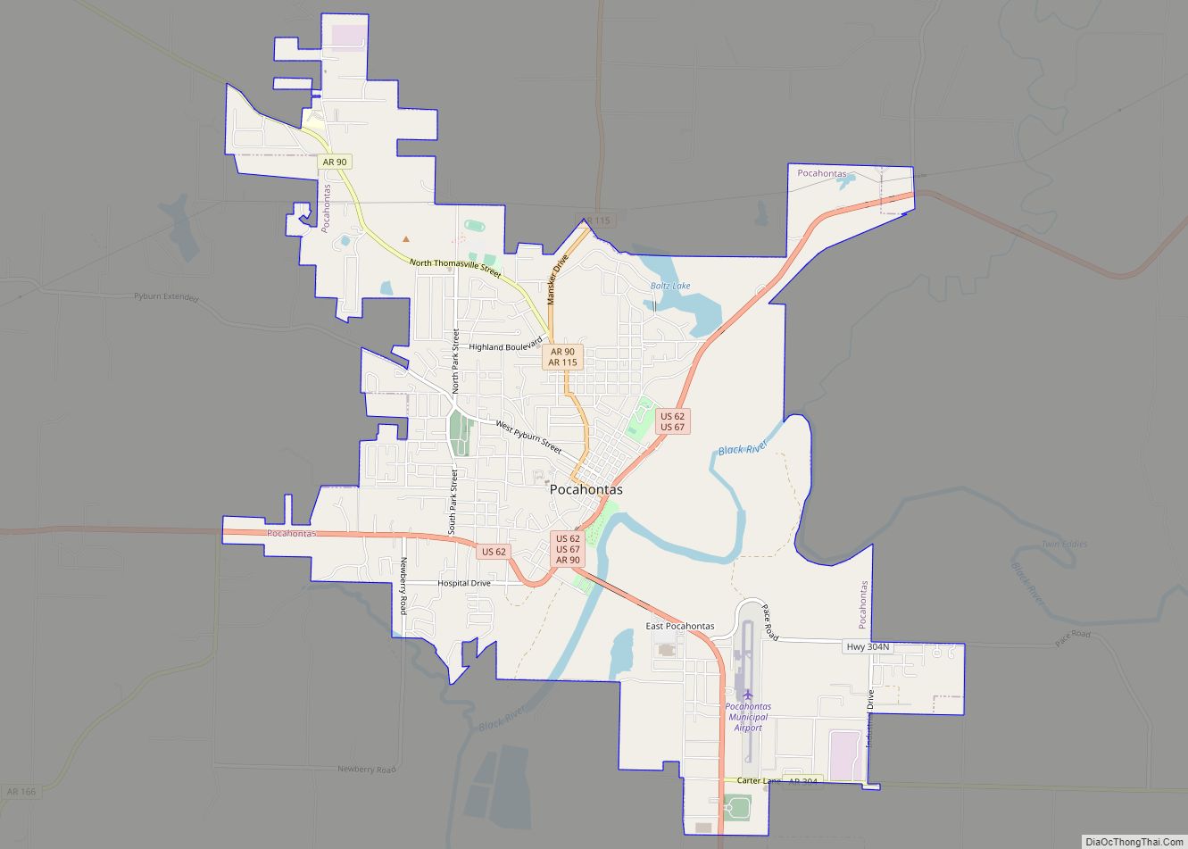
Online Interactive Map
Click on ![]() to view map in "full screen" mode.
to view map in "full screen" mode.
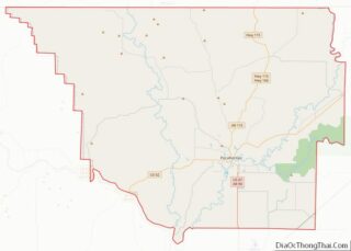
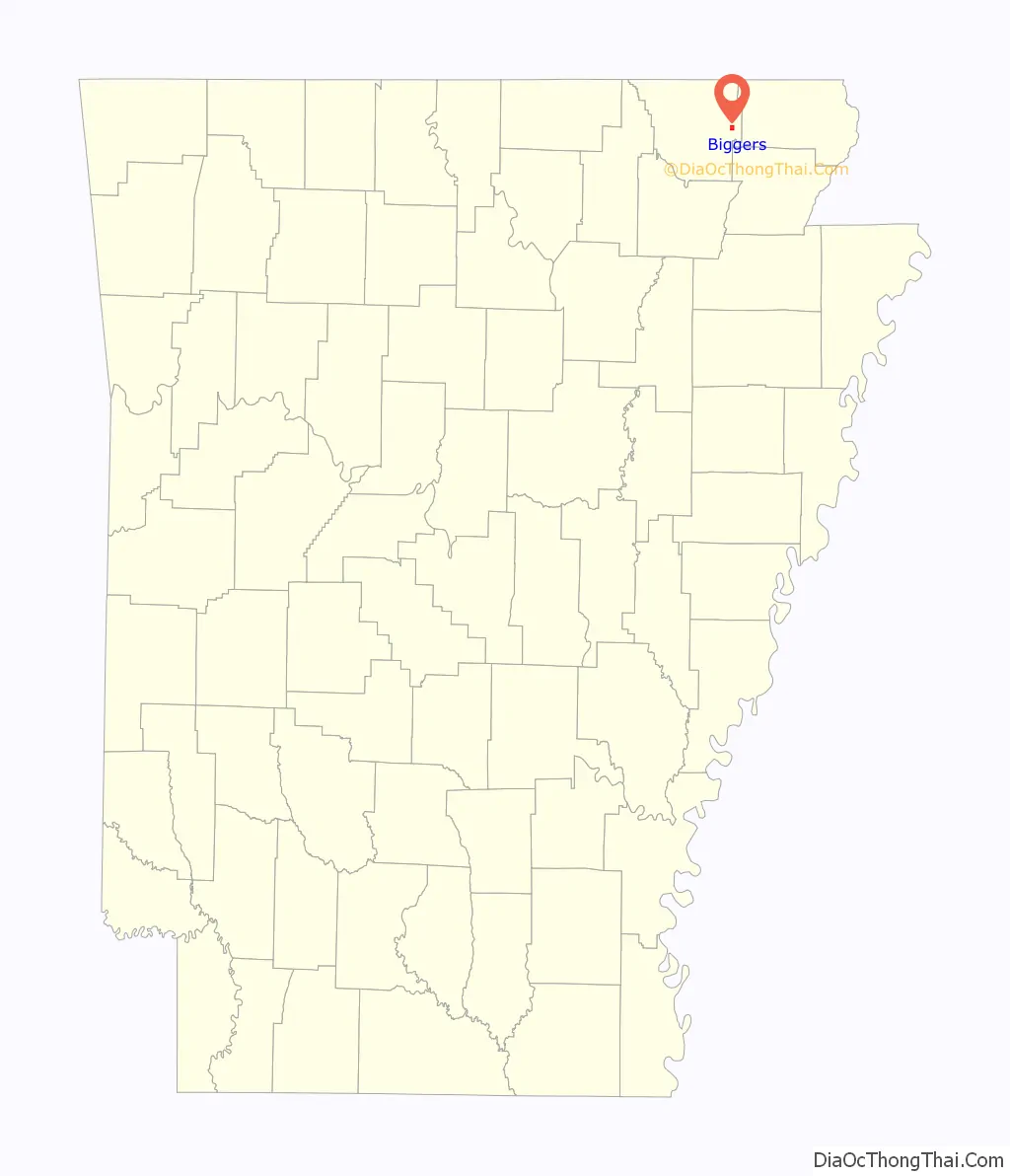
Biggers location map. Where is Biggers town?

History
During the first half of the 19th century, what is now Biggers was part of a large plantation owned by Arkansas governor Thomas Stevenson Drew. In 1889, a businessman named Benjamin Franklin Bigger, the town’s namesake, bought the land at the town site and established a ferry and distillery. In 1901, a depot was established with the completion of the Southern Missouri and Arkansas Railroad (later part of the St. Louis–San Francisco Railway).
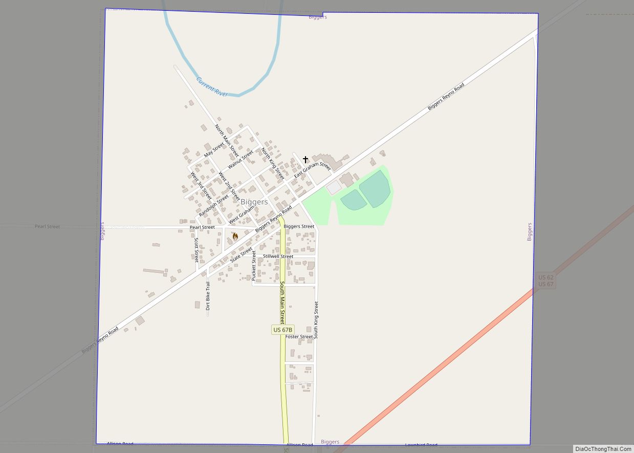
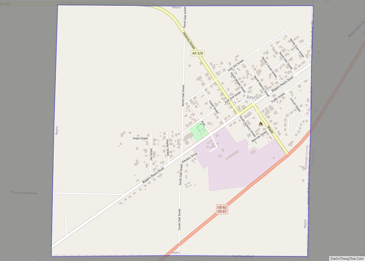
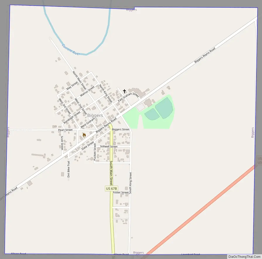
Biggers Road Map
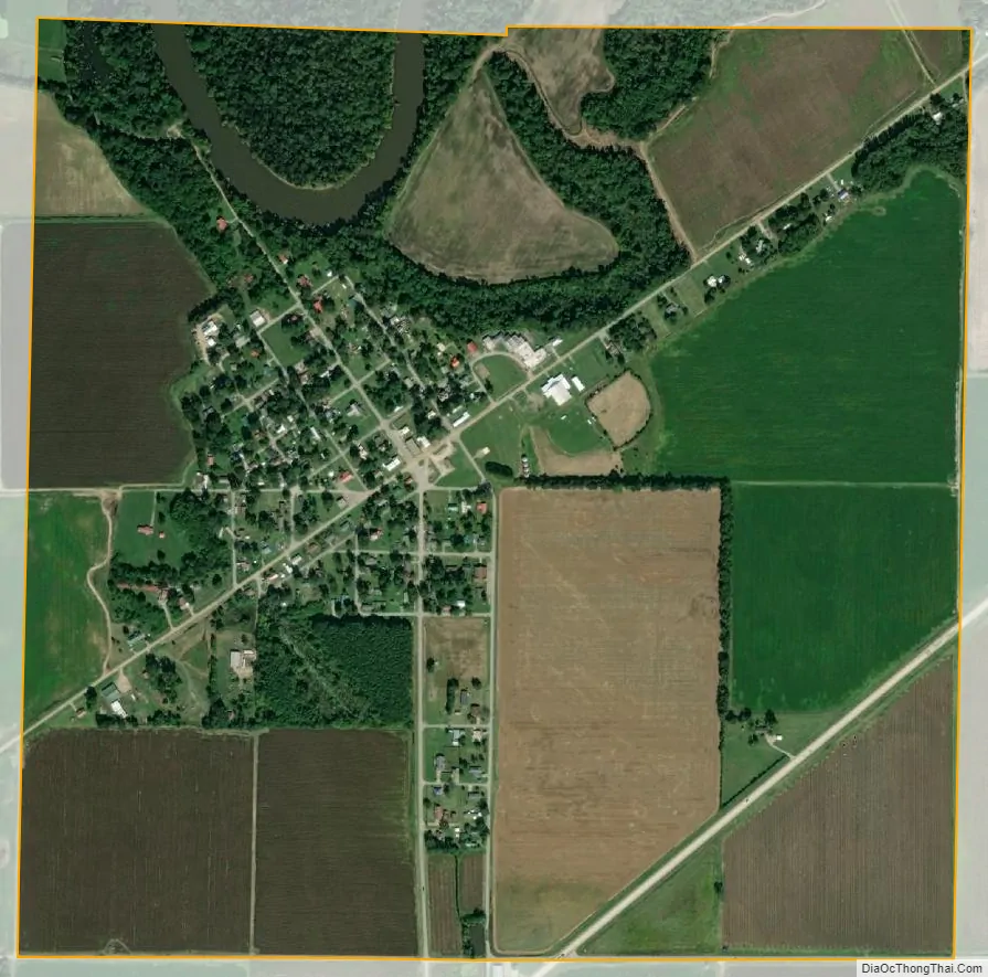
Biggers city Satellite Map
Geography
The Current River passes through the northern part of town.
According to the United States Census Bureau, the town has a total area of 1.0 square mile (2.6 km), of which 1.0 square mile (2.6 km) is land and 0.04 square miles (0.10 km) (1.92%) is water.
List of highways
- US 62
- US 67
US Highways 62 and 67 run concurrently, just to the southeast of town; no actual state or federal maintained highway runs through the town, however, the original U.S. Highway 67 did run through the town as the current day, “Biggers-Reyno Road” before the town was bypassed and the original route was decommissioned.
See also
Map of Arkansas State and its subdivision:- Arkansas
- Ashley
- Baxter
- Benton
- Boone
- Bradley
- Calhoun
- Carroll
- Chicot
- Clark
- Clay
- Cleburne
- Cleveland
- Columbia
- Conway
- Craighead
- Crawford
- Crittenden
- Cross
- Dallas
- Desha
- Drew
- Faulkner
- Franklin
- Fulton
- Garland
- Grant
- Greene
- Hempstead
- Hot Spring
- Howard
- Independence
- Izard
- Jackson
- Jefferson
- Johnson
- Lafayette
- Lawrence
- Lee
- Lincoln
- Little River
- Logan
- Lonoke
- Madison
- Marion
- Miller
- Mississippi
- Monroe
- Montgomery
- Nevada
- Newton
- Ouachita
- Perry
- Phillips
- Pike
- Poinsett
- Polk
- Pope
- Prairie
- Pulaski
- Randolph
- Saint Francis
- Saline
- Scott
- Searcy
- Sebastian
- Sevier
- Sharp
- Stone
- Union
- Van Buren
- Washington
- White
- Woodruff
- Yell
- Alabama
- Alaska
- Arizona
- Arkansas
- California
- Colorado
- Connecticut
- Delaware
- District of Columbia
- Florida
- Georgia
- Hawaii
- Idaho
- Illinois
- Indiana
- Iowa
- Kansas
- Kentucky
- Louisiana
- Maine
- Maryland
- Massachusetts
- Michigan
- Minnesota
- Mississippi
- Missouri
- Montana
- Nebraska
- Nevada
- New Hampshire
- New Jersey
- New Mexico
- New York
- North Carolina
- North Dakota
- Ohio
- Oklahoma
- Oregon
- Pennsylvania
- Rhode Island
- South Carolina
- South Dakota
- Tennessee
- Texas
- Utah
- Vermont
- Virginia
- Washington
- West Virginia
- Wisconsin
- Wyoming