Reyno is a city in Randolph County, Arkansas, United States. The population was 456 at the 2010 census.
| Name: | Reyno city |
|---|---|
| LSAD Code: | 25 |
| LSAD Description: | city (suffix) |
| State: | Arkansas |
| County: | Randolph County |
| Elevation: | 282 ft (86 m) |
| Total Area: | 1.01 sq mi (2.62 km²) |
| Land Area: | 1.01 sq mi (2.62 km²) |
| Water Area: | 0.00 sq mi (0.00 km²) |
| Total Population: | 391 |
| Population Density: | 387.13/sq mi (149.42/km²) |
| ZIP code: | 72462 |
| Area code: | 870 |
| FIPS code: | 0559180 |
| GNISfeature ID: | 2404608 |
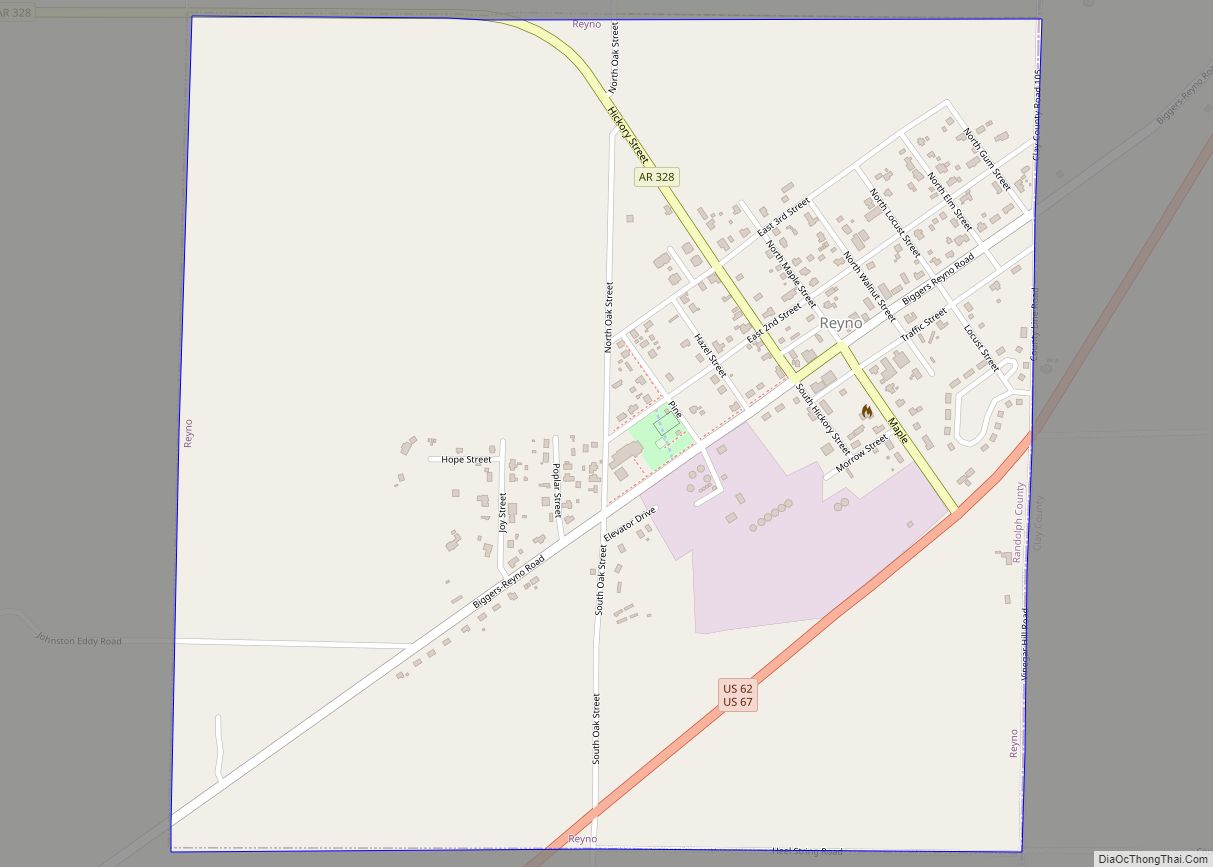
Online Interactive Map
Click on ![]() to view map in "full screen" mode.
to view map in "full screen" mode.
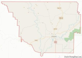
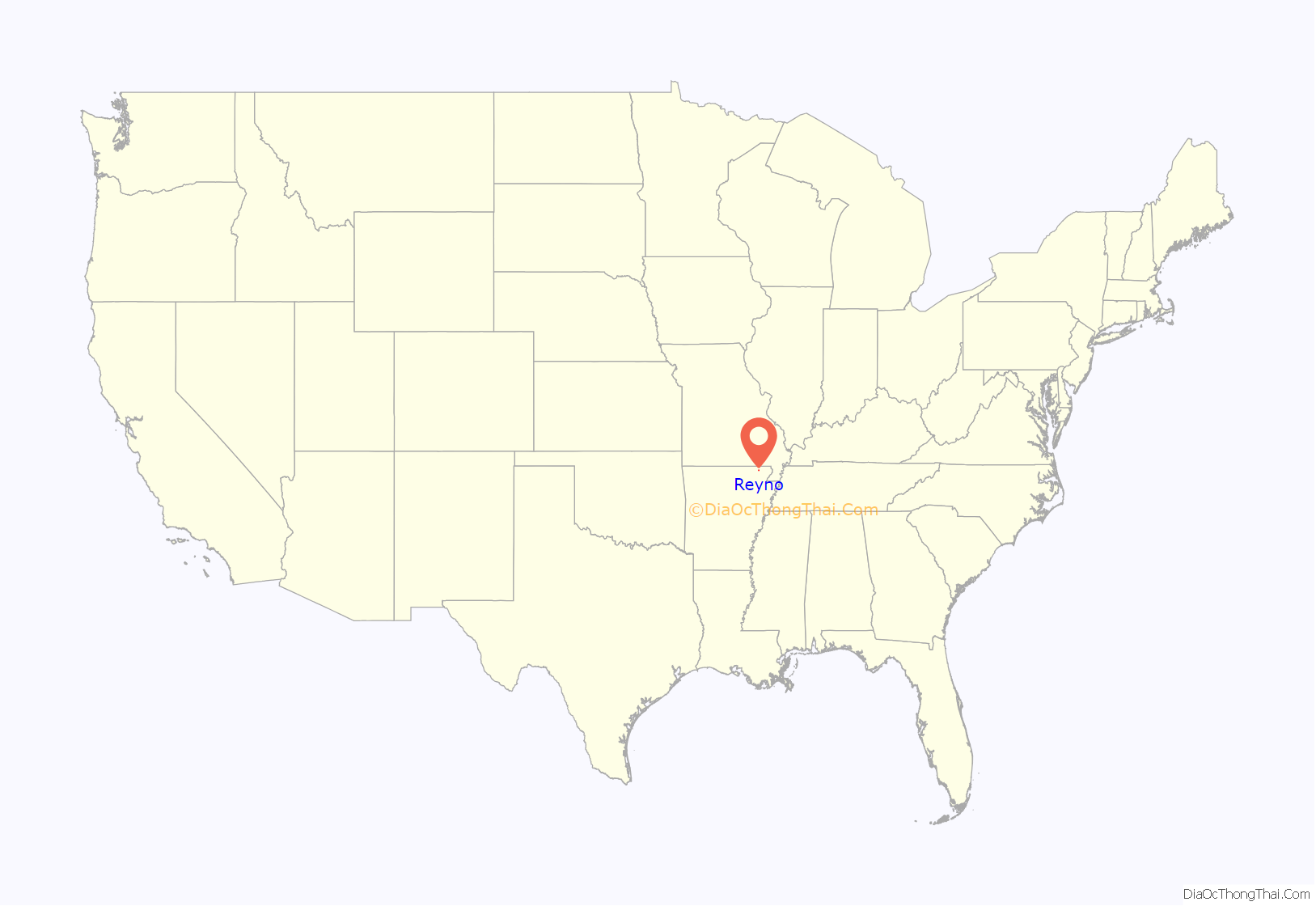
Reyno location map. Where is Reyno city?

History
The town was originally called Needmore, and was located one and one-half miles south of its present location. This name was changed to Cherokee Bay when the post office operating by that name moved there from its location at Shoemaker’s Ferry on Current River. The name was changed again, this time to Reyno, a shortened version of Reynolds, named for Dennis Wells Reynolds, a merchant who opened the town’s first store and built the first home there in 1857. In 1901, the town relocated to its present site to be adjacent to the newly built St. Louis-San Francisco Railway there. Upon relocation, the new town adopted the name of Esselwood, but reverted to Reyno due to the majority of residents moving from the previous location.
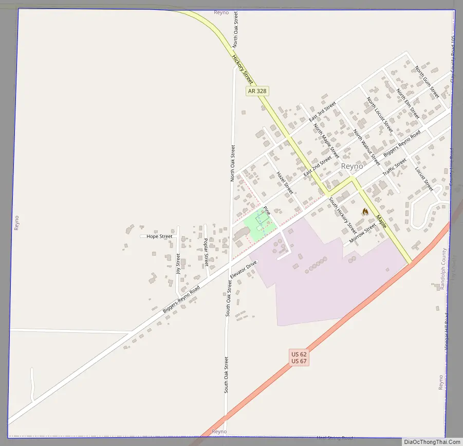
Reyno Road Map
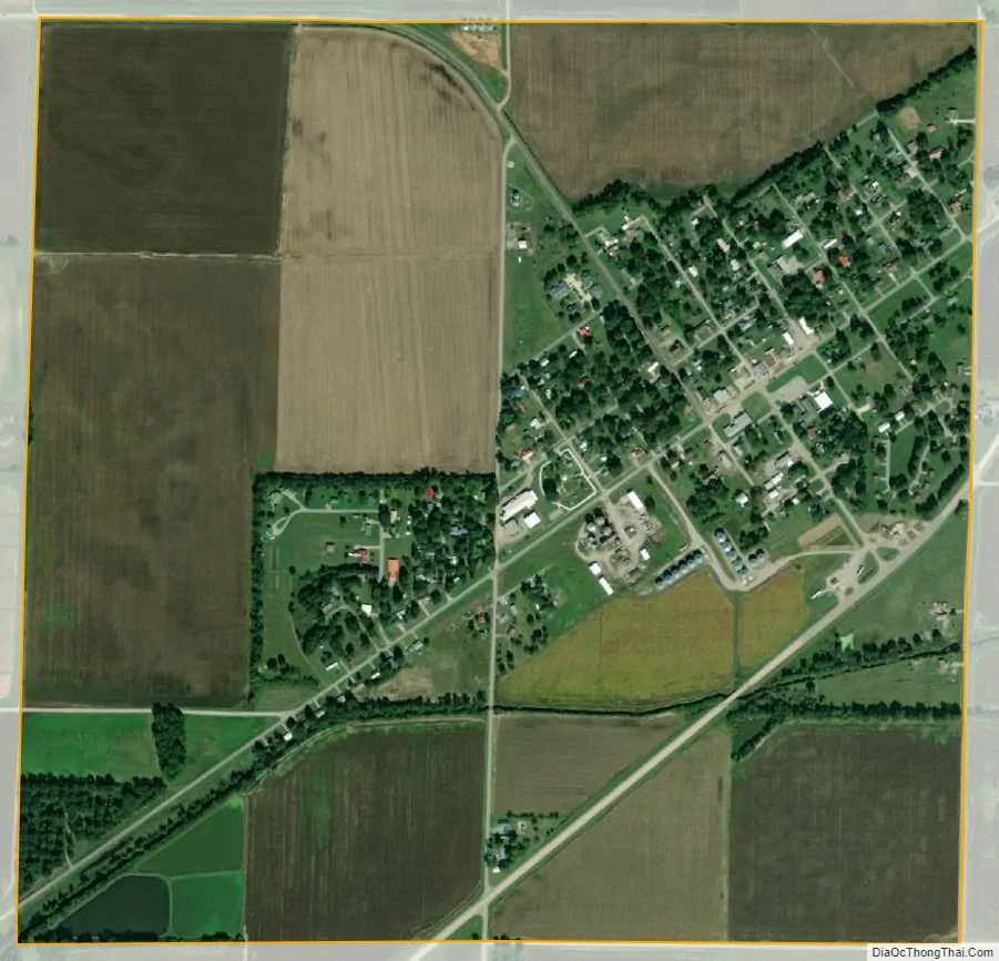
Reyno city Satellite Map
Geography
Reyno is located at 36°21′44″N 90°45′17″W / 36.36222°N 90.75472°W / 36.36222; -90.75472 (36.362304, -90.754772).
According to the United States Census Bureau, the town has a total area of 2.6 km (1.0 mi), all land.
List of highways
- US 62
- US 67
- Highway 328
U.S. Highway 62 and 67 run concurrently, just to the southeast of town.
See also
Map of Arkansas State and its subdivision:- Arkansas
- Ashley
- Baxter
- Benton
- Boone
- Bradley
- Calhoun
- Carroll
- Chicot
- Clark
- Clay
- Cleburne
- Cleveland
- Columbia
- Conway
- Craighead
- Crawford
- Crittenden
- Cross
- Dallas
- Desha
- Drew
- Faulkner
- Franklin
- Fulton
- Garland
- Grant
- Greene
- Hempstead
- Hot Spring
- Howard
- Independence
- Izard
- Jackson
- Jefferson
- Johnson
- Lafayette
- Lawrence
- Lee
- Lincoln
- Little River
- Logan
- Lonoke
- Madison
- Marion
- Miller
- Mississippi
- Monroe
- Montgomery
- Nevada
- Newton
- Ouachita
- Perry
- Phillips
- Pike
- Poinsett
- Polk
- Pope
- Prairie
- Pulaski
- Randolph
- Saint Francis
- Saline
- Scott
- Searcy
- Sebastian
- Sevier
- Sharp
- Stone
- Union
- Van Buren
- Washington
- White
- Woodruff
- Yell
- Alabama
- Alaska
- Arizona
- Arkansas
- California
- Colorado
- Connecticut
- Delaware
- District of Columbia
- Florida
- Georgia
- Hawaii
- Idaho
- Illinois
- Indiana
- Iowa
- Kansas
- Kentucky
- Louisiana
- Maine
- Maryland
- Massachusetts
- Michigan
- Minnesota
- Mississippi
- Missouri
- Montana
- Nebraska
- Nevada
- New Hampshire
- New Jersey
- New Mexico
- New York
- North Carolina
- North Dakota
- Ohio
- Oklahoma
- Oregon
- Pennsylvania
- Rhode Island
- South Carolina
- South Dakota
- Tennessee
- Texas
- Utah
- Vermont
- Virginia
- Washington
- West Virginia
- Wisconsin
- Wyoming