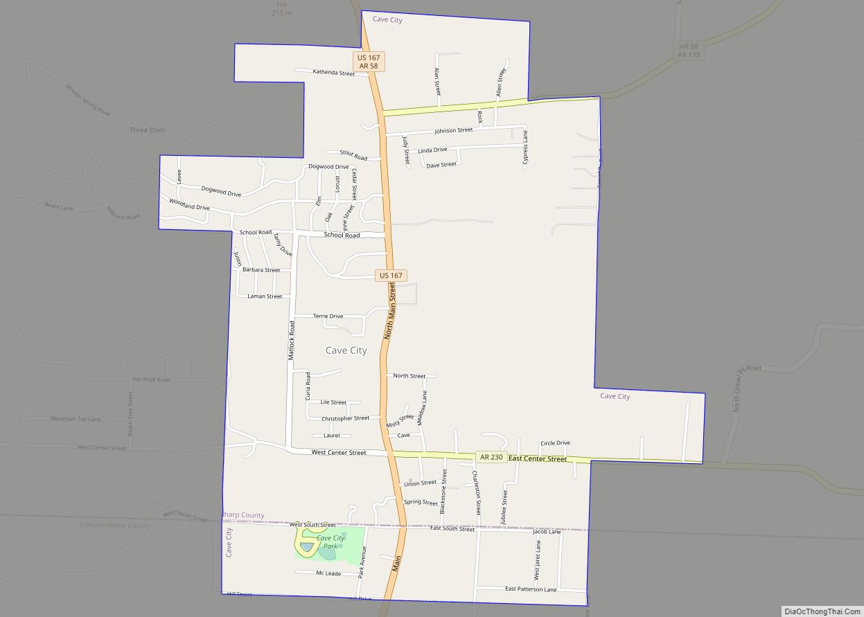
Cave City is a city in Independence and Sharp counties in the U.S. state of Arkansas. The population was 1,904 at the 2010 census. The city was named for a large cave underneath the Crystal River Tourist Camp, which is the oldest motor court in Arkansas. Cave City is known for its award-winning “world’s sweetest” watermelons and holds an annual watermelon festival in July.
| Name: | Cave City city |
|---|---|
| LSAD Code: | 25 |
| LSAD Description: | city (suffix) |
| State: | Arkansas |
| County: | Independence County, Sharp County |
| Elevation: | 653 ft (199 m) |
| Total Area: | 2.56 sq mi (6.62 km²) |
| Land Area: | 2.56 sq mi (6.62 km²) |
| Water Area: | 0.00 sq mi (0.00 km²) |
| Total Population: | 1,922 |
| Population Density: | 751.66/sq mi (290.23/km²) |
| ZIP code: | 72521 |
| Area code: | 870 |
| FIPS code: | 0512280 |
| GNISfeature ID: | 2404007 |
| Website: | www.cavecity.us |
Online Interactive Map
Click on ![]() to view map in "full screen" mode.
to view map in "full screen" mode.
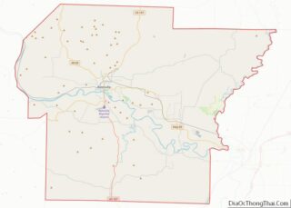
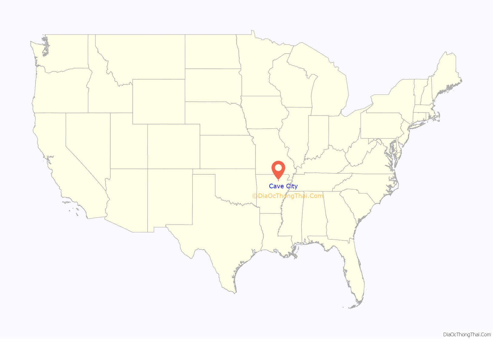
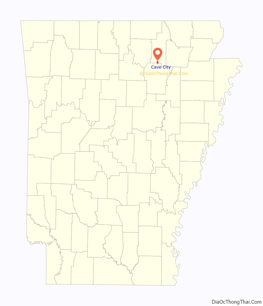
Cave City location map. Where is Cave City city?
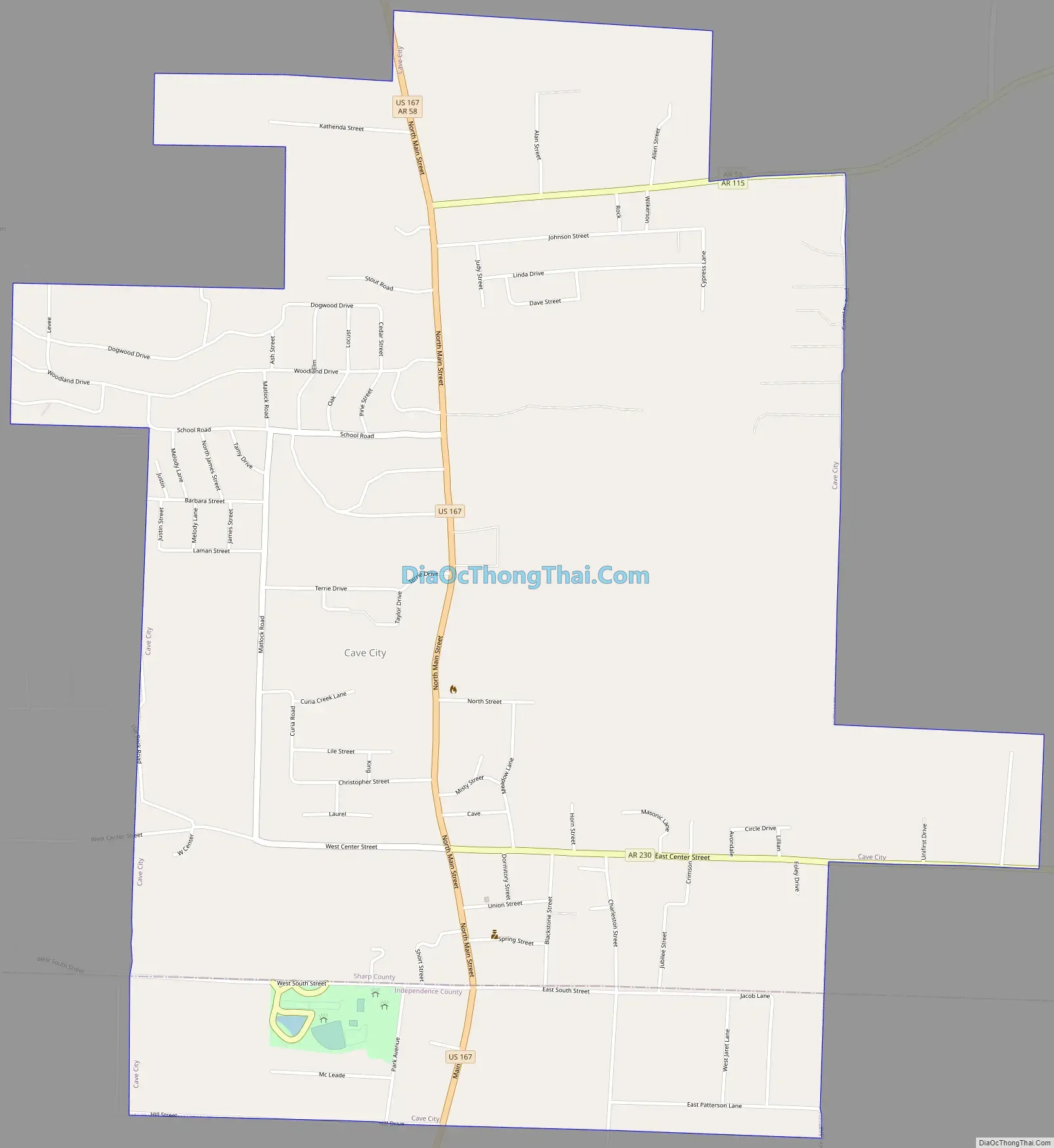
Cave City Road Map
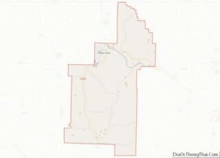
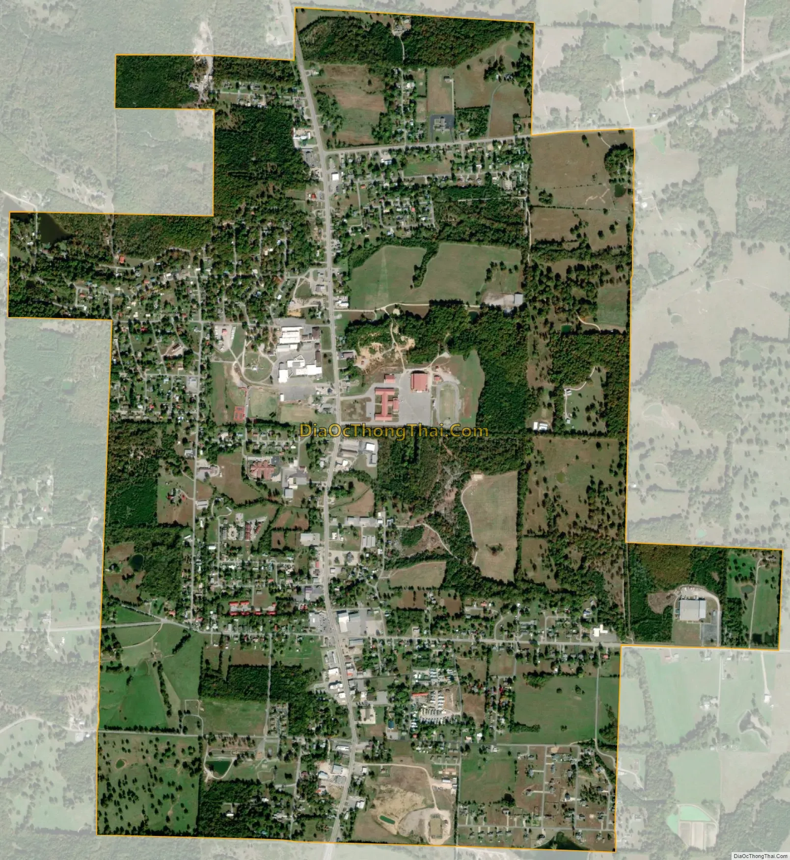
Cave City city Satellite Map
Geography
Cave City is located at 35°56′53″N 91°33′3″W / 35.94806°N 91.55083°W / 35.94806; -91.55083 (35.948087, -91.550952). The town is centered on, and partially located above, the Crystal River, an underground body of water located in the multi-room Crystal River Cave, for which the town is named. The beginning and ending of the water source has never been determined.
According to the United States Census Bureau, the city has a total area of 1.2 square miles (3.1 km), all land.
List of highways
- U.S. Highway 167
- Arkansas Highway 58
- Arkansas Highway 230
See also
Map of Arkansas State and its subdivision:- Arkansas
- Ashley
- Baxter
- Benton
- Boone
- Bradley
- Calhoun
- Carroll
- Chicot
- Clark
- Clay
- Cleburne
- Cleveland
- Columbia
- Conway
- Craighead
- Crawford
- Crittenden
- Cross
- Dallas
- Desha
- Drew
- Faulkner
- Franklin
- Fulton
- Garland
- Grant
- Greene
- Hempstead
- Hot Spring
- Howard
- Independence
- Izard
- Jackson
- Jefferson
- Johnson
- Lafayette
- Lawrence
- Lee
- Lincoln
- Little River
- Logan
- Lonoke
- Madison
- Marion
- Miller
- Mississippi
- Monroe
- Montgomery
- Nevada
- Newton
- Ouachita
- Perry
- Phillips
- Pike
- Poinsett
- Polk
- Pope
- Prairie
- Pulaski
- Randolph
- Saint Francis
- Saline
- Scott
- Searcy
- Sebastian
- Sevier
- Sharp
- Stone
- Union
- Van Buren
- Washington
- White
- Woodruff
- Yell
- Alabama
- Alaska
- Arizona
- Arkansas
- California
- Colorado
- Connecticut
- Delaware
- District of Columbia
- Florida
- Georgia
- Hawaii
- Idaho
- Illinois
- Indiana
- Iowa
- Kansas
- Kentucky
- Louisiana
- Maine
- Maryland
- Massachusetts
- Michigan
- Minnesota
- Mississippi
- Missouri
- Montana
- Nebraska
- Nevada
- New Hampshire
- New Jersey
- New Mexico
- New York
- North Carolina
- North Dakota
- Ohio
- Oklahoma
- Oregon
- Pennsylvania
- Rhode Island
- South Carolina
- South Dakota
- Tennessee
- Texas
- Utah
- Vermont
- Virginia
- Washington
- West Virginia
- Wisconsin
- Wyoming