Gateway is a town in Benton County, Arkansas, United States. The population was 436 at the 2020 census, up from 405 in 2010. It is part of the Northwest Arkansas region. The town’s name reflects its situation as the “gateway” to and from Arkansas.
| Name: | Gateway town |
|---|---|
| LSAD Code: | 43 |
| LSAD Description: | town (suffix) |
| State: | Arkansas |
| County: | Benton County |
| Elevation: | 1,558 ft (475 m) |
| Total Area: | 6.56 sq mi (17.00 km²) |
| Land Area: | 6.56 sq mi (16.99 km²) |
| Water Area: | 0.00 sq mi (0.01 km²) |
| Total Population: | 436 |
| Population Density: | 66.47/sq mi (25.66/km²) |
| ZIP code: | 72733 |
| Area code: | 479 |
| FIPS code: | 0526110 |
| GNISfeature ID: | 2406553 |
Online Interactive Map
Click on ![]() to view map in "full screen" mode.
to view map in "full screen" mode.
Gateway location map. Where is Gateway town?
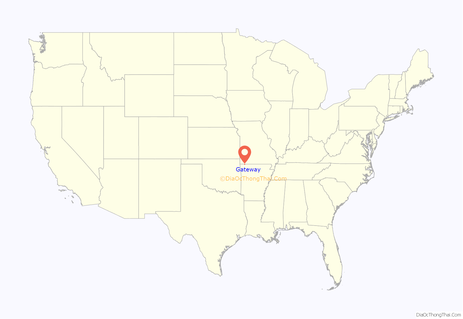
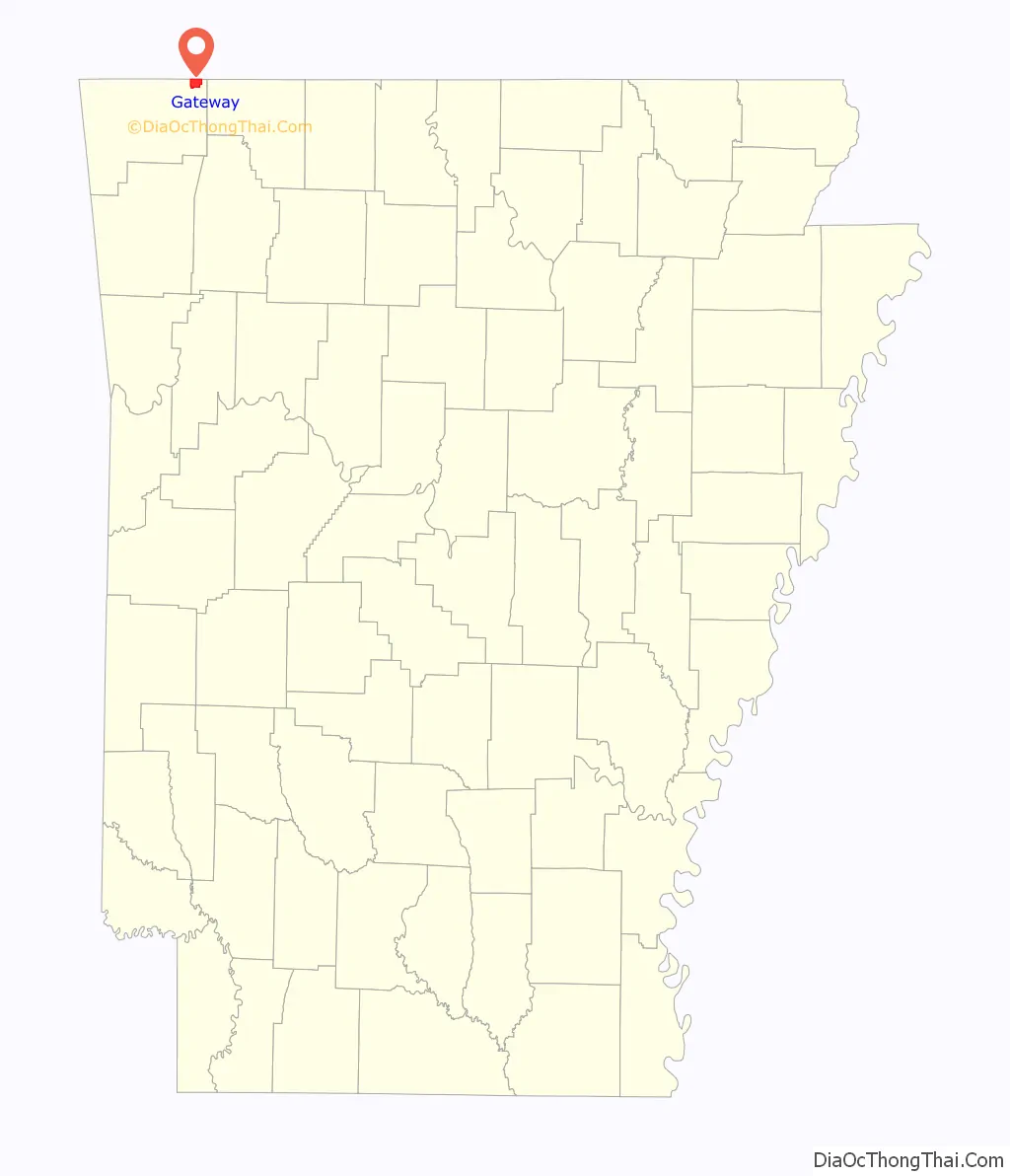
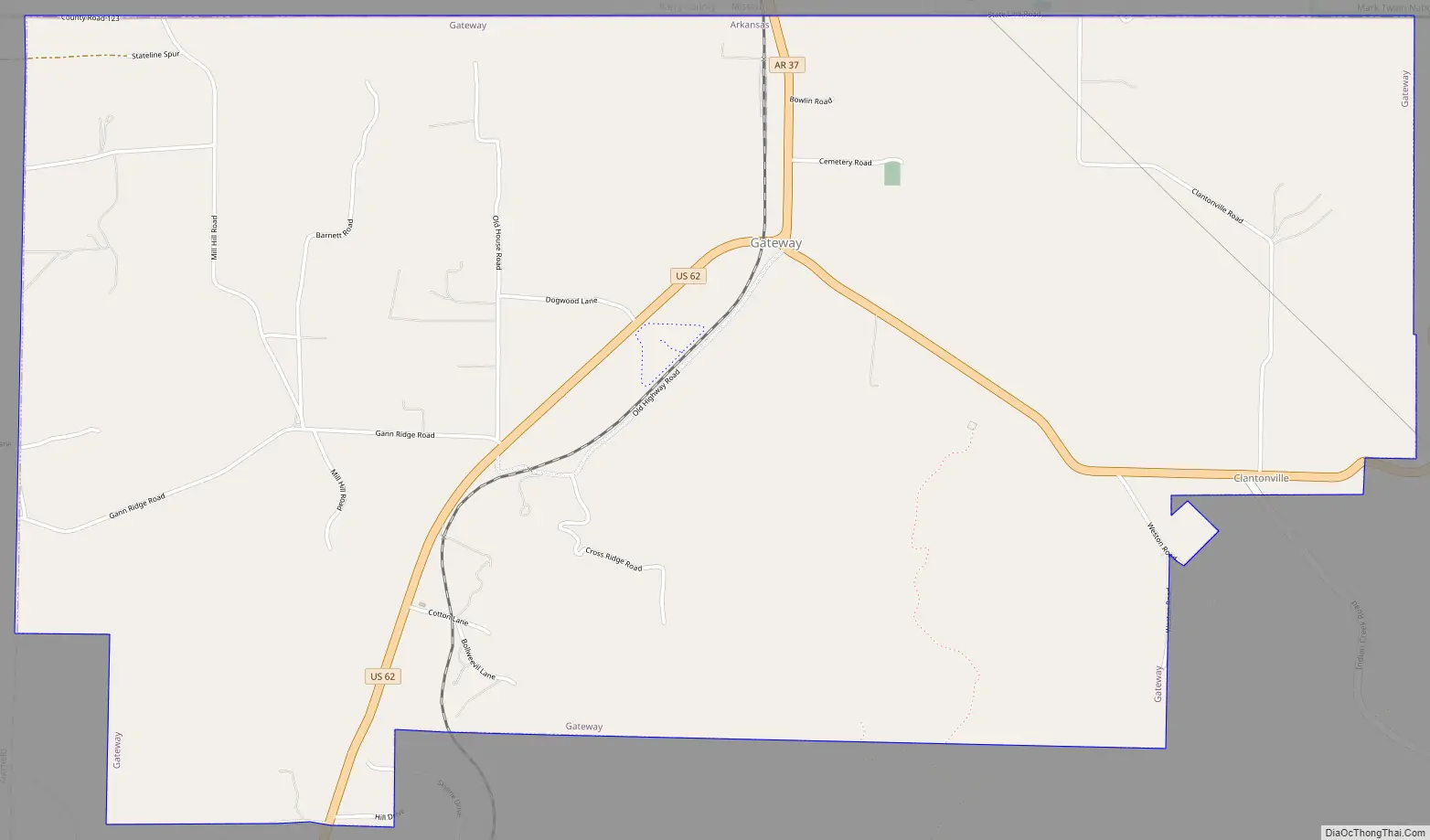
Gateway Road Map
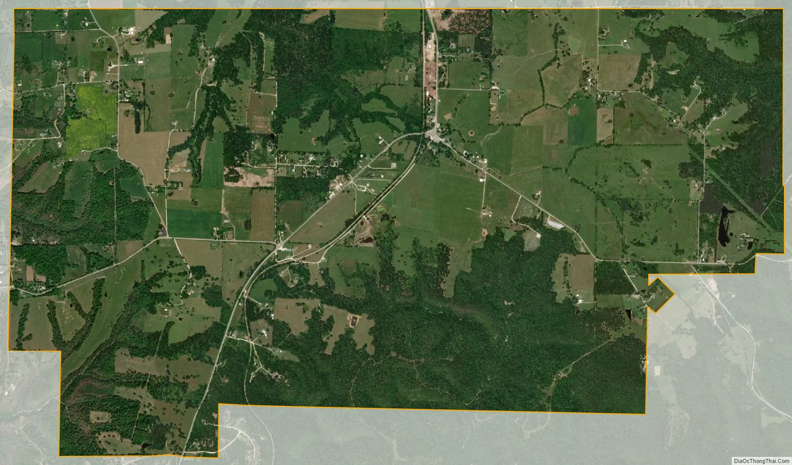
Gateway city Satellite Map
Geography
Gateway is located in northeastern Benton County at 36°29′10″N 93°56′18″W / 36.48611°N 93.93833°W / 36.48611; -93.93833 (36.486000, -93.938253), along the Missouri border. U.S. Route 62 passes through the town, leading east to Eureka Springs and Berryville and southwest to Rogers. Arkansas Highway 37 leads north to the Missouri line, where Missouri Route 37 continues north to Seligman and Cassville, Missouri. Gateway is on a plateau in the Ozarks at 1,600 feet (490 m) above sea level, overlooking the valley of the White River and Beaver Lake to the south.
According to the United States Census Bureau, the town has a total area of 6.1 square miles (15.9 km), all land.
See also
Map of Arkansas State and its subdivision:- Arkansas
- Ashley
- Baxter
- Benton
- Boone
- Bradley
- Calhoun
- Carroll
- Chicot
- Clark
- Clay
- Cleburne
- Cleveland
- Columbia
- Conway
- Craighead
- Crawford
- Crittenden
- Cross
- Dallas
- Desha
- Drew
- Faulkner
- Franklin
- Fulton
- Garland
- Grant
- Greene
- Hempstead
- Hot Spring
- Howard
- Independence
- Izard
- Jackson
- Jefferson
- Johnson
- Lafayette
- Lawrence
- Lee
- Lincoln
- Little River
- Logan
- Lonoke
- Madison
- Marion
- Miller
- Mississippi
- Monroe
- Montgomery
- Nevada
- Newton
- Ouachita
- Perry
- Phillips
- Pike
- Poinsett
- Polk
- Pope
- Prairie
- Pulaski
- Randolph
- Saint Francis
- Saline
- Scott
- Searcy
- Sebastian
- Sevier
- Sharp
- Stone
- Union
- Van Buren
- Washington
- White
- Woodruff
- Yell
- Alabama
- Alaska
- Arizona
- Arkansas
- California
- Colorado
- Connecticut
- Delaware
- District of Columbia
- Florida
- Georgia
- Hawaii
- Idaho
- Illinois
- Indiana
- Iowa
- Kansas
- Kentucky
- Louisiana
- Maine
- Maryland
- Massachusetts
- Michigan
- Minnesota
- Mississippi
- Missouri
- Montana
- Nebraska
- Nevada
- New Hampshire
- New Jersey
- New Mexico
- New York
- North Carolina
- North Dakota
- Ohio
- Oklahoma
- Oregon
- Pennsylvania
- Rhode Island
- South Carolina
- South Dakota
- Tennessee
- Texas
- Utah
- Vermont
- Virginia
- Washington
- West Virginia
- Wisconsin
- Wyoming