Armona is a census-designated place (CDP) in Kings County, California, United States. Armona is located 3.5 miles (5.6 km) west-southwest of Hanford, at an elevation of 239 feet (73 m). It is part of the Hanford–Corcoran Metropolitan Statistical Area. The population was 4,156 at the 2010 census. Armona’s motto is “Small and Loud”.
| Name: | Armona CDP |
|---|---|
| LSAD Code: | 57 |
| LSAD Description: | CDP (suffix) |
| State: | California |
| County: | Kings County |
| Elevation: | 239 ft (73 m) |
| Total Area: | 2.05 sq mi (5.32 km²) |
| Land Area: | 2.05 sq mi (5.32 km²) |
| Water Area: | 0.00 sq mi (0.00 km²) 0% |
| Total Population: | 4,274 |
| Population Density: | 2,081.83/sq mi (803.81/km²) |
| ZIP code: | 93202 |
| Area code: | 559 |
| FIPS code: | 0602700 |
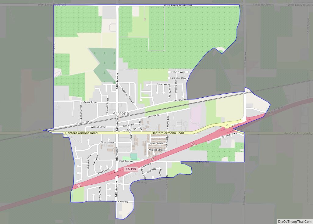
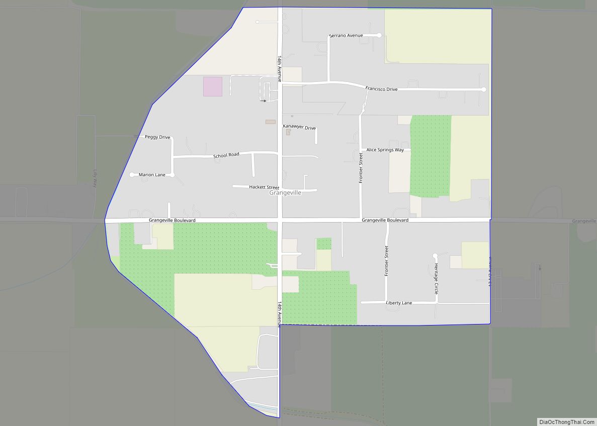
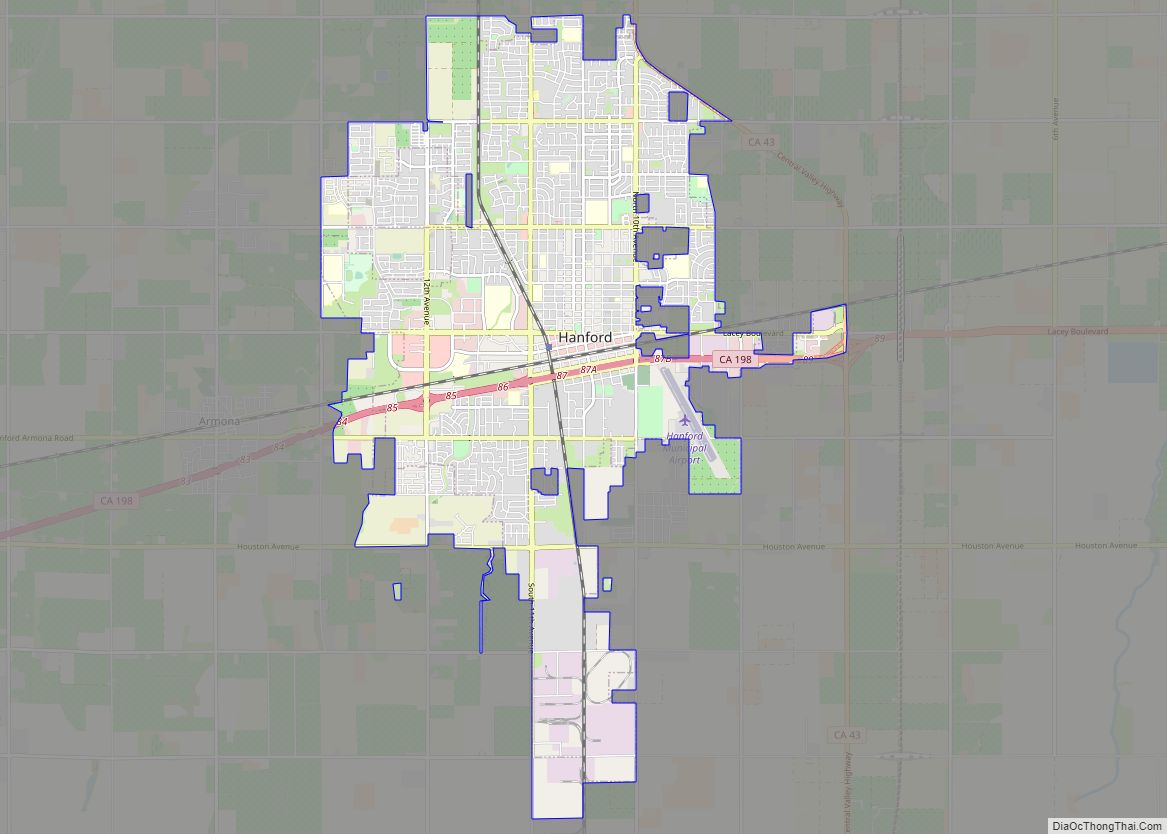
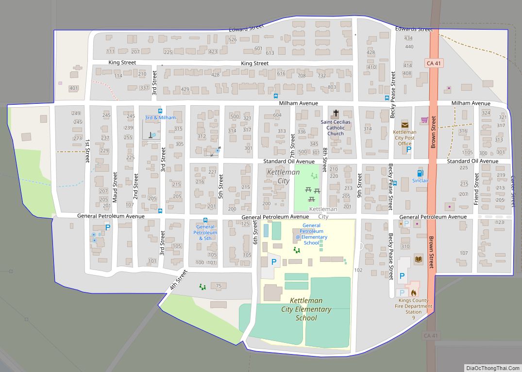
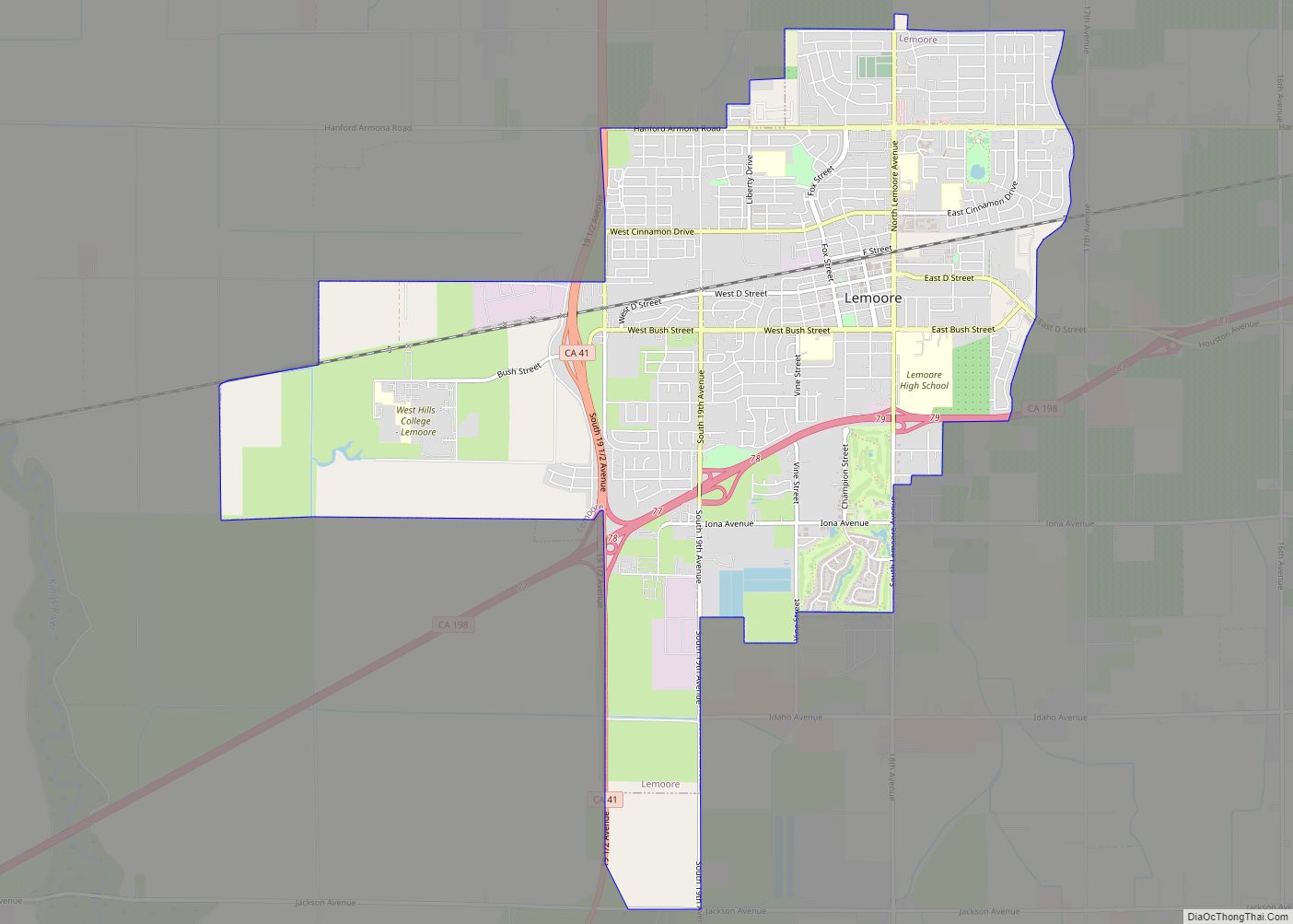
Online Interactive Map
Click on ![]() to view map in "full screen" mode.
to view map in "full screen" mode.
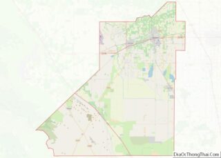
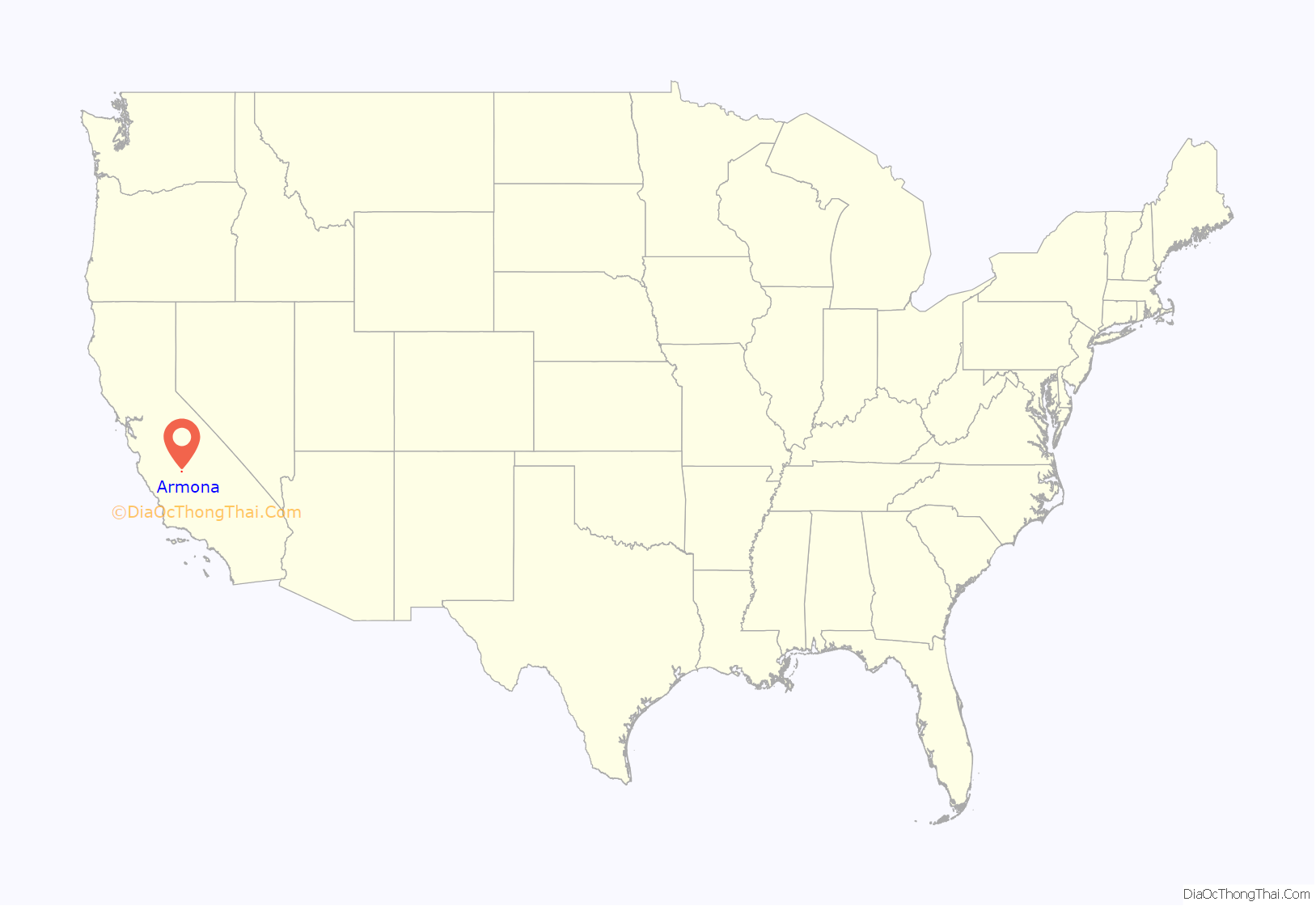
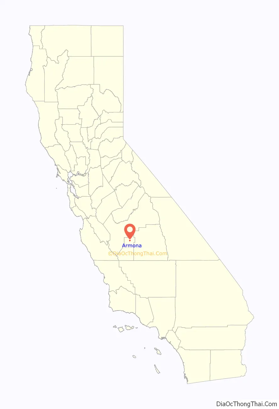
Armona location map. Where is Armona CDP?
History
The name “Armona” was applied to a railroad station in the 1880s. It was subsequently transferred to the present location on the Southern Pacific Railroad in 1891. Reportedly, the name was coined by transposing the first two letters of the name “Ramona”.
The first school in the Armona vicinity was the Giddings School built in 1880. The Giddings School District was renamed Armona in 1907. A new brick school house was constructed in the early 1920s. As that structure did not comply with California’s earthquake standards (the Field Act), it was replaced in 1953 with what is now the Armona Elementary School.
The Armona post office was established in 1887.
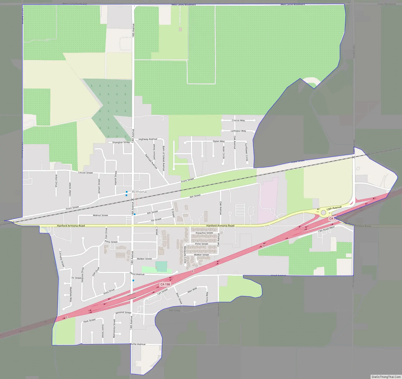
Armona Road Map
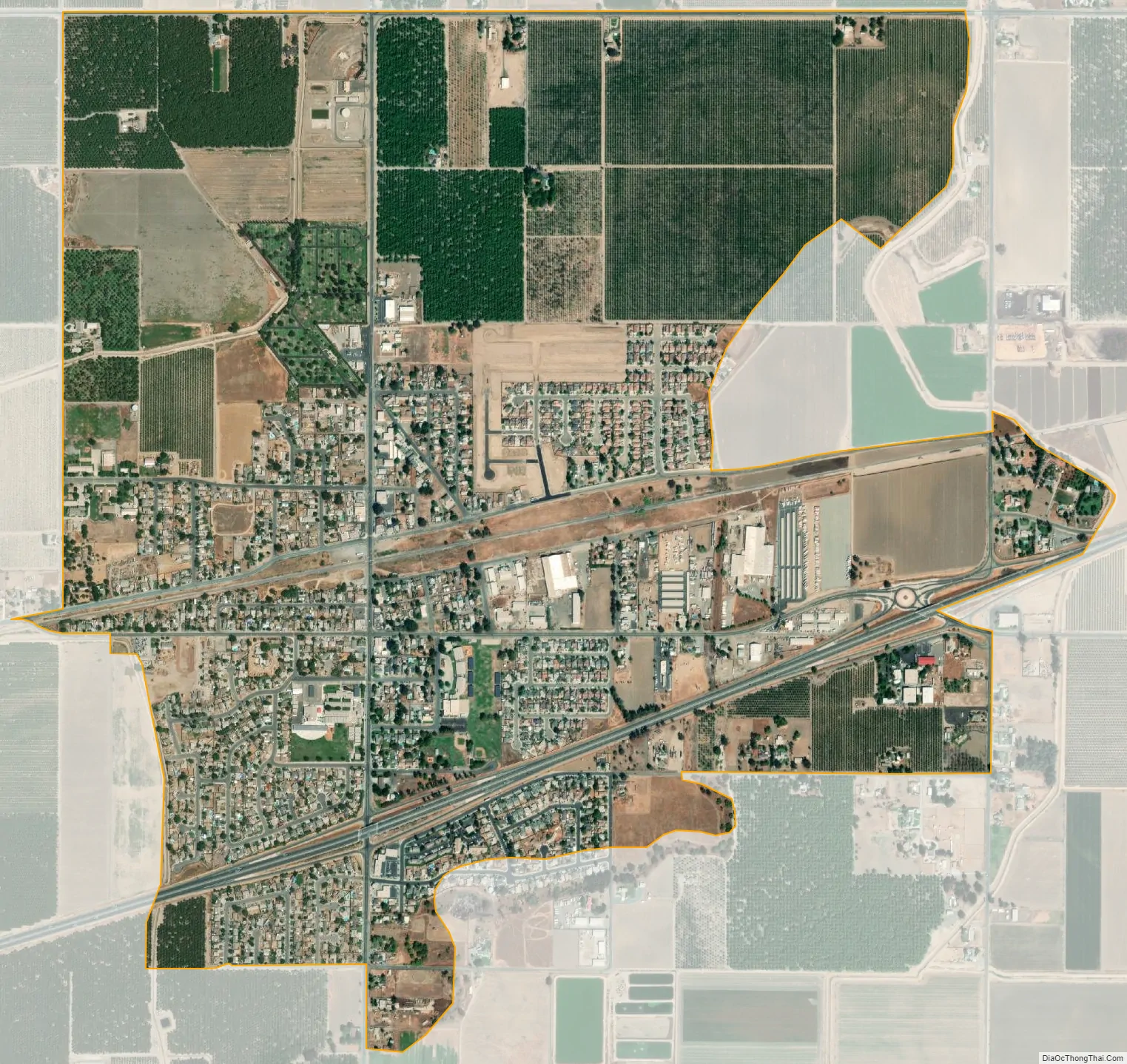
Armona city Satellite Map
Geography
Armona is located in northern Kings County at 36°18′57″N 119°42′30″W / 36.31583°N 119.70833°W / 36.31583; -119.70833. California State Route 198 runs through the community, leading east into Hanford, the county seat, and west 4 miles (6 km) to Lemoore.
According to the United States Census Bureau, the CDP has a total area of 1.9 square miles (4.9 km), all of it land.
See also
Map of California State and its subdivision:- Alameda
- Alpine
- Amador
- Butte
- Calaveras
- Colusa
- Contra Costa
- Del Norte
- El Dorado
- Fresno
- Glenn
- Humboldt
- Imperial
- Inyo
- Kern
- Kings
- Lake
- Lassen
- Los Angeles
- Madera
- Marin
- Mariposa
- Mendocino
- Merced
- Modoc
- Mono
- Monterey
- Napa
- Nevada
- Orange
- Placer
- Plumas
- Riverside
- Sacramento
- San Benito
- San Bernardino
- San Diego
- San Francisco
- San Joaquin
- San Luis Obispo
- San Mateo
- Santa Barbara
- Santa Clara
- Santa Cruz
- Shasta
- Sierra
- Siskiyou
- Solano
- Sonoma
- Stanislaus
- Sutter
- Tehama
- Trinity
- Tulare
- Tuolumne
- Ventura
- Yolo
- Yuba
- Alabama
- Alaska
- Arizona
- Arkansas
- California
- Colorado
- Connecticut
- Delaware
- District of Columbia
- Florida
- Georgia
- Hawaii
- Idaho
- Illinois
- Indiana
- Iowa
- Kansas
- Kentucky
- Louisiana
- Maine
- Maryland
- Massachusetts
- Michigan
- Minnesota
- Mississippi
- Missouri
- Montana
- Nebraska
- Nevada
- New Hampshire
- New Jersey
- New Mexico
- New York
- North Carolina
- North Dakota
- Ohio
- Oklahoma
- Oregon
- Pennsylvania
- Rhode Island
- South Carolina
- South Dakota
- Tennessee
- Texas
- Utah
- Vermont
- Virginia
- Washington
- West Virginia
- Wisconsin
- Wyoming