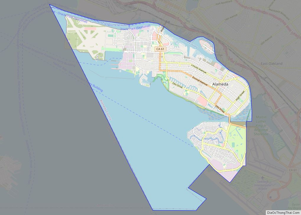
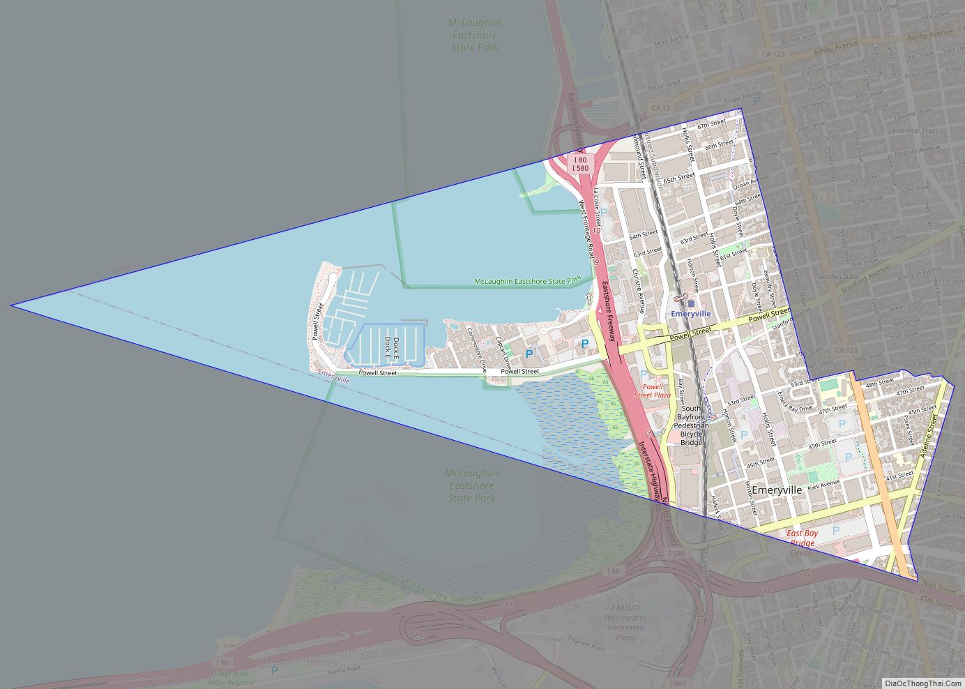
Alameda (/ˌæləˈmiːdə/ AL-ə-MEE-də; Spanish: [alaˈmeða]; Spanish for “tree-lined path”) is a city in Alameda County, California, located in the East Bay region of the Bay Area. The city is primarily located on Alameda Island, but also spans Bay Farm Island and Coast Guard Island, as well as a few other smaller islands in San Francisco Bay. As of the 2020 census, the city’s population was 78,280.
| Name: | Alameda city |
|---|---|
| LSAD Code: | 25 |
| LSAD Description: | city (suffix) |
| State: | California |
| County: | Alameda County |
| Elevation: | 33 ft (10 m) |
| Total Area: | 22.98 sq mi (59.52 km²) |
| Land Area: | 10.45 sq mi (27.06 km²) |
| Water Area: | 12.53 sq mi (32.45 km²) 53.79% |
| Total Population: | 78,280 |
| Population Density: | 7,491.63/sq mi (2,892.62/km²) |
| Area code: | 510, 341 |
| FIPS code: | 0600562 |
| Website: | alamedaca.gov |
Online Interactive Map
Click on ![]() to view map in "full screen" mode.
to view map in "full screen" mode.
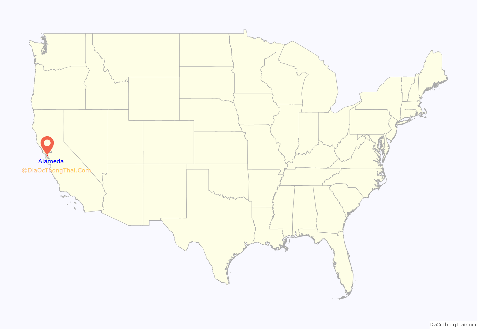
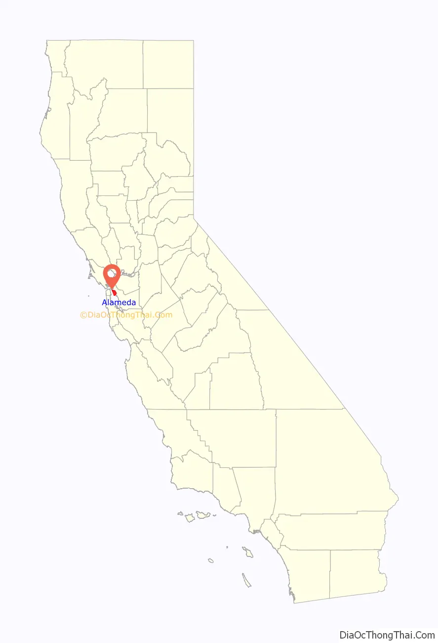
Alameda location map. Where is Alameda city?
History
Spanish & Mexican era
Alameda occupies what was originally a peninsula connected to Oakland. Much of it was low-lying and marshy. The higher ground nearby and adjacent parts of what is now downtown Oakland were the site of one of the largest coastal oak forests in the world. Spanish colonists called the area Encinal, meaning “forest of evergreen oak”. Alameda is Spanish for “grove of poplar trees” or “tree-lined avenue.” It was chosen as the name of the city in 1853 by popular vote.
The inhabitants at the time of the arrival of the Spanish in the late 18th century were a local band of the Ohlone tribe. The peninsula was included in the vast Rancho San Antonio granted in 1820 to Luis Peralta by the Spanish king who claimed California. The grant was later confirmed by the Republic of Mexico upon its independence in 1821 from Spain.
Over time, the place became known as Bolsa de Encinal or Encinal de San Antonio.
Post-Conquest era
The city was founded on June 6, 1853, after the United States acquired California following the Mexican–American War of 1848. The town originally contained three small settlements. “Alameda” referred to the village at Encinal and High streets, Hibbardsville was located at the North Shore ferry and shipping terminal, and Woodstock was on the west near the ferry piers of the South Pacific Coast Railroad and the Central Pacific. Eventually, the Central Pacific’s ferry pier became the Alameda Mole. The borders of Alameda were made coextensive with the island in 1872, incorporating Woodstock into Alameda. In his autobiography, writer Mark Twain described Alameda as “The Garden of California.”
The first post office opened in 1854. The first school, Schermerhorn School, was opened in 1855 (and eventually renamed as Lincoln School). The San Francisco and Alameda Railroad opened the Encinal station in 1864. Encinal’s own post office opened in 1876, was renamed West End in 1877, and closed in 1891. On September 6, 1869, the Alameda Terminal made history; it was the site of the arrival of the first train via the First transcontinental railroad to reach the shores of San Francisco Bay, thus achieving the first coast to coast transcontinental railroad in North America.
The Croll Building, on the corner of Webster Street and Central Avenue, was the site of Croll’s Gardens and Hotel, used as training quarters for some of the most popular fighters in boxing from 1883 to 1914. Jack Johnson and several other champions all stayed and trained here.]
The need for expanded shipping facilities and increased flow of current through the estuary led to the dredging of a tidal canal through the marshland between Oakland and Alameda. Construction started in 1874, but it was not completed until 1902, resulting in Alameda becoming an island.
Modern era
In 1917, a private entertainment park called Neptune Beach was built in the area now known as Crab Cove, which became a major recreation destination in the 1920s and 1930s. Both the American snow cone and the popsicle were first sold at Neptune Beach. The Kewpie doll became the original prize for winning games of chance at the beach – another Neptune Beach innovation. The park closed down in 1939.
The Alameda Works Shipyard was one of the largest and best-equipped shipyards in the country. Together with other industrial facilities, it became part of the defense industry buildup before and during World War II, which attracted many migrants from other parts of the United States for the high-paying jobs. In the 1950s, Alameda’s industrial and shipbuilding industries thrived along the Alameda Estuary.
In the early 21st century, the Port of Oakland, across the estuary, has become one of the largest ports on the West Coast. Its operators use shipping technologies originally experimented within Alameda. As of March 21, 2006, Alameda is a “Coast Guard City”, one of seven then designated in the country. As of 2018, it is one of twenty-one within the country.
In addition to the regular trains running to the Alameda Mole, Alameda was also served by local steam commuter lines of the Southern Pacific (initially, the Central Pacific). Alameda was the site of the Southern Pacific’s West Alameda Shops, where all the electric trains were maintained and repaired. These were later adapted as the East Bay Electric Lines. The trains ran to both the Oakland Mole and the Alameda Mole.
In the 1930s Pan American Airways established a seaplane port along with the fill that led to the Alameda Mole, the original home base for the China Clipper flying boat. In 1929, the University of California established the San Francisco Airdrome located near the current Webster Street tube as a public airport. The Bay Airdrome had its gala christening party in 1930. The Airdrome was closed in 1941 when its air traffic interfered with the newly built Naval Air Station Alameda (NAS Alameda).
In the late 1950s, the Utah Construction Company began a landfill beyond the Old Sea Wall and created South Shore.
On February 7, 1973, a USN Vought A-7E Corsair II fighter jet on a routine training mission from Lemoore Naval Air Station suddenly caught fire 28,000 feet (8,500 m) above the San Francisco Bay, crashing into the Tahoe Apartments in Alameda. Eleven people, including pilot Lieutenant Robert Lee Ward, died in the crash and fire.
Alameda Road Map
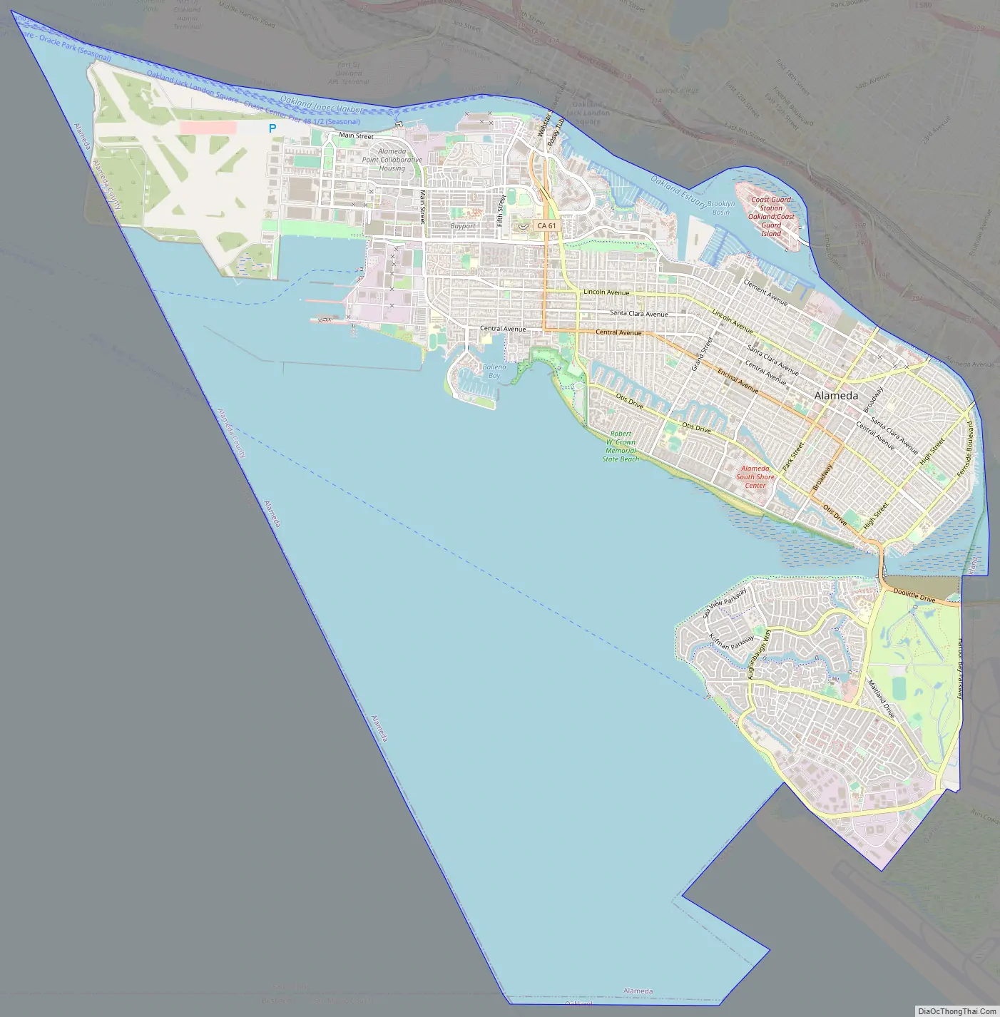
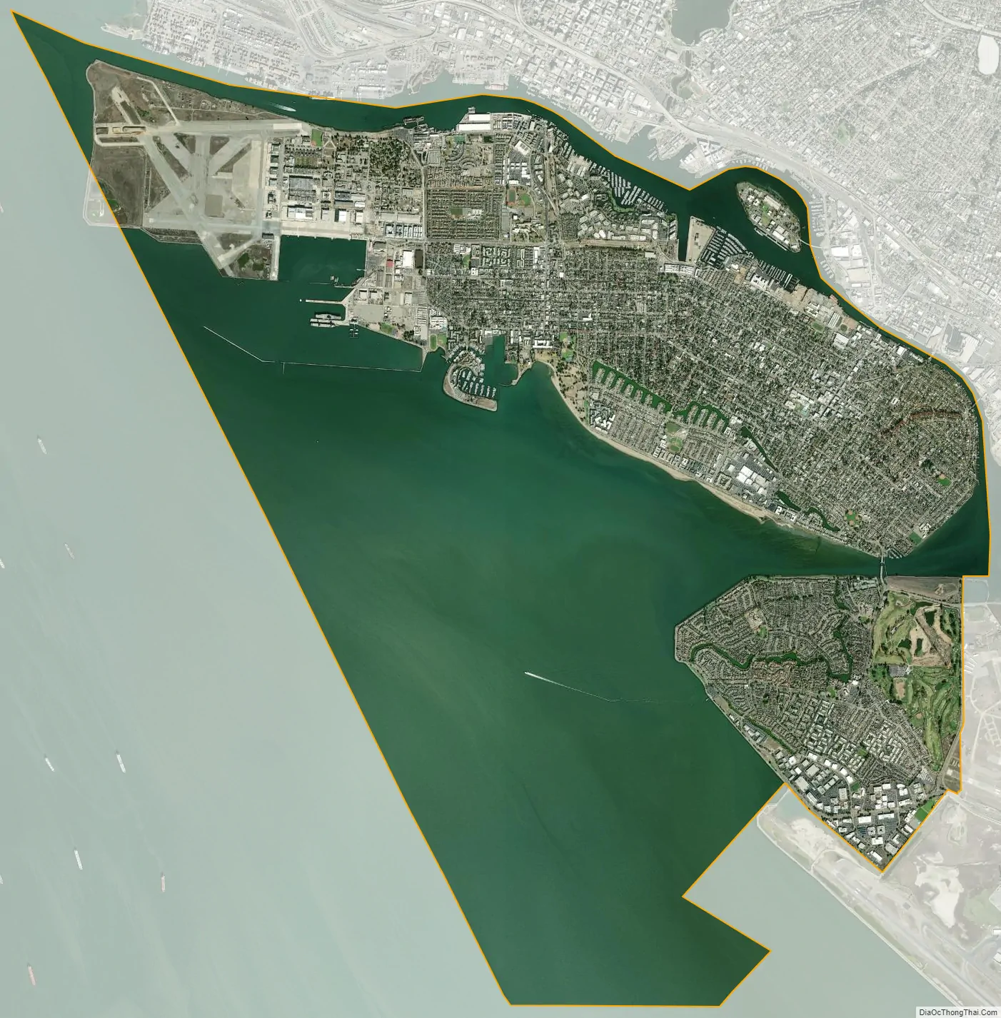
Alameda city Satellite Map
Geography
Alameda’s nickname is “The Island City” (or simply “the island”). The current city occupies three islands as well as a small section of the mainland. Today, the city consists of the main original section, with the former Naval Air Station Alameda (NAS Alameda) at the west end of Alameda Island, Southshore along the southern side of Alameda Island, and Bay Farm Island, which is part of the mainland proper.
The area of the former NAS is now known as “Alameda Point.” The Southshore area is separated from the main part of Alameda Island by a lagoon; the north shore of the lagoon is located approximately where the original south shore of the island was. Alameda Point and Southshore are built on bay fill.
Not all of Alameda Island is part of the City of Alameda; a small portion of a dump site west of the former runway at Alameda Naval Air Station extends far enough into San Francisco Bay that it is over the county line and therefore part of the City and County of San Francisco.
Coast Guard Island, a small island between Alameda Island and Oakland, is also part of Alameda and is the home of Integrated Support Command Alameda.
Ballena Isle, an even smaller island, is also part of Alameda.
Climate
This region experiences warm (but not hot), dry summers, and cool (but not cold), wet winters. According to the Köppen climate classification system, Alameda has a warm-summer Mediterranean climate, abbreviated “Csb” on climate maps. Annual precipitation is about 22 in (560 mm), all rain (snow is extremely rare at sea level in the San Francisco Bay Area).
Hazards
The low-lying island has seen sea-level and groundwater level rise threaten its infrastructure and people not just through flooding events, but through the increased liquefaction risk from more saturated soils. The locations of increasing groundwater-induced risks and flooding risks (such as from another megaflood) may be most precise in private insurance company maps.
See also
Map of California State and its subdivision:- Alameda
- Alpine
- Amador
- Butte
- Calaveras
- Colusa
- Contra Costa
- Del Norte
- El Dorado
- Fresno
- Glenn
- Humboldt
- Imperial
- Inyo
- Kern
- Kings
- Lake
- Lassen
- Los Angeles
- Madera
- Marin
- Mariposa
- Mendocino
- Merced
- Modoc
- Mono
- Monterey
- Napa
- Nevada
- Orange
- Placer
- Plumas
- Riverside
- Sacramento
- San Benito
- San Bernardino
- San Diego
- San Francisco
- San Joaquin
- San Luis Obispo
- San Mateo
- Santa Barbara
- Santa Clara
- Santa Cruz
- Shasta
- Sierra
- Siskiyou
- Solano
- Sonoma
- Stanislaus
- Sutter
- Tehama
- Trinity
- Tulare
- Tuolumne
- Ventura
- Yolo
- Yuba
- Alabama
- Alaska
- Arizona
- Arkansas
- California
- Colorado
- Connecticut
- Delaware
- District of Columbia
- Florida
- Georgia
- Hawaii
- Idaho
- Illinois
- Indiana
- Iowa
- Kansas
- Kentucky
- Louisiana
- Maine
- Maryland
- Massachusetts
- Michigan
- Minnesota
- Mississippi
- Missouri
- Montana
- Nebraska
- Nevada
- New Hampshire
- New Jersey
- New Mexico
- New York
- North Carolina
- North Dakota
- Ohio
- Oklahoma
- Oregon
- Pennsylvania
- Rhode Island
- South Carolina
- South Dakota
- Tennessee
- Texas
- Utah
- Vermont
- Virginia
- Washington
- West Virginia
- Wisconsin
- Wyoming