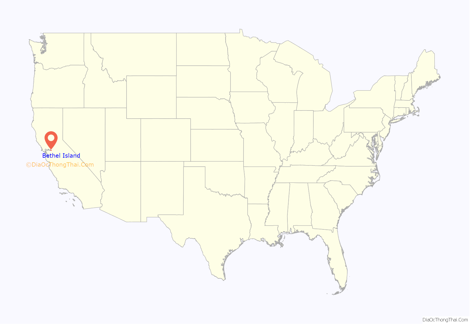
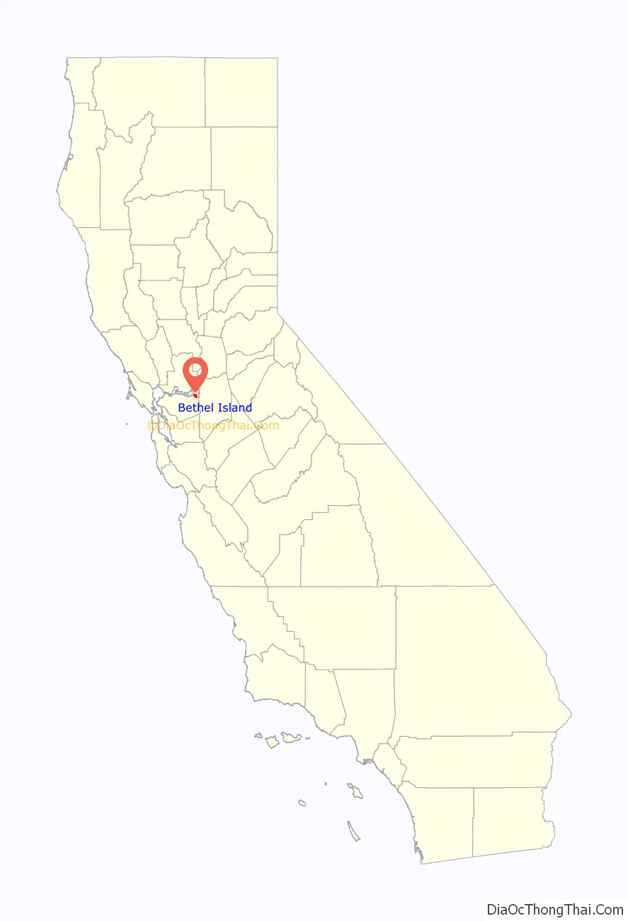
Bethel Island is an island in the Sacramento–San Joaquin River Delta of Contra Costa County, California, approximately 10 kilometres (6.2 mi) east of Antioch. The island describes itself as “the heart of the California Delta.”
Bethel Island (formerly known as Bethell, Bethell Ranch, Bethel Tract, Sand Mound Ranch, Sand Mound Tract) is also a census-designated place (CDP) on the island. The population at the 2010 census was 2,137, a 7.6 percent decline from 2,312 at the 2000 census. The community of Bethel Island is governed as a Special Act District created by the California State legislature and named the Bethel Island Municipal Improvement District (BIMID). It is a popular destination for recreation seekers, especially hunters, fishermen and boaters.
| Name: | Bethel Island CDP |
|---|---|
| LSAD Code: | 57 |
| LSAD Description: | CDP (suffix) |
| State: | California |
| County: | Contra Costa County |
| FIPS code: | 0606210 |
Online Interactive Map
Click on ![]() to view map in "full screen" mode.
to view map in "full screen" mode.
Bethel Island location map. Where is Bethel Island CDP?
History
Bethel Island was named for the Bethell Brothers, Frank and Warren Bethell, who formed the first successful farm on the island, called Sand Mound Ranch.
The landform known as Bethel Island was created between 1859 and 1870 by several men, see the names and survey numbers below. (Source: California State Archives for Land Patent Certificate of Purchase for Swamp and Overflow Surveys Numbers 80, 81, 82, 83, 225, 226, 227 and 250). Alonzo Stone purchased much of the property formerly owned by Warren and Anne Bethell, and the area was briefly referred to as the “Stone Tract” in the 1930s. Prior to this, it was referred to as “Sandmound Ranch”, “Sandmound Tract” or “Bethel Tract” and contained an estimated area of 6,000 acres (24 km), and did not become an island until 1911, when Dutch Slough was dredged eastward to join with Sandmound Slough. East Contra Costa Historical Society has been made aware of these inaccuracies, however has not yet updated their website.
The first post office opened in 1898, and named for its first postmaster Franklin Cloud Bethell. The second “L” was dropped by a rather pious postal commissioner that reportedly felt it would be ungodly to allow the new location to be called “Bet Hell”, and took liberties to change it to “Bethel” (בית אל), meaning “House of God” in Hebrew. The post office closed in 1902. A Post Office re-opened on Bethel Island in 1947.
Though it was common for the era to name the post office after the postmaster, and for the communities to assume the name of the post office, there are some references to the area as “Bethell” referring to the Sand Mound Ranch farm established by a coalition led by Franklin’s older brother, Warren King Bethell, Nicholas Harris (Sheriff of San Jose) and James C. Smith. Prior “owners” of these lands were considered “land speculators” and only performed the minimum amount of improvements to reclaim the land in order to secure land patents. This may not be a fair assessment of all, since some did make an honest attempt to reclaim the lands only to be forced out by changes in governmental policy and financial constraints.
Actual “ownership” of the lands was accomplished through a long process of applications, surveys, improvements and Patents, as defined by the frequently amended Swamp and Overflow Lands Act. The first applications for land patents for what is now Bethel Island, Jersey Island, Franks Tract and Webb Tract, were secured by early California pioneers (the patent number precedes the name, and the date of application follows): 80-H. L. Henderon (1859), 81-Jabez Hatch (1859), 82-Elijah Hook (1859), 83-Stephen C. Vaughn (1859), 221-Edward P. Paine (1865), 222-John F. Arnold (1865), 223-John P. Curtis (1865), 224-Jessa Cheney (1865), 225-William Nye (1865), 226-Stephen L. Piper (1865), 227-D. J. West (1865), 250-Benjamin Taylor (1865), 284-Thomas Murphy (1868) and 297-C. C. Web (1868). Through the remainder of the 1860s and most of the 1870s, interest in several of these lands were traded or sold, passing to Cheney (who later partnered with Van W. Phillips), Hatch, Piper and Taylor. Also, interest in some of the lands were acquired by such notable names in the Delta as J. B. Haggin and A. E. Davis, and by G. D. Roberts and A. G. Kimbell. It might be of interest to note that Elijah Hook later helped establish the city of Oakland to be a distinct and separate entity from San Francisco, and Van W. Phillips was instrumental in the creation of the city of Antioch. Jabez Hatch’s wife, Mary, was sister to Elijah Hook.
Bethells
Warren King Bethel was born in 1823 in Indiana to the Reverend Cloud Bethell, served in the Mexican War, and then came to California via the Isthmus of Panama in 1854. There, he engaged in mining for a few months, then settled in Santa Clara County, buying 250 acres on Almaden Road. On August 15, 1856, Warren married Ann Youree Hamilton. In 1871, Warren and Ann moved to San Jose and ran a Livery business. In 1872, along with Nicholas Harris and James C. Smith, Warren purchased the 3500 acre Sand Mound Ranch from Jessa Cheney and Van W. Phillips (Phillips went on to help establish the town of Antioch, California.)
Warren encouraged his younger brother, Franklin, to move West to assist in this new venture. Franklin C. Bethell (born: Cloud Franklyn Bethell) was born in 1833, 10 years junior to Warren, married Lucy Maria Hazen on June 2, 1857, in Indiana. Frank and Lucy had no children. There, Franklin did not appear to prosper in any noted occupation. Newspaper records of the time show Franklin as a frequent occupant of several of the finer hotels in San Francisco, Sacramento, and Brentwood. It is unclear if Franklin was employed by the Sand Mound Ranch, or if he had other means of income. After the death of his brother Warren, Franklin did purchase the lands that were previously held by Nicholas Harris, presumably using money inherited from his brother. Lands that were specifically titled to Warren went to his wife Ann. Frank Bethell and Warren Bethell’s widow, Ann Youree (Hamilton) Bethell sold their interest in the island in 1901, much of it to Alonzo Stone. Ann went on to form a successful ranch in Almaden Valley and established the Bethell Block in downtown San Jose (site of the current Federal Building). The portion of the land along the levee of Taylor Slough were held by James C. Smith stayed with his descendants until 1941.
In 1898, Franklin was appointed Post Master for the local post office, run out of his house near Horseshoe Bend. Prior to 1898, mail was delivered to the Post Office at Jersey Landing, and special service carried mail to the Sand Mound Ranch from there. A pious clerk at the U.S. Postal office did not want the name “Bet Hell” and dropped the additional “L” to make it “Bethel”, like the Hebrew term בית אל beth el which translates to “House of God,” Franklin’s post office closed in 1902, however the name Bethel(l) was now officially tied to the locality.
20th century
A one-lane wooden bridge was built in 1911, but was removed by order of the Army Corps of Engineers. After litigation, it was ordered to be replaced in 1921. In the late 1930s a resort was created by Houston (Jack) Farrar and his wife Blanche (Ruby), with a recreational area for picnics and swimming. Known as Farrar Park, it was the first recreational business on the island. Hunters, fishermen, and boaters began buying property after World War II.
Remsburg Marina was started by Warren Remsburg in 1938, and in 1944 a fishing resort called Frank’s had gained popularity on the island. The resort was built by the Andronico family.
Electricity was first supplied in 1946, and telephone service arrived in 1949. From then on, Bethel Island became an increasingly popular recreation spot.
By the 1950s the area became popular with sport fishermen and the rich.
It is now the most densely populated island in the delta. The community calls itself, “The Heart of the Delta.”
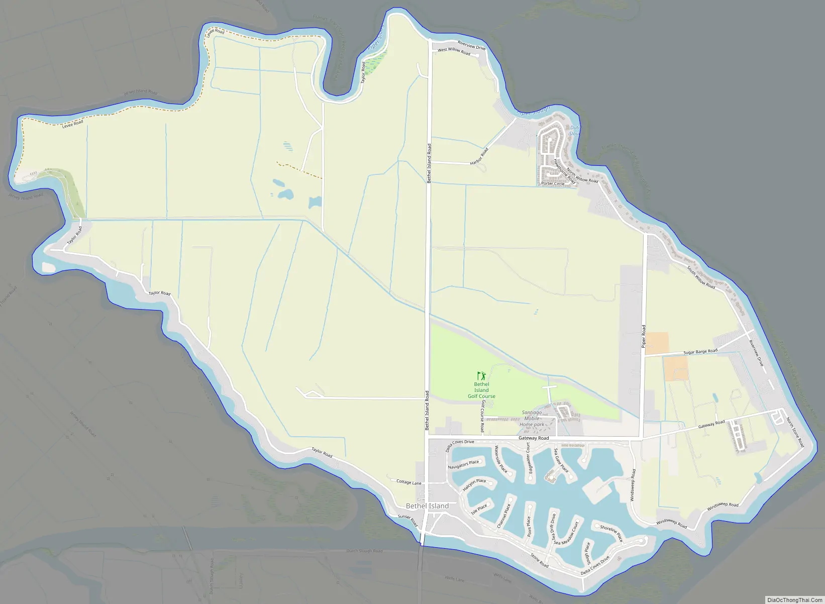
Bethel Island Road Map
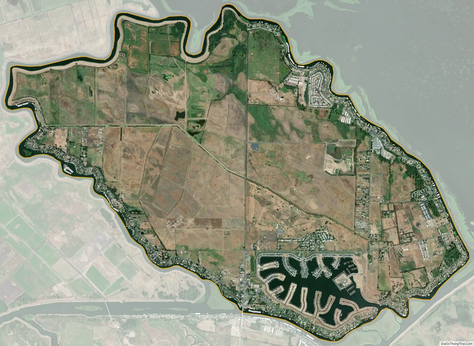
Bethel Island city Satellite Map
Geography
According to the United States Census Bureau, the CDP has a total area of 5.1 square miles (13 km), all of it land. It is located on an island of the same name 9 miles (14 km) east of Antioch. The island is surrounded by Taylor, Piper, Dutch and Sandmound Sloughs, and protected by 11.5 miles (18.5 km) of earthen levees. The only land access is a bridge that connects Bethel Island Road to Cypress Road in Oakley.
Other nearby communities are Oakley, which adjoins Bethel Island on the west-southwest, Knightsen and Brentwood, which is south of the island.
See also
Map of California State and its subdivision:- Alameda
- Alpine
- Amador
- Butte
- Calaveras
- Colusa
- Contra Costa
- Del Norte
- El Dorado
- Fresno
- Glenn
- Humboldt
- Imperial
- Inyo
- Kern
- Kings
- Lake
- Lassen
- Los Angeles
- Madera
- Marin
- Mariposa
- Mendocino
- Merced
- Modoc
- Mono
- Monterey
- Napa
- Nevada
- Orange
- Placer
- Plumas
- Riverside
- Sacramento
- San Benito
- San Bernardino
- San Diego
- San Francisco
- San Joaquin
- San Luis Obispo
- San Mateo
- Santa Barbara
- Santa Clara
- Santa Cruz
- Shasta
- Sierra
- Siskiyou
- Solano
- Sonoma
- Stanislaus
- Sutter
- Tehama
- Trinity
- Tulare
- Tuolumne
- Ventura
- Yolo
- Yuba
- Alabama
- Alaska
- Arizona
- Arkansas
- California
- Colorado
- Connecticut
- Delaware
- District of Columbia
- Florida
- Georgia
- Hawaii
- Idaho
- Illinois
- Indiana
- Iowa
- Kansas
- Kentucky
- Louisiana
- Maine
- Maryland
- Massachusetts
- Michigan
- Minnesota
- Mississippi
- Missouri
- Montana
- Nebraska
- Nevada
- New Hampshire
- New Jersey
- New Mexico
- New York
- North Carolina
- North Dakota
- Ohio
- Oklahoma
- Oregon
- Pennsylvania
- Rhode Island
- South Carolina
- South Dakota
- Tennessee
- Texas
- Utah
- Vermont
- Virginia
- Washington
- West Virginia
- Wisconsin
- Wyoming


