Burbank is a census-designated place in Santa Clara County, California. Part of the neighborhood has been annexed to San Jose, while the rest consists of unincorporated areas of Santa Clara County. The population was 4,926 at the 2010 census. The area was named for horticulturist Luther Burbank.
The area is also a center for antique stores and is centrally located to Santana Row, Westfield Valley Fair, and also the downtown area.
The area is in ZIP code 95128 and area codes 408 and 669.
| Name: | Burbank CDP |
|---|---|
| LSAD Code: | 57 |
| LSAD Description: | CDP (suffix) |
| State: | California |
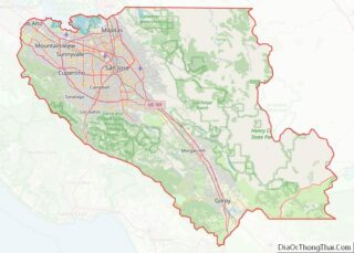
| County: | Santa Clara County |
| Total Area: | 0.42 sq mi (1.08 km²) |
| Land Area: | 0.42 sq mi (1.08 km²) |
| Water Area: | 0.00 sq mi (0.00 km²) 0% |
| Total Population: | 4,940 |
| Population Density: | 11,875.00/sq mi (4,582.38/km²) |
| ZIP code: | 95128 |
| FIPS code: | 0608968 |
Online Interactive Map
Click on ![]() to view map in "full screen" mode.
to view map in "full screen" mode.
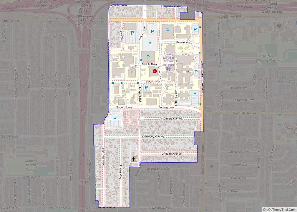
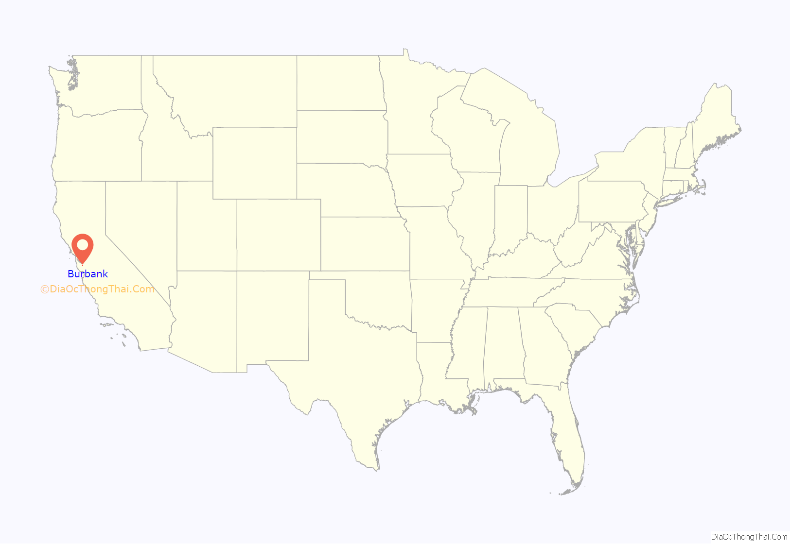
Burbank location map. Where is Burbank CDP?
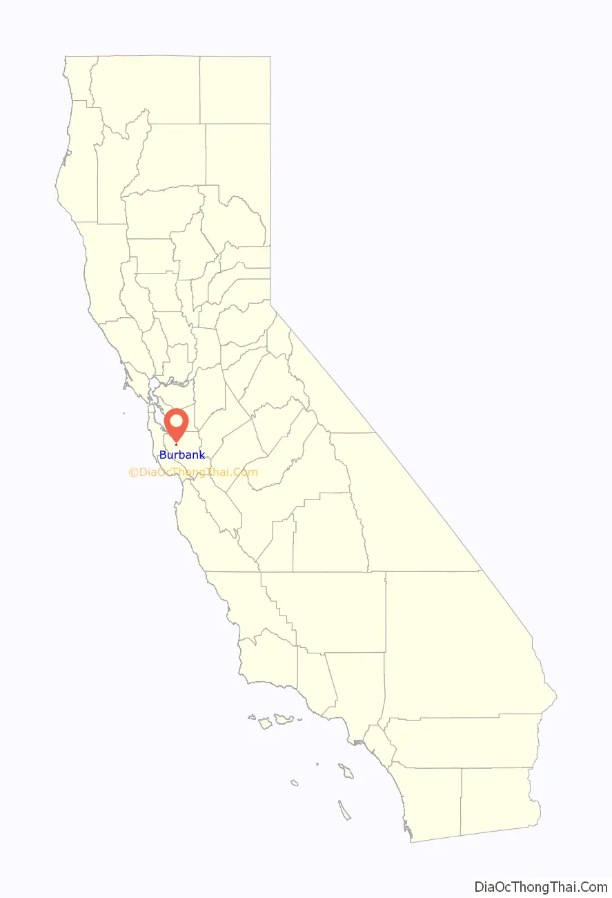
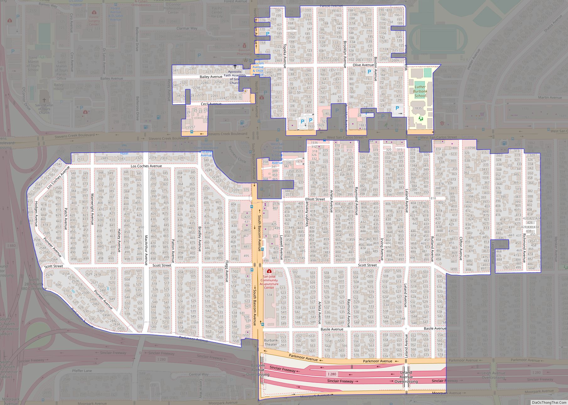
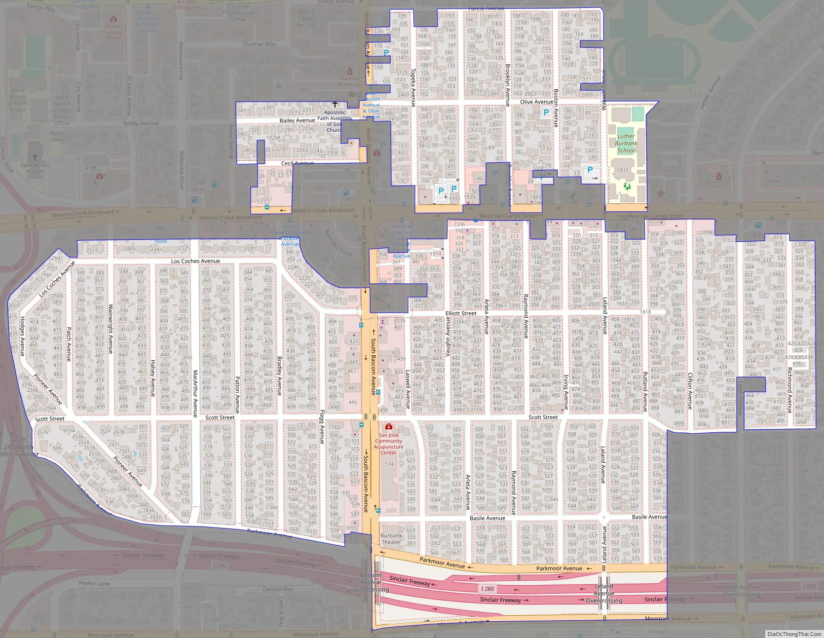
Burbank Road Map
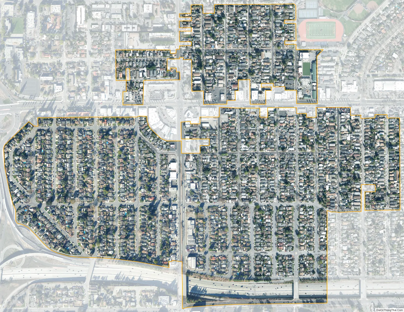
Burbank city Satellite Map
Geography
Burbank is located at 37°19′14″N 121°55′54″W / 37.32056°N 121.93167°W / 37.32056; -121.93167 (37.320521, -121.931591). According to the United States Census Bureau, the CDP has a total area of 0.4 square miles (1.0 km), all of it land.
The Burbank District is roughly defined as an unincorporated area along Bascom Avenue between West San Carlos Street and Interstate 280. The area is an “urban island” entirely surrounded by the City of San Jose. KQED, the local NPR affiliate, ran a story about Burbank’s status as an urban island, and the local communities desire to not be annexed by the city of San Jose. The U.S. Geological Survey shows the area’s name as official on the San Jose West, California 7.5-minute Quadrangle and it has been assigned a feature ID of 277480 in the National Geographic Names Database. Official NAD27 coordinates are given as 37°19′24″N 121°55′50″W / 37.32333°N 121.93056°W / 37.32333; -121.93056. It is an areal feature occupying some of the area between I-280 and San Carlos Street extending east almost to Meridian Avenue and west almost to SR17. The area of this district is an irregular shape. Some parcels considered inside the district, including the Luther Burbank Elementary School, 4 Wabash Avenue, lie outside this boundary.
See also
Map of California State and its subdivision:- Alameda
- Alpine
- Amador
- Butte
- Calaveras
- Colusa
- Contra Costa
- Del Norte
- El Dorado
- Fresno
- Glenn
- Humboldt
- Imperial
- Inyo
- Kern
- Kings
- Lake
- Lassen
- Los Angeles
- Madera
- Marin
- Mariposa
- Mendocino
- Merced
- Modoc
- Mono
- Monterey
- Napa
- Nevada
- Orange
- Placer
- Plumas
- Riverside
- Sacramento
- San Benito
- San Bernardino
- San Diego
- San Francisco
- San Joaquin
- San Luis Obispo
- San Mateo
- Santa Barbara
- Santa Clara
- Santa Cruz
- Shasta
- Sierra
- Siskiyou
- Solano
- Sonoma
- Stanislaus
- Sutter
- Tehama
- Trinity
- Tulare
- Tuolumne
- Ventura
- Yolo
- Yuba
- Alabama
- Alaska
- Arizona
- Arkansas
- California
- Colorado
- Connecticut
- Delaware
- District of Columbia
- Florida
- Georgia
- Hawaii
- Idaho
- Illinois
- Indiana
- Iowa
- Kansas
- Kentucky
- Louisiana
- Maine
- Maryland
- Massachusetts
- Michigan
- Minnesota
- Mississippi
- Missouri
- Montana
- Nebraska
- Nevada
- New Hampshire
- New Jersey
- New Mexico
- New York
- North Carolina
- North Dakota
- Ohio
- Oklahoma
- Oregon
- Pennsylvania
- Rhode Island
- South Carolina
- South Dakota
- Tennessee
- Texas
- Utah
- Vermont
- Virginia
- Washington
- West Virginia
- Wisconsin
- Wyoming