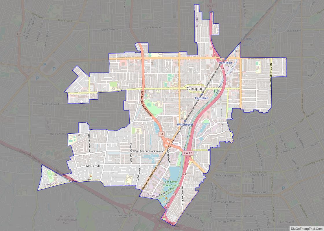
Campbell /ˈkæmbəl/ is a city in Santa Clara County, California, in the San Francisco Bay Area. As of the 2020 U.S. Census, Campbell’s population is 43,959. Campbell is home to the Pruneyard Shopping Center, a sprawling open-air retail complex which was involved in a famous U.S. Supreme Court case that established the extent of the right to free speech in California.
Today, the Pruneyard Shopping Center is home to the South Bay offices of the Federal Bureau of Investigation.
| Name: | Campbell city |
|---|---|
| LSAD Code: | 25 |
| LSAD Description: | city (suffix) |
| State: | California |
| County: | Santa Clara County |
| Incorporated: | March 28, 1952 |
| Elevation: | 200 ft (61 m) |
| Total Area: | 43,959 |
| Land Area: | 6.35 sq mi (16.4 km²) |
| Population Density: | 7,228.91/sq mi (2,791.25/km²) |
| ZIP code: | 95008, 95009, 95011 |
| FIPS code: | 0610345 |
| Website: | www.campbellca.gov |
Online Interactive Map
Click on ![]() to view map in "full screen" mode.
to view map in "full screen" mode.
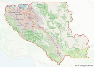
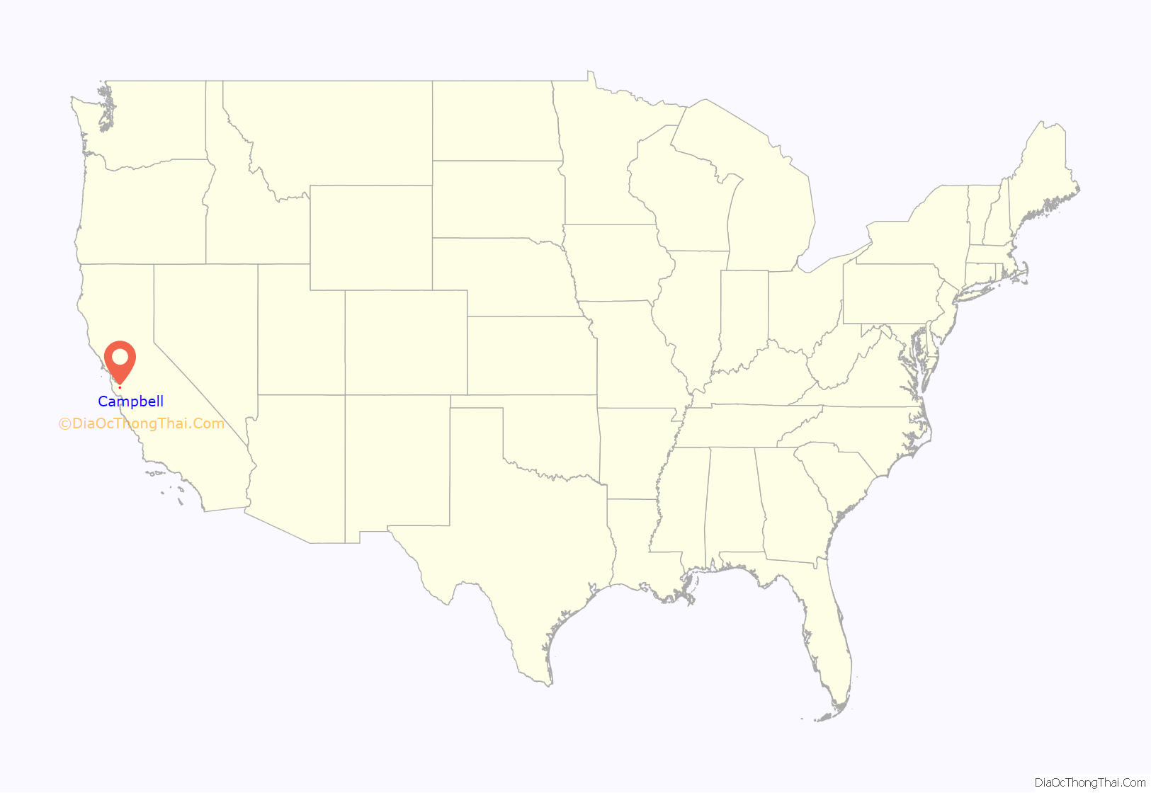
Campbell location map. Where is Campbell city?

History
Prior to the city
Prior to the founding of the neighborhood of Campbell, the land was occupied by the Ohlone, the Native American people of the Northern California coast.
About a third of present-day Campbell was part of the 1839 Alta California Rancho Rinconada de Los Gatos land grant. The northern extent of the grant land was along present-day Rincon Avenue, and across the North end of John D. Morgan Park in central Campbell.
Industrialization
The city was founded by Benjamin Campbell (1826–1907), after whom the city is named. Benjamin came to California in 1846 with his father, William M. Campbell I (1793–1885). William started a sawmill in Saratoga, and surveyed the cities of San Jose and Santa Clara. In 1851, Benjamin bought 160 acres (0.65 km) in southern Santa Clara Valley and cultivated hay and grain on it. This area later became Campbell’s historical downtown core.
In 1878, Campbell sold his land for $5 an acre to a railroad company. By 1887, the first subdivision was recorded west of the railroad, from Campbell Avenue to the spot where the Water Tower Plaza now stands. He and his wife Mary (née Rucker) Campbell (1834–1913) founded the city which was first known as Campbell’s Place, but would later become the town of Campbell.
In 1888, the Campbell School District was formed.
The area became the center for shipping fruit grown in the surrounding area, and within a short time, the drying grounds and canneries made Campbell an important rail center. By 1892, the Campbell Fruit Growers’ Union became a well-known cooperative with its 17-acre (69,000 m) drying yard. J.C. Ainsley Packing Company, Hyde Cannery, and Payne Cannery were the main fruit packing companies.
In 1895, The Bank of Campbell was founded and the first newspaper, the Campbell Weekly Visitor, began publication.
Campbell was incorporated as a city in 1952. The city then grew rapidly as orchard lands disappeared, tract by tract. Today, Campbell is a suburban residential neighborhood in the southern part of the Santa Clara Valley.
Campbell Road Map
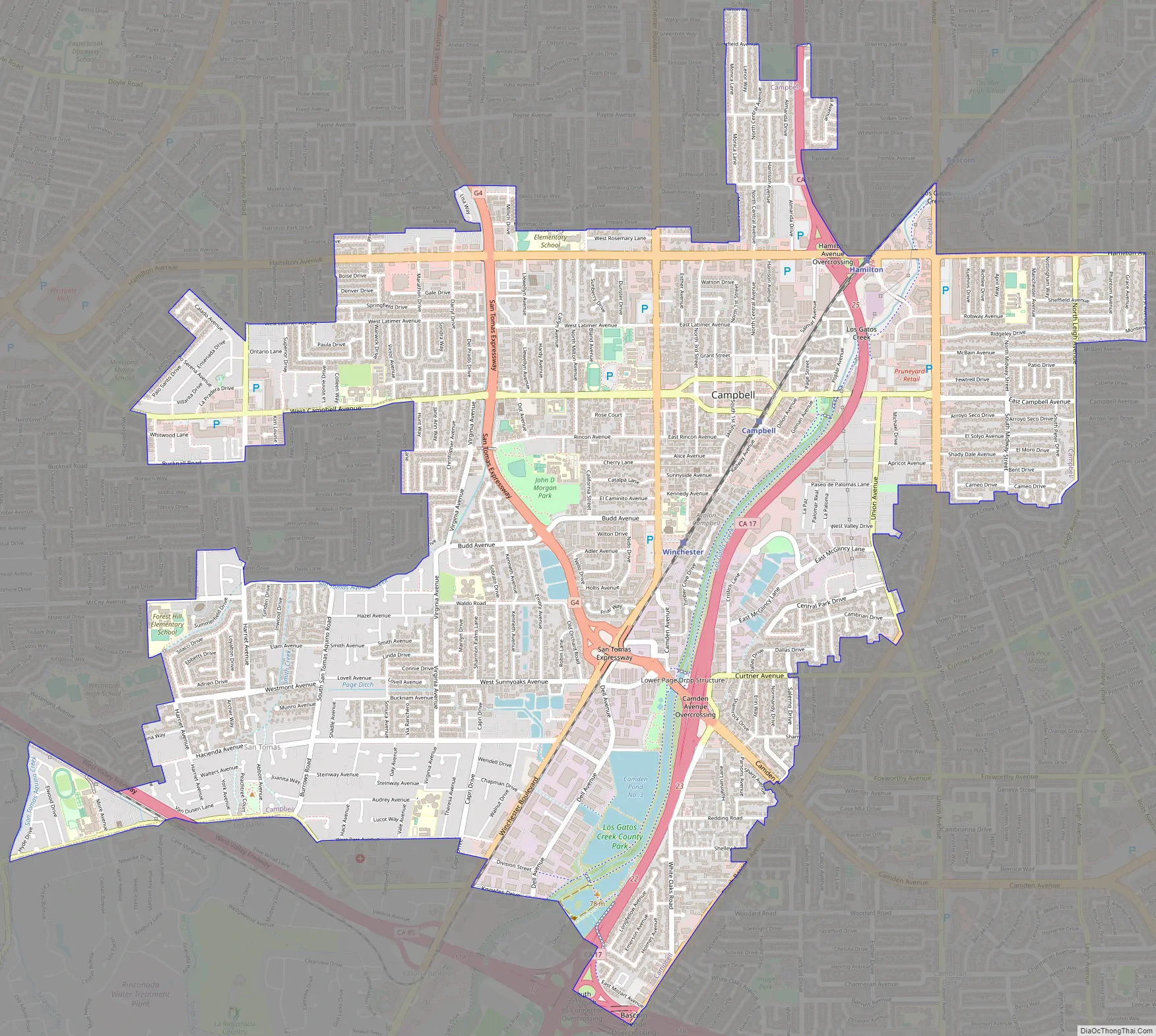
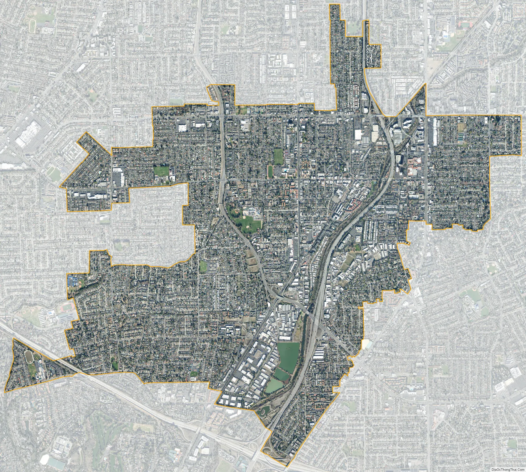
Campbell city Satellite Map
Geography
Campbell is bordered on the east and north by San Jose, on the south by Los Gatos, and on the west by a small portion of Saratoga.
According to the United States Census Bureau, the city has a total area of 5.9 square miles (15 km), of which 5.8 square miles (15 km) is land and 0.1 square miles (0.26 km) is water.
Of the total area, 1.49% is water, consisting of percolation ponds in Los Gatos Creek Park and in other locations; San Tomas Aquino Creek, which flows north on the west side of the city, is completely enclosed with fences and runs through concrete culverts; and Los Gatos Creek, which flows north-north-east on the east side of the city and has paths along both banks for hikers and joggers (locally called the “Perc Ponds”). Residents are able to reach Los Gatos by continuing on the creek trail. Downtown Campbell contains many local stores and shops, and every Sunday the downtown street close from 8am-1pm for a local farmers market.
State Route 17 runs roughly parallel to Los Gatos Creek on its eastern side; State Route 85 runs roughly east–west through Los Gatos just south of Campbell and cuts through the southwest corner of the city.
See also
Map of California State and its subdivision:- Alameda
- Alpine
- Amador
- Butte
- Calaveras
- Colusa
- Contra Costa
- Del Norte
- El Dorado
- Fresno
- Glenn
- Humboldt
- Imperial
- Inyo
- Kern
- Kings
- Lake
- Lassen
- Los Angeles
- Madera
- Marin
- Mariposa
- Mendocino
- Merced
- Modoc
- Mono
- Monterey
- Napa
- Nevada
- Orange
- Placer
- Plumas
- Riverside
- Sacramento
- San Benito
- San Bernardino
- San Diego
- San Francisco
- San Joaquin
- San Luis Obispo
- San Mateo
- Santa Barbara
- Santa Clara
- Santa Cruz
- Shasta
- Sierra
- Siskiyou
- Solano
- Sonoma
- Stanislaus
- Sutter
- Tehama
- Trinity
- Tulare
- Tuolumne
- Ventura
- Yolo
- Yuba
- Alabama
- Alaska
- Arizona
- Arkansas
- California
- Colorado
- Connecticut
- Delaware
- District of Columbia
- Florida
- Georgia
- Hawaii
- Idaho
- Illinois
- Indiana
- Iowa
- Kansas
- Kentucky
- Louisiana
- Maine
- Maryland
- Massachusetts
- Michigan
- Minnesota
- Mississippi
- Missouri
- Montana
- Nebraska
- Nevada
- New Hampshire
- New Jersey
- New Mexico
- New York
- North Carolina
- North Dakota
- Ohio
- Oklahoma
- Oregon
- Pennsylvania
- Rhode Island
- South Carolina
- South Dakota
- Tennessee
- Texas
- Utah
- Vermont
- Virginia
- Washington
- West Virginia
- Wisconsin
- Wyoming