Butte Valley is an unincorporated community and census-designated place (CDP) named for a former settlement in Butte County, California, United States. It is located 5.5 miles (8.9 km) southeast of Chico. A post office operated at Butte Valley from 1861 to 1871, when it was re-located to Durham. Butte Valley sits at an elevation of 351 feet (107 m). The 2010 United States census reported Butte Valley’s population is 899.
| Name: | Butte Valley CDP |
|---|---|
| LSAD Code: | 57 |
| LSAD Description: | CDP (suffix) |
| State: | California |
| County: | Butte County |
| Elevation: | 351 ft (107 m) |
| Total Area: | 18.301 sq mi (49.400 km²) |
| Land Area: | 18.290 sq mi (47.371 km²) |
| Water Area: | 0.011 sq mi (0.029 km²) 0.06% |
| Total Population: | 899 |
| Population Density: | 49/sq mi (18/km²) |
| FIPS code: | 0609324 |
| GNISfeature ID: | 2612475 |
Online Interactive Map
Click on ![]() to view map in "full screen" mode.
to view map in "full screen" mode.
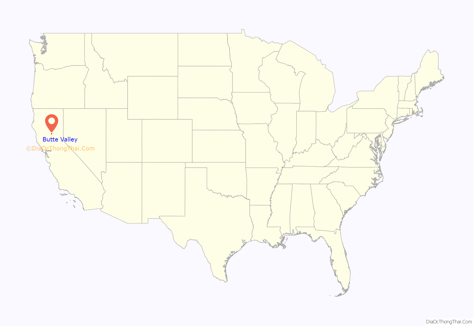
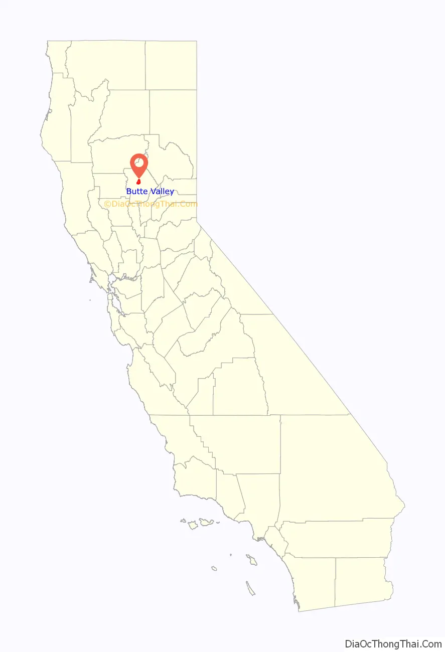
Butte Valley location map. Where is Butte Valley CDP?
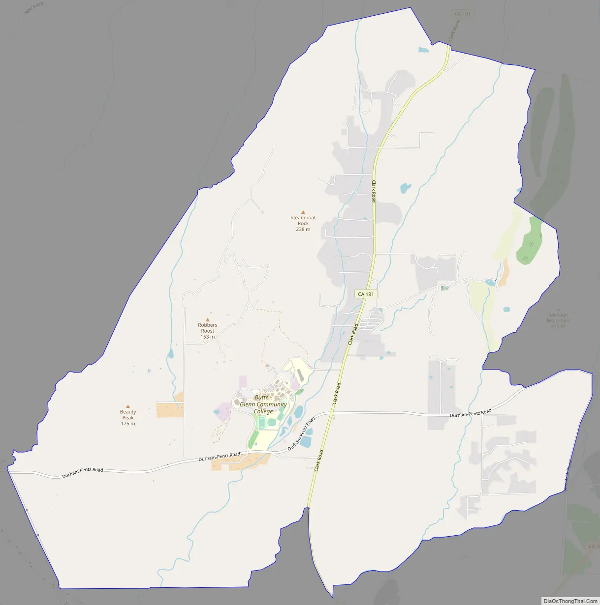
Butte Valley Road Map
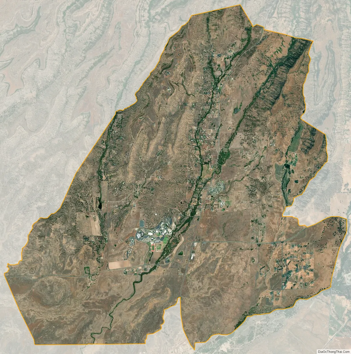
Butte Valley city Satellite Map
See also
Map of California State and its subdivision:- Alameda
- Alpine
- Amador
- Butte
- Calaveras
- Colusa
- Contra Costa
- Del Norte
- El Dorado
- Fresno
- Glenn
- Humboldt
- Imperial
- Inyo
- Kern
- Kings
- Lake
- Lassen
- Los Angeles
- Madera
- Marin
- Mariposa
- Mendocino
- Merced
- Modoc
- Mono
- Monterey
- Napa
- Nevada
- Orange
- Placer
- Plumas
- Riverside
- Sacramento
- San Benito
- San Bernardino
- San Diego
- San Francisco
- San Joaquin
- San Luis Obispo
- San Mateo
- Santa Barbara
- Santa Clara
- Santa Cruz
- Shasta
- Sierra
- Siskiyou
- Solano
- Sonoma
- Stanislaus
- Sutter
- Tehama
- Trinity
- Tulare
- Tuolumne
- Ventura
- Yolo
- Yuba
- Alabama
- Alaska
- Arizona
- Arkansas
- California
- Colorado
- Connecticut
- Delaware
- District of Columbia
- Florida
- Georgia
- Hawaii
- Idaho
- Illinois
- Indiana
- Iowa
- Kansas
- Kentucky
- Louisiana
- Maine
- Maryland
- Massachusetts
- Michigan
- Minnesota
- Mississippi
- Missouri
- Montana
- Nebraska
- Nevada
- New Hampshire
- New Jersey
- New Mexico
- New York
- North Carolina
- North Dakota
- Ohio
- Oklahoma
- Oregon
- Pennsylvania
- Rhode Island
- South Carolina
- South Dakota
- Tennessee
- Texas
- Utah
- Vermont
- Virginia
- Washington
- West Virginia
- Wisconsin
- Wyoming


