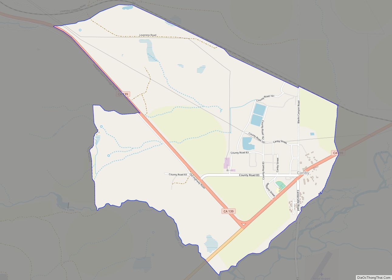
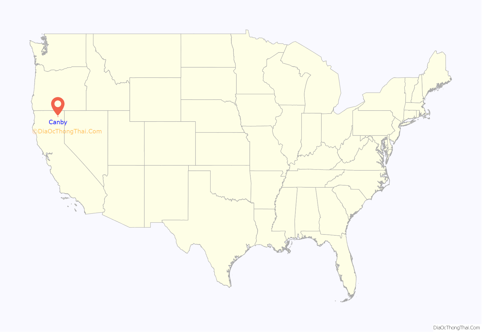
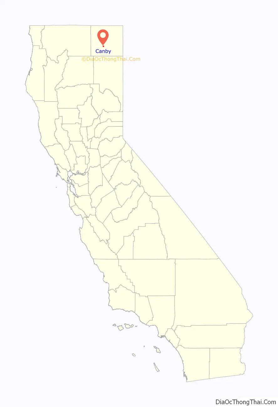
Canby is a census-designated place in Modoc County, California. It is located 17 miles (27 km) west of Alturas, at an elevation of 4314 feet (1315 m). Its population is 183 as of the 2020 census, down from 315 from the 2010 census. The ZIP Code is 96015. The community is inside area code 530.
Canby is the location of the main branch of the I’SOT religious community, and is known for the I’SOT’s nativity scenes prominently displayed along the town’s main street, California State Route 299.
| Name: | Canby CDP |
|---|---|
| LSAD Code: | 57 |
| LSAD Description: | CDP (suffix) |
| State: | California |
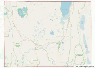
| County: | Modoc County |
| Elevation: | 4,314 ft (1,315 m) |
| Total Area: | 2.32 sq mi (6.01 km²) |
| Land Area: | 2.29 sq mi (5.93 km²) |
| Water Area: | 0.03 sq mi (0.08 km²) 1.79% |
| Total Population: | 183 |
| Population Density: | 79.88/sq mi (30.84/km²) |
| ZIP code: | 96015 |
| Area code: | 530 |
| FIPS code: | 0610732 |
| GNISfeature ID: | 220535; 2582963 |
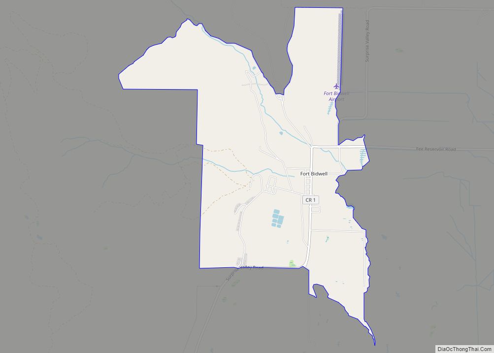
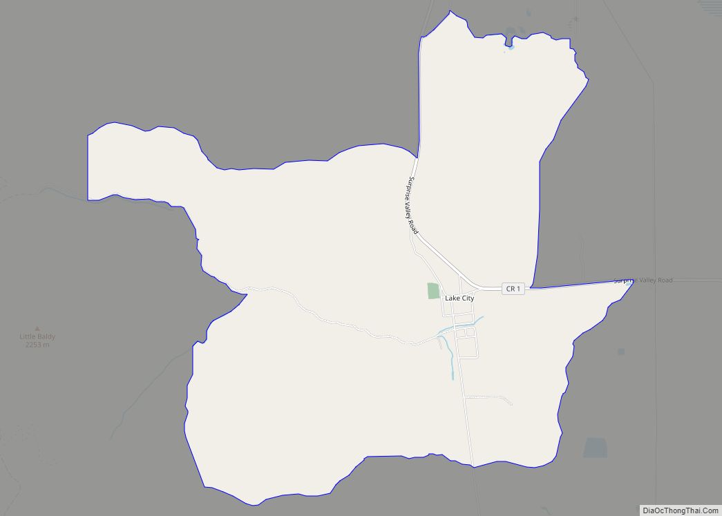
Online Interactive Map
Click on ![]() to view map in "full screen" mode.
to view map in "full screen" mode.
Canby location map. Where is Canby CDP?
History
The first post office opened at Canby in 1874. The town was named in honor of General Edward Canby, who was shot by the Modoc tribal leader Captain Jack at a peacemaking session as part of the Modoc War. This shooting lead to the siege at Captain Jack’s Stronghold.
Until the late 1940s, Canby was the site of Big Lakes Box Company and the supply point for Big Lakes Logging Camp in the Adin Mountains about 10 miles to the southeast, where conditions were primitive.
- California Historical Landmarks:
About 9.3 mi northwest of Canby is a California Historical Landmark number #111 about the Old Emigrant Trail.
California Historical Landmark number 111 reads:
About 5 miles southeast of Canby is California Historical Landmark number 125.
California Historical Landmark number 125 reads:
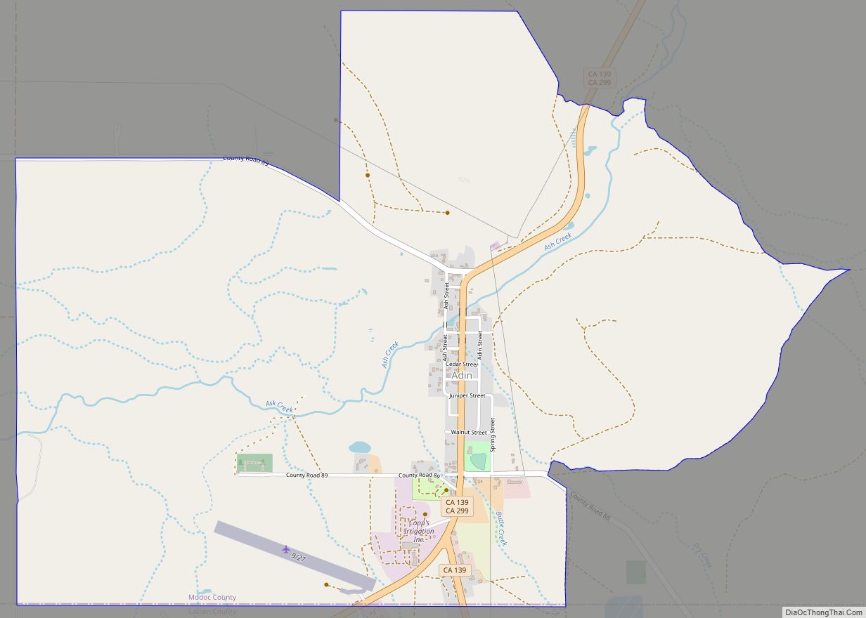
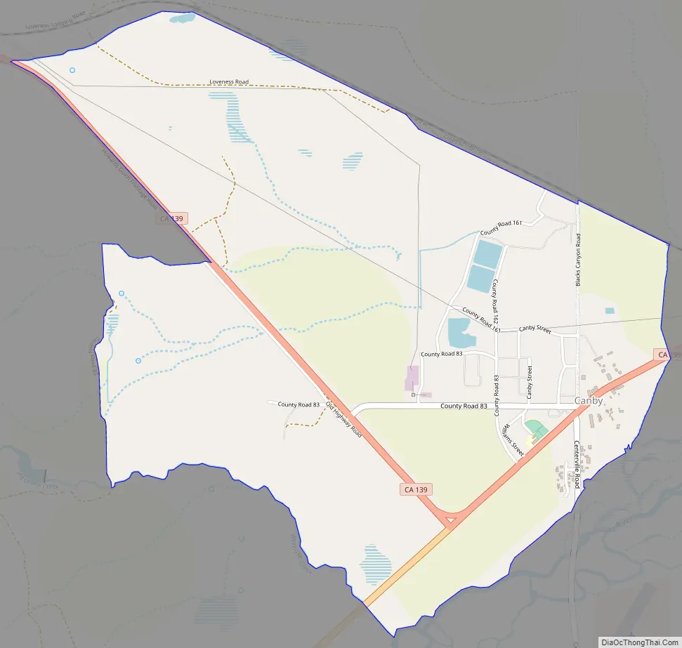
Canby Road Map
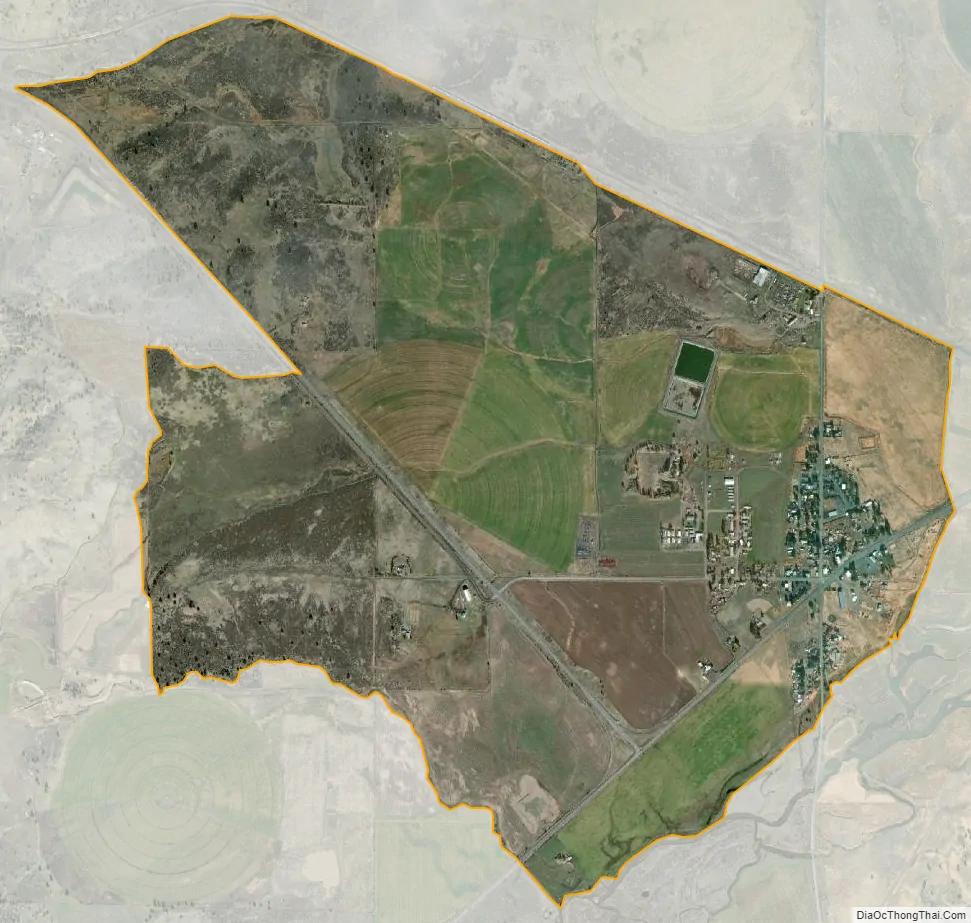
Canby city Satellite Map
Geography
According to the United States Census Bureau, the CDP covers an area of 2.3 square miles (6.0 km), 98.21% of it land, and 1.79% of it water.
Climate
This region experiences hot and dry summers, with no average monthly temperatures above 71.6 °F. According to the Köppen Climate Classification system, Canby has a warm-summer Mediterranean climate, abbreviated “Csb” on climate maps.
See also
Map of California State and its subdivision:- Alameda
- Alpine
- Amador
- Butte
- Calaveras
- Colusa
- Contra Costa
- Del Norte
- El Dorado
- Fresno
- Glenn
- Humboldt
- Imperial
- Inyo
- Kern
- Kings
- Lake
- Lassen
- Los Angeles
- Madera
- Marin
- Mariposa
- Mendocino
- Merced
- Modoc
- Mono
- Monterey
- Napa
- Nevada
- Orange
- Placer
- Plumas
- Riverside
- Sacramento
- San Benito
- San Bernardino
- San Diego
- San Francisco
- San Joaquin
- San Luis Obispo
- San Mateo
- Santa Barbara
- Santa Clara
- Santa Cruz
- Shasta
- Sierra
- Siskiyou
- Solano
- Sonoma
- Stanislaus
- Sutter
- Tehama
- Trinity
- Tulare
- Tuolumne
- Ventura
- Yolo
- Yuba
- Alabama
- Alaska
- Arizona
- Arkansas
- California
- Colorado
- Connecticut
- Delaware
- District of Columbia
- Florida
- Georgia
- Hawaii
- Idaho
- Illinois
- Indiana
- Iowa
- Kansas
- Kentucky
- Louisiana
- Maine
- Maryland
- Massachusetts
- Michigan
- Minnesota
- Mississippi
- Missouri
- Montana
- Nebraska
- Nevada
- New Hampshire
- New Jersey
- New Mexico
- New York
- North Carolina
- North Dakota
- Ohio
- Oklahoma
- Oregon
- Pennsylvania
- Rhode Island
- South Carolina
- South Dakota
- Tennessee
- Texas
- Utah
- Vermont
- Virginia
- Washington
- West Virginia
- Wisconsin
- Wyoming