Chowchilla is a city in Madera County, California, United States. The city’s population was 19,039 at the 2020 census. Chowchilla is located 16 miles (26 km) northwest of Madera, at an elevation of 240 feet (73 m).
The city is the location of two prisons: Central California Women’s Facility and Valley State Prison.
| Name: | Chowchilla city |
|---|---|
| LSAD Code: | 25 |
| LSAD Description: | city (suffix) |
| State: | California |
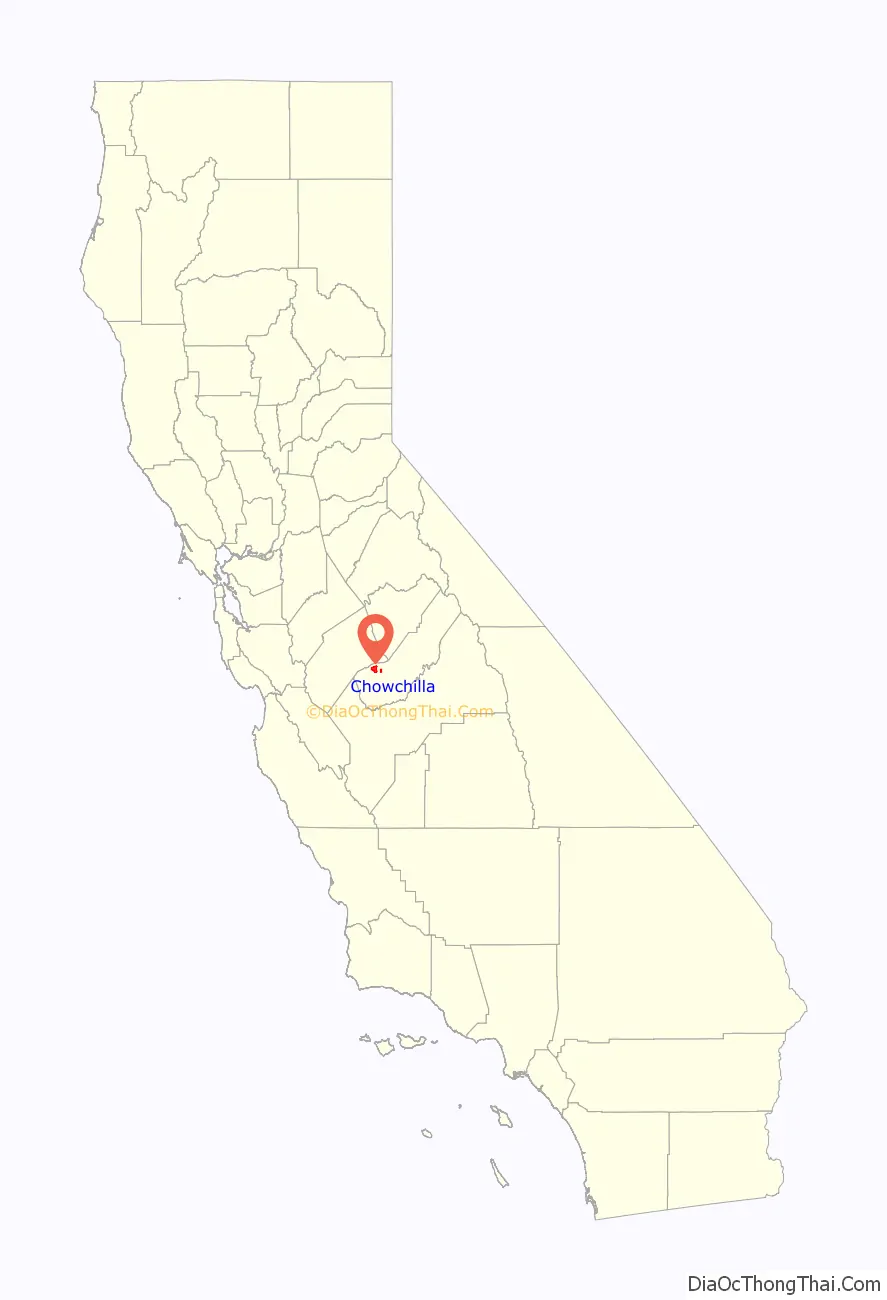
| County: | Madera County |
| Incorporated: | February 7, 1923 |
| Elevation: | 240 ft (73 m) |
| Total Area: | 11.13 sq mi (28.83 km²) |
| Land Area: | 11.09 sq mi (28.71 km²) |
| Water Area: | 0.05 sq mi (0.12 km²) 0% |
| Total Population: | 19,039 |
| Population Density: | 1,717.39/sq mi (663.07/km²) |
| ZIP code: | 93610 |
| Area code: | 559 |
| FIPS code: | 0613294 |
| Website: | www.cityofchowchilla.org |
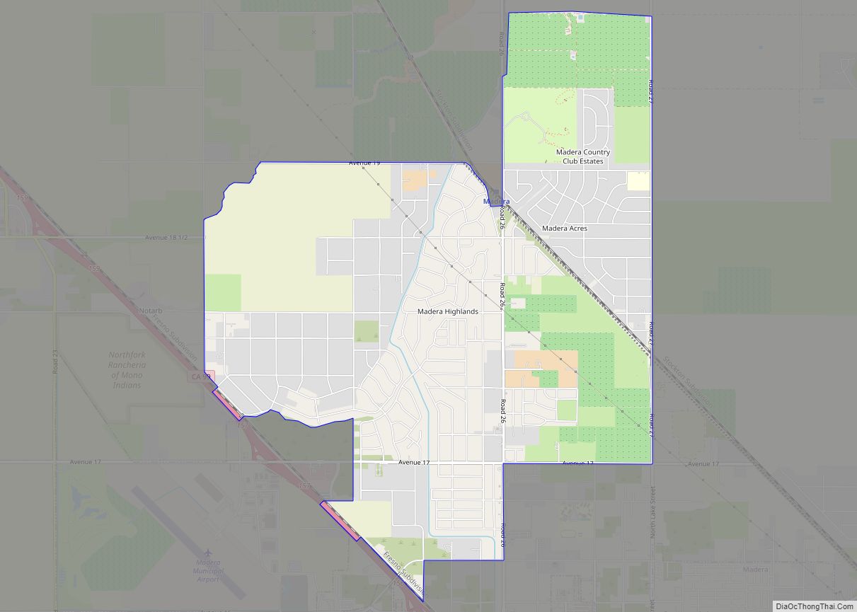
Online Interactive Map
Click on ![]() to view map in "full screen" mode.
to view map in "full screen" mode.
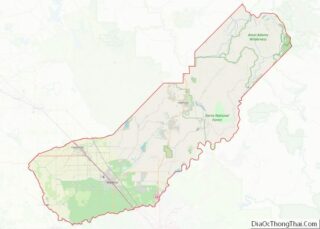
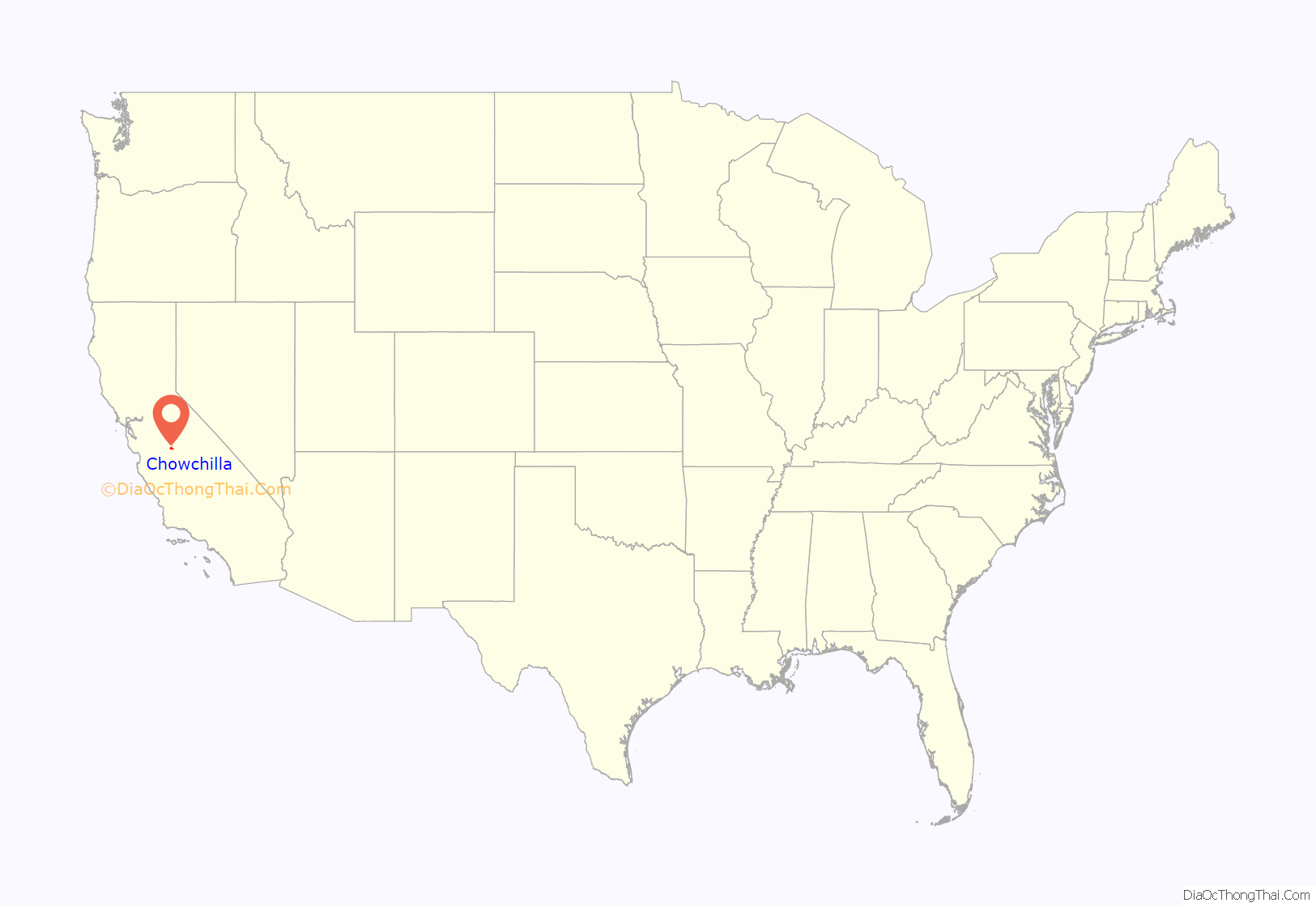
Chowchilla location map. Where is Chowchilla city?
History
The word “Chowchilla” is an anglicized spelling of chaushila, the name of an indigenous Yokuts people whom, historically, inhabited the areas in and around Madera County.
The first post office at Chowchilla opened in 1912 and the city incorporated eleven years later, in 1923.
1976 bus kidnapping
Chowchilla made national news on July 15, 1976, when 26 children and their school bus driver were kidnapped and held in a buried moving van at a quarry in Livermore, California. The driver and some of the children were able to escape and notify the quarry guard. All the victims returned unharmed. The quarry owner’s son and two friends were convicted and sentenced to life in prison.
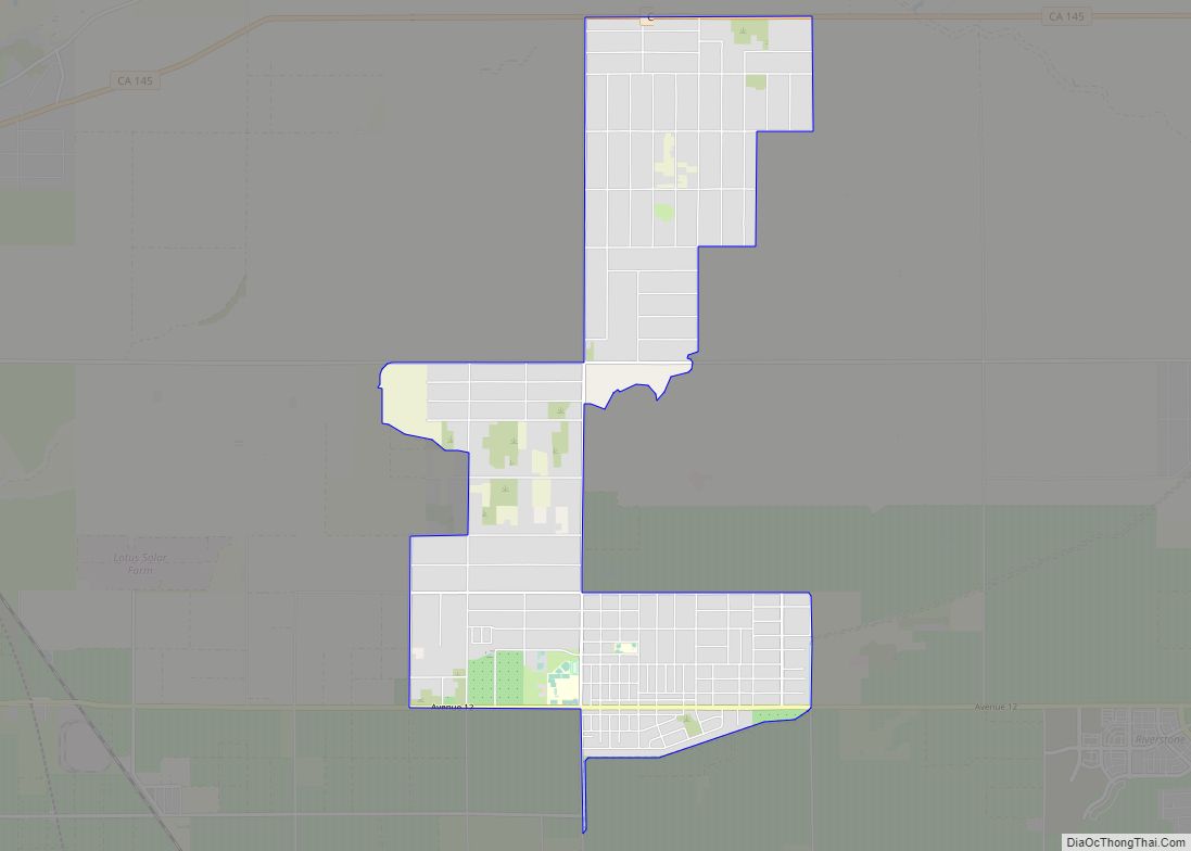
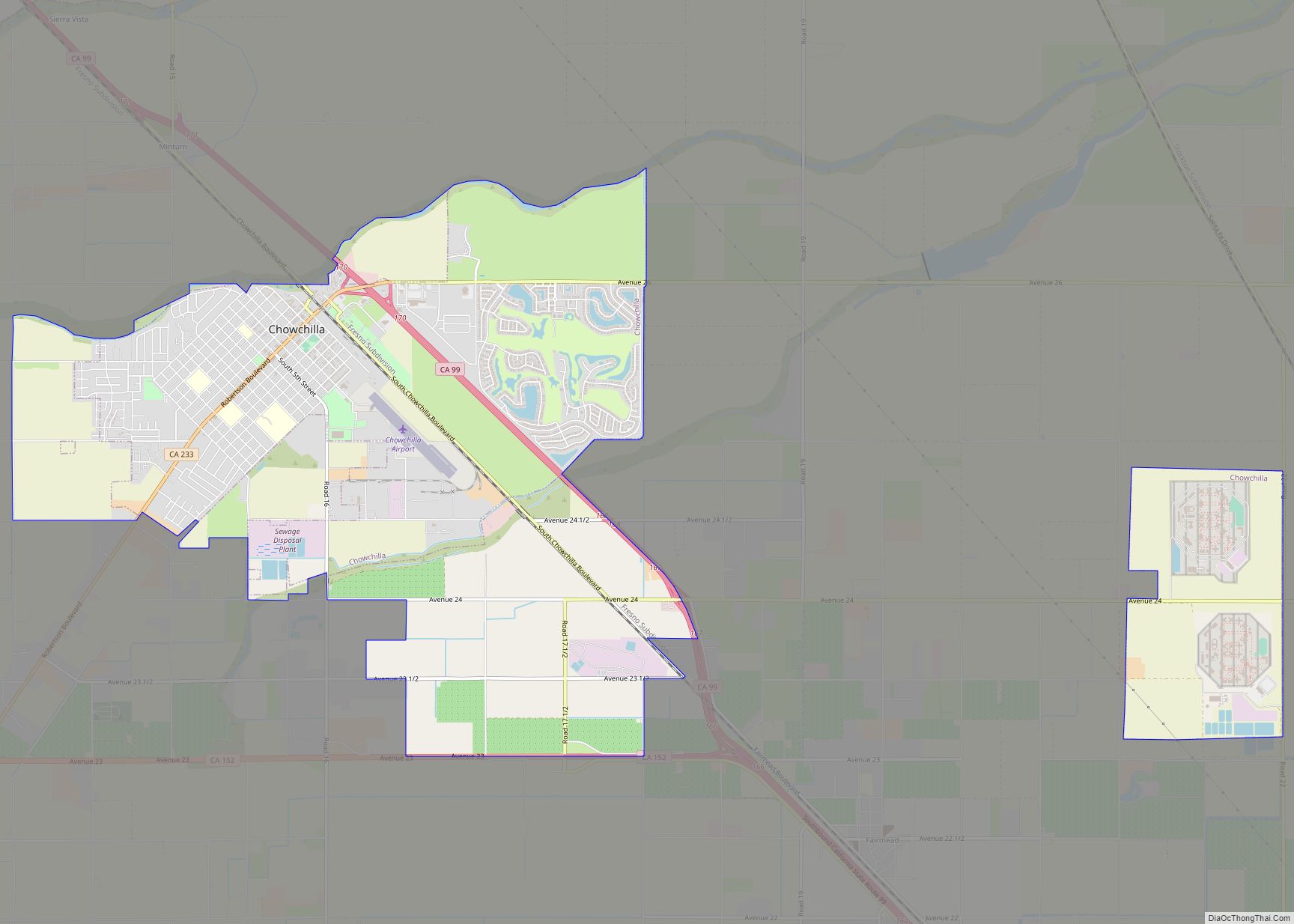
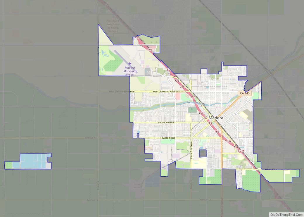
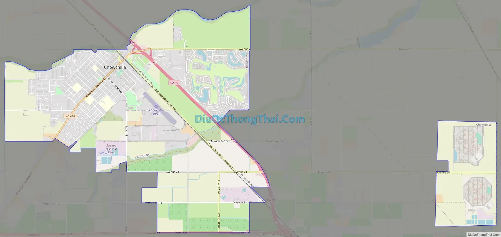
Chowchilla Road Map
Chowchilla city Satellite Map
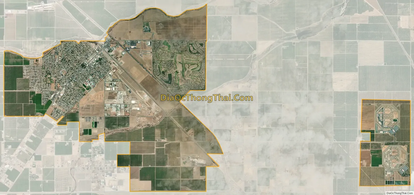
Geography
Chowchilla is located in California’s Central Valley. Via California Route 99, it is 16 miles (26 km) northwest of Madera, the county seat, and 18 miles (29 km) southeast of Merced. It is 39 miles (63 km) northwest of Fresno and 256 miles (412 km) north of Downtown Los Angeles.
According to the United States Census Bureau, the city has a total area of 11.1 square miles (29 km), of which 0.05 square miles (0.13 km), or 0.41%, are water. Ash Slough, a tributary of the Fresno River, runs along the northern edge of the city.
Climate
The climate of Chowchilla is Mediterranean. It receives an average of about 12 inches of precipitation per year. The wettest months are December, January, and February, with January being the wettest. Chowchilla has dry, hot summers, and mild to cool, rainy winters. Chowchilla experiences frequent fog from November to March and overcast days are common, especially in January. In 2005, Chowchilla had 20 consecutive cloudy, rainy days. There are days with moderate to heavy rain during the winter months. In January, the high temperature may drop as low as 45 °F (7 °C). During the summer, when there is usually no rain, the temperature may reach as high or higher than 110 °F (43 °C). Snow in Chowchilla is rare.
See also
Map of California State and its subdivision:- Alameda
- Alpine
- Amador
- Butte
- Calaveras
- Colusa
- Contra Costa
- Del Norte
- El Dorado
- Fresno
- Glenn
- Humboldt
- Imperial
- Inyo
- Kern
- Kings
- Lake
- Lassen
- Los Angeles
- Madera
- Marin
- Mariposa
- Mendocino
- Merced
- Modoc
- Mono
- Monterey
- Napa
- Nevada
- Orange
- Placer
- Plumas
- Riverside
- Sacramento
- San Benito
- San Bernardino
- San Diego
- San Francisco
- San Joaquin
- San Luis Obispo
- San Mateo
- Santa Barbara
- Santa Clara
- Santa Cruz
- Shasta
- Sierra
- Siskiyou
- Solano
- Sonoma
- Stanislaus
- Sutter
- Tehama
- Trinity
- Tulare
- Tuolumne
- Ventura
- Yolo
- Yuba
- Alabama
- Alaska
- Arizona
- Arkansas
- California
- Colorado
- Connecticut
- Delaware
- District of Columbia
- Florida
- Georgia
- Hawaii
- Idaho
- Illinois
- Indiana
- Iowa
- Kansas
- Kentucky
- Louisiana
- Maine
- Maryland
- Massachusetts
- Michigan
- Minnesota
- Mississippi
- Missouri
- Montana
- Nebraska
- Nevada
- New Hampshire
- New Jersey
- New Mexico
- New York
- North Carolina
- North Dakota
- Ohio
- Oklahoma
- Oregon
- Pennsylvania
- Rhode Island
- South Carolina
- South Dakota
- Tennessee
- Texas
- Utah
- Vermont
- Virginia
- Washington
- West Virginia
- Wisconsin
- Wyoming