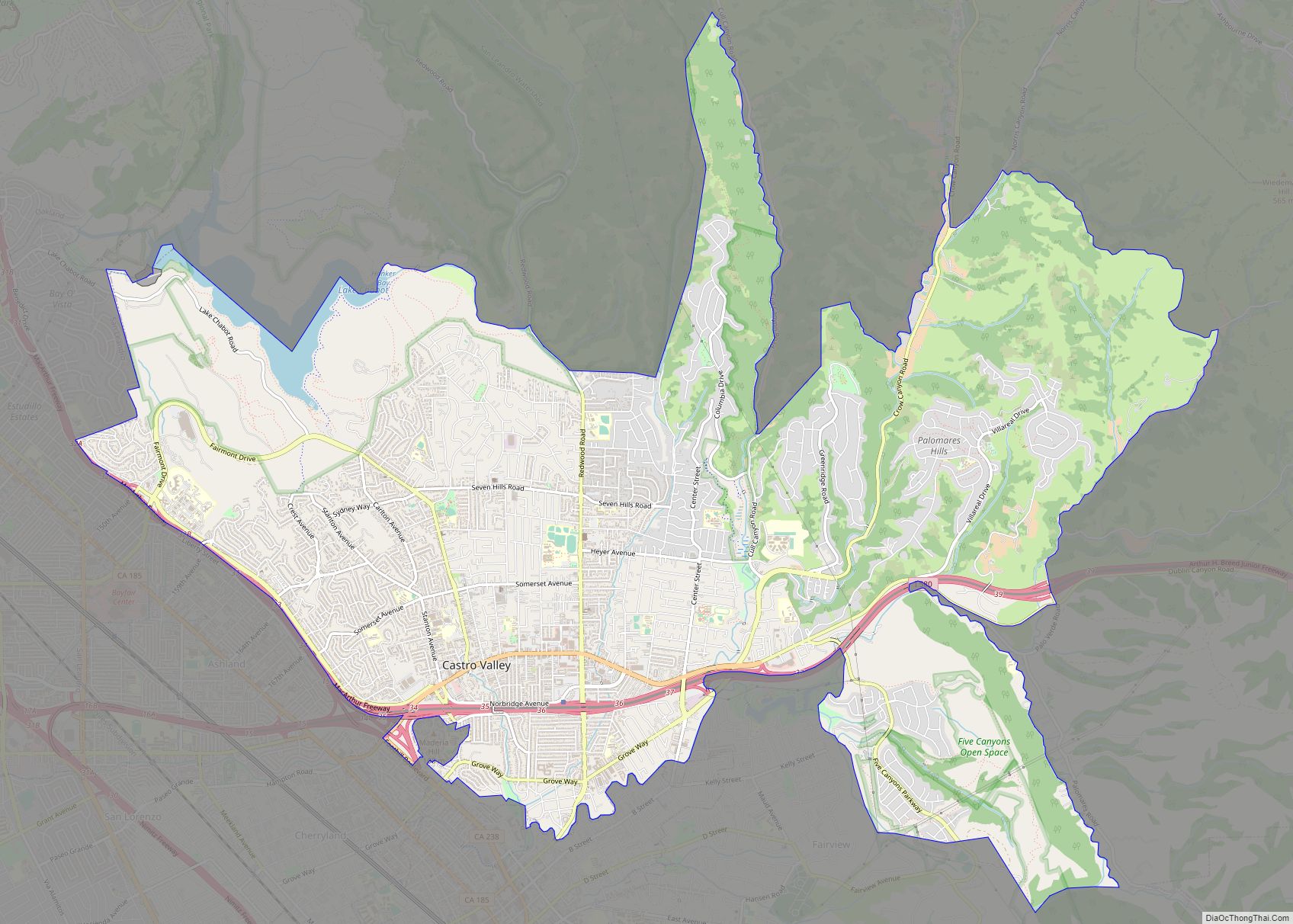
Livermore (formerly Livermorès, Livermore Ranch, and Nottingham) is a city in Alameda County, California. With a 2020 population of 87,955, Livermore is the most populous city in the Tri-Valley, giving its name to the Livermore Valley. It is located on the eastern edge of California’s San Francisco Bay Area. The current mayor is John Marchand.
Livermore was platted and registered on November 4, 1869, as a railroad town by William Mendenhall and named for Robert Livermore, Mendenhall’s friend and a local rancher who settled in the area in the 1840s. It is the home of the Lawrence Livermore National Laboratory, for which the chemical element livermorium is named (and thus, placing the city’s name in the periodic table). It is also the California site of Sandia National Laboratories, which is headquartered in Albuquerque, New Mexico. Its south side is home to local vineyards, and its downtown district is being redeveloped.
The United States Census Bureau defines an urban area of Tri-Valley-area cities, with Livermore as the principal city: the Livermore–Pleasanton–Dublin, CA urban area had a 2020 population of 240,381, making it the 167th largest in the United States.
| Name: | Livermore city |
|---|---|
| LSAD Code: | 25 |
| LSAD Description: | city (suffix) |
| State: | California |
| County: | Alameda County |
| Incorporated: | April 1, 1876 |
| Elevation: | 495 ft (151 m) |
| Land Area: | 26.45 sq mi (68.49 km²) |
| Water Area: | 0.00 sq mi (0.01 km²) 0.010% |
| Population Density: | 3,300/sq mi (1,300/km²) |
| ZIP code: | 94550, 94551 |
| Area code: | 925 |
| FIPS code: | 0641992 |
| Website: | www.cityoflivermore.net |
Online Interactive Map
Click on ![]() to view map in "full screen" mode.
to view map in "full screen" mode.
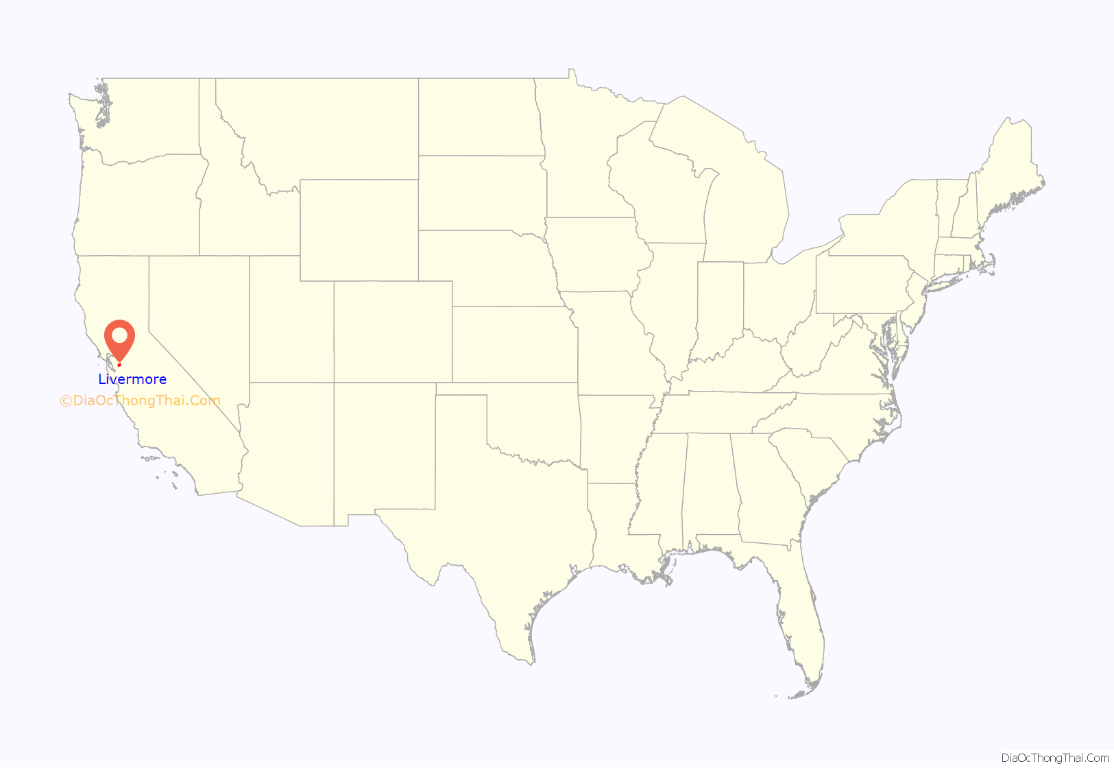
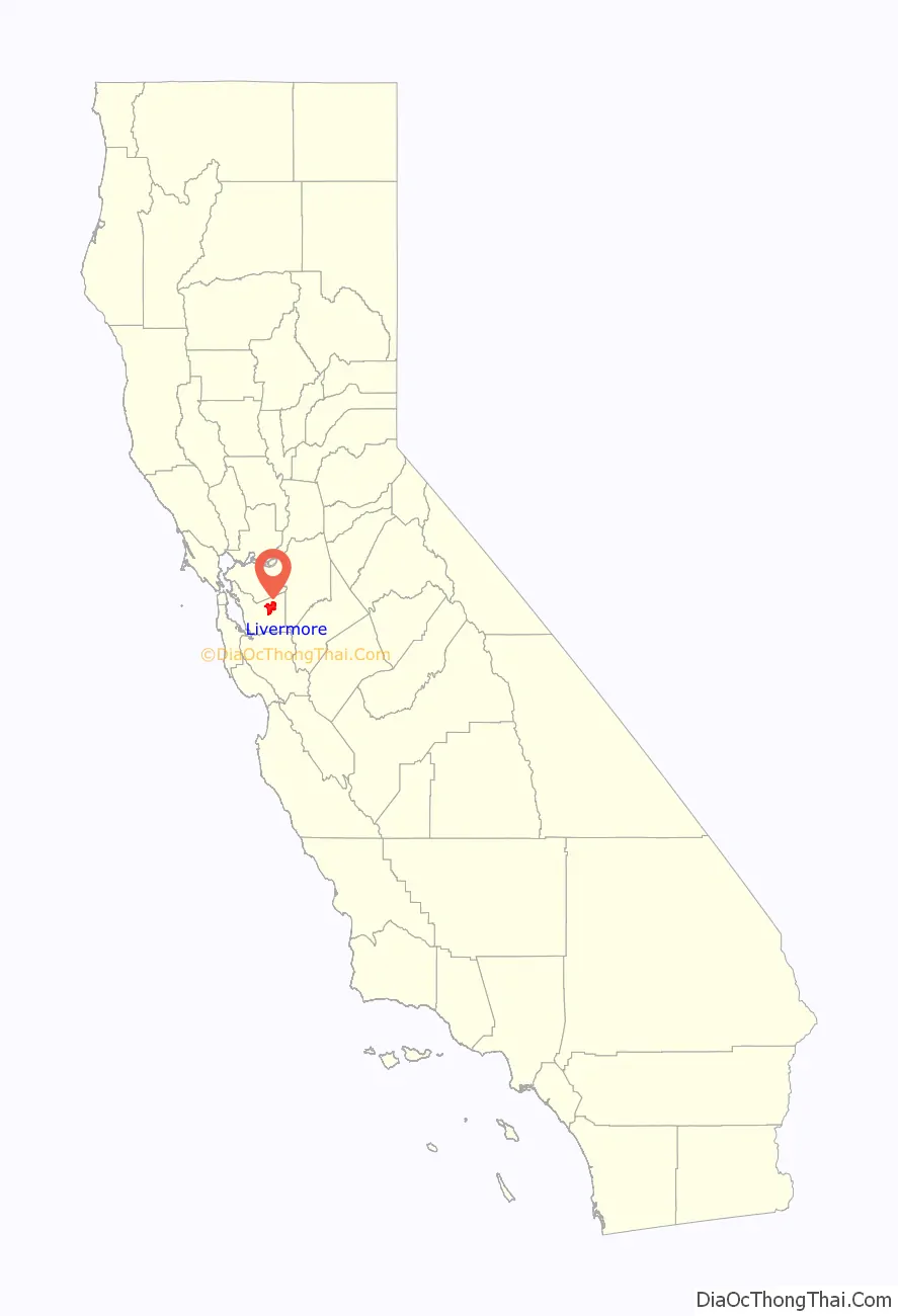
Livermore location map. Where is Livermore city?
History
Pre-Contact
The valley and upland areas, where contemporary Livermore is located, was home to Chochenyo speaking peoples. As a group, these people are considered Ohlone Costonoan with distinct cultural affiliation in contrast to and closely bordering the Bay Miwok to the north and the Valley Yokuts to the east. Four tribelets, the Yulien, Ssaoam, Ssouyn, and the Pelnen occupied the valley floor with territory extending into the hills. Semi-permanent villages were located near water drainages at the valley floor within the current urban limits of Livermore with seasonal camps in the surrounding uplands.
1700s
A Spanish expedition led by Pedro Fages skirted the western edge of Livermore Valley in 1772. Shortly afterwards, the Spanish Mission of San Jose was founded in 1797 on the slopes of what is modern day Fremont. Mission San Jose viewed the people and land stretching to the east as under their control. Livermore Valley was called the Valley of San Jose by the Friars and actively recruited native peoples of the valley into the mission system. In contrast, the valley was also used as a staging area for raids on Mission San Jose by neighboring tribes in this early period and beyond.
1800s
During the first seven years of the 1800s, five hundred and two individuals were baptized at Mission San Jose from the four tribelets in the Livermore Valley. In this time, Spanish military conducted raids throughout the East Bay using the valley as a natural corridor for movement. Deaths from measles outbreaks were recorded in Mission San Jose in 1806 which forced recruiting beyond the Livermore Valley and into the Altamont range. The Livermore-Amador Valley from 1800 to about 1837 was primarily used as grazing land for the Mission San Jose’s growing herds of cattle, sheep and horses. The valley helped San Jose Mission emerge as one of the more wealthy Spanish enclaves. As a result of the secularization of the mission system, in 1839, two large ranchos were created that encompassed the Livermore Valley; Rancho Las Positas and Rancho Valle de San Jose. Many Native groups left the San Jose Mission during this period and reestablished themselves in communities in the East Bay, including the Livermore Valley.
The 48,000-acre (19,000 ha) Rancho Las Positas grant, which includes most of Livermore, was made to ranchers Robert Livermore and Jose Noriega in 1839. Most land grants were given with little or no cost to the recipients. Robert Livermore (1799-1858) was a British citizen who had jumped from a British merchant sailing ship stopping in Monterey, California, in 1822. He became a naturalized Mexican citizen who had converted to Catholicism in 1823 as was required for citizenship and legal residence. After working for a number of years as a majordomo (ranch foreman), Livermore married on 5 May 1838 the widow Maria Josefa de Jesus Higuera (1815–1879), daughter of Jose Loreto Higuera, grantee of Rancho Los Tularcitos, at the Mission San José. Livermore, after he got his rancho in 1839, was as interested in viticulture and horticulture as he was in cattle and horses, despite the fact that about the only source of income was the sale of cow hides and tallow. In the early 1840s he moved his family to the Livermore valley to his new rancho as the second non-Indian family to settle in the Livermore valley area, and after building a home he was the first in the area in 1846 to direct the planting of vineyards and orchards of pears and olives. Typical of most early rancho dwellings, the first building on his ranch was an adobe on Las Positas Creek near the western end of today’s Las Positas Road. After the Americans took control of California in 1847 and gold was discovered in 1848, he started making money by selling California longhorn cattle to the thousands of hungry California Gold Rush miners who soon arrived. The non-Indian population skyrocketed, and cattle were suddenly worth much more than the $1.00-$3.00 their hides could bring. With his new wealth and with goods flooding into newly rich California, in 1849 Livermore bought a two-story “Around the Horn” disassembled house that had been shipped about 18,000 miles (29,000 km) on a sailing ship around Cape Horn from the East Coast. It is believed to be the first wooden building in the Livermore Tri-Valley.
During the Gold Rush, Livermore’s ranch became a popular “first day” stopping point for prospectors and businessmen leaving San Francisco or San Jose and headed for Sacramento and the Mother Lode gold country. Most horse traffic went by way of Altamont Pass just east of Livermore. Robert Livermore was a very accommodating host and welcomed nearly all that stopped by with lodging and meals.
Robert Livermore died in 1858 and was buried at Mission San Jose before the establishment of the town that bears his name. His ranch included much of the present-day city.
Robert Livermore was one of the first to settle the Livermore Valley, but he wasn’t the only one. The first significant settlement in the valley was Laddsville, a small settlement of about 75 that had grown up around the hotel established by Alponso Ladd in 1864 on what is now Junction Avenue. William Mendenhall was another rancher who had set up in the Livermore valley. In 1869, he legally set aside 100 acres of his land for a townsite, creating a new town which he named Livermore, after his friend Robert Livermore. He had first met Livermore while marching through the valley with John C. Fremont’s California Battalion in 1846 as they were recruited to occupy the surrendering Californio towns captured by the U.S. Navy’s Pacific Squadron. He also donated 20 acres of this land to the Western Pacific Railroad, which in September 1869 built rail nearby, placing a stop and a station on the land William Mendenhall had donated. The railroad passing through Livermore went from Alameda Terminal to Sacramento over the nearby Altamont Pass in the east and Niles Canyon on the west. The railroad greatly accelerated Livermore’s growth, and the town was officially incorporated by the state as a city on April 1, 1876.
By 1870 the Western Pacific had been absorbed by the Central Pacific Railroad as part of the First transcontinental railroad. Central Pacific was later acquired by the Southern Pacific Railroad and then the Union Pacific Railroad, which owns the tracks through town today, although these are primarily the tracks of the “second” Western Pacific Railroad that was founded in 1903 and absorbed into the UP in 1983.
The Livermore Ranch post office, in Robert Livermore’s home, operated from 1851 to 1853. The official U.S. post office in Livermore opened on Jan. 15, 1869. It was called Nottingham in the mistaken belief that Robert Livermore had been born in Nottingham, England. (He was actually born in Springfield, Essex, England.) The post office’s name was changed to Livermore on July 7, 1870.
Private grade schools were operating in Livermore from the 1860s on. The Livermore Collegiate Institute was founded in 1870, and Union High School (later called Livermore High School) graduated its first class of students in 1896. Petroleum was discovered near Livermore and become a valuable asset. Extensive coal deposits were mined near Corral Hollow by the Livermore Coal Company. In September 1871 Laddsville mostly burned down, and the people rebuilt their homes and businesses nearer the railroad in what is now downtown Livermore. Until 1875 the townspeople enjoyed bull fights in a small bullring on many Sundays, and on other occasions a captured grizzly bear might be pitted against a longhorn bull. Apparently, roping a grizzly was thought then to be a great sport. By 1876 the town had grown and a fire company, churches, a bank, and a library were built. Livermore was officially incorporated by the state as a city on April 1, 1876, its original city limits being the line a block north of 1st Street on the north and Livermore Avenue (then Lizzie Street) on the east. The part of the west side north of 5th Street was bounded by Q Street, and the part of it south of 5th Street by I Street. The part of the south side east of I Street was bounded by 6th Street, and the part of it west of I Street by 5th Street.
During Livermore’s early years, it was well known for large hotels that graced the downtown street corners, before new buildings replaced them. Livermore after the 1880s is also notable for the Wente Vineyards, Concannon Vineyard, Cresta Blanca Winery and many other wineries. Since it has a Mediterranean climate, gravelly soil, warm days and cool nights, it was a good location to grow wine grapes. By 1880 the extensive winter wheat and hay crop lands were being replaced by vineyards. Extensive chromite deposits were found and exploited for a time. In 1885, the Remillard Brick Company was producing an extensive line of bricks and employing over 100 men. A telephone line connected Livermore to Arroyo Valley by 1886, and electric lights were introduced by 1889. By 1890 Livermore had over 20 miles (32 km) of streets. Livermore originally had a Boot Hill called the Old Knoll Cemetery.
1900s
During the late 19th century and early 20th century, the Livermore Valley attracted the creation of sanitariums due to the warm climate. From 1894 to 1960, the Livermore Sanitarium was in operation for the treatment of alcoholism and mental disorders; and from 1918 to around 1960, the Arroyo del Valle Sanitarium was in operation in the town for the treatment of tuberculosis.
In 1909, the Livermore Carnegie Library and Park opened after taking advantage of a Carnegie library grant. As the city grew and larger libraries were needed, other libraries were built, and the original site was converted into a historic center and park.
In 1942, the U.S. government bought 692 acres (280 ha) of ranch land, bounded by Vasco and Greenville roads and East Avenue, and built the Livermore Naval Air Station. The primary mission of the base was to train Navy pilots. This facility operated until it was decommissioned in 1946 after the end of World War II. On 5 January 1951, the Bureau of Yards and Docks, U.S. Navy, formally transferred the former NAS Livermore in its entirety to the Atomic Energy Commission (AEC) for use by the University of California’s Radiation Laboratory. In 1952, the government established Lawrence Livermore National Laboratory (LLNL), named after physicist Ernest O. Lawrence, as the site of a second laboratory for the study of nuclear energy like the research being done at the Los Alamos National Laboratory. The laboratory was run by the University of California. Edward Teller was a co-founder of LLNL and was both its director and associate director for many years. In 1956, the California campus of Sandia National Laboratories opened across East Avenue from LLNL. Both LLNL and Sandia are technically on U.S. government property just outside the city’s jurisdiction limits, but with employment at LLNL at about 6,800 and Sandia/California at about 1,150 they are Livermore’s largest employers.
Livermore Road Map
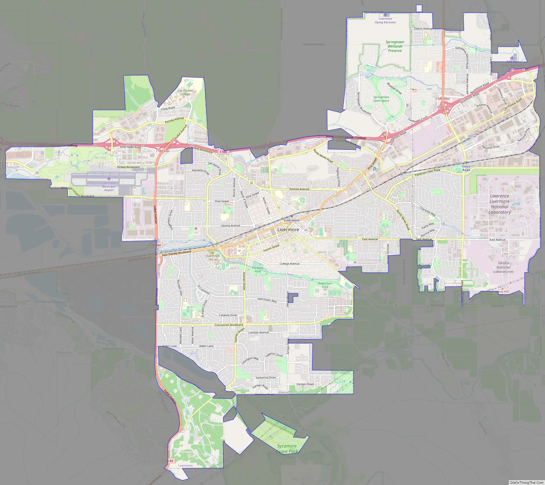
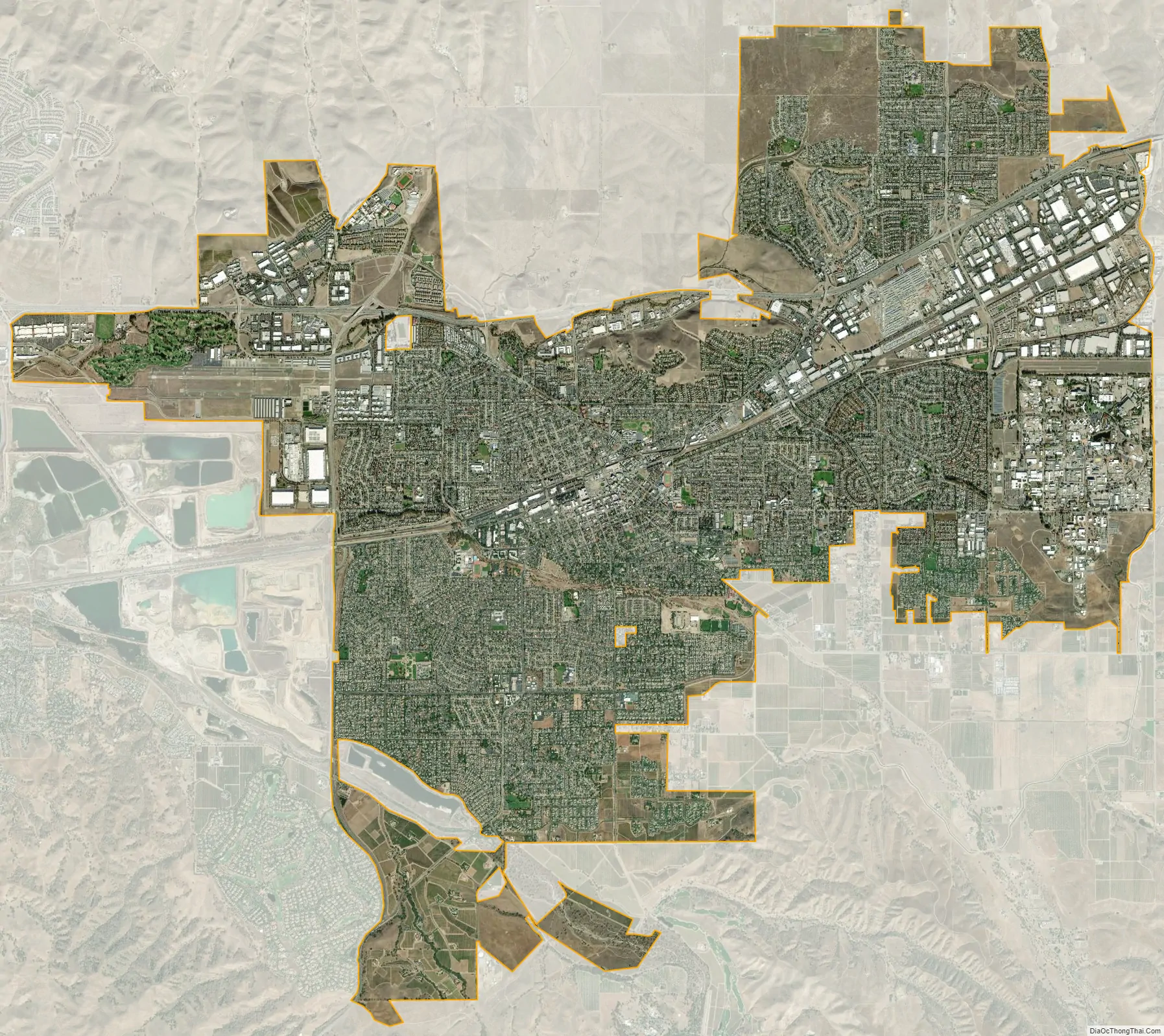
Livermore city Satellite Map
Geography
The Livermore Valley is located 10 miles (16 km) east of the first coastal range of foothills that surround the San Francisco Bay Area. The Livermore Valley has an east–west orientation with mountain passes on the west and east connecting the Bay Area and the Central Valley. The passes are used by railroads and highways to connect the two regions. Livermore Valley is about 15 miles (24 km) long (east to west), 10 miles (16 km) wide (north to south), and surrounded by California coastal range mountains and foothills.
Watercourses draining the city of Livermore include Arroyo Mocho, Arroyo Valle, Arroyo Seco and Arroyo Las Positas. The principal aquifer underlying the city is the Mocho Subbasin. According to the United States Census Bureau, the city has a total area of 25.2 square miles (65 km), over 99% of it land. Several local seismic areas of activity lie near the city, including the Greenville Fault, Tesla Fault and the Livermore Fault.
The soil is primarily gravel with excellent drainage. The gravel is used in several gravel extraction sites outside the city. The gravelly soil and Mediterranean climate increases the flavor concentration in the grapes planted in the soil.
Climate
Livermore has a Mediterranean climate, although it is close to a semi-arid climate because of its relatively low annual precipitation being in a rain shadow of the East Bay hills. Livermore features hot, dry summers and mild to cool winters with occasional rainfall (Köppen climate classification Csa). The valley’s passes direct the normal west to east flow of air through the valley. Usually there is a strong evening wind in the summer that brings cool air off the Pacific Ocean into the Livermore valley as it heads towards the much hotter Central Valley. This wind is strong enough with an average summer wind speed of about 9 miles per hour (14 km/h) and predictable enough to encourage the use of the wind turbines in the Altamont Pass between the cities of Livermore and Tracy. The period from June to September is extremely dry and is characterized by clear skies. On rare occasion, subtropical moisture occasionally surges into the Livermore Valley in the late summer. This can bring high humidity, monsoon clouds, and, much less commonly, thunderstorms.
Snow is very rare, but light dustings do occur on the surrounding hills and occasionally in the valley.
See also
Map of California State and its subdivision:- Alameda
- Alpine
- Amador
- Butte
- Calaveras
- Colusa
- Contra Costa
- Del Norte
- El Dorado
- Fresno
- Glenn
- Humboldt
- Imperial
- Inyo
- Kern
- Kings
- Lake
- Lassen
- Los Angeles
- Madera
- Marin
- Mariposa
- Mendocino
- Merced
- Modoc
- Mono
- Monterey
- Napa
- Nevada
- Orange
- Placer
- Plumas
- Riverside
- Sacramento
- San Benito
- San Bernardino
- San Diego
- San Francisco
- San Joaquin
- San Luis Obispo
- San Mateo
- Santa Barbara
- Santa Clara
- Santa Cruz
- Shasta
- Sierra
- Siskiyou
- Solano
- Sonoma
- Stanislaus
- Sutter
- Tehama
- Trinity
- Tulare
- Tuolumne
- Ventura
- Yolo
- Yuba
- Alabama
- Alaska
- Arizona
- Arkansas
- California
- Colorado
- Connecticut
- Delaware
- District of Columbia
- Florida
- Georgia
- Hawaii
- Idaho
- Illinois
- Indiana
- Iowa
- Kansas
- Kentucky
- Louisiana
- Maine
- Maryland
- Massachusetts
- Michigan
- Minnesota
- Mississippi
- Missouri
- Montana
- Nebraska
- Nevada
- New Hampshire
- New Jersey
- New Mexico
- New York
- North Carolina
- North Dakota
- Ohio
- Oklahoma
- Oregon
- Pennsylvania
- Rhode Island
- South Carolina
- South Dakota
- Tennessee
- Texas
- Utah
- Vermont
- Virginia
- Washington
- West Virginia
- Wisconsin
- Wyoming