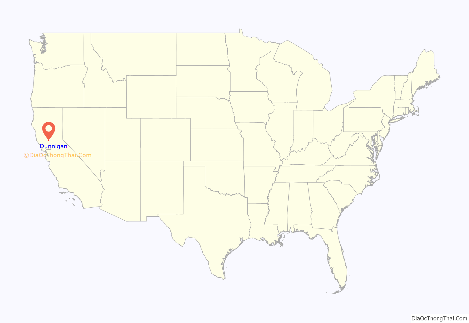
Dunnigan (formerly, Antelope) is a census-designated place in Yolo County, California on Interstate 5. The population was 1,416 at the 2010 census. Dunnigan’s ZIP code is 95937 and its area code 530. It lies at an elevation of 69 feet (21 m).
| Name: | Dunnigan CDP |
|---|---|
| LSAD Code: | 57 |
| LSAD Description: | CDP (suffix) |
| State: | California |
| County: | Yolo County |
| Elevation: | 69 ft (21 m) |
| Total Area: | 5.23 sq mi (13.55 km²) |
| Land Area: | 5.23 sq mi (13.55 km²) |
| Water Area: | 0.00 sq mi (0.00 km²) 0% |
| Total Population: | 1,382 |
| Population Density: | 264.14/sq mi (101.98/km²) |
| ZIP code: | 95937 |
| Area code: | 530 |
| FIPS code: | 0620228 |
Online Interactive Map
Click on ![]() to view map in "full screen" mode.
to view map in "full screen" mode.
Dunnigan location map. Where is Dunnigan CDP?
History
The town of Dunnigan was founded as Antelope by two early settlers, J. S. Copp and Jolin Wilson. During the year 1853 they were living down nearer the Sacramento River, but the winter flood washed them on to higher ground and they settled on new claims here. Next year, A. W. Dunnigan, a Yolo County postal worker, came and gave name to the place. With him were Henry Yarick and Abial Barker, the former going into the hotel business with Dunnigan, the inn being known as “Dunnigan’s.” Other neighbors were Irving W. and William Brownell, Isaac Rice, D. T. Bird, Harry Porterfield and M. A. Rahm. The first store was opened in 1866 by G. B. Lewis, who sold out to William Earll. Z. J. Brown was the proprietor of a drug and notion store for several years, after which he was succeeded by G. W. Gray. In 1876 the railroad came along, and the town plat of Dunnigan was filed for record at the county seat November 1 of that year.
A post office opened in 1856, the name was changed from Antelope to Dunnigan in 1876.
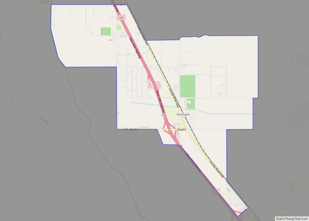
Dunnigan Road Map
Dunnigan city Satellite Map
Geography
Dunnigan is located 11 miles (18 km) from Arbuckle and nearly 40 miles (64 km) from Vacaville and Sacramento.
According to the United States Census Bureau, the community is approximately 5.2 sq mi (13.2 km); all land.
Climate
According to the Köppen Climate Classification system, Dunnigan has a hot-summer Mediterranean climate, abbreviated “Csa” on climate maps.
See also
Map of California State and its subdivision:- Alameda
- Alpine
- Amador
- Butte
- Calaveras
- Colusa
- Contra Costa
- Del Norte
- El Dorado
- Fresno
- Glenn
- Humboldt
- Imperial
- Inyo
- Kern
- Kings
- Lake
- Lassen
- Los Angeles
- Madera
- Marin
- Mariposa
- Mendocino
- Merced
- Modoc
- Mono
- Monterey
- Napa
- Nevada
- Orange
- Placer
- Plumas
- Riverside
- Sacramento
- San Benito
- San Bernardino
- San Diego
- San Francisco
- San Joaquin
- San Luis Obispo
- San Mateo
- Santa Barbara
- Santa Clara
- Santa Cruz
- Shasta
- Sierra
- Siskiyou
- Solano
- Sonoma
- Stanislaus
- Sutter
- Tehama
- Trinity
- Tulare
- Tuolumne
- Ventura
- Yolo
- Yuba
- Alabama
- Alaska
- Arizona
- Arkansas
- California
- Colorado
- Connecticut
- Delaware
- District of Columbia
- Florida
- Georgia
- Hawaii
- Idaho
- Illinois
- Indiana
- Iowa
- Kansas
- Kentucky
- Louisiana
- Maine
- Maryland
- Massachusetts
- Michigan
- Minnesota
- Mississippi
- Missouri
- Montana
- Nebraska
- Nevada
- New Hampshire
- New Jersey
- New Mexico
- New York
- North Carolina
- North Dakota
- Ohio
- Oklahoma
- Oregon
- Pennsylvania
- Rhode Island
- South Carolina
- South Dakota
- Tennessee
- Texas
- Utah
- Vermont
- Virginia
- Washington
- West Virginia
- Wisconsin
- Wyoming
