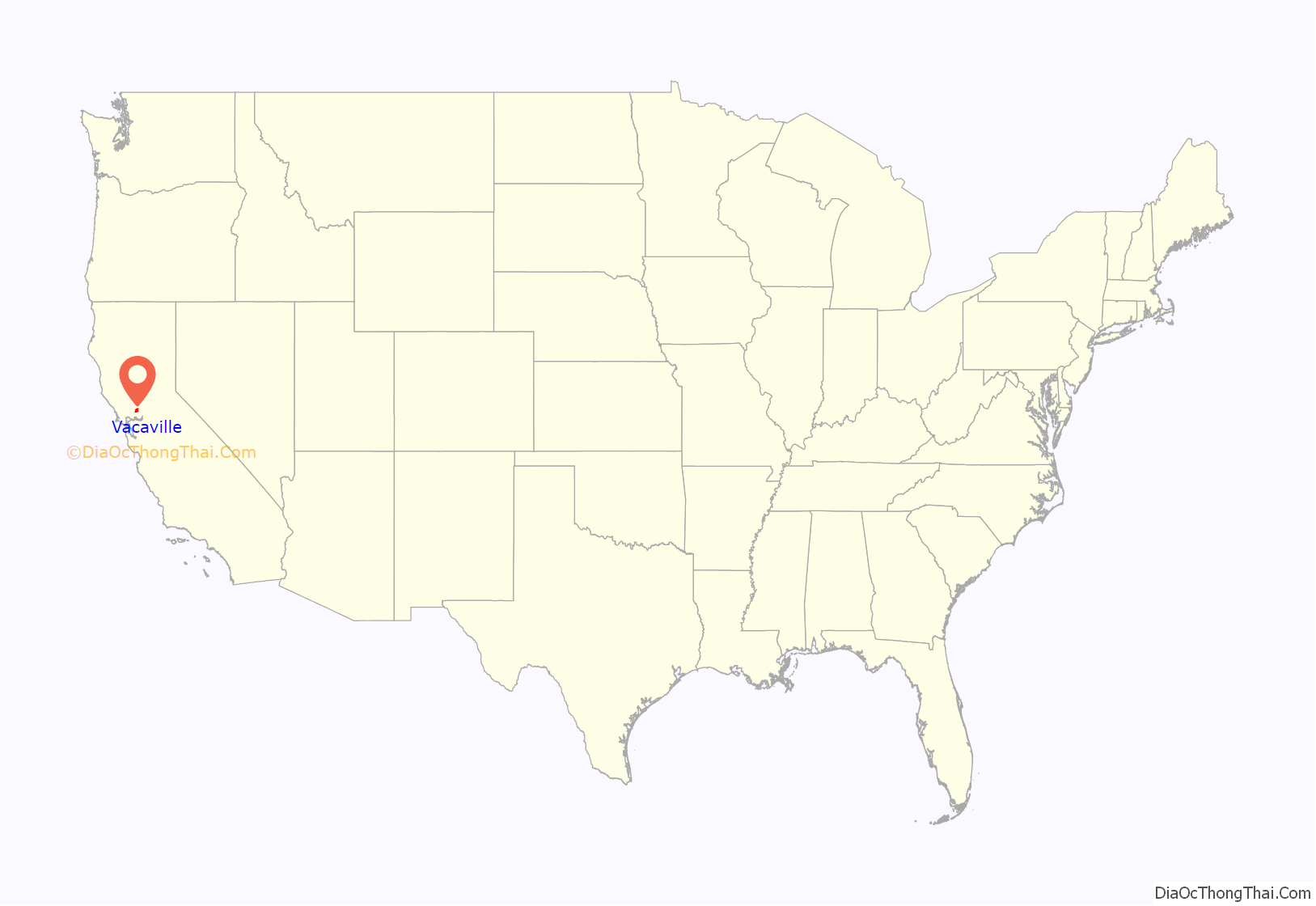
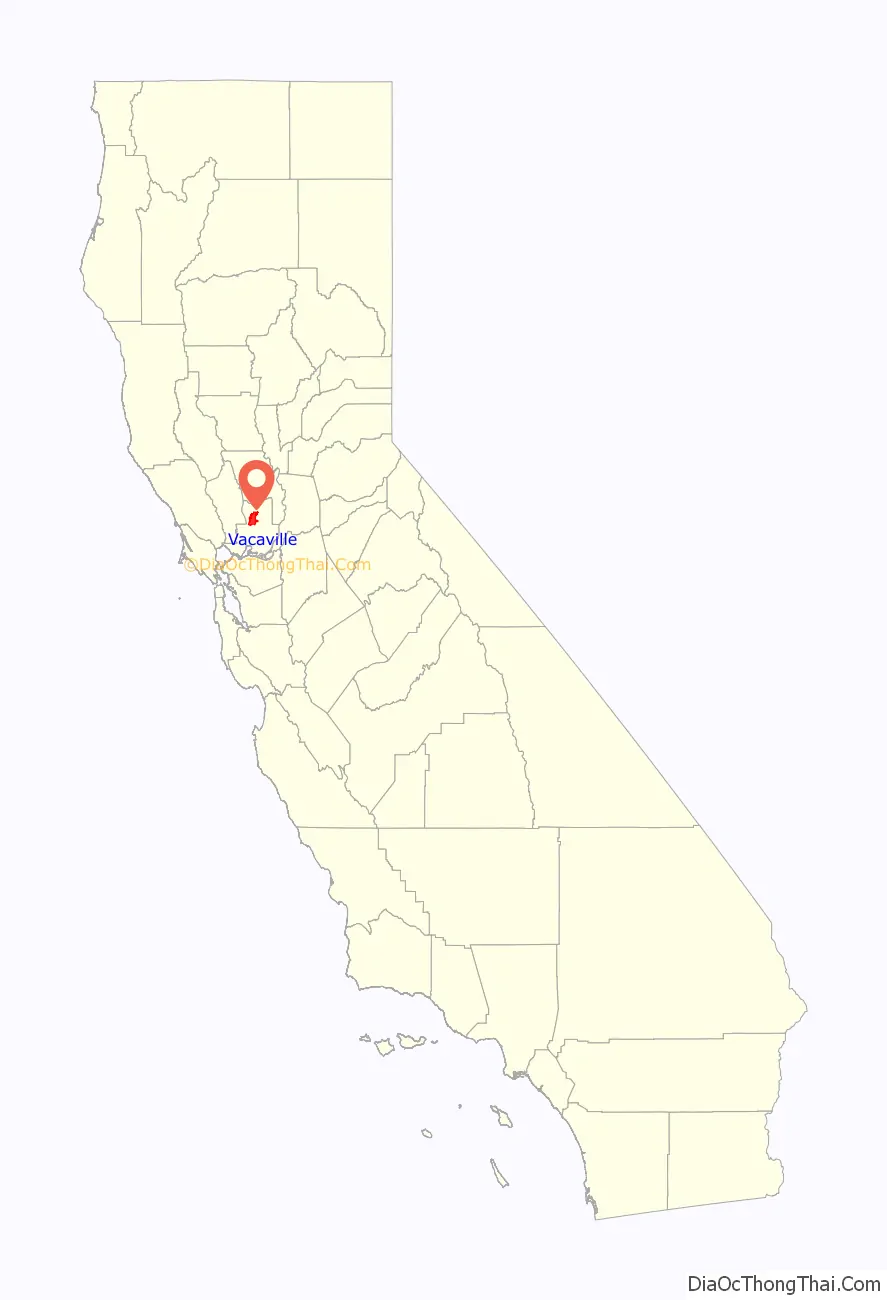
Vacaville is a city located in Solano County, California, within the North Bay subregion of the San Francisco Bay Area. Sitting about 35 miles (56 km) from Sacramento and 55 miles (89 km) from San Francisco, it is on the edge of the Sacramento Valley in Northern California. The city was founded in 1851 and is named after Juan Manuel Vaca.
As of the 2020 census, Vacaville had a population of 102,386, making it the third-largest city in Solano County. Other nearby cities include Fairfield, Suisun City, Dixon, Rio Vista, Vallejo, Benicia, and Napa.
| Name: | Vacaville city |
|---|---|
| LSAD Code: | 25 |
| LSAD Description: | city (suffix) |
| State: | California |
| County: | Solano County |
| Incorporated: | August 9, 1892 |
| Elevation: | 174 ft (53 m) |
| Total Area: | 29.42 sq mi (76.19 km²) |
| Land Area: | 29.19 sq mi (75.59 km²) |
| Water Area: | 0.23 sq mi (0.60 km²) 0.74% |
| Total Population: | 102,386 |
| Population Density: | 3,449.14/sq mi (1,331.73/km²) |
| ZIP code: | 95687, 95688, 95696 |
| Area code: | 707 |
| FIPS code: | 0681554 |
Online Interactive Map
Click on ![]() to view map in "full screen" mode.
to view map in "full screen" mode.
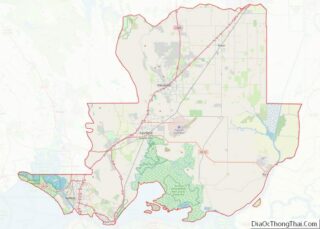
Vacaville location map. Where is Vacaville city?
History
Prior to European contact, the indigenous Patwin tribe lived in the area with the Ululato tribelet establishing a chiefdom around the Ululato village in what is now downtown Vacaville along the Ulatis Creek.
The early settler pioneers of the land were Juan Manuel Cabeza Vaca and Juan Felipe Peña, who were awarded a 44,000-acre (18,000 ha) Mexican land grant in 1842. The same year, Vaca and Peña’s families settled in the area of Lagoon Valley. Peña’s Adobe home is the oldest standing building, built in 1842.
Discussions for the sale of a portion of land to William McDaniel began in August 1850. A written agreement was signed on December 13, 1851, forming a township, nine square miles of land were deeded to William McDaniel for $3,000, and the original city plans were laid out from that. In the agreement, McDaniel’s would name the new town after Juan Manuel Cabeza Vaca.
In 1880, Leonard Buck created the California Fruit Shipping Association, and the L.W. and F.H. Buck Company, an early company auctioning fruit in the state, and Vacaville was soon home to many large produce companies and local farms, which flourished due to the Vaca Valley’s rich soil.
It officially became a city in 1892.
In 1885, the first grade school built was Ulatis School. In 1898, the town’s first high school was built, Vacaville Union High School.
In 1968, the Vacaville Heritage Council was established.
In August 2020, parts of Vacaville were evacuated due to the Hennessey Fire, which resulted in the burning of over 315,000 acres (127,476 ha) in five counties, including in Vacaville, where farms and homes were destroyed.
On August 29, 2022, a truck transporting tomatoes crashed on Interstate 80 in Vacaville, injuring four, splattering over 150,000 of the tomatoes onto the eastbound section of the freeway, and significantly delaying eastbound traffic for hours. The peculiarity of the freeway accident subsequently resulted in international news coverage.
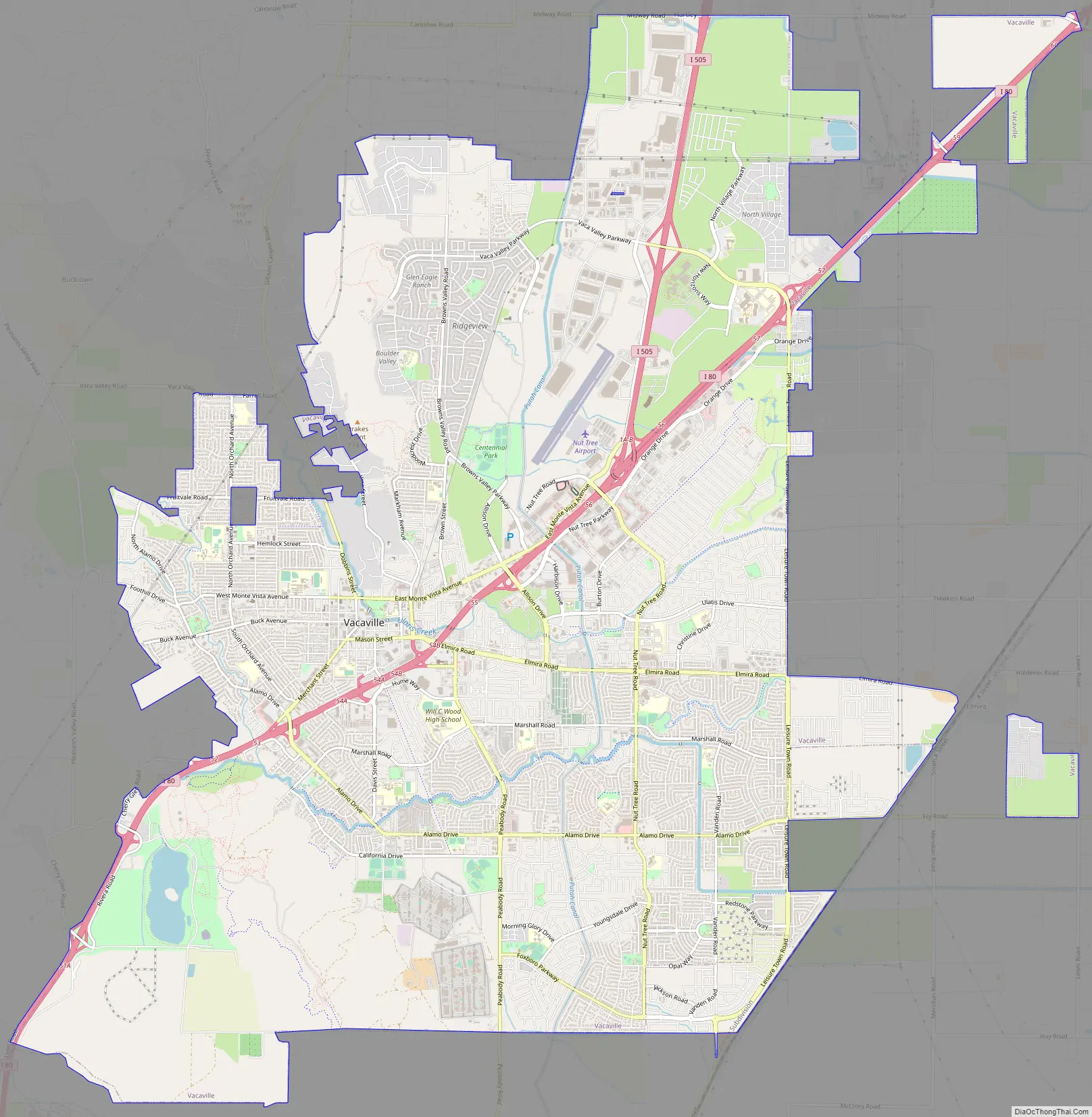
Vacaville Road Map
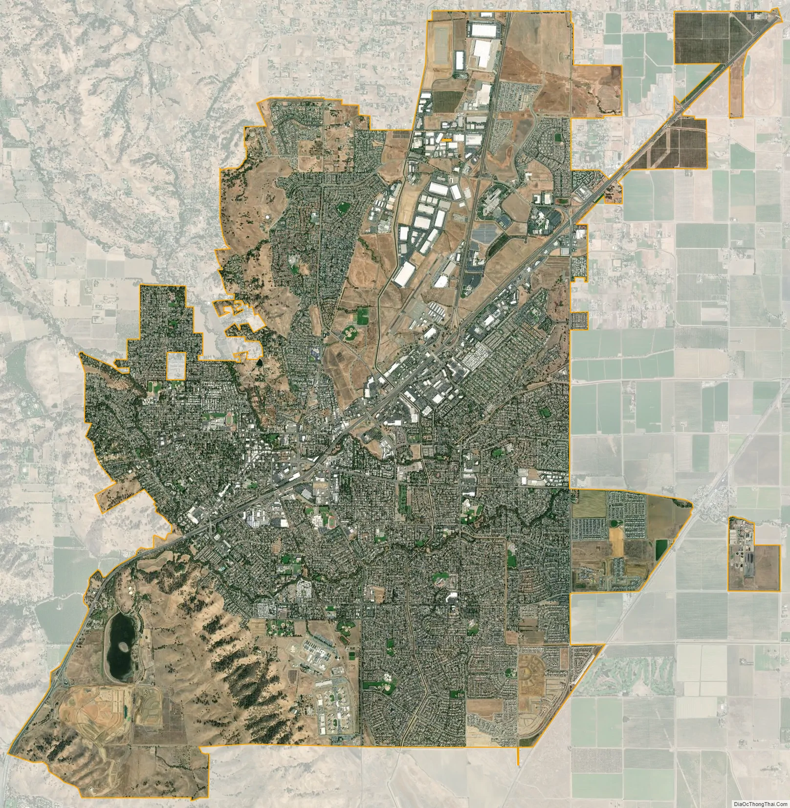
Vacaville city Satellite Map
Geography
Vacaville is surrounded by the Vaca Mountains to the south and to the west and the Sacramento Valley to the north and to the east.
A number of rare and endangered species occur in the Vacaville area. Endangered plants, which have historically occurred in the vernal pool areas in and around Vacaville include Legenre limosa, Plagiobothrys hystriculus, Downingia humilis, Contra Costa goldfields (Lasthenia conjugens), and showy Indian clover (Trifolium amoenum). To this day Trifolium amoenum can still be found in Lagoon Valley Regional Park.
According to the United States Census Bureau, the city has a total area of 28.6 square miles (74 km), of which 0.74% is covered by water. Excluding the Putah South Canal and minor local creeks, the only significant body of water within the city is the 105-acre (0.42 km) Lagoon Valley Lake.
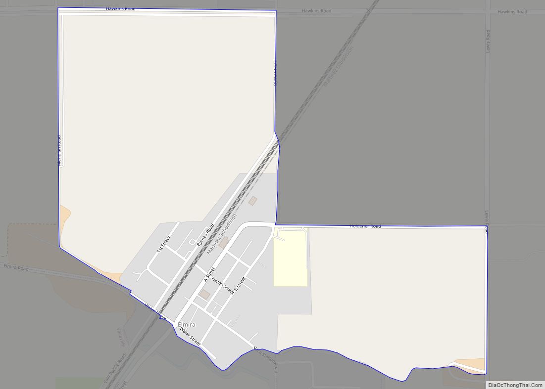
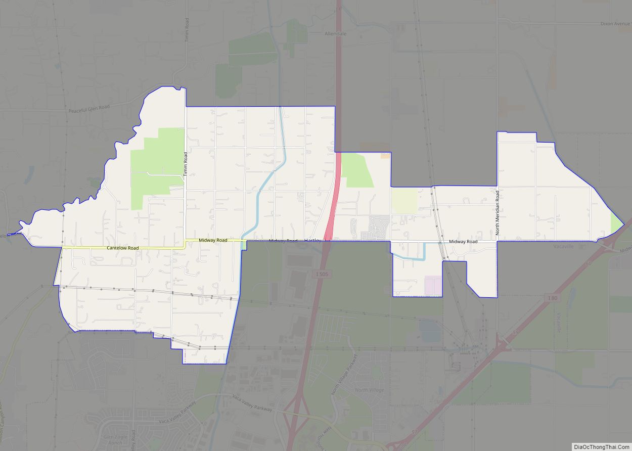
The unincorporated communities of Allendale and Elmira are generally considered to be part of “greater” Vacaville.
Climate
Vacaville has a typical Mediterranean climate (Köppen Csa) with hot, dry summers and cool, wet winters. Characteristic of inland California, summers can get quite hot. Autumns are warm in the early part, but quickly cool down as the wet season approaches. Winters can be cool, and often foggy, but are mild compared to other regions. Spring is a rather pleasant season with fairly mild temperatures and not so much rain. The greater majority of precipitation falls in the autumn, winter, and spring, little to none in summer.
According to National Weather Service records, average January temperatures in Vacaville are a maximum of 55.4 °F (13.0 °C) and a minimum of 36.7 °F (2.6 °C). Average July temperatures are a maximum of 95.2 °F (35.1 °C) and a minimum of 56.1 °F (13.4 °C). On average, 87.7 days have highs of 90 °F (32 °C) or higher. On average, 30.7 days have lows of 32 °F (0 °C) or lower. The record high temperature was 116 °F (47 °C) on July 23, 2006. The record low temperature was 14 °F (−10 °C) on December 26, 1924.
Average annual precipitation is 24.55 inches (624 mm). An average of 57 days have measurable precipitation. The wettest year was 1983 with 48.9 inches (1,240 mm) and the driest year was 2012 with 5.0 inches. The most precipitation in one month was 19.83 inches (504 mm) in January 1916. The most precipitation in 24 hours was 6.10 inches (155 mm) on February 27, 1940. Snowfall is rare in Vacaville, but light measurable amounts have occurred, including 2.2 inches (56 mm) in January 1907 and 2.0 inches (51 mm) in December 1988.
See also
Map of California State and its subdivision:- Alameda
- Alpine
- Amador
- Butte
- Calaveras
- Colusa
- Contra Costa
- Del Norte
- El Dorado
- Fresno
- Glenn
- Humboldt
- Imperial
- Inyo
- Kern
- Kings
- Lake
- Lassen
- Los Angeles
- Madera
- Marin
- Mariposa
- Mendocino
- Merced
- Modoc
- Mono
- Monterey
- Napa
- Nevada
- Orange
- Placer
- Plumas
- Riverside
- Sacramento
- San Benito
- San Bernardino
- San Diego
- San Francisco
- San Joaquin
- San Luis Obispo
- San Mateo
- Santa Barbara
- Santa Clara
- Santa Cruz
- Shasta
- Sierra
- Siskiyou
- Solano
- Sonoma
- Stanislaus
- Sutter
- Tehama
- Trinity
- Tulare
- Tuolumne
- Ventura
- Yolo
- Yuba
- Alabama
- Alaska
- Arizona
- Arkansas
- California
- Colorado
- Connecticut
- Delaware
- District of Columbia
- Florida
- Georgia
- Hawaii
- Idaho
- Illinois
- Indiana
- Iowa
- Kansas
- Kentucky
- Louisiana
- Maine
- Maryland
- Massachusetts
- Michigan
- Minnesota
- Mississippi
- Missouri
- Montana
- Nebraska
- Nevada
- New Hampshire
- New Jersey
- New Mexico
- New York
- North Carolina
- North Dakota
- Ohio
- Oklahoma
- Oregon
- Pennsylvania
- Rhode Island
- South Carolina
- South Dakota
- Tennessee
- Texas
- Utah
- Vermont
- Virginia
- Washington
- West Virginia
- Wisconsin
- Wyoming