East Rancho Dominguez, (pronunciation) also known as East Compton, is an unincorporated community and census-designated place (CDP) located in southern Los Angeles County, California. The population was 15,135 at the 2010 census, up from 9,286 at the 2000 census. East Rancho Dominguez is an accepted city name according to the USPS, and shares the 90221 ZIP Code with Compton.
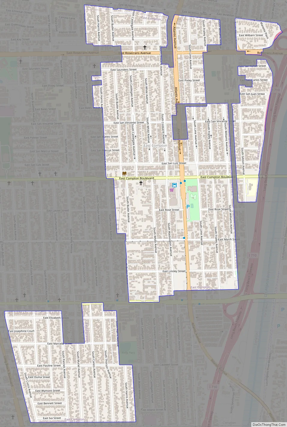
East Rancho Dominguez is an unincorporated enclave surrounded by Compton within five blocks east and west of Atlantic Ave. Alondra Boulevard is the southern border, and three blocks north of Rosecrans Ave. is roughly the northern border. East Rancho Dominguez County Park is in the center of the community.
To the north is the city of Lynwood. To the east is the Long Beach Freeway, the Los Angeles River, and then the city of Paramount. To the south and southeast is the city of Long Beach.
Its sphere of influence is the city of Compton, which has tried to annex East Rancho Dominguez, but business and property owners in the area have opposed the annexation. Rancho Dominguez is a separate unincorporated, mostly industrial area south of the city of Compton.
| Name: | East Rancho Dominguez CDP |
|---|---|
| LSAD Code: | 57 |
| LSAD Description: | CDP (suffix) |
| State: | California |
| County: | Los Angeles County |
| Elevation: | 72 ft (22 m) |
| Total Area: | 0.822 sq mi (2.129 km²) |
| Land Area: | 0.822 sq mi (2.129 km²) |
| Water Area: | 0 sq mi (0 km²) 0% |
| Total Population: | 15,135 |
| Population Density: | 18,000/sq mi (7,100/km²) |
| ZIP code: | 90221 |
| Area code: | 310/424 |
| FIPS code: | 0621034 |
| GNISfeature ID: | 1867014 |
Online Interactive Map
Click on ![]() to view map in "full screen" mode.
to view map in "full screen" mode.
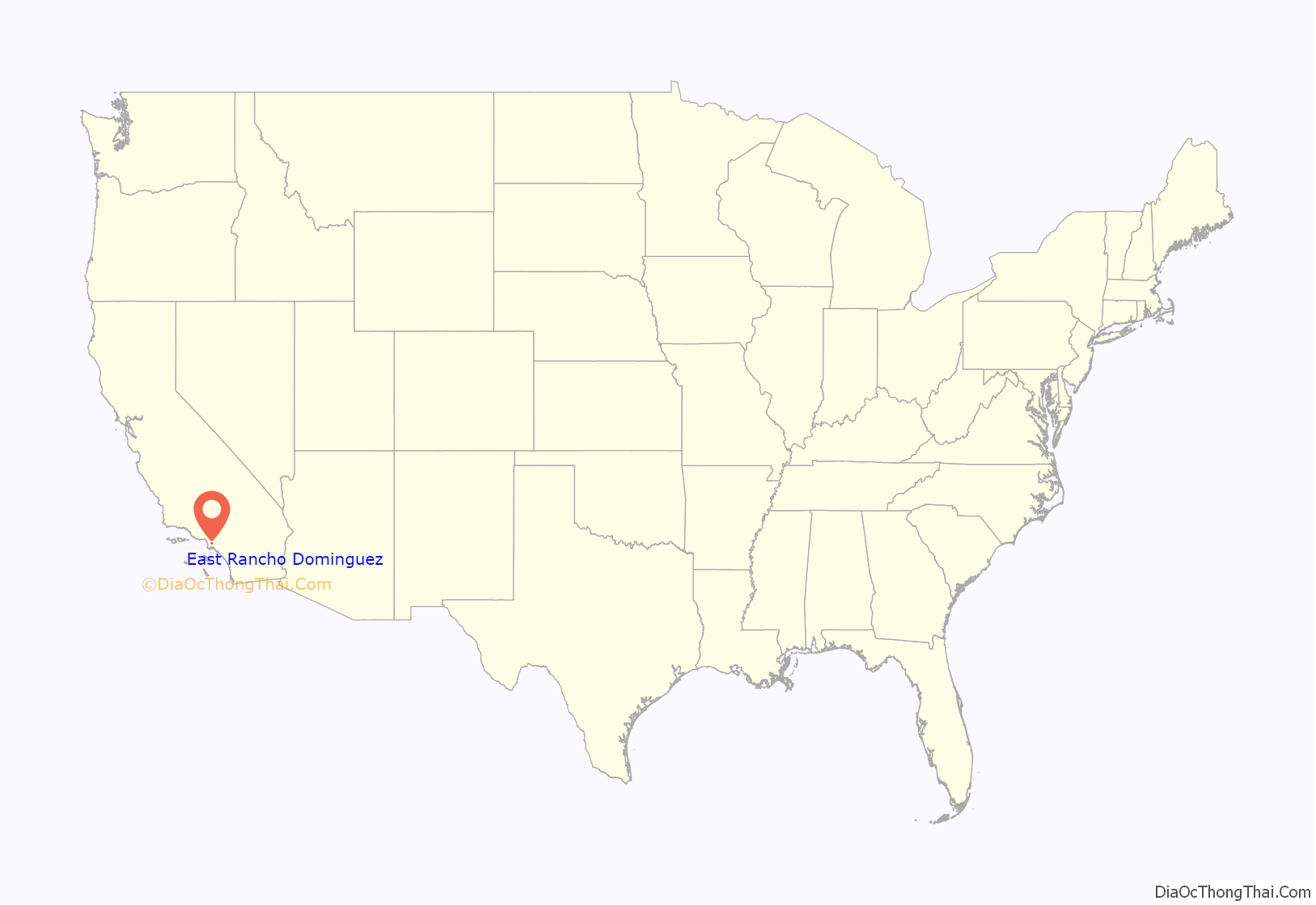
East Rancho Dominguez location map. Where is East Rancho Dominguez CDP?
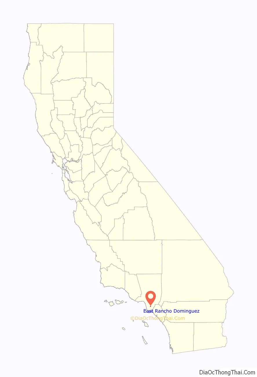
East Rancho Dominguez Road Map
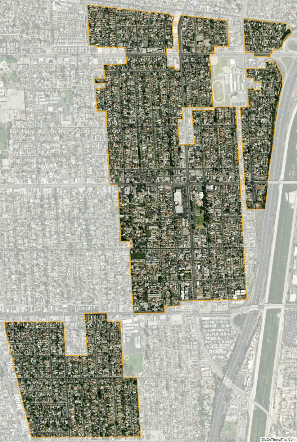
East Rancho Dominguez city Satellite Map
Geography
East Compton is located at 33°53′52″N 118°11′39″W / 33.89778°N 118.19417°W / 33.89778; -118.19417 (33.897748, -118.194093).
According to the United States Census Bureau, the CDP has a total area of 0.8 square miles (2.1 km), all land.
See also
Map of California State and its subdivision:- Alameda
- Alpine
- Amador
- Butte
- Calaveras
- Colusa
- Contra Costa
- Del Norte
- El Dorado
- Fresno
- Glenn
- Humboldt
- Imperial
- Inyo
- Kern
- Kings
- Lake
- Lassen
- Los Angeles
- Madera
- Marin
- Mariposa
- Mendocino
- Merced
- Modoc
- Mono
- Monterey
- Napa
- Nevada
- Orange
- Placer
- Plumas
- Riverside
- Sacramento
- San Benito
- San Bernardino
- San Diego
- San Francisco
- San Joaquin
- San Luis Obispo
- San Mateo
- Santa Barbara
- Santa Clara
- Santa Cruz
- Shasta
- Sierra
- Siskiyou
- Solano
- Sonoma
- Stanislaus
- Sutter
- Tehama
- Trinity
- Tulare
- Tuolumne
- Ventura
- Yolo
- Yuba
- Alabama
- Alaska
- Arizona
- Arkansas
- California
- Colorado
- Connecticut
- Delaware
- District of Columbia
- Florida
- Georgia
- Hawaii
- Idaho
- Illinois
- Indiana
- Iowa
- Kansas
- Kentucky
- Louisiana
- Maine
- Maryland
- Massachusetts
- Michigan
- Minnesota
- Mississippi
- Missouri
- Montana
- Nebraska
- Nevada
- New Hampshire
- New Jersey
- New Mexico
- New York
- North Carolina
- North Dakota
- Ohio
- Oklahoma
- Oregon
- Pennsylvania
- Rhode Island
- South Carolina
- South Dakota
- Tennessee
- Texas
- Utah
- Vermont
- Virginia
- Washington
- West Virginia
- Wisconsin
- Wyoming


