El Segundo (Spanish for ‘The Second’; /ˌɛl səˈɡʌndoʊ/; EL sə-GUN-doh; Spanish: [el seˈɣundo]) is a city in Los Angeles County, California. Located on Santa Monica Bay, it was incorporated on January 18, 1917, and is part of the South Bay Cities Council of Governments. The population was 16,731 as of the 2020 census, a 0.5% increase from 16,654 in the 2010 census.
| Name: | El Segundo city |
|---|---|
| LSAD Code: | 25 |
| LSAD Description: | city (suffix) |
| State: | California |
| County: | Los Angeles County |
| Incorporated: | January 18, 1917 |
| Elevation: | 115 ft (35 m) |
| Total Area: | 10.88 sq mi (28.18 km²) |
| Land Area: | 5.46 sq mi (14.15 km²) |
| Water Area: | 5.42 sq mi (14.03 km²) 0.03% |
| Total Population: | 16,731 |
| Population Density: | 1,500/sq mi (590/km²) |
| ZIP code: | 90245 |
| FIPS code: | 0622412 |
| Website: | www.elsegundo.org |
Online Interactive Map
Click on ![]() to view map in "full screen" mode.
to view map in "full screen" mode.
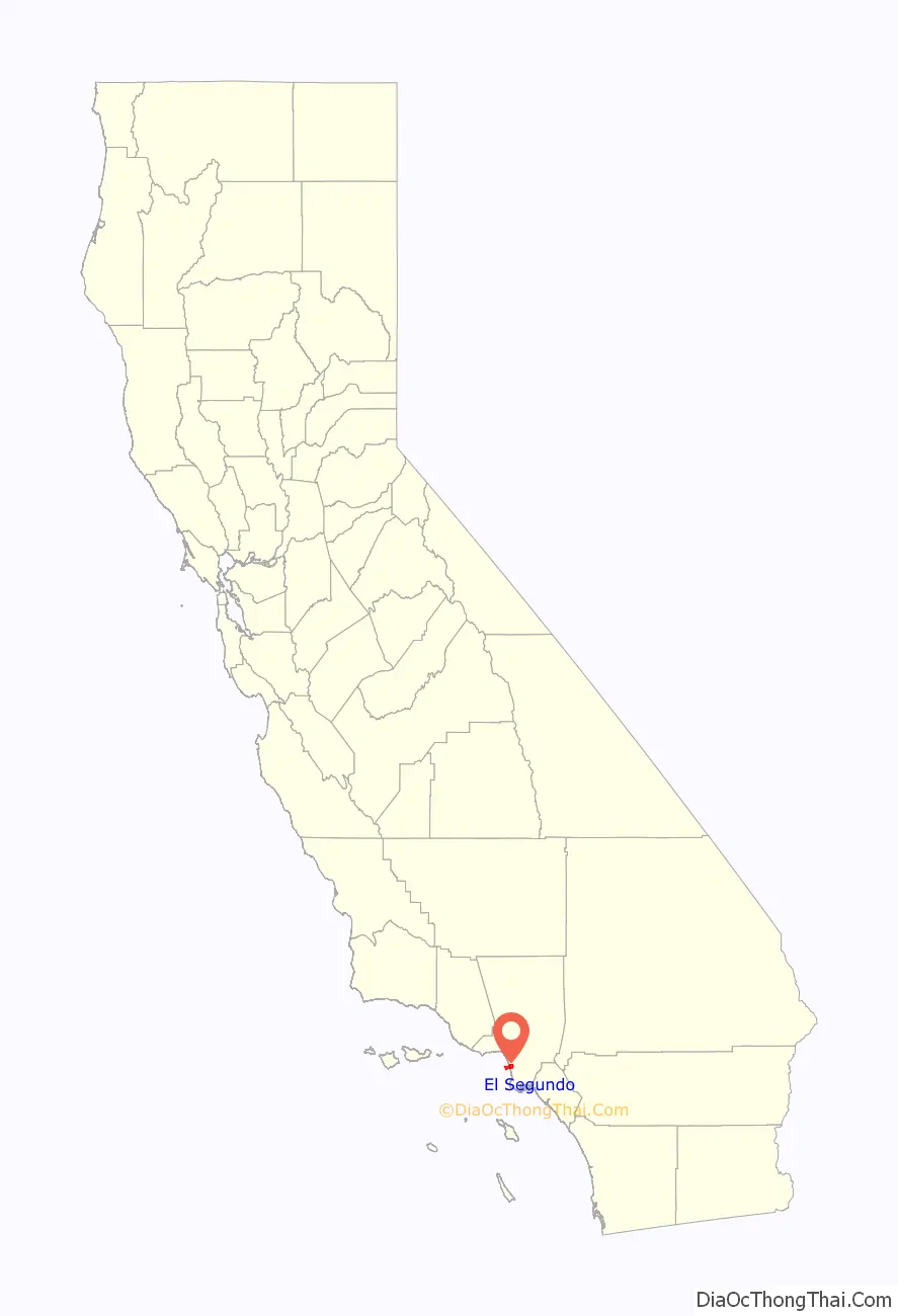
El Segundo location map. Where is El Segundo city?

History
The El Segundo and Los Angeles coastal area was first settled by the Tongva (or Gabrieleños) Native American tribes thousands of years ago. The area was once a part of Rancho Sausal Redondo (“Round Willow Patch Ranch”). Rancho Sausal Redondo extended from Playa Del Rey in the north to Redondo Beach in the south. Originally a Mexican land grant owned by Antonio Ygnacio Avila, the rancho was later purchased by a Scottish baronet named Sir Robert Burnett. After his return to Scotland, the property was purchased by then-manager of the rancho, Daniel Freeman. Daniel Freeman sold portions of the rancho to several persons. George H. Peck owned the 840 acres (340 ha) of land where the Chevron Refinery now sits. Peck also developed land in neighboring El Porto, where a street still bears his name. The city earned its name (“the second” in Spanish), as it was the site of the second Standard Oil refinery on the West Coast (the first was at Richmond in Northern California), when Standard Oil of California purchased the farm land in 1911.
The city was incorporated in 1917. The Standard Oil Company was renamed Chevron in 1984. The El Segundo refinery entered its second century of operation in 2011.
The Douglas Aircraft Company plant in El Segundo was one of the major aircraft manufacturing facilities in California during World War II. It was one of the major producers of SBD Dauntless dive bombers, which achieved fame in the Battle of Midway. The facility, now operated by Northrop Grumman, is still an aircraft plant.
El Segundo and Standard Oil Refinery, c. 1920
SBD Dauntless dive bombers being built by Douglas Aircraft Factory in El Segundo during World War II
El Segundo Road Map
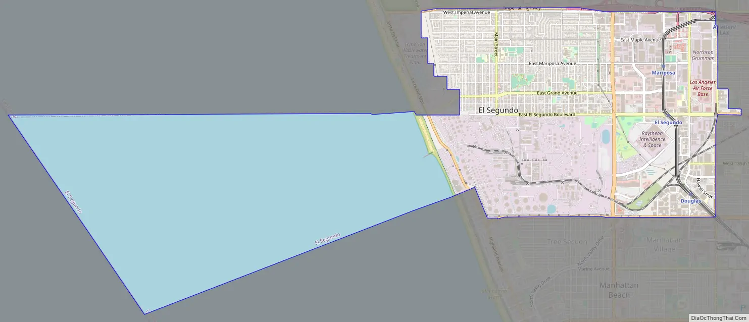
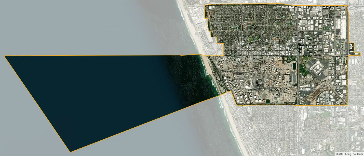
El Segundo city Satellite Map
Geography
The northern and southern boundaries of the town are Los Angeles International Airport and Manhattan Beach, with the Pacific Ocean as the western boundary. Its eastern boundary is roughly marked by Aviation Blvd.
According to the United States Census Bureau, the city has a total area of 5.5 square miles (14 km), over 99% of which is land.
Guinness World Records has listed El Segundo as having the most roads with a hill or grade.
See also
Map of California State and its subdivision:- Alameda
- Alpine
- Amador
- Butte
- Calaveras
- Colusa
- Contra Costa
- Del Norte
- El Dorado
- Fresno
- Glenn
- Humboldt
- Imperial
- Inyo
- Kern
- Kings
- Lake
- Lassen
- Los Angeles
- Madera
- Marin
- Mariposa
- Mendocino
- Merced
- Modoc
- Mono
- Monterey
- Napa
- Nevada
- Orange
- Placer
- Plumas
- Riverside
- Sacramento
- San Benito
- San Bernardino
- San Diego
- San Francisco
- San Joaquin
- San Luis Obispo
- San Mateo
- Santa Barbara
- Santa Clara
- Santa Cruz
- Shasta
- Sierra
- Siskiyou
- Solano
- Sonoma
- Stanislaus
- Sutter
- Tehama
- Trinity
- Tulare
- Tuolumne
- Ventura
- Yolo
- Yuba
- Alabama
- Alaska
- Arizona
- Arkansas
- California
- Colorado
- Connecticut
- Delaware
- District of Columbia
- Florida
- Georgia
- Hawaii
- Idaho
- Illinois
- Indiana
- Iowa
- Kansas
- Kentucky
- Louisiana
- Maine
- Maryland
- Massachusetts
- Michigan
- Minnesota
- Mississippi
- Missouri
- Montana
- Nebraska
- Nevada
- New Hampshire
- New Jersey
- New Mexico
- New York
- North Carolina
- North Dakota
- Ohio
- Oklahoma
- Oregon
- Pennsylvania
- Rhode Island
- South Carolina
- South Dakota
- Tennessee
- Texas
- Utah
- Vermont
- Virginia
- Washington
- West Virginia
- Wisconsin
- Wyoming


