Manhattan Beach is a city in southwestern Los Angeles County, California, United States, on the Pacific coast south of El Segundo, west of Hawthorne and Redondo Beach, and north of Hermosa Beach. As of the 2010 census, the population was 35,135.
Manhattan Beach is one of the three Beach Cities, along with Hermosa Beach and Redondo Beach within the South Bay region of Los Angeles County. The community is known for a long beach stretching approximately 2.1 miles (3.4 km) and roughly 450 feet (140 m) wide. The climate is unusually moderate because of Manhattan Beach’s proximity to the Pacific Ocean, with an average year-round high temperature of 69.1 °F (20.6 °C) and an average year-round low of 56.4 °F (13.6 °C).
| Name: | Manhattan Beach city |
|---|---|
| LSAD Code: | 25 |
| LSAD Description: | city (suffix) |
| State: | California |
| County: | Los Angeles County |
| Incorporated: | December 12, 1912 |
| Elevation: | 66 ft (20 m) |
| Total Area: | 3.94 sq mi (10.20 km²) |
| Land Area: | 3.93 sq mi (10.19 km²) |
| Water Area: | 0.00 sq mi (0.01 km²) 0.1% |
| Total Population: | 35,135 |
| Population Density: | 8,943.31/sq mi (3,452.87/km²) |
| ZIP code: | 90266, 90267 |
| FIPS code: | 0645400 |
| Website: | www.citymb.info |
Online Interactive Map
Click on ![]() to view map in "full screen" mode.
to view map in "full screen" mode.
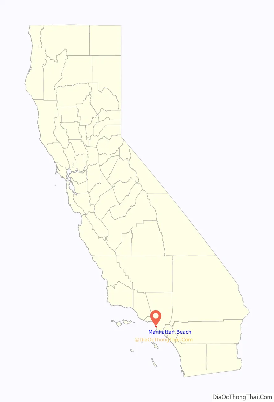
Manhattan Beach location map. Where is Manhattan Beach city?

History
The sandy coastal area was likely inhabited by the Tongva tribe of Native Americans. Archeological work in the nearby Chowigna excavation show evidence of inhabitants as far back as 7,100 years ago. The Tongva Village of Ongovanga was located near neighbouring Redondo Beach. It has been mentioned at the Historical Society that the location of a portion of current day Manhattan Beach may have been used as a Native American burial grounds.
In the mid-18th century, the Portolá expedition was the first European land exploration of present-day California. It traveled north from San Diego to the San Gabriel Valley, Los Angeles Basin, San Fernando Valley, Monterey Bay, and San Francisco Bay. In 1784, the Spanish Crown deeded Rancho San Pedro, a tract of over 75,000 acres (300 km), to soldier Juan José Domínguez. It included what is today the entire Port of Los Angeles; San Pedro, Los Angeles; Harbor City, Los Angeles; Wilmington, Los Angeles; Carson; Compton; the Dominguez Hills; Lomita; the Palos Verdes Peninsula; Redondo Beach; Hermosa Beach; Manhattan Beach; and Torrance.
In 1863, a Scottish immigrant, Sir Robert Burnett, purchased Rancho Sausal Redondo and Rancho Aguaje de la Centinela from Avila’s heirs for $33,000. Ten years later in 1873, Burnett leased the ranch to a Canadian, Daniel Freeman (not the American of the same name, who was the first to file a claim under the Homestead Act of 1862). Burnett returned to Scotland. Freeman moved his wife and three children onto the ranch and started growing various crops. On May 4, 1885, Freeman bought the ranch from Burnett for $140,000. At some point after this the location was informally called “Shore Acres.” Shortly thereafter, in 1888 the area’s first freight and passenger railroad tracks were built by the Santa Fe Railroad company. The tracks ran through Manhattan Beach and spanned all the way to Redondo Beach with a substation constructed in later years at Center Street, which today is Manhattan Beach Boulevard.
George H. Peck owned the land that became part of the north section of Manhattan Beach. A coin flip decided the town’s name. Around 1902, the beach suburb was named “Manhattan” after developer Stewart Merrill’s home, the New York City borough of Manhattan. “Beach” was appended to the city’s name, in 1927, at the behest of the postmaster.
Upon the city’s incorporation in 1912, Peck divided out a 2 block area for minority residents on the beachfront. The Bruce family bought some of the area and developed it into the first beach resort for Black Americans in southern California, Bruce’s Beach. In the 1920s, the Ku Klux Klan began violently harassing the resort’s visitors, the Bruce family, and four other Black families that bought lots. In 1924, the city used eminent domain to seize the land from the Black property owners under the pretense of building a park. In 2021 California Governor Gavin Newsom, ordered by law to begin procedures for immediate restitution of property to descendants of the family.
The land in Manhattan Beach was formerly sand dunes. During the 1920s and 1930s, Kuhn Brothers Construction Company leveled uneven sandy sites and some excess sand was sold and shipped to Waikiki, Hawaii, to convert their reef and rock beach into a sandy beach. The sand was also used to build the Los Angeles Coliseum and portions of the Pacific Coast Highway.
The McMartin preschool trials, allegedly an example of day care sex abuse hysteria, started with investigations of a Manhattan Beach preschool in 1983. The trials ran from 1987 to 1990 and resulted in no convictions. HBO dramatized this case in the Emmy-winning Indictment: The McMartin Trial, which was partially filmed in Manhattan Beach.
The Manhattan Beach Historical Society is now in charge of preserving the history of the city.
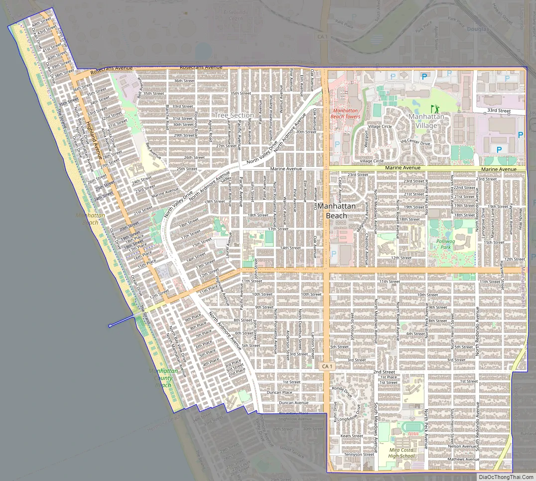
Manhattan Beach Road Map
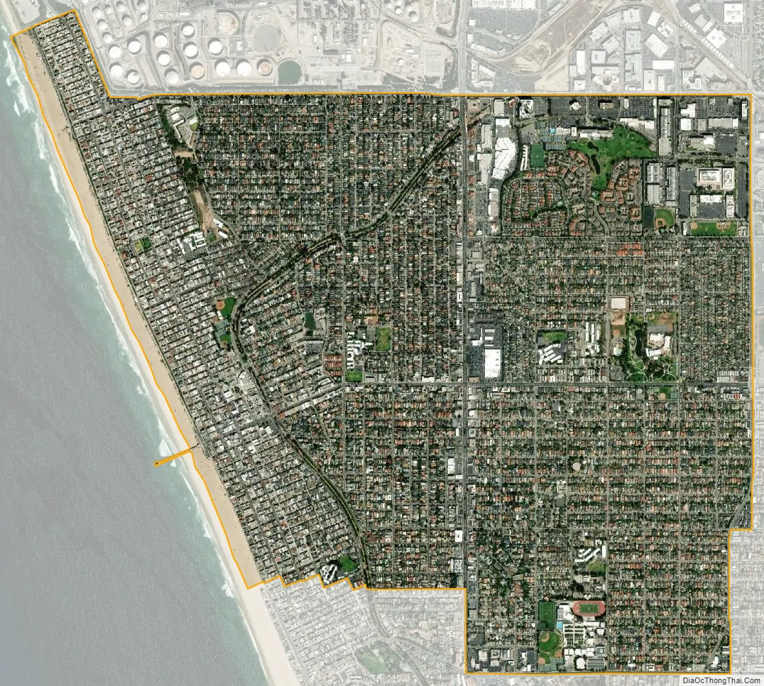
Manhattan Beach city Satellite Map
Geography
Climate
Manhattan Beach benefits from ocean breezes that provide clean air and summer temperatures that are 10 to 20 °F (5.6 to 11.1 °C) cooler than the inland regions of Southern California.
The city has a total area of 3.9 square miles (10 km). Manhattan Beach features 2.1 miles (3.4 km) of ocean frontage.
Beach and sand dunes
Manhattan Beach is a prominent area for beach volleyball and surfing.
A majority of the land in Manhattan Beach was once exposed sand dunes, which now lie beneath the city’s buildings and streets. The underlying dunes afford residents ocean views throughout western portions of the city. The tallest hill is 244 feet high, and it is located in the city’s southwest region. The only remaining exposed sand dune is at Sand Dune Park, where sand resembling the original landscape can also be found. In the late 1920s, excess sand from Manhattan Beach was purchased by Hawaiʻian developers, who negotiated a deal with the Kuhn Brothers Construction Company to ship the sand across the Pacific Ocean from Manhattan Beach via Los Angeles Harbor to Waikiki Beach over a ten-year period.
The beach is approximately 2.1 miles long and 400 feet wide. In the early part of the last century, the beach was narrow (approximately 150 feet) and sloping. From 1938 to 1989, it more than doubled in width when large quantities of sand were placed on beaches to the north during construction of the Hyperion Treatment Plant, Marina del Rey, and Scattergood Power Plant. The sand was carried southward by the ocean’s natural littoral flow and widened Manhattan Beach.
Every August, the city hosts the Manhattan Beach Open Volleyball Tournament and the International Surf Festival.
Neighborhoods
The city has several distinct neighborhoods, including the “Strand”, “Sand Section”, “Hill Section”, “Tree Section”, “Gas Lamp Section”, “Manhattan Village”, “Manhattan Heights”, “East Manhattan Beach” (Manhattan Village, Manhattan Heights, Liberty Village), The Poet’s Section” (Shelley, Tennyson, Longfellow, Keats), and “El Porto” (North Manhattan Beach). The Roth Tract, between Herrin and Peck, is sometimes referred to as the “Bird Section.”
The “Hill Section” is known for its high-priced homes; many of the residences are remodeled or newly constructed. The steep hills allow panoramic ocean and city views.
The “Sand Section” has quiet walk-street neighborhoods adjacent to the ocean. Oceanfront homes stretch along the bike path and walking lane of “The Strand”. “The Strand” section of Manhattan Beach includes some of the most expensive real estate per square foot in the United States.
Since 2010, new property developments in Manhattan Beach cannot exceed two lot parcels. Size and appearance restrictions were enacted by the Manhattan Beach City Council to preserve the appearance of the beachfront community after three lots were joined to create a 16,000-square-foot (1,500 m) oceanside home in 2008.
“Downtown” Manhattan Beach is considered the heart of the city. The area runs along Manhattan Beach Boulevard and the streets perpendicular to the Manhattan Beach Pier and Valley Drive. There are Zagat-rated casual fine-dining restaurants, specialty boutiques and retailers that create a pedestrian-friendly, mixed-use downtown center. The Metlox site, where the pottery factory once stood for decades, was closed in the early 1990s and redeveloped into a mixed-use center. The Metlox site includes a luxury boutique hotel, spa, restaurants, shops and underground parking.
North Manhattan Beach business district is located near the intersection of Rosecrans and Highland and has restaurants and shops. The district is defined as covering “32nd Street to 45th Street and consist[s] of over 80 businesses”.
The Rosecrans corridor is located on the south side of Rosecrans Avenue, east of Sepulveda, and west of Aviation.
The Manhattan Beach Country Club, the westdrift Manhattan Beach Hotel and Golf Course, retail stores, restaurants, supermarkets, multi-story office buildings, and shopping centers border the Rosecrans corridor between Sepulveda and Aviation Boulevards. The Rosecrans corridor is adjacent to The Point and Plaza El Segundo off Sepulveda Blvd, which features additional retailers, including Whole Foods Market.
The Sepulveda Corridor occupies the commercial zone, and is the city’s main north–south highway. The area includes the Manhattan Village Mall, which is located east of Sepulveda Boulevard between Marine and Rosecrans Avenues. The mall, built in the early 1980s, was remodeled in the late 1990s and early 2000s. The mall is anchored by Macy’s on both ends and tenants include Pottery Barn, Pottery Barn Kids, Williams Sonoma, and the Apple Store. Many restaurants such as Islands, Chili’s, Olive Garden, and the Tin Roof are co-located with the mall. The Manhattan Village Mall is executing a multimillion-dollar redevelopment which adds both outdoor and enclosed retail and restaurant space. There are several medium-size hotels, large automobile dealerships, automotive repair shops, restaurants, multi-story office buildings, medical buildings, pharmacies, banks, small shopping centers and a Target store along this corridor. Kaiser Permanente’s medical offices include a laboratory and pharmacy.
The Aviation Corridor is located along Aviation Boulevard (the city’s eastern boundary), south of Rosecrans Avenue, and north of Marine Avenue. Aviation High School was located at the intersection of Manhattan Beach Blvd. and Aviation until it closed in the early 1980s. The zone includes several major entertainment and aerospace complexes, including Manhattan Beach Studios and the Northrop Grumman Space Park Complex. Manhattan Beach Media Campus has production for movies and entertainment including the Marvel motion pictures Thor and Iron Man 2 and both sequels to James Cameron’s Avatar movie. The studio complex has large photovoltaic solar panel rooftop installations in the area which generates approximately 1 megawatt of power.
See also
Map of California State and its subdivision:- Alameda
- Alpine
- Amador
- Butte
- Calaveras
- Colusa
- Contra Costa
- Del Norte
- El Dorado
- Fresno
- Glenn
- Humboldt
- Imperial
- Inyo
- Kern
- Kings
- Lake
- Lassen
- Los Angeles
- Madera
- Marin
- Mariposa
- Mendocino
- Merced
- Modoc
- Mono
- Monterey
- Napa
- Nevada
- Orange
- Placer
- Plumas
- Riverside
- Sacramento
- San Benito
- San Bernardino
- San Diego
- San Francisco
- San Joaquin
- San Luis Obispo
- San Mateo
- Santa Barbara
- Santa Clara
- Santa Cruz
- Shasta
- Sierra
- Siskiyou
- Solano
- Sonoma
- Stanislaus
- Sutter
- Tehama
- Trinity
- Tulare
- Tuolumne
- Ventura
- Yolo
- Yuba
- Alabama
- Alaska
- Arizona
- Arkansas
- California
- Colorado
- Connecticut
- Delaware
- District of Columbia
- Florida
- Georgia
- Hawaii
- Idaho
- Illinois
- Indiana
- Iowa
- Kansas
- Kentucky
- Louisiana
- Maine
- Maryland
- Massachusetts
- Michigan
- Minnesota
- Mississippi
- Missouri
- Montana
- Nebraska
- Nevada
- New Hampshire
- New Jersey
- New Mexico
- New York
- North Carolina
- North Dakota
- Ohio
- Oklahoma
- Oregon
- Pennsylvania
- Rhode Island
- South Carolina
- South Dakota
- Tennessee
- Texas
- Utah
- Vermont
- Virginia
- Washington
- West Virginia
- Wisconsin
- Wyoming


