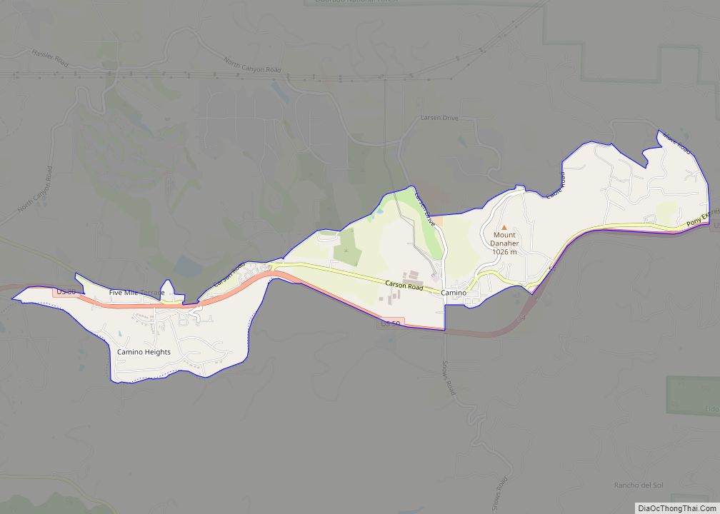
Camino (Spanish for “Path”) is a census-designated place in El Dorado County, California, and, per the 2010 census, has a population of 1,750. According to the USGS, it lies at an elevation of 3133 feet (955 m).
Nearby cities and towns include Pollock Pines, Placerville, Diamond Springs, El Dorado, Grizzly Flats, Somerset, Coloma, Garden Valley, Cameron Park, Shingle Springs, and Lotus. The elevation of Camino ranges between 3,000 and 3,500 feet, and gets snow several times per year. Camino is a popular area in the fall for apples and is often incorrectly mistaken as Apple Hill, which is the trademarked name of the Apple Hill Growers Association, a 55-member collection of ranches in Camino/Placerville/Pollock Pines. It is also known for its many Christmas tree farm ranches and is home to the annual Apple Hill Run. Camino is located about halfway between Sacramento and South Lake Tahoe on U.S. Route 50. The first post office was opened in 1904; the ZIP code is 95709. The community is inside area code 530.
| Name: | Camino CDP |
|---|---|
| LSAD Code: | 57 |
| LSAD Description: | CDP (suffix) |
| State: | California |
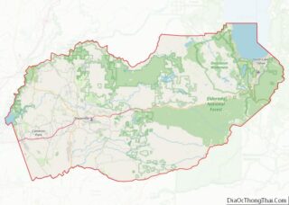
| County: | El Dorado County |
| Elevation: | 3,133 ft (955 m) |
| Total Area: | 2.57 sq mi (6.66 km²) |
| Land Area: | 2.57 sq mi (6.66 km²) |
| Water Area: | 0.00 sq mi (0.00 km²) 0% |
| Total Population: | 1,871 |
| Population Density: | 727.73/sq mi (280.94/km²) |
| ZIP code: | 95709 |
| Area code: | 530 |
| FIPS code: | 0610270 |
Online Interactive Map
Click on ![]() to view map in "full screen" mode.
to view map in "full screen" mode.
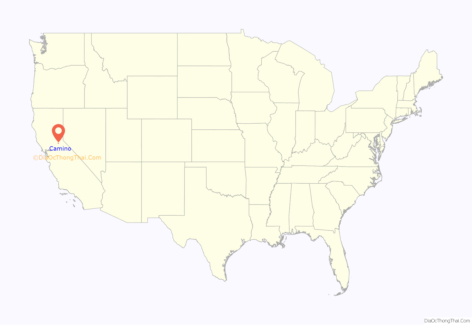
Camino location map. Where is Camino CDP?

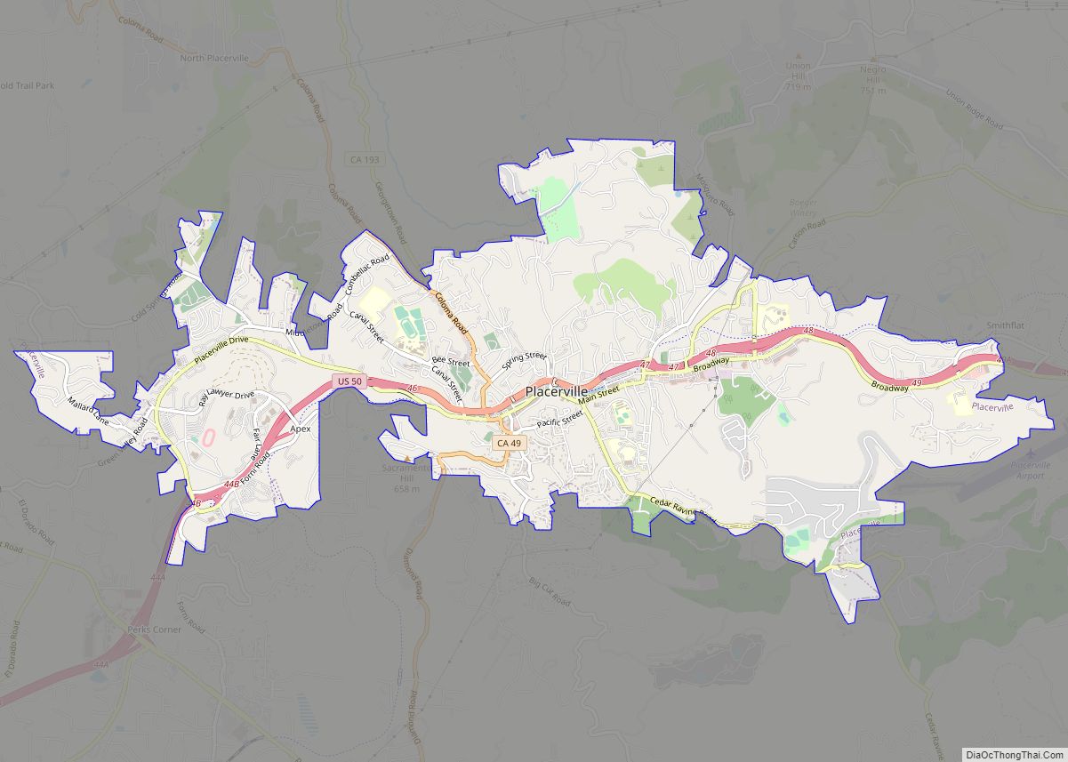
Camino Road Map

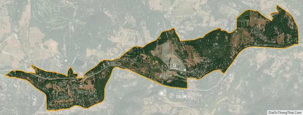
Camino city Satellite Map
See also
Map of California State and its subdivision:- Alameda
- Alpine
- Amador
- Butte
- Calaveras
- Colusa
- Contra Costa
- Del Norte
- El Dorado
- Fresno
- Glenn
- Humboldt
- Imperial
- Inyo
- Kern
- Kings
- Lake
- Lassen
- Los Angeles
- Madera
- Marin
- Mariposa
- Mendocino
- Merced
- Modoc
- Mono
- Monterey
- Napa
- Nevada
- Orange
- Placer
- Plumas
- Riverside
- Sacramento
- San Benito
- San Bernardino
- San Diego
- San Francisco
- San Joaquin
- San Luis Obispo
- San Mateo
- Santa Barbara
- Santa Clara
- Santa Cruz
- Shasta
- Sierra
- Siskiyou
- Solano
- Sonoma
- Stanislaus
- Sutter
- Tehama
- Trinity
- Tulare
- Tuolumne
- Ventura
- Yolo
- Yuba
- Alabama
- Alaska
- Arizona
- Arkansas
- California
- Colorado
- Connecticut
- Delaware
- District of Columbia
- Florida
- Georgia
- Hawaii
- Idaho
- Illinois
- Indiana
- Iowa
- Kansas
- Kentucky
- Louisiana
- Maine
- Maryland
- Massachusetts
- Michigan
- Minnesota
- Mississippi
- Missouri
- Montana
- Nebraska
- Nevada
- New Hampshire
- New Jersey
- New Mexico
- New York
- North Carolina
- North Dakota
- Ohio
- Oklahoma
- Oregon
- Pennsylvania
- Rhode Island
- South Carolina
- South Dakota
- Tennessee
- Texas
- Utah
- Vermont
- Virginia
- Washington
- West Virginia
- Wisconsin
- Wyoming