Meiners Oaks is an unincorporated community lying west of the city of Ojai in Ventura County, California, United States. The population was 3,571 at the 2010 census. For statistical purposes, the United States Census Bureau has defined Meiners Oaks as a census-designated place (CDP).
| Name: | Meiners Oaks CDP |
|---|---|
| LSAD Code: | 57 |
| LSAD Description: | CDP (suffix) |
| State: | California |
| County: | Ventura County |
| Elevation: | 741 ft (226 m) |
| Total Area: | 1.408 sq mi (3.647 km²) |
| Land Area: | 1.408 sq mi (3.647 km²) |
| Water Area: | 0 sq mi (0 km²) 0% |
| Total Population: | 3,751 |
| Population Density: | 2,700/sq mi (1,000/km²) |
| ZIP code: | 93023 |
| Area code: | 805 |
| FIPS code: | 0646702 |
| GNISfeature ID: | 1661004 |
Online Interactive Map
Click on ![]() to view map in "full screen" mode.
to view map in "full screen" mode.
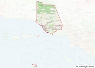
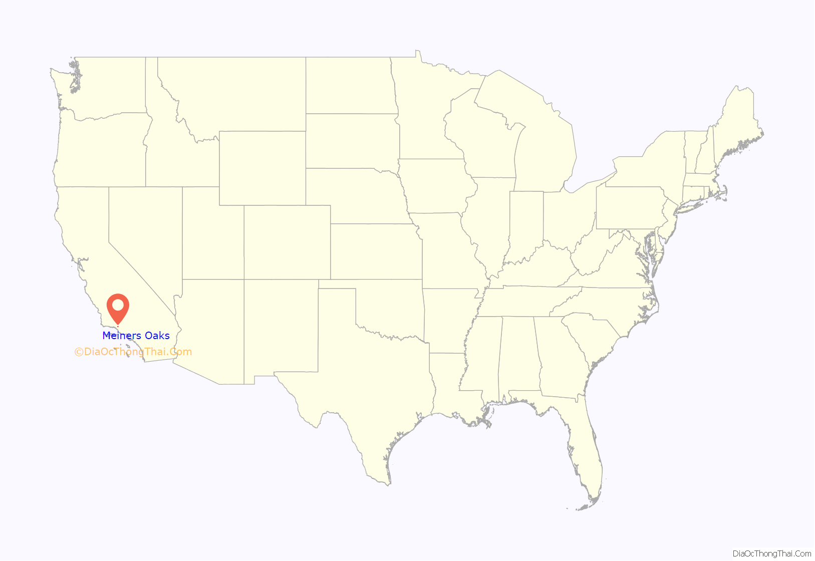
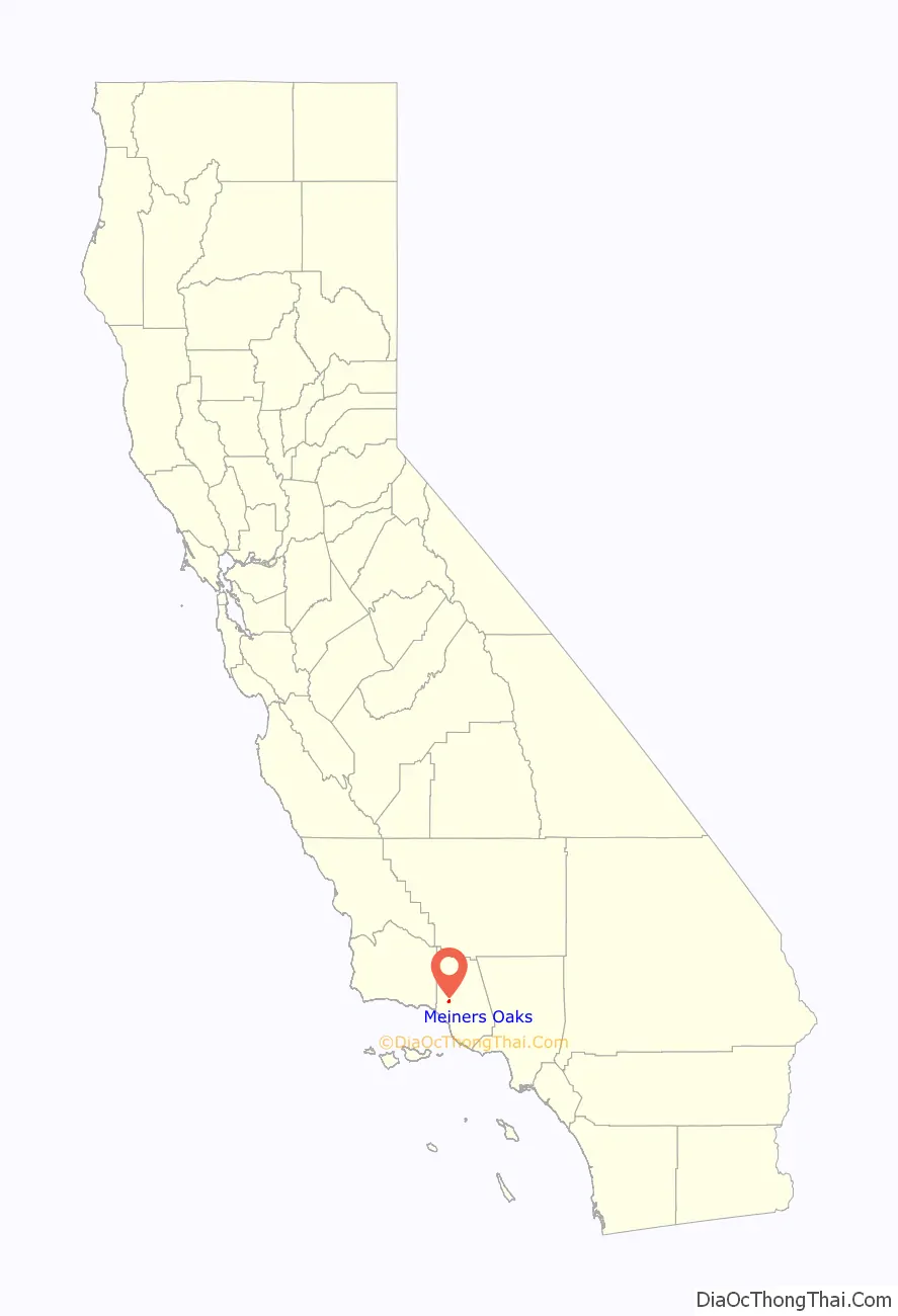
Meiners Oaks location map. Where is Meiners Oaks CDP?
History
German native John Meiners had immigrated to America in 1848 and established a successful brewing operation in Milwaukee. In the 1870s, he acquired the land that would become Meiners Oaks as payment for a debt. When a friend and business associate, Edward D. Holton, travelled through California and investigated the land, Meiners learned that he had acquired one of the largest oak groves on flat ground in southern California. Upon arriving in person, Meiners also found the climate agreeable, and established a ranch. Several hundred acres, north of the oak grove, were used quite successfully to grow lemons, oranges, plums, apricots and apples, as well as oats, wheat, barley and more. Meiners lived on his ranch intermittently until his death in 1898.
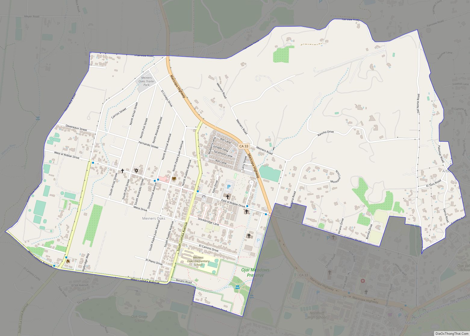
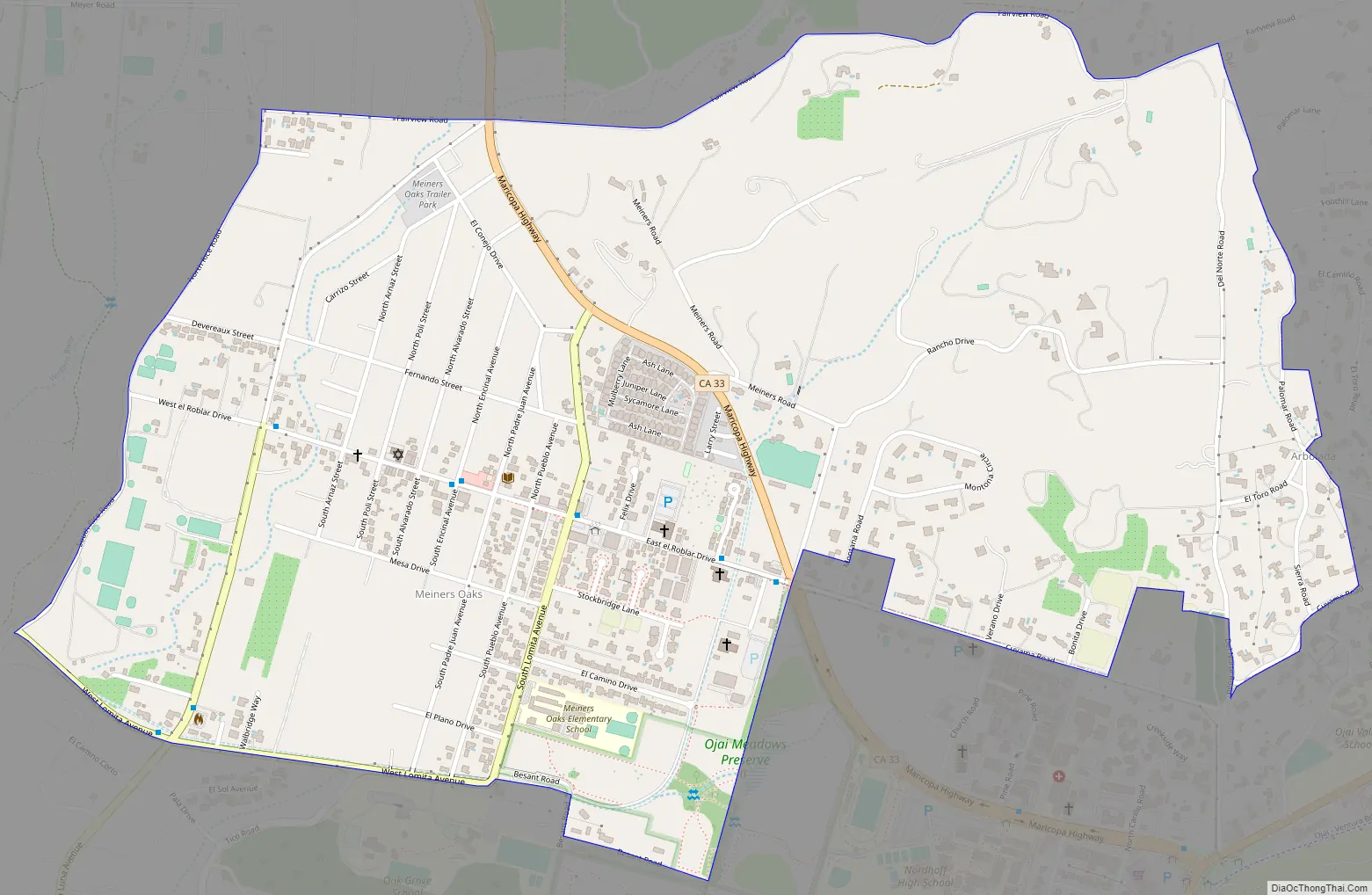
Meiners Oaks Road Map
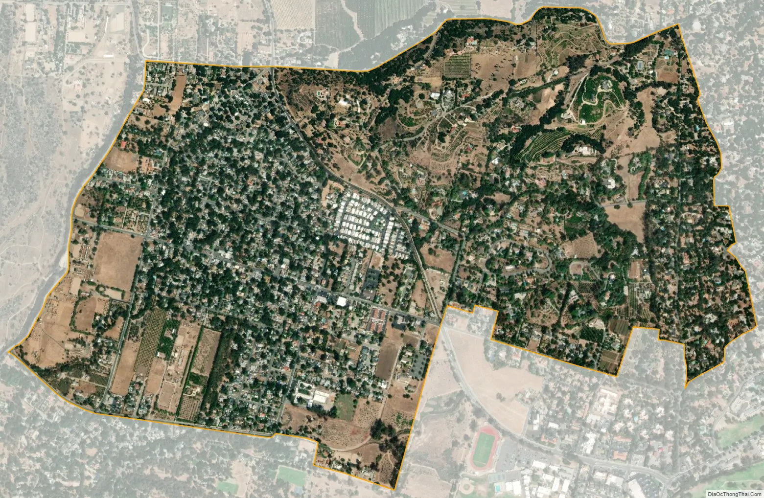
Meiners Oaks city Satellite Map
Geography
Meiners Oaks is in the mid-northern section of the Ojai Valley, and is bordered by the community of Mira Monte to the south, and the City of Ojai to the east. Meiners Oaks is in the heart of the Ojai Valley, very close to the Ventura River, where there are several hiking trails.
The community is 70 miles (110 km) north of Los Angeles. The census bureau definition of the area as a CDP may not precisely correspond to local understanding of the area with the same name.
Climate
The climate of Meiners Oaks is Mediterranean, characterized by hot, dry summers, at times exceeding 100 °F or 37.8 °C, and mild, rainy winters, with lows at night falling below freezing at times. During dry spells with continental air, morning temperatures, due to Ojai’s valley location, can drop well below most of Southern California, with the record being 13 °F (−10.6 °C) on January 6 and 7 of 1913. On the other hand, Meiners Oaks is far enough from the sea to minimize marine cooling, and very hot days can occur during summer, with the record being 119 °F (48.3 °C) on June 16, 1917 – when it fell as low as 65 °F (18.3 °C) in the morning due to clear skies and dry air.
Typically for much of coastal southern California, most precipitation falls in the form of rain between the months of October and April, with intervening dry summers. As with all of Southern California, rain falls on few days, but when it does rain it is often extremely heavy: the record being 9.05 inches (229.9 mm) on February 24, 1913, followed by 8.15 inches (207.0 mm) on January 26, 1914. During the wettest month on record of January 1969, 25.76 inches or 654.3 millimetres fell, with a whopping 23.46 inches (595.9 mm) in eight days from January 19 to January 26. In contrast, the median annual rainfall for all years in Meiners Oaks is only around 18.1 inches or 460 millimetres and in the driest “rain year” from July 2006 to June 2007, just 6.87 inches or 174.5 millimetres fell in twelve months. The wettest “rain year” was from July 1997 to June 1998 with 48.29 inches (1,226.6 mm).
See also
Map of California State and its subdivision:- Alameda
- Alpine
- Amador
- Butte
- Calaveras
- Colusa
- Contra Costa
- Del Norte
- El Dorado
- Fresno
- Glenn
- Humboldt
- Imperial
- Inyo
- Kern
- Kings
- Lake
- Lassen
- Los Angeles
- Madera
- Marin
- Mariposa
- Mendocino
- Merced
- Modoc
- Mono
- Monterey
- Napa
- Nevada
- Orange
- Placer
- Plumas
- Riverside
- Sacramento
- San Benito
- San Bernardino
- San Diego
- San Francisco
- San Joaquin
- San Luis Obispo
- San Mateo
- Santa Barbara
- Santa Clara
- Santa Cruz
- Shasta
- Sierra
- Siskiyou
- Solano
- Sonoma
- Stanislaus
- Sutter
- Tehama
- Trinity
- Tulare
- Tuolumne
- Ventura
- Yolo
- Yuba
- Alabama
- Alaska
- Arizona
- Arkansas
- California
- Colorado
- Connecticut
- Delaware
- District of Columbia
- Florida
- Georgia
- Hawaii
- Idaho
- Illinois
- Indiana
- Iowa
- Kansas
- Kentucky
- Louisiana
- Maine
- Maryland
- Massachusetts
- Michigan
- Minnesota
- Mississippi
- Missouri
- Montana
- Nebraska
- Nevada
- New Hampshire
- New Jersey
- New Mexico
- New York
- North Carolina
- North Dakota
- Ohio
- Oklahoma
- Oregon
- Pennsylvania
- Rhode Island
- South Carolina
- South Dakota
- Tennessee
- Texas
- Utah
- Vermont
- Virginia
- Washington
- West Virginia
- Wisconsin
- Wyoming