Whittier (/ˈhwɪtiər/) is a city in Southern California in Los Angeles County, part of the Gateway Cities. The 14.7-square-mile (38.0 km) city had 87,306 residents as of the 2020 United States census, an increase of 1,975 from the 2010 census figure. Whittier was incorporated in February 1898 and became a charter city in 1955. The city is named for the Quaker poet John Greenleaf Whittier and is home to Whittier College.
| Name: | Whittier city |
|---|---|
| LSAD Code: | 25 |
| LSAD Description: | city (suffix) |
| State: | California |
| County: | Los Angeles County |
| Incorporated: | February 25, 1898 |
| Elevation: | 367 ft (112 m) |
| Total Area: | 14.66 sq mi (37.98 km²) |
| Land Area: | 14.65 sq mi (37.94 km²) |
| Water Area: | 0.02 sq mi (0.04 km²) 0.11% |
| Total Population: | 87,306 |
| Population Density: | 5,824.9/sq mi (2,249.0/km²) |
| Area code: | 562 |
| FIPS code: | 0685292 |
| Website: | www.cityofwhittier.org |
Online Interactive Map
Click on ![]() to view map in "full screen" mode.
to view map in "full screen" mode.
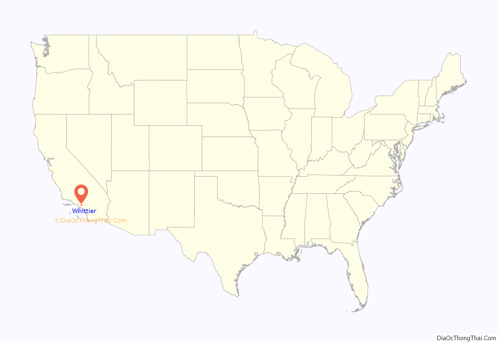
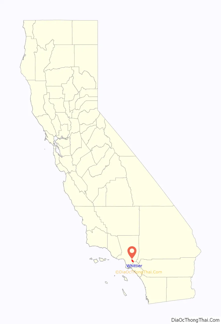
Whittier location map. Where is Whittier city?
History
Whittier’s roots can be traced to Spanish soldier Manuel Nieto. In 1784, Nieto received a Spanish land grant of 300,000 acres (1,200 km), Rancho Los Nietos, as a reward for his military service and to encourage settlement in California. The area of Nieto’s land grant was reduced in 1790 as the result of a dispute with Mission San Gabriel. Nonetheless, Nieto still had claim to 167,000 acres (680 km) stretching from the hills north of Whittier, Fullerton, and Brea, south to the Pacific Ocean, and from what is known today as the Los Angeles River east to the Santa Ana River. Nieto built a rancho for his family near Whittier, and purchased cattle and horses for his ranch and also planted cornfields. When Nieto died in 1804, his children inherited their father’s property.
At the time of the 1840s Mexican–American War, much of the land that would become Whittier was owned by Pio Pico, a rancher and the last Mexican governor of Alta California. Pio Pico built a hacienda here on the San Gabriel River, known today as Pio Pico State Historic Park. Following the Mexican–American War, German immigrant Jacob F. Gerkens paid $234 to the U.S. government to acquire 160 acres (0.6 km) of land under the Homestead Act and built the cabin known today as the Jonathan Bailey House. Gerkens would later become the first chief of police of the Los Angeles Police Department. Gerkens’ land was owned by several others before a group of Quakers purchased it and expanded it to 1,259 acres (5 km), with the intent of founding a Quaker community. The area soon became known as a thriving citrus ranching region, with “Quaker Brand” fruit being shipped all over the United States. Beginning in 1887, walnut trees were planted, and Whittier became the largest walnut grower in the United States. In addition to walnuts and citrus, Whittier was also a major producer of pampas grass.
For many years, the sole means of transport from this area to Los Angeles was on foot, or via horse and wagon over rough dirt roads, impeding settlement, development, and the export of agriculture. Thus in 1887 “enterprising and aggressive businessmen” contracted with the Southern Pacific Railroad to build the first railroad spur to Whittier, including a depot. The businessmen covered the $43,000 construction cost for the six-mile spur, which branched off from the Southern Pacific mainline at a junction near what is now Studebaker Road between Firestone Boulevard and Imperial Highway. By 1906, 650 carloads of oranges and 250 carloads of lemons were shipped annually by rail. In 1904, the Pacific Electric opened the trolley line known as “Big Red Cars” from Los Angeles to Whittier. In the first two decades, over a million passengers a year rode to and from Los Angeles on the Whittier Line. After World War II, Whittier grew rapidly and the sub-dividing of orange groves began, driven by housing shortages in southern California. In 1955, the new Civic Center complex was completed and the City Council met in new chambers for the first time on March 8, 1955. The city continued to grow as the City annexed portions of Whittier Boulevard and East Whittier. The 1961 annexation added over 28,000 people to the population, bringing the total to about 67,000.
Quakers
The first Quaker meetings were held on the front porch of the Jonathan Bailey House. Eventually, as more Quakers arrived, the need for an actual Meeting House arose and the first Quaker meeting house was built on the corner of Comstock Avenue and Wardman Street in 1887. The meeting soon outgrew this 100-seat meeting house and a new larger building was erected on the corner of Philadelphia Street and Washington Avenue in 1902. By 1912, membership had grown to 1,200 and a third building was dedicated on the same site in 1917. With a capacity of 1,700, the 1917 meeting house featured a balcony and was constructed of brick with mahogany paneling and pews. The present meeting house, dedicated in 1975, features many architectural elements and materials from the 1917 building including the stained glass windows and mahogany interior. The Quakers also founded Whittier Academy (later Whittier College), and additional meetings met in East Whittier and at Whittier College’s Mendenhall. Both the Mendenhall meeting and the East Whittier meeting kept the silent meeting longer than the main church.
Colleges
In 1887 the Pickering Land and Water Company set aside a 20-acre (81,000 m) parcel of land for the development of a college, but a collapse in the land boom stalled construction. Progress on developing a college was sporadic, but on July 30, 1896, the Whittier Academy, operating since 1891, officially changed its name to Whittier College with 100 students enrolled. The school mascot is “The Poet.” By 1906, Whittier College was an educational institution with laboratories, boarding halls, a large gymnasium and athletic fields. Due to an economic depression in the 1890s, the first bachelor’s degrees were not awarded at the college for 17 years.
The Mendenhall Building at Whittier College was donated by Leona May Mendenhall in honor of her husband Oscar. The Mendenhalls were among the founding families of Whittier. Oscar’s brother, Samuel Mendenhall, helped bring in the water system and post office. The Mendenhalls were large growers for Sunkist oranges and Blue Diamond walnuts.
Whittier was the first home to Azusa Pacific University, established on March 3, 1899, by the Quaker community and a Methodist evangelist under the name Training School for Christian Workers.
Whittier Narrows earthquake
On October 1, 1987, at 7:42 a.m., the Whittier Narrows earthquake struck, the epicenter being six miles (10 km) north by northwest of Whittier. The seismic event, which registered 5.9 on the moment magnitude scale, killed eight people and damaged many of uptown Whittier’s historic buildings. Three days later, on October 4, 1987, at 3:59 a.m., a major aftershock measuring 5.2 caused further damage. Buildings and residential structures which were already borderline unsafe were now deemed unsafe or uninhabitable. In the years following the earthquake, the city’s deteriorating uptown business district became the focus of renewed development, which met with opposition from many Whittier citizens. The Whittier Conservancy was formed in 1987 in an effort to stop the demolition of many historic buildings and residences after the disaster. The city also created a Historic Resources Commission to oversee the approval of historic designations, historic districts and Mills Act proposals. The Whittier Narrows earthquake also destroyed The Quad at Whittier, a shopping mall which had to be rebuilt.
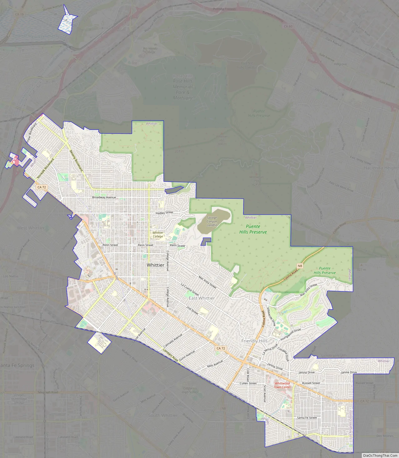
Whittier Road Map
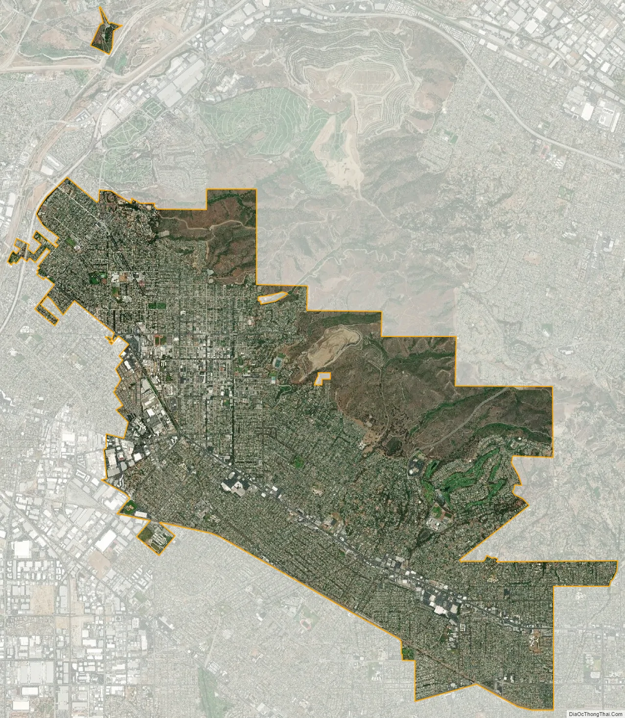
Whittier city Satellite Map
Geography
According to the United States Census Bureau, the city has a total area of 14.7 square miles (38 km), virtually all land.
Whittier is bordered by the community of Hacienda Heights to the northeast, City of Industry to the north, and several other unincorporated communities in the San Gabriel Valley mostly along its northern sections. Pico Rivera lies at the west, La Habra Heights to the east, La Habra to the southeast and Santa Fe Springs to the south.
Neighborhoods
There are several neighborhoods in Whittier. The area centered around Philadelphia Street and Greenleaf Avenue is known as Uptown Whittier and contains the traditional central business core. Just north of Uptown Whittier are the neighborhoods known as Central Park and Hadley-Greenleaf. They have been designated historic districts by the city Historic Resources Commission, and together comprise most of the area of the Whittier Historic Neighborhood Association. These districts contain many Craftsman and Spanish Colonial Revival homes. In and abutting the hills north of the historic districts is Starlite Estates. The area surrounding Whittier College is known as College Hills and was also recently designated a historic district, as has a small cluster of homes along Earlham Drive. The area east of College Avenue is referred to as East Whittier. East Whittier was a separate agricultural community until the postwar era. The eastern parts of East Whittier, developed in the 1950s and 1960s, are known as Friendly Hills, which was developed at the same time as Murphy Ranch and Leffingwell Ranch.
Climate
Whittier is about 15 miles (24 km) inland of the Pacific Ocean, resulting in higher daytime temperatures, and since it lies at a higher elevation than the cities further west, cold air drains into the lower elevation of the Los Angeles Basin which results in warmer night-time lows, producing an example of thermal inversion. Winter daytime highs typically range from 68 °F to 80 °F (20 °C to 27 °C) with overnight lows dropping to about 43 °F to 54 °F (6° to 12 °C). In the summer highs range from 78 °F to 95 °F (26 °C to 35 °C) and corresponding overnight lows in the 58 °F to 72 °F (14 °C to 22 °C). Rainfall follows a Mediterranean pattern with most rain falling during the winter months, while summers tend to be rather dry. The mean annual rainfall is about 14 inches (360 mm).
See also
Map of California State and its subdivision:- Alameda
- Alpine
- Amador
- Butte
- Calaveras
- Colusa
- Contra Costa
- Del Norte
- El Dorado
- Fresno
- Glenn
- Humboldt
- Imperial
- Inyo
- Kern
- Kings
- Lake
- Lassen
- Los Angeles
- Madera
- Marin
- Mariposa
- Mendocino
- Merced
- Modoc
- Mono
- Monterey
- Napa
- Nevada
- Orange
- Placer
- Plumas
- Riverside
- Sacramento
- San Benito
- San Bernardino
- San Diego
- San Francisco
- San Joaquin
- San Luis Obispo
- San Mateo
- Santa Barbara
- Santa Clara
- Santa Cruz
- Shasta
- Sierra
- Siskiyou
- Solano
- Sonoma
- Stanislaus
- Sutter
- Tehama
- Trinity
- Tulare
- Tuolumne
- Ventura
- Yolo
- Yuba
- Alabama
- Alaska
- Arizona
- Arkansas
- California
- Colorado
- Connecticut
- Delaware
- District of Columbia
- Florida
- Georgia
- Hawaii
- Idaho
- Illinois
- Indiana
- Iowa
- Kansas
- Kentucky
- Louisiana
- Maine
- Maryland
- Massachusetts
- Michigan
- Minnesota
- Mississippi
- Missouri
- Montana
- Nebraska
- Nevada
- New Hampshire
- New Jersey
- New Mexico
- New York
- North Carolina
- North Dakota
- Ohio
- Oklahoma
- Oregon
- Pennsylvania
- Rhode Island
- South Carolina
- South Dakota
- Tennessee
- Texas
- Utah
- Vermont
- Virginia
- Washington
- West Virginia
- Wisconsin
- Wyoming


