The Town of Boone is a Statutory Town located in Pueblo County, Colorado, United States. The town population was 305 at the 2020 United States Census. Boone is a part of the Pueblo, CO Metropolitan Statistical Area and the Front Range Urban Corridor.
| Name: | Boone town |
|---|---|
| LSAD Code: | 43 |
| LSAD Description: | town (suffix) |
| State: | Colorado |
| County: | Pueblo County |
| Elevation: | 4,465 ft (1,361 m) |
| Total Area: | 0.388 sq mi (1.006 km²) |
| Land Area: | 0.379 sq mi (0.981 km²) |
| Water Area: | 0.010 sq mi (0.025 km²) |
| Total Population: | 305 |
| Population Density: | 805/sq mi (311/km²) |
| ZIP code: | 81025 |
| Area code: | 719 |
| FIPS code: | 0807795 |
| GNISfeature ID: | 0204800 |
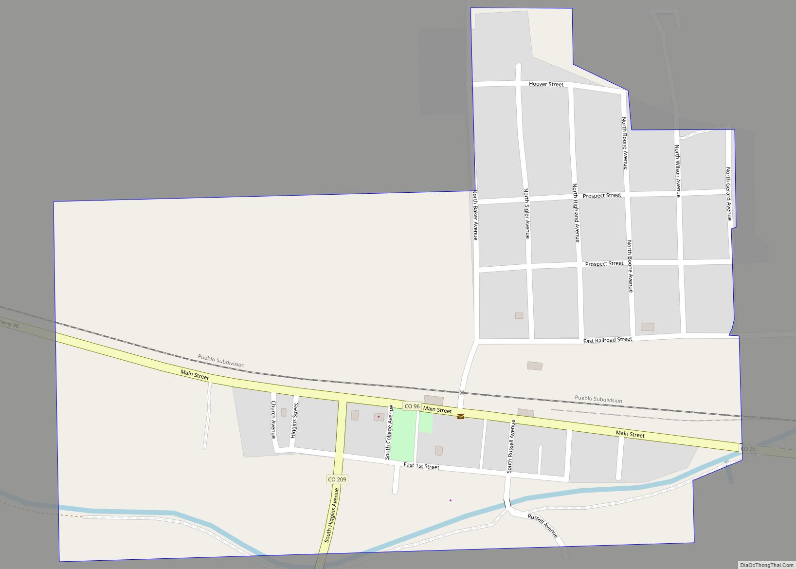
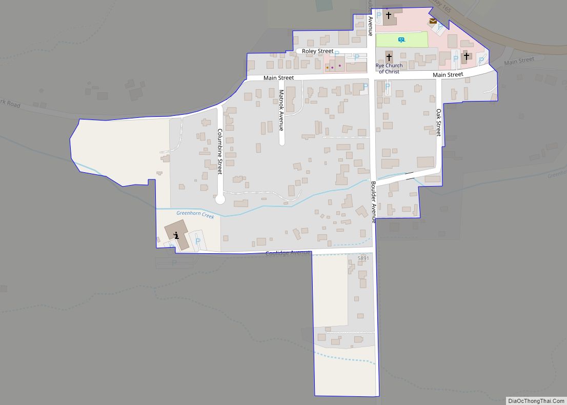
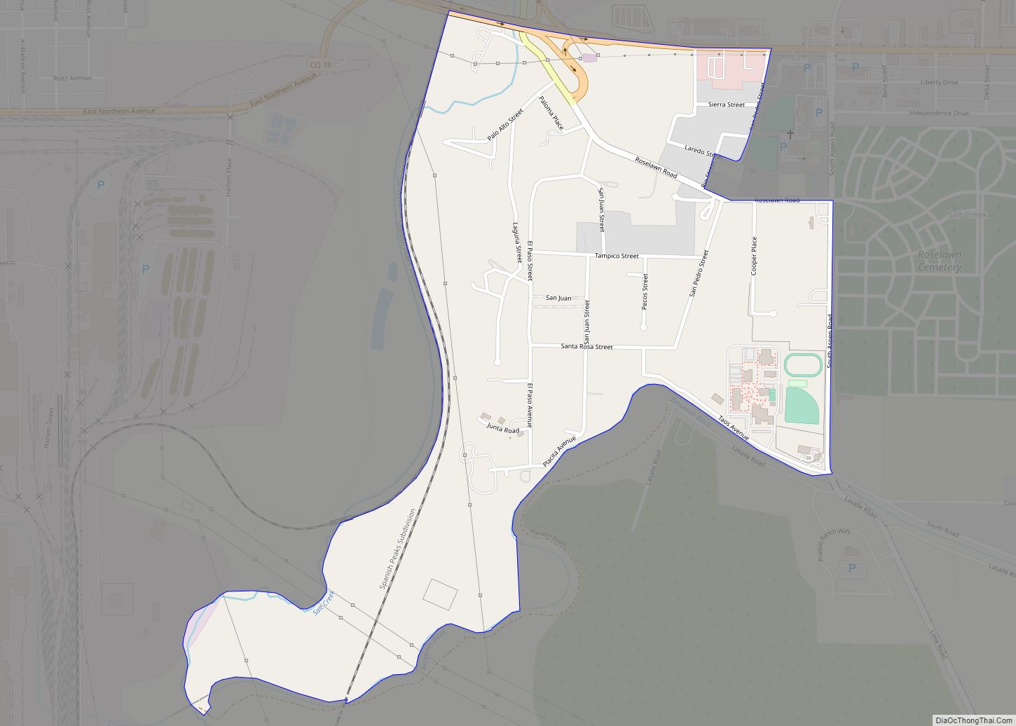
Online Interactive Map
Click on ![]() to view map in "full screen" mode.
to view map in "full screen" mode.
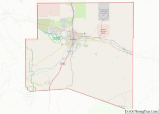
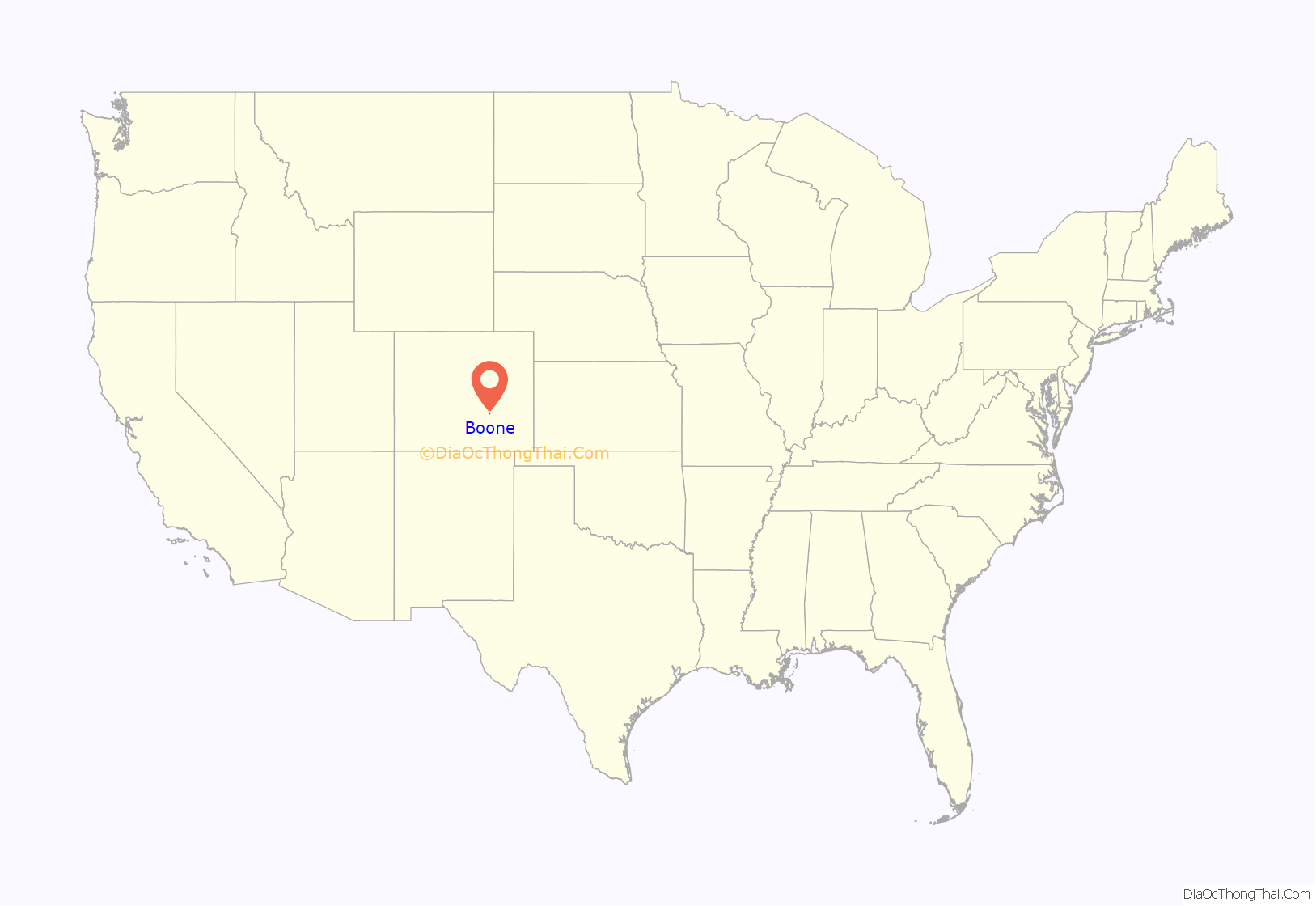
Boone location map. Where is Boone town?
History
Boone was founded as Booneville during the Pikes Peak Gold Rush by Albert Gallatin Boone, a grandson of Daniel Boone. Boone was the first postmaster and for a brief time Indian agent to the Cheyenne and Arapaho.
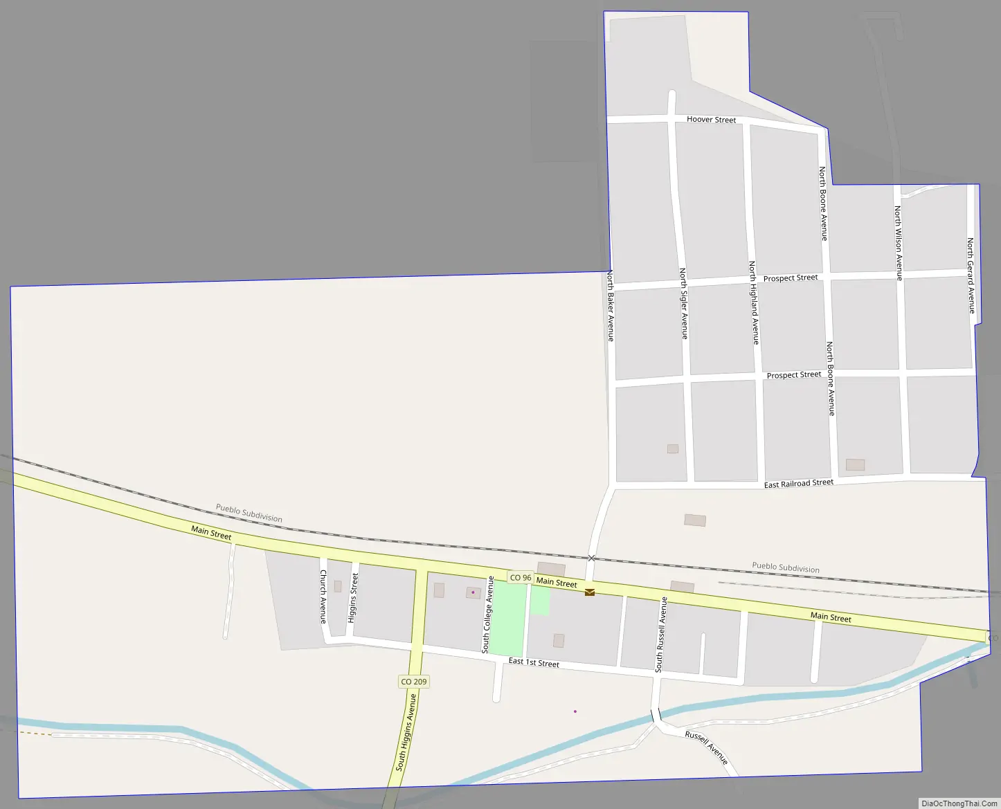
Boone Road Map
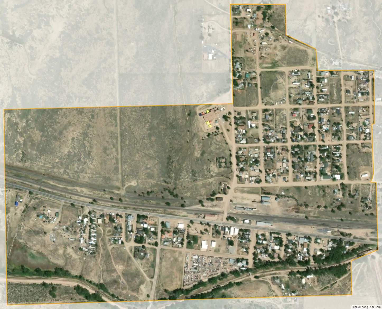
Boone city Satellite Map
Geography
Boone is located at 38°15′0″N 104°15′19″W / 38.25000°N 104.25528°W / 38.25000; -104.25528 (38.250083, -104.255166).
At the 2020 United States Census, the town had a total area of 249 acres (1.006 km) including 6.2 acres (0.025 km) of water.
See also
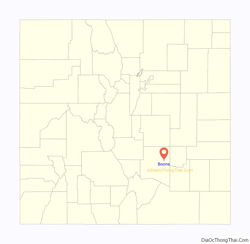
Map of Colorado State and its subdivision:- Adams
- Alamosa
- Arapahoe
- Archuleta
- Baca
- Bent
- Boulder
- Broomfield
- Chaffee
- Cheyenne
- Clear Creek
- Conejos
- Costilla
- Crowley
- Custer
- Delta
- Denver
- Dolores
- Douglas
- Eagle
- El Paso
- Elbert
- Fremont
- Garfield
- Gilpin
- Grand
- Gunnison
- Hinsdale
- Huerfano
- Jackson
- Jefferson
- Kiowa
- Kit Carson
- La Plata
- Lake
- Larimer
- Las Animas
- Lincoln
- Logan
- Mesa
- Mineral
- Moffat
- Montezuma
- Montrose
- Morgan
- Otero
- Ouray
- Park
- Phillips
- Pitkin
- Prowers
- Pueblo
- Rio Blanco
- Rio Grande
- Routt
- Saguache
- San Juan
- San Miguel
- Sedgwick
- Summit
- Teller
- Washington
- Weld
- Yuma
- Alabama
- Alaska
- Arizona
- Arkansas
- California
- Colorado
- Connecticut
- Delaware
- District of Columbia
- Florida
- Georgia
- Hawaii
- Idaho
- Illinois
- Indiana
- Iowa
- Kansas
- Kentucky
- Louisiana
- Maine
- Maryland
- Massachusetts
- Michigan
- Minnesota
- Mississippi
- Missouri
- Montana
- Nebraska
- Nevada
- New Hampshire
- New Jersey
- New Mexico
- New York
- North Carolina
- North Dakota
- Ohio
- Oklahoma
- Oregon
- Pennsylvania
- Rhode Island
- South Carolina
- South Dakota
- Tennessee
- Texas
- Utah
- Vermont
- Virginia
- Washington
- West Virginia
- Wisconsin
- Wyoming